Walking in NYC, Paris, and London

Park Avenue

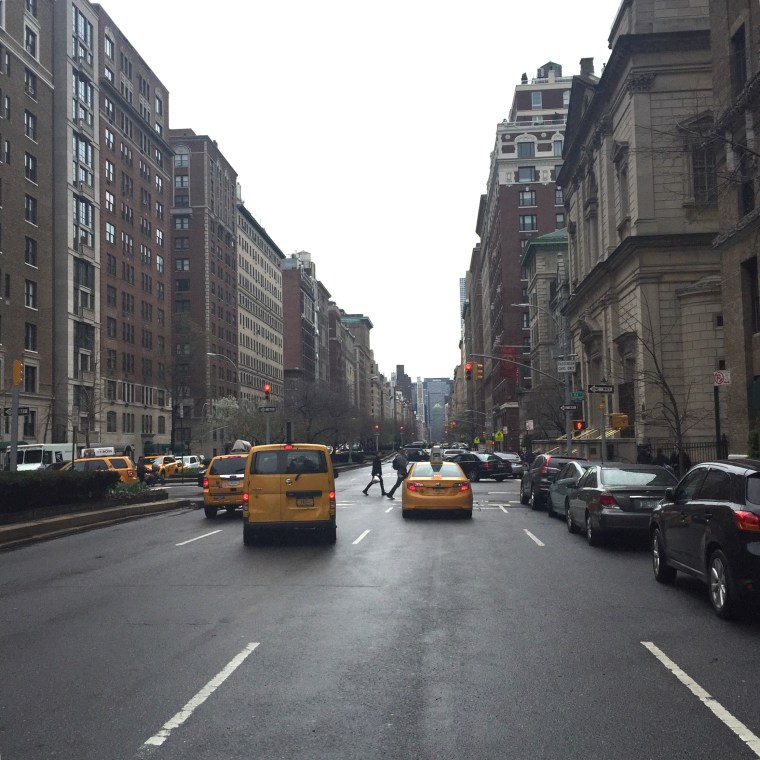
Recently I was fortunate enough to spend a few days each in Paris and London before returning to my beloved New York City (see above, the magnificent Manhattan grid, personified here on majestic Park Avenue). I was able to take several dérives (unplanned walks in an urban environment) as well as talk with New Yorkers currently living in each city. This experience led me to think about the similarities and differences of each of these great cities, and how living in each is unique. In addition, because I am a real estate agent in New York City, I will share what I learned from meeting with colleagues in the other two cities and compare all three markets.

IMG_0322

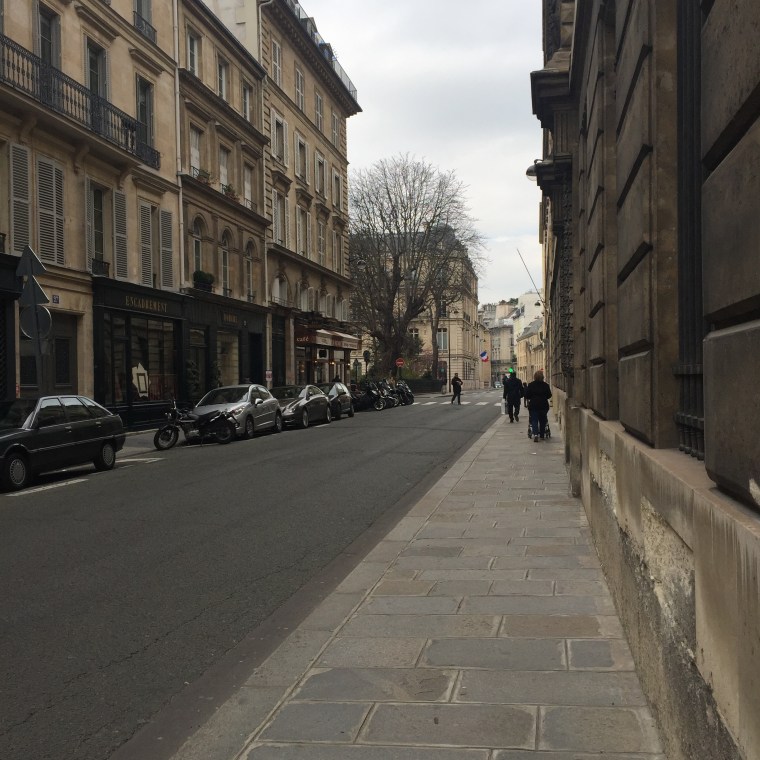
My first stop was Paris. It’s hard to find someone not charmed by this extremely elegant city. Oscar Wilde once quipped, “When good Americans die, they go to Paris.” Thomas Jefferson, after his years as Ambassador to France, noted that “a walk about Paris will provide lessons in history, beauty, and the point of Life.” I don’t know if I would agree to that extent (perhaps I missed my lesson on the point of life?) but I do agree with the filmmaker Wes Anderson, who said “Paris is a place where, for me, just walking down a street that I’ve never been down before is like going to a movie or something. Just wandering the city is entertainment.” I noted in a previous blog post about Dumbo in Brooklyn that I felt you couldn’t take a bad photo in Paris (and felt the same about Dumbo), because every new vista seemed to provide a perfectly framed gorgeous scene.

IMG_0334

Central Paris looks the way it does mainly due to the vast restructuring under the time of President Louis-Napoléon Bonaparte, the nephew of the more famous Napoléon, and the urban planner Georges Eugène Haussmann. Medieval Paris through the nineteenth century was filthy and unsanitary, with reeking sewers (Victor Hugo described it well in Les Misérables) and gorgeous buildings like the Louvre hidden behind crumbling tenements. Haussmann appropriated land and destroyed what he needed to in order to create a gigantic cross through the heart of the city made up from east to west along the Rue de Rivoli and Rue Saint-Antoine, and north-south along two new Boulevards, Strasbourg and Sébastopol. In later renovations, more boulevards were created, generally on the diagonal rather than a grid.

IMG_0335

The unusual aspect of all of this is that so much work was done within a relatively short period of time in the mid-nineteenth century. This is the more significant factor to the consistency of the look of Paris compared to most other cities.

IMG_0338

I asked a native New Yorker who now lives in Paris about how the layout of the two cities affects living there. She pointed out that, with most of Manhattan a grid, people refer to an address as an intersection of an Avenue and a Street. For example, if you were meeting someone at Carl Schurz Park in Yorkville you might agree to meet on the corner of East End Avenue and 84th Street. In Paris,  a meeting place is more likely to be described as what arrondissement it is in, what metro stop it is near, and then the actual address.

IMG_0339

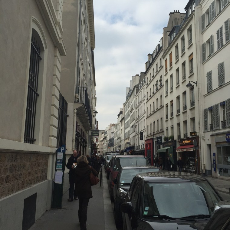
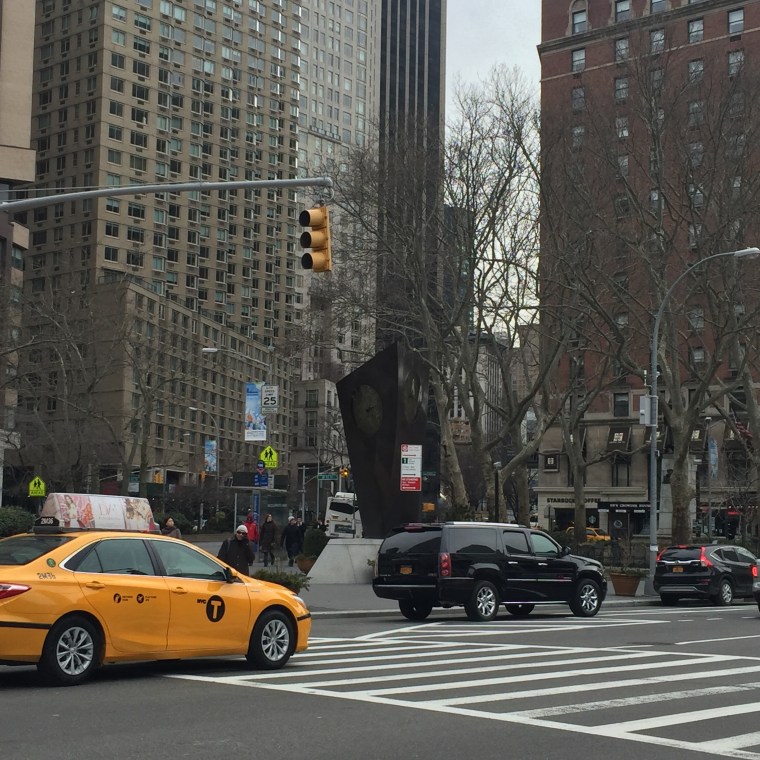
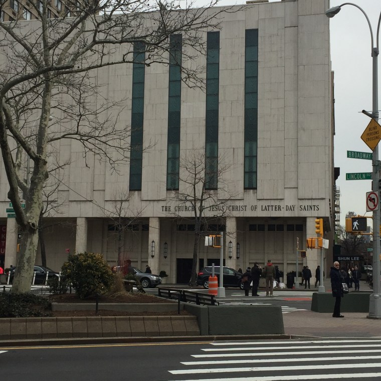
The experience of walking in Paris is very different on the wide boulevards versus the much narrower streets. In addition, the boulevards keep cutting through on the diagonal, creating triangles. New York City has Broadway running on a huge diagonal along the entire length of Manhattan from northwest to southeast, creating such iconic “squares” as Times Square and Herald Square. However, most of Manhattan above 14th Street unfolds as a predictable series of streets intersecting at right angles with avenues.

IMG_0340

IMG_0337

After a very enjoyable and easy trip on the Eurostar train, my next stop was London.

IMG_0371

When looking up quotes to enliven this blog post, I was surprised to find so few really positive quotes about London compared to Paris. For instance, William Butler Yeats commented, “This melancholy London – I sometimes imagine that the souls of the lost are compelled to walk through its streets perpetually. One feels them passing like a whiff of air.” Hmmm. Worse, from G.K. Chesterton: “London is a riddle. Paris is an explanation.” And confusingly, from author Peter Shaffer: “If London is a watercolor, New York is an oil painting.” While I enjoy Paris and of course find it to be beautiful, I love London – second in my heart only to New York City. If only I could write a pithy quotable quote to express this feeling!

IMG_0374

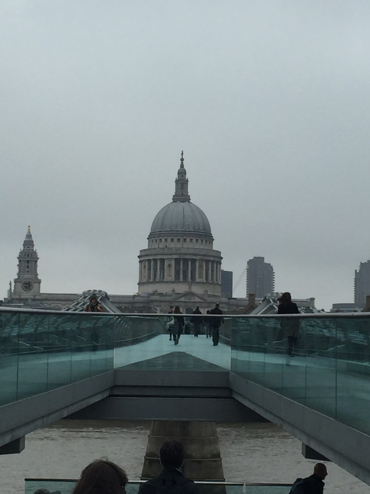
Walking across the Millennium Bridge, itself completed and opened in June 2000, you get part of why I love London – the juxtaposition of new and old, with St. Paul’s (completed in 1711) framed by this very modern structure.

IMG_0375

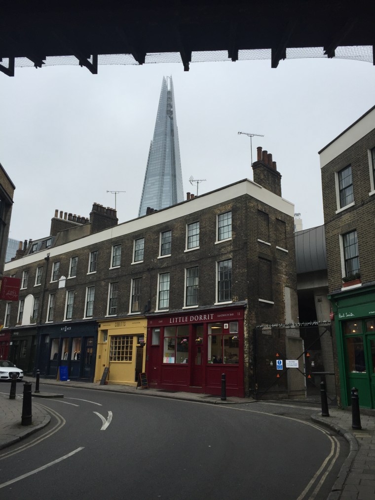
Another example of this is seen here, near Borough Market, with the hyper-modern Shard building visible above these tiny quaint buildings.

IMG_0377

And speaking of Borough Market, it’s one of my favorite places in London. The Southwark neighborhood surrounding it is a delightful jumble of streets.

IMG_0392

London is not consistent in architectural style as Paris is – not only are neighborhoods (like the newly fashionable East End, depicted in a mural above) different, even within a neighborhood you can find a variety of styles and eras represented. This is in part due to the Great Fire of 1666, meaning that very little of medieval London still exists (the Tower being a notable exception), and in part due to the bombings during World War II and the rebuilding since then.

IMG_0418IMG_0419

Some neighborhoods, like Chelsea (above) and Mayfair (below) do keep more of a consistent architectural style, however.

IMG_0421IMG_0424IMG_0428IMG_0429

Walking in London can be confusing, since it is even less of a grid than Paris and certainly much less so than Manhattan above 14th Street. However, this labyrinth of twisting streets and sudden alleyways is what makes taking an unplanned walk (with few time constraints) so rewarding. James Geary, the American journalist, remarked, “London always reminds me of a brain. It is similarly convoluted and circuitous. A lot of cities, especially American ones like New York and Chicago, are laid out in straight lines. Like the circuits on computer chips, there are a lot of right angles in cities like this. But London is a glorious mess. It evolved from a score or so of distinct villages, that merged and meshed as their boundaries enlarged. As a result, London is a labyrinth, full of turnings and twistings just like a brain.” I don’t know that the brain analogy would have ever come to me (and I have a degree in neuroscience!) but I would agree that the twistings and turnings do make it a “glorious mess.” A native New Yorker now living in London pointed out how much larger in area central London is compared to Manhattan, while central Paris is much more compact. Of course the population of London was 8.539 million in 2014, while New York City (all five boroughs) was an equivalent 8.406 million at roughly the same time (Manhattan only 1.626 million, however). Paris, on the other hand, has a population of 2.244 million, a significantly smaller number.

IMG_0448

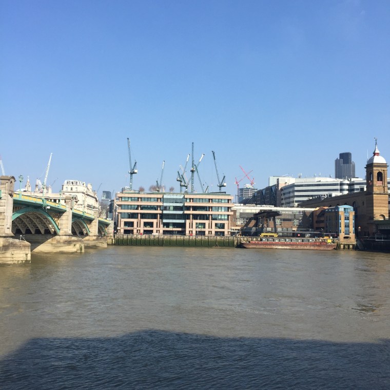
One last comparison between New York City and London. One of my favorite quotes about NYC is from O. Henry, who said (quite a long time ago, I will add), “It’ll be a great place if they ever finish it.” The constant construction and cranes seen in London (above) remind me very much of New York. I love how NYC is constantly changing, and while obviously historic preservation is important, the tearing down and building up of our city is part of what gives it the feeling of always being new, in the process of reinventing itself.

A significant similarity between Paris and London is that they each have rivers running through the heart of the city, with part of the joy of walking there involving crossing bridges to get from one side to the other. In Manhattan, you are surrounded by water, and there are enjoyable strolls both on the East River and the Hudson. You can also walk over the Brooklyn Bridge (see my photo tour of doing that here), highly recommended. However, I would say that the most similar feeling to crossing a bridge in Paris or London is to cross Central Park, not as long as a river but as significant for the large section of Manhattan it divides. The difference in feeling (and strong loyalty it inspires) among east siders and west siders is similar to the change between the north and south bank areas of the Thames, or Rive Gauche versus Rive Droit.

As far as real estate values in these three cities, despite all the recent concern over whether London’s housing prices could continue their meteoric rise despite new concerns over a possible Brexit and the additional tax on luxury properties, London housing prices increased 13.5% in the past year, compared to New York City’s 12% (still a large increase!). There is some indication, however, that the foreign investor is starting to see London as a less advantageous place to buy, since prime real estate in London at the highest price points declined 0.8% in the first three months of 2016. Meanwhile, in Paris, even before the November 2015 terrorist attacks, home values were down 2.8% and projected to fall another 3% in 2015. At this point in 2016, homes in Paris are down 9% from values in 2011.

Most people, of course, live in a particular city because their work brings them there, they have family there, or some other practical reason. Those who can afford to own places in more than one city may choose to do so in part for financial reasons, but often also because the city is an appealing place to visit. New York, London, and Paris all offer so much and uniquely so – although I would argue that they are equally suited for an individual like myself who loves to walk.

Lincoln Square

IMG_0118

Just as the larger neighborhood known as the Upper East Side has many smaller neighborhoods within it, such as Yorkville, Carnegie Hill, Lenox Hill (yes, lots of hills on the UES!), the Upper West Side – on the opposite side of Central Park – also has subdivisions. Recently I have had two customers interested in looking for homes in the area of the UWS known as Lincoln Square, the southeast corner of the neighborhood – roughly bounded by Central Park West and Amsterdam Avenue to the east and west, and 59th to 66th Streets to the south and north.  Interestingly enough, the area was characterized in 1940 as the “worst slum in New York City” by the New York Housing Authority, and the urban renewal efforts in the 1950’s and 1960’s led to the development of the Lincoln Center for the Performing Arts. This anchored the residential redevelopment of the area into the vibrant neighborhood it is now.

As I have written before, my favorite way to experience a neighborhood is by taking an unplanned walk within the area (a dérive), so on an overcast but not terribly cold February day, I started at Columbus Circle and began my stroll.

IMG_0108

At Columbus Circle, you stand at the intersection of the Upper West Side, Central Park, and Midtown West. The shops at Columbus Circle house a Whole Foods as well as specialty stores and Jazz at Lincoln Center.

IMG_0109

Turning around to look at Central Park for a moment . . .

IMG_0110

Just north of the statue of Columbus, a subway hub that can get you quickly to virtually any location in the city.

IMG_0111

Walking north a few block on Central Park West, I can’t resist stopping to admire 15 Central Park West, a phenomenally successful building on so many different levels – a classic limestone two-towered building that looks as though it could have always been there, but simultaneously a new development from 2007 with prices per square foot averaging well over $5000 per square foot. I greatly enjoyed reading Michael Gross’s recent book about the development of the site, House of Outrageous Fortune.

IMG_0112

Walking west on W. 61st Street, you can see a side entrance to 15 CPW. On the W. 62nd Street side, there is a lovely garden.

IMG_0114

This part of the Upper West Side can be a little confusing, in that Broadway is the next Avenue you come to after Central Park West, while for much of the neighborhood the park block is between CPW and Columbus. Broadway, transecting the length of Manhattan on a diagonal, disrupts the orderly grid of most of Manhattan above 14th Street, creating “squares” – really triangles – as it cuts across the orderly boulevards. Union Square, Madison Square Park, Herald Square, and Times Square are all the result of Broadway’s slow progress from west to east as it heads south in Manhattan, and Lincoln Square is yet another. Walking up Broadway to W. 63rd, I headed west again to see Lincoln Square itself, namesake for this neighborhood.

IMG_0115

Just south of Lincoln Square is the Empire Hotel, whose sign is a local landmark, and P.J. Clarke’s, a cozy yet upscale place to sit and have a nice meal.

IMG_0116

Obviously a strong selling point for the neighborhood is the proximity to Lincoln Center, and the ease of attending performances of  opera, music, ballet, theatre, and even the Big Apple Circus in the fall of each year.

IMG_0119

The Julliard School, just north of Lincoln Center, also offers high quality student performances.

IMG_0120

Looking east while standing in front of Julliard, I noticed the Mormon Visitor Center, best known to me as the place where Hannah and Harper volunteer in Tony Kushner’s epic play, “Angels in America.”

IMG_0121

Just north of Julliard is Alice Tully Hall, home to more intimate concerts than those in much larger Avery Fisher Hall (newly renamed David Geffen Hall).

IMG_0122

Turning east again on West 66th St., I walked past ABC studios on the way back to Central Park. Just a few blocks north of this intersection is the Loews Lincoln Square Cineplex. I really love this as an option for seeing popular movies, as each individual theatre has the name and style of an old-time movie palace, making the experience there have a little more personality than many multiplexes.

IMG_0123

Ending up in Central Park at 66th, yet another advantage to this neighborhood is its proximity to Tavern on the Green, renovated a few years ago but with the twinkling outside fairy lights remaining.

IMG_0125

So what does it cost to live in Lincoln Square? As with any neighborhood, it varies greatly depending on the building, but average prices are just under $3000/square foot, compared to just over $2000/square foot for all of the Upper West Side (averaging prices of the far northern sections of the UWS with those to the south, of course). Central Park South, just to the south and east of Lincoln Square averages $5000/square foot, in part because of the premium associated with apartments with views of the park. Lincoln Square tends to be newer buildings, mostly condos, compared to the largely prewar coop inventory of most of the UWS.

In my opinion, the location of Lincoln Square is unparalleled – at the intersection of the Upper West Side, Midtown West, and with Central Park as a virtual front yard.


Turtle Bay

Turtle Bay 3

Walking to show two apartments in the 400 block of East 52nd (not in the actual building Greta Garbo lived in for decades, but the same block), I was struck by the nomenclature “Turtle Bay” for the area (roughly from 42nd Street to 53rd Street, from Lexington Avenue to the East River) and vowed to find out whether there had in fact been turtles in a bay here a long time ago. What I discovered was one of those funny mistranslations that sometimes occurs: the Dutch called this area “Deutal” (Knife) Bay after a sharp turn in the East River (the reason why York Avenue/Sutton Place disappears at 54th Street) but the English-speaking later settlers misheard it as “Turtle.” My interest piqued, I decided to take my next dérive (an unplanned walk in an urban environment) in this area.

Turtle Bay 2

Initially farmland (including that of the Beekman family, who gave their name to Beekman Place), Turtle Bay evolved into an industrial neighborhood, noted particularly for its slaughterhouses. In the early 20th Century, Charlotte Hunnewell Sorchan bought and renovated a series of houses in the area, and sold to friends, including Maria Bowen Chapin, who founded the Chapin School. This began the evolution of Turtle Bay into a residential neighborhood, which was cemented when the last of the slaughterhouses was torn down to make way for the United Nations building.

MurrayHillChrysler

I began my dérive at my favorite skyscraper in New York City, the Chrysler Building. Finished in 1930, it was the world’s tallest skyscraper for 11 months before being ousted by the Empire State Building, and is still the world’s tallest brick building (although it does have a steel skeleton). An Art Deco masterpiece, to me it has an airy fairy-castle quality that contrasts markedly with the more aggressive forms of most NYC skyscrapers.

Turtle Bay 1

Walking east on 42nd Street, the distinctive Tudor City sign dominates the eastern view. The first residential skyscraper complex in the world, it was built in the 1920’s by a real estate developer with dreams of keeping middle-class people in the city rather than taking flight to the suburbs. Despite the name “Tudor,” the architecture is neo-Gothic in style. Most of the apartments face away from the East River, since when they were built the slaughterhouses, and their accompanying smell, still operated along the river. Many Tudor City apartments have wonderful views of the Chrysler and Empire State Buildings, but few face the United Nations for this reason.

Turtle Bay 4

Taking a set of steps down from Tudor City to First Avenue, the United Nations (as well as multiple diplomatic missions) now dominates the area of Turtle Bay between First Avenue and the East River. Established after World War II to promote cooperation between the nations of the world and winner of the Nobel Peace Prize in 2001, the organization is imperfect but the quote across the street from the UN from Isaiah (“ . . . neither shall they learn war any more”) reveals the hope behind creating such an assembly. On a lighter note, I remember my young daughters once asking where aliens would land on earth if they were to try to reach the “leader” and I said it would have to be Manhattan because of the UN. Whether this was good news or bad news to them, I will have to ask and find out.

Turtle Bay 5

Continuing north on First from the UN, I passed Mitchell Place, one of New York’s micro-streets (comprising just one block between First and Beekman Place, next to E. 49th Street). Turning west on 49th Street, I thought of E.B. White writing Charlotte’s Web in this neighborhood (he was living on E. 48th at the time) and stopped to admire the signage for “Katharine Hepburn Place” on the corner of Second and 49th). She lived in a beautiful townhouse between Third and Second on 49th Street for most of her adult life, and that block is a gracious quiet row of townhouses.

Turtle Bay 6

Turtle Bay, unlike some more cohesive neighborhoods in NYC, has a wide variety of experiences represented: from the bustle of the shops and restaurants along the Avenues, to the quiet of Beekman Place, or from the gardens of Tudor City surrounded by neo-Gothic residences, to the international nexus of the United Nations. It is, however, a place where it is possible to find an apartment on a dead-end block with little to no traffic noise, but only a few blocks from everything midtown Manhattan has to offer.

Turtle Bay 7

Financial District

Financial district 7

Recently I was fortunate enough to see the new musical “Hamilton” at the Public Theater (arriving on Broadway this summer), leading me to my last  blog  post – a walk through Hamilton Heights, the neighborhood in upper Manhattan where Alexander Hamilton had farmland and lived in his final two years. However, much of Alexander Hamilton’s time in the city was spent in the area now known as the Financial District. Roughly occupying the same space as the original settlement of New Amsterdam, it lies at the very southernmost point of Manhattan, below City Hall Park, excluding the areas of Battery Park and Battery Park City. This neighborhood is a unique mixture of very old (the colonial remnants of New Amsterdam) and very new (it’s only recently become a popular choice as a residential neighborhood and new development buildings abound). With these thoughts in mind, I decided to take my next unplanned walk in an urban environment (a dérive) in the Financial District.

I emerged from the subway at Bowling Green, the traditional starting point of ticket tape parades up Broadway. This tradition with a spontaneous parade associated with the dedication of the Statue of Liberty in 1886, and since has continued with celebrants as diverse as Theodore Roosevelt (upon his return from safari in Africa in 1910), Albert Einstein in the 1920’s, Charles Lindbergh as well as Amelia Earhart following their successful solo trans-Atlantic  flights, Jesse Owens after winning four Olympic gold medals in 1936, the pianist Van Cliburn in 1958, the Apollo 11 astronauts, and the New York Yankees (nine times).

Financial district 1

Wandering from Battery Park to State Street and on to Pearl Street, I came across what is possibly Manhattan’s oldest building (from 1719), Fraunces Tavern. This building is now a museum and restaurant as well as a National Historic Landmark. Once the meeting place of the secret society the Sons of Liberty, it became the headquarters for General George Washington at one point during the Revolution, and is where he gave his famous farewell address to his officers.

Financial district 2

Continuing north on Broad Street, as I approached the intersection with Wall Street it was impossible to miss the imposing façade of the New York Stock Exchange. The roots of this center of American finance go back as far as the years immediately following the Revolution, and the earliest securities traded were War Bonds and stock from the First Bank of the United States (established by the first Secretary of the Treasury, Alexander Hamilton).

Financial district 3

Nearby, on the corner of Wall Street and Nassau Street, is Federal Hall, the site of the first United States Capitol Building and the location of George Washington’s inaugural. A statue of the first President stands imposingly in front, gesturing as if to say “hold your applause.”

Financial district 4

Nearby at Broadway and Wall Street is Trinity Wall Street Episcopal Church, first charted during colonial days (1696) by King William III. The current building on the site dates from 1846, but the cemetery attached to it is much older, and one of the few in Manhattan. It holds several luminaries, including Robert Fulton (inventor of the steamboat) as well as Alexander Hamilton and his wife Eliza Schuyler Hamilton.

Financial district 5

Walking behind the cemetery along Church Street, it is impossible to miss One World Trade. Adjacent to the original footprints of the World Trade Center (now reflecting pools) and the site of the 9-11 Museum, it dominates the skyline in the area, and is now open for business. The influx of workers to One World Trade is bringing new shops and restaurants to the area.  The new World Trade Center transportation hub is due to open at the intersections of Vesey, West Broadway, and Greenwich Streets at the end of 2015. Designed by famed Spanish architect Santiago Calatrava, it has been the source of controversy over its cost and overruns. However, seeing it soar in such an emotionally impactful area (Calatrava has said it is supposed to look like a bird being released from a child’s hand) was very pleasing to me.

Financial district 6

Prior to 2001 and the 9-11 attacks, about 15-20,000 residents lived in the Financial District. Nothing could be more revealing of the strong and resilient nature of New Yorkers (and also of the success of some incentives and tax breaks created by the city to spur growth) than the fact that now there are over 60,000 residents of the neighborhood. In 2014, the average price per square foot in the Financial District was higher than the average in Manhattan for the first time, comparable to that of the Upper West Side and Greenwich Village. Simultaneously historic and fresh, this neighborhood is the closest thing New York City has to the center of Rome, where new buildings are interspersed with views of the Forum or Coliseum.

Hamilton Heights

HamiltonHeights3

The hottest ticket in New York City this year is Lin-Manuel Miranda’s new musical, “Hamilton,” currently at the Public Theater on Lafayette Street but moving to Broadway this summer. Coincidentally the day after I was fortunate enough to see it, while searching for a new apartment for a couple, I found a possibility for them in Hamilton Heights. Of course I had heard of the neighborhood in upper Manhattan and had been there before, but the connection to Alexander Hamilton didn’t fully register until that moment. I decided that my next dérive (an unplanned walk in an urban environment) would take place in Hamilton Heights, while the soundtrack to “Hamilton” was still freshly ringing in my head.

Hamilton Heights lies between 135th and 155th Streets to the south and north, and between Edgecombe Road and the Hudson River to the east and west. This puts it just south of Washington Heights (location of Miranda’s “In the Heights”) and just north of Manhattanville and Morningside Heights. Why all the “heights” in upper Manhattan? Take a walk in any of these neighborhoods, and you will see – the elevation in this part of the island is considerable, and some streets are quite steep, particularly rising from the Hudson. Alexander Hamilton’s farmland in the last two years of his life before the infamous duel with Aaron Burr was roughly in the part of the neighborhood between 140th and 146th Streets.

HamiltonHeights4

Public transportation options are good in Hamilton Heights. The 1, A, B, C, and D trains all make stops here, and it is possible to get from 155th Street to Times Square in about 15 minutes. For my dérive, I took the C and emerged at St. Nicholas Avenue and 135th Street. St. Nicholas Park rises steeply to the west of St. Nicholas Avenue here, and the majestic neo-Gothic tower of Shepard Hall of the City College of New York can be seen rising from the ice-age Manhattan schist that was used to construct the iconic campus buildings. CCNY was the first public institution of higher learning in the United States, and the beauty of its campus holds up to the private colleges and universities that predated it. Ten Nobel Prize winners have graduated from CCNY, the most recent alum winning for Medicine in 2014.
HamiltonHeights1

Just to the north of the main quad of CCNY sits Alexander Hamilton’s home for the final two years of his life, named Hamilton Grange after his ancestral home in Scotland. This location in St. Nicholas Park is not where he lived, however – the house itself has been moved three times, but has settled in this location, not too far from its original spot. The Grange is a National Park Service site, and has been restored to reflect its appearance during 1802-1804 when Hamilton lived in it.

Walking north on Hamilton Terrace from St. Nicholas Park, it is easy to forget that you are in Manhattan. This is a very quiet, residential neighborhood with rows of townhouses or brownstones on tree-lined streets. Hamilton Terrace goes on for blocks without any intersections, and most of the townhouses here date from the 1890’s. Hamilton Terrace runs into Convent Avenue, and continuing north, the sub-neighborhood of Sugar Hill reveals stately rowhouses that once were the residences of famous New Yorkers such as Cab Calloway, W.E.B DuBois, Duke Ellington, and Babe Ruth (when he was an infant). Nicknamed Sugar Hill because it was where wealthy residents of Harlem moved in the 1920’s to enjoy the “sweet life,” the area holds large pre-war apartments that are still affordable, by current New York City standards.

HamiltonHeights2

The Billy Strayhorn standard, “Take the A Train,” most familiar as an instrumental version performed by the Duke Ellington orchestra, does have lyrics, and they give you clear directions about how to get to this charming affordable neighborhood in upper Manhattan:
You must take the A Train
To go to Sugar Hill way up in Harlem
If you miss the A Train
You’ll find you’ve missed the quickest way to Harlem
Hurry, get on, now, it’s coming
Listen to those rails a-thrumming (All Aboard!)
Get on the A Train
Soon you will be on Sugar Hill in Harlem

The Lower East Side

Lowereastside2

What’s the first word that pops into your mind when you think of the Lower East Side of Manhattan? Tenements? Immigration? Delis? Nightlife? All of those would be correct associations, but we can now add gastropubs, new development high-rises, and trendy hotels to the mix. For this dérive (an unplanned walk in an urban environment), I wandered this rapidly transforming neighborhood.

The Lower East Side once included the area now known as the East Village, but now is considered to be roughly between East Houston Street and Canal Street to the north and south, Bowery to the west, and the FDR Drive to the east. Before the Revolutionary War, the area was home to the Delancey farm, leaving only the names of Delancey and Orchard Streets as remnants of this pastoral history. A working class neighborhood for centuries, it hosted many different immigrant groups, but is perhaps best known for its Jewish population. When the American Girl doll company chose to add Rebecca Rubin – a Jewish girl growing up with an immigrant family in 1914 – to their roster of historical dolls, this fictional family was placed in the Lower East Side.

Lowereastside1

Starting on East Houston and Bowery, heading east, it doesn’t take long to find one of the iconic symbols of the area’s Jewish immigrant past – Katz’s deli on East Houston and Ludlow.  It’s hard to be in Katz’s without thinking of the famous scene from When Harry Met Sally (culminating in the famous line, “I’ll have what she’s having”) but it’s survived since 1888 based on the quality of its pastrami sandwiches. Bring cash – no credit cards accepted, but the attitude from your server is free.

Lowereastside6

Continuing east on Houston and turning south on Norfolk Street, the fifth oldest synagogue building in the United States, now the home of the Angel Orensanz Foundation, is on the east side of the street. After the Jewish population had largely left the area in the 1970’s, the building was abandoned and left to disrepair before being purchased by Spanish sculptor Angel Orensanz for studio space. The gothic-revival architecture of the building has been restored and the building now functions as a center for the arts as well as an artist’s studio.

Lowereastside7

Walking along Orchard Street, several signs of the changes taking place in the neighborhood appear. Russ and Daughters (named back in 1914, so don’t think that going into business with your daughters is solely a modern trend) has had a storefront selling Jewish deli food on East Houston for a century, but now an upscale sit-down restaurant, Russ and Daughters Café, is on Orchard Street. Guss’ Pickles was once in a small store on Orchard and Broome, but now with the retail location  closed, jars can be found for purchase in Whole Foods and Fairway. Similarly, the Essex Street Market on Essex near Rivington reflects in some ways the small food shops that once populated the neighborhood, but now exists in a food hall, with prices the residents of the neighborhood even 15 or 20 years ago could not have believed. The Tenement Museum, on Orchard near Delancey, has preserved the way of life of immigrants to the area during the 19th and early 20th centuries. Given that quite often only the history of the wealthy is recorded for future generations, it’s significant and rather unique that this museum exists.

Lowereastside8

Turning back to head north again, when crossing Delancey, I looked east and saw the Williamsburg Bridge. When it was built, many Jewish residents moved from the Lower East Side to Williamsburg in Brooklyn. Now the rebirth of Williamsburg as a popular place for young people to live and go for nightlife is mirrored in the Lower East Side, part of the fascinating cycle of change seen all over New York City in all time periods.

Lowereastside9

Heading over to Ludlow Street, I could not help but notice the new developments being built in the neighborhood. Although still primarily low-rise tenement buildings, new high-rise condos with all the amenities you could find in a similar building in Soho or Nolita (for, at least for now, at a lower price point) are beginning to spring up. The Blue Condominium was the first – and to many, it failed to fit into its environment (being much larger than surrounding buildings and extremely blue) – and many more are now in various states of construction. The rapid gentrification of the area led the National Trust for Historic Places to put the Lower East Side on their list of America’s Most Endangered Places. While it seems to me that it benefits neither the city nor the neighborhood to leave it full of crumbling tenements, a increased sensitivity in ensuring that the new developments blend in better with their surroundings can only be a good thing. The Hotel on Rivington was built to show off and contrast with its neighbors, while the Blue Moon Hotel, equally new and trendy inside, kept the exterior appearance of the building it renovated, making it almost identical to surrounding buildings.

Lowereastside5

Julian Casablancas sings about the inevitable changes that have been transforming the area in his song, “Ludlow Street.” In a typical Lower East Side scene, heading out in the morning after an evening of drinking too much, he thinks about how the indigenous Lenape tribes were first to be pushed out in 1624. As he sings, “Faces are changing on Ludlow Street/Yuppies invading on Ludlow Street/Nightlife is invading on Ludlow Street/And it’s hard to just move along.”

Soho

soho7
Before Tribeca (TRIangle BElow CAnal), Dumbo (Down Under Manhattan Bridge Overpass), Nolita (North of Little ITAly), or Nomad (North of MADison Square Park), there was SoHo (South of Houston Street). Although London’s Soho isn’t a shortened version of anything (it might be based on a hunting cry but has been a place name there since the early 1600’s so no one really knows), Manhattan’s Soho started the trend of cute acronyms for neighborhood names in the city. Today’s dérive (an unplanned walk in an urban environment) takes place in this cool downtown neighborhood.

Although today we know it as a beautiful area full of artists’ lofts and galleries, and as an upscale shopping destination, Soho in lower Manhattan has an interesting history. Originally a community for freed slaves of the Dutch East India Company in the 1600’s, this was the first settlement for people of color in the city. Surrounded by swampland and a canal, the area was not widely settled until the canal was filled in and became Canal Street. Becoming an industrial center in the mid-1800’s, most of the neighborhood’s characteristic cast iron buildings (the actual name of the historic district is Soho-Cast Iron) were created between 1840 and 1800. Originally used as a building material because cast iron was cheaper than stone or brick (but could be painted to resemble stone), cast iron was also easily molded and allowed for elaborate decoration around the large windows, themselves possible because of the strength of cast iron. With industry moving out of the area, the neighborhood fell into decline, until the 1960’s when artists looking for large spaces with plenty of natural light began to move in. Although originally the artists’ lofts were not zoned for residential living, eventually the city recognized the change that had occurred, and since the 1980’s, the neighborhood has become one of the city’s wealthiest.

Roughly bounded by (naturally) Houston Street to the north, Canal Street to the south, Crosby Street to the east, and Sixth Avenue to the west, I began this dérive on Houston and Crosby, walking south and turning west on Prince Street. Although Soho is surrounded by Greenwich Village, Little Italy, and Tribeca on various sides, and shares certain similarities with each, it also has its own distinctive feel. The neighborhood is full of architecturally significant buildings, many quite unique. The Little Singer Building (named because a few years after it was built in 1903, the Singer Company also built what was for a few years the tallest building in the world – and which was destroyed in 1967 before it could be landmarked), for instance, is now a combination of office spaces and artists’ lofts. It is covered in elaborate wrought iron decoration, terra cotta panels, and cast iron ornamentation. At Prince and Greene, one entire side of a building is painted in a trompe l’oeil façade of a cast iron building.

Prince and Spring Streets, particularly the areas near Broadway, are full of upscale shopping experiences. Dominique Ansel Bakery, famous for being the home of the cronut, is on Spring between Sullivan and Thompson. People line up between 7AM and 8AM every day to get the limited supply of cronuts (2 per person, only one type made per month), but don’t neglect the bakery later in the day – they make delicious treats in addition to the elusive cronuts!

While on Spring Street, glancing south when crossing Thompson Street reveals a beautiful view of One World Trade. Continuing east on Spring, I appreciated crossing the charming cobblestoned streets. Although all of SoHo would have been originally cobblestoned, only those streets still paved with Belgian blocks when the area was landmarked (a few of the north-south streets such as Mercer, Crosby, and Wooster Streets) remain as such. Seeing a row of Citibikes ready for rental, I imagine that cobblestoned streets and bicycling might not be the best pairing.

Soho becomes less hectic as you get away from Houston. Heading south on Mercer Street, It’s hard to imagine that plans to build two large elevated highways linking the Manhattan and Williamsburg Bridges with the Holland Tunnel were narrowly averted in the 1960’s. Fortunately, the value of this lovely area and its concentration of ornate cast iron buildings was recognized in time to preserve Soho for us to enjoy now and for future generations.

Soho3

Soho6

Soho5

Soho4

Soho2

Soho1

Central Park in winter (with photos)

Last week we missed having three feet of snow in the city as the storm veered east by about 50 miles, but we still had enough snow to make Central Park a winter wonderland. This made me think about the advantages of living near the park, and that they are not limited to warm weather months. My sister, who lives in Vermont, says that it’s important to find a winter weather sport to enjoy there so that one doesn’t get too much cabin fever during the long winter. There are far too many things to do in New York City for anyone to get cabin fever (although most cabins are larger than the average NYC apartment, I would speculate!), but it is important to be able to enjoy the outdoors and commune with nature year-round even in the city with so many indoor things to do.

There are two outdoor skating rinks in Central Park: Wollman Rink (now Trump Rink) in the southern part of the park, and Lasker Rink near the Harlem Meer in the northern part. Both rent skates and have a fee to enter, but Lasker Rink is less expensive and often less crowded. However, the views of the skyscrapers looming over the edges of the southern part of the park do make the views a little more picturesque at Wollman (Trump).

Every time it snows, certain areas of the park are well known as prime sledding spots. The best are both mid-park on the east side, Pilgrim Hill (enter at Fifth and 72nd) and Cedar Hill (enter at Fifth and 76th). Pilgrim Hill is steeper and Cedar Hill a little more gentle, but both get very crowded on a snow day. Bring your own sled, of course (or use a garbage bag or an empty pizza box in a pinch).

Every year, Central Park hosts a Winter Jam one weekend, mid-park near the Bandshell. Snow machines are brought in to create (or augment) snow and there are opportunities to learn snowshoeing, skiing, and kicksledding (equipment provided for all of these but lines can be long). There are also snowman building contests and a chance to sled, as well as pop-up food vendors.

After the park has received enough snow, you will see cross-country skiers and snowshoers in the park, but you don’t even need special equipment to truly enjoy the spectacular beauty of Central Park covered in white. Whether appreciating the permanent residents of the park (statuary) with a new layer of frosting to upgrade their look, seeing that someone has already cleared the Imagine mosaic in Strawberry Fields (do it yourself if no one else has), or appreciating a fresh look at the contrast of the stately buildings surrounding the park with the dazzling white of the park itself, Central Park in winter shows that the value of living in New York City within walking distance of the park is a year-round benefit.

Winter 5 Winter 7 Winter 8 Winter 9 Winter1 Winter2 Winter3 Winter4 Winter6 Winter10

Long Island City

LIC 1 rotated

UPDATED JANUARY 2019 – With the announcement that Amazon is moving to LIC, everything I said a few years ago about the true bargains being in the past are even more true. However, this neighborhood is going nowhere but up . . .

Do you look back now and wish you had bought into Williamsburg or Dumbo 10 or 15 years ago? (I know I do.) Today’s dérive (an unplanned walk in an urban environment) takes place in a neighborhood that you may be feeling that way about in the very near future – and in fact, many of the true bargains are already in the past – Long Island City, Queens. One subway stop from 59th and Lexington (on the N and Q lines) and from Grand Central (on the 7 train), or from 53rd and Lexington (on the E train), this neighborhood is much more convenient to midtown Manhattan than most areas in Manhattan itself, has a thriving arts scene, and a park on the East River with magnificent views of the Manhattan skyline.

LIC 8 rotated

Long Island City (LIC) was its own actual city until joining greater New York in 1898. The area was originally the home to numerous factories and bakeries, but now many of these spaces have been or are in the process of being transformed. The Silvercup Bakery site was converted in 1983 to Silvercup Studios, the largest TV and film production studio in the Northeast United States. “Sex and the City” shot there, and current shows shot at Silvercup include “Elementary” and “Girls.” The sign is visible from many areas in LIC and from the 7, N and Q trains as you head toward Queensboro Plaza. The iconic Pepsi-Cola sign, visible from most riverfront areas of Midtown East in Manhattan, sits in front of the former Pepsi factory, now being converted to residential condos.

LIC 6 rotated

In my walk around Long Island City, I was drawn as usual to the waterfront – in this case, a beautiful sprawling park along the East River. Hunter’s Point South Park (a city park) and Gantry Plaza State Park meander for about a mile along the shores of the East River. The views of Midtown Manhattan from here are extraordinary.

LIC 7 rotated

The rapidly changing nature of this neighborhood has its pluses and minuses, as is typical when an area is redeveloped. The building covered in graffiti from multiple artists, 5 Pointz, was painted over despite protests and has now been demolished as the site is being replaced by a residential condo development. On the other hand, since the contemporary art museum PS1 (named after the school building it took over) merged with MoMA in 2000, the museum attracts approximately 150,000 visitors a year to LIC.

The first open house I ever worked in real estate was for a friend and colleague who sold a townhouse in Long Island City for a record price, but one that was still a fraction of what one would pay in Manhattan, or Brooklyn. Queens has come a long way since Claude in Hair (the tribal rock musical on Broadway) claimed to be from Manchester, England, to disguise his shame at hailing from Flushing. Long Island City is already transforming, and while it is still possible to find relative bargains here, a beautiful landmarked townhome or a new development condo with a city view won’t be even relative bargains soon. I was recently asked at a party for advice on investing in a new area (not an uncommon topic of conversation once someone learns you are in real estate) and I recommended Long Island City. The largest producer of fortune cookies in the United States (4 million per day!) is in LIC, but if you decide to make a purchase in the area now, you might be able to create your own luck.

Morningside Heights

Morningside 1

Bounded by Manhattan Valley to the south, Harlem to the north, Morningside Park to the east, and Riverside Park and the Hudson River to the West, Morningside Heights is an area with a long history (an important Revolutionary War battle was fought here) and many illustrious former residents (F. Scott Fitzgerald, George Gershwin, Cecil B. deMille, Fiona Apple, Thurgood Marshall, and Barack Obama among them). Recently I have heard of a trend to call the area “SoHa” or “south of Harlem” – but other than the names of a few places in the neighborhood, have not actually heard anyone use this term! Recently I took a winter stroll through the area to get a feel for what Morningside Heights has to offer.

To begin my dérive (an unplanned walk in an urban environment), I walked along Central Park West until I hit 110th Street, and turned west. Dominating the horizon almost immediately is the fourth largest Christian church in the world, the Episcopal Cathedral of St. John the Divine. Also known as “St. John the Unfinished,” it was designed in 1888 and begun in 1892, but was interrupted by two world wars and is still being fully completed. The Cathedral takes up a huge swath of land on Amsterdam Avenue between 110th and 113th Streets. A pleasant mix of secular and religious, the interior features sculptures of figures representing great thinkers of different centuries: representing the 17th, 18th and 19th centuries are William Shakespeare, George Washington, and Abraham Lincoln. In 2001 the 20th century representatives were completed with a group of four: Martin Luther King, Albert Einstein, Susan B. Anthony, and Mohandas Gandhi. A center for the arts, Philippe Petit (the French high-wire walker who was the subject of Man on Wire) is the Artist in Residence.

When I stopped by on this dérive in late December of 2014, one of the largest pieces of sculpture ever exhibited in the US, Phoenix (by Chinese artist Xu Bing) dominated the nave, two enormous birds suspended in air, looking at the Rose Window. The Cathedral’s Halloween celebration is a “don’t miss” (unless you fail to get your tickets early enough and are shut out) – a screening of an old silent horror movie accompanied by live organ music, followed by the Procession of the Ghouls, a parade of costumed performers and enormous spooky puppets. There are so many reasons to visit the Cathedral – the Feast of St. Francis procession that could include animals as diverse as a kangaroo, a camel, or a yak; the wild and wonderful Winter Solstice celebration – that living in proximity to it would be sufficient to make someone want to be a resident of this neighborhood, in my opinion.

However, walking west from the Cathedral along 113th Street, the quiet nature of these side streets provides yet another reason to live here. Although Broadway is bustling with places to eat and shop, the side streets are largely residential. Continuing west, I ran into Riverside Park, gorgeous year-round. Walking north, I treasured the magnificent buildings along Riverside Drive that face the Hudson River and the park, and their wonderful old-world elegance.

Turning to walk east along 116th Street, I appreciated the banners representing Barnard College – Transforming women and the world for 125 years. One thing people don’t generally think of when they think of New York City is that in fact it is a “college town.” There are over 600,000 students enrolled in the city’s 120 colleges and universities – more than any other city in the United States (yes, more than Boston!). Continuing up 116th Street to Broadway, I entered the campus of NYC’s own member of the Ivy League, Columbia University. It is the fifth oldest institute of higher learning in the US, and one of only nine “Colonial Colleges” founded before the American Revolution. Originally named King’s College and located at Trinity Church in lower Manhattan, it moved (under its post-Revolution name, Columbia College) to midtown for about 50 years in the 1800’s and then to its current spot (as Columbia University) in Morningside Heights in 1896. Although the campus was designed along Beaux-Arts principles, neo-classical styles abound, including its grand library, named one of the most beautiful in the United States.

Columbia’s presence remains a stabilizing force in Morningside Heights, but doesn’t dominate the neighborhood. Residential prices in the area are more reasonable than the Upper West Side, but with abundant public transportation it’s still an easy trip into midtown or downtown. Where else can you confirm who is buried in Grant’s Tomb (Riverside at W. 122nd) or search for peacocks wandering in a garden behind a grand unfinished cathedral? Morningside Heights is a wonderful destination, whether you are an occasional visitor or decide to become a resident.