The Lower East Side

Lowereastside2

What’s the first word that pops into your mind when you think of the Lower East Side of Manhattan? Tenements? Immigration? Delis? Nightlife? All of those would be correct associations, but we can now add gastropubs, new development high-rises, and trendy hotels to the mix. For this dérive (an unplanned walk in an urban environment), I wandered this rapidly transforming neighborhood.

The Lower East Side once included the area now known as the East Village, but now is considered to be roughly between East Houston Street and Canal Street to the north and south, Bowery to the west, and the FDR Drive to the east. Before the Revolutionary War, the area was home to the Delancey farm, leaving only the names of Delancey and Orchard Streets as remnants of this pastoral history. A working class neighborhood for centuries, it hosted many different immigrant groups, but is perhaps best known for its Jewish population. When the American Girl doll company chose to add Rebecca Rubin – a Jewish girl growing up with an immigrant family in 1914 – to their roster of historical dolls, this fictional family was placed in the Lower East Side.

Lowereastside1

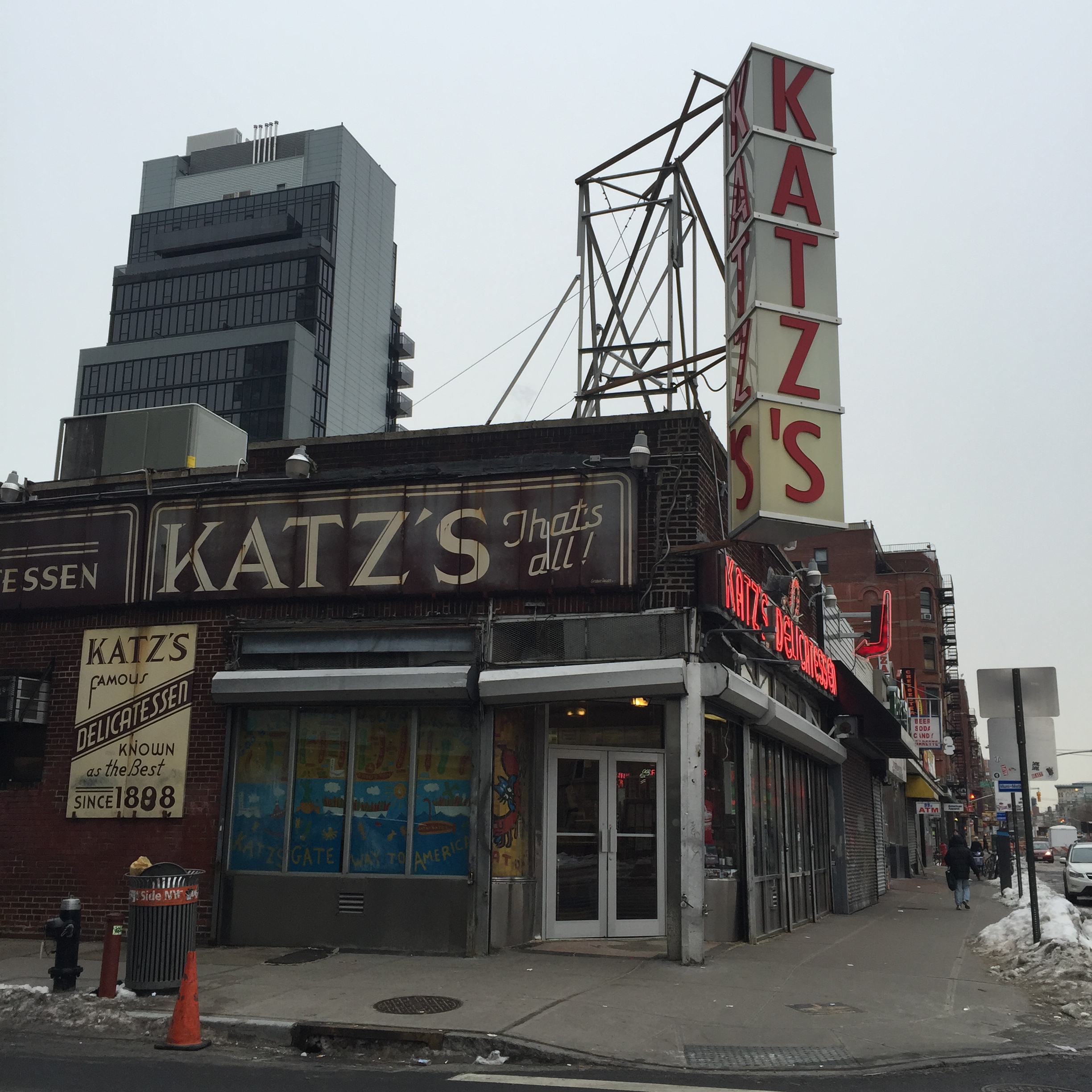
Starting on East Houston and Bowery, heading east, it doesn’t take long to find one of the iconic symbols of the area’s Jewish immigrant past – Katz’s deli on East Houston and Ludlow.  It’s hard to be in Katz’s without thinking of the famous scene from When Harry Met Sally (culminating in the famous line, “I’ll have what she’s having”) but it’s survived since 1888 based on the quality of its pastrami sandwiches. Bring cash – no credit cards accepted, but the attitude from your server is free.

Lowereastside6

Continuing east on Houston and turning south on Norfolk Street, the fifth oldest synagogue building in the United States, now the home of the Angel Orensanz Foundation, is on the east side of the street. After the Jewish population had largely left the area in the 1970’s, the building was abandoned and left to disrepair before being purchased by Spanish sculptor Angel Orensanz for studio space. The gothic-revival architecture of the building has been restored and the building now functions as a center for the arts as well as an artist’s studio.

Lowereastside7

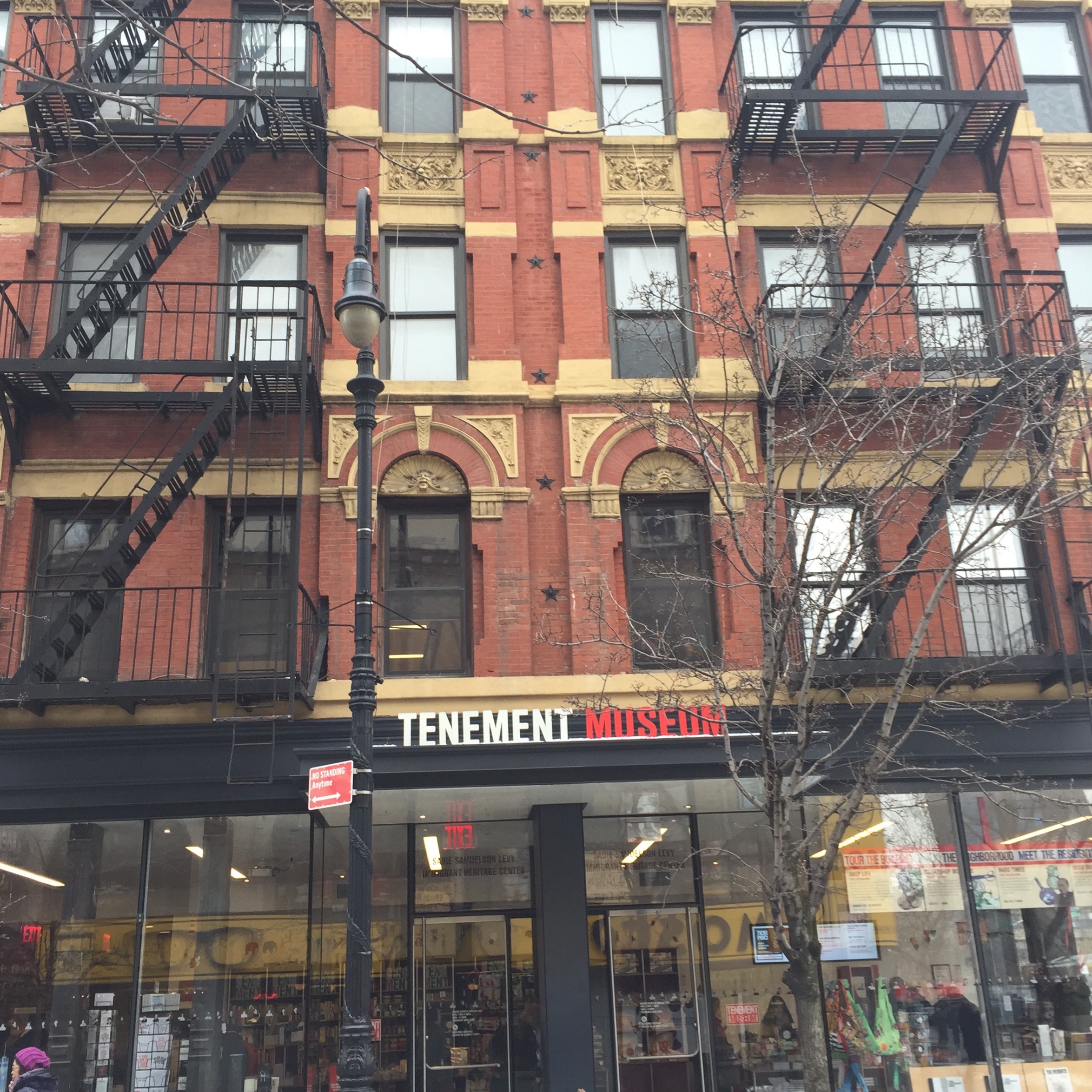
Walking along Orchard Street, several signs of the changes taking place in the neighborhood appear. Russ and Daughters (named back in 1914, so don’t think that going into business with your daughters is solely a modern trend) has had a storefront selling Jewish deli food on East Houston for a century, but now an upscale sit-down restaurant, Russ and Daughters Café, is on Orchard Street. Guss’ Pickles was once in a small store on Orchard and Broome, but now with the retail location  closed, jars can be found for purchase in Whole Foods and Fairway. Similarly, the Essex Street Market on Essex near Rivington reflects in some ways the small food shops that once populated the neighborhood, but now exists in a food hall, with prices the residents of the neighborhood even 15 or 20 years ago could not have believed. The Tenement Museum, on Orchard near Delancey, has preserved the way of life of immigrants to the area during the 19th and early 20th centuries. Given that quite often only the history of the wealthy is recorded for future generations, it’s significant and rather unique that this museum exists.

Lowereastside8

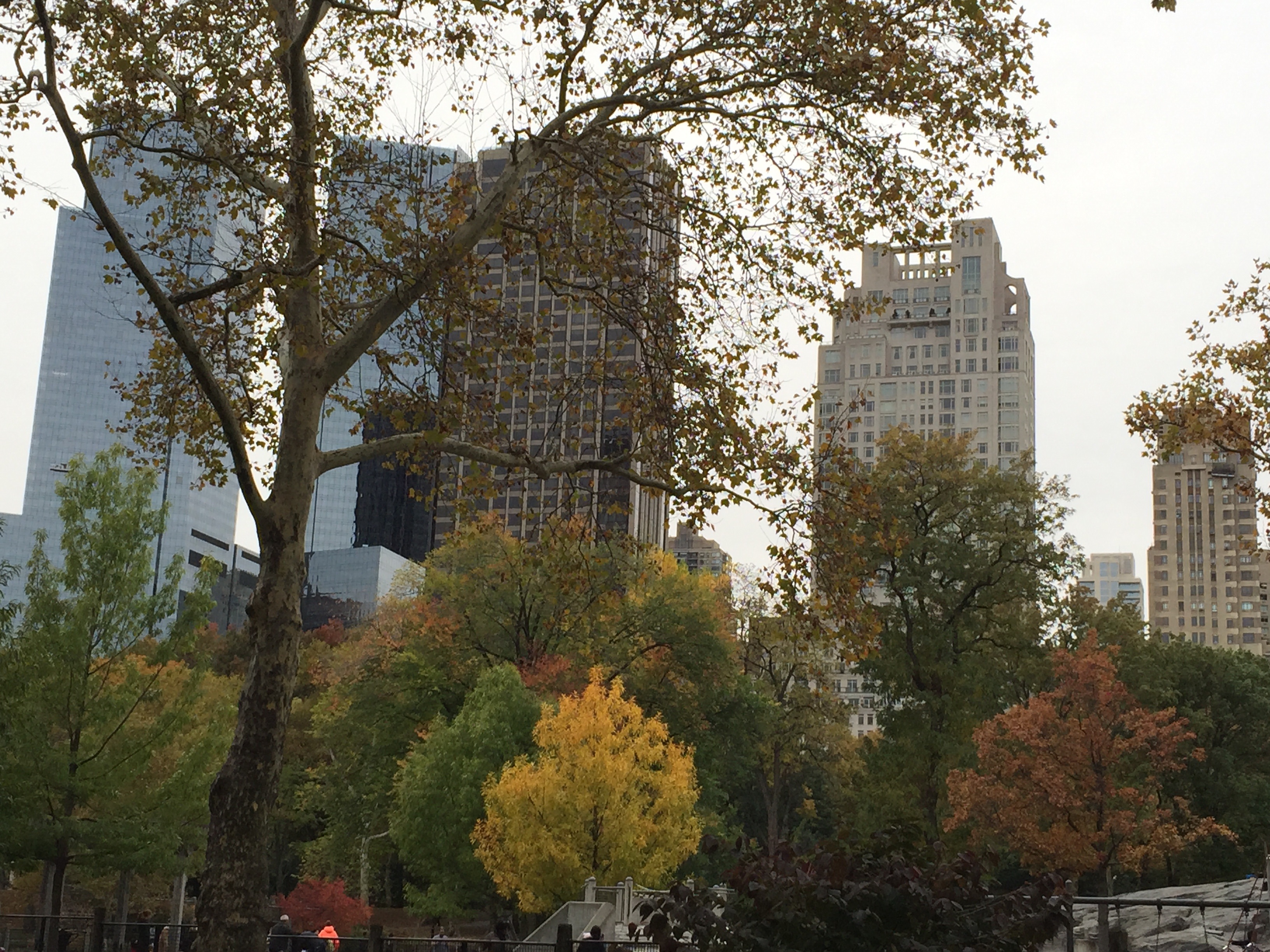
Turning back to head north again, when crossing Delancey, I looked east and saw the Williamsburg Bridge. When it was built, many Jewish residents moved from the Lower East Side to Williamsburg in Brooklyn. Now the rebirth of Williamsburg as a popular place for young people to live and go for nightlife is mirrored in the Lower East Side, part of the fascinating cycle of change seen all over New York City in all time periods.

Lowereastside9

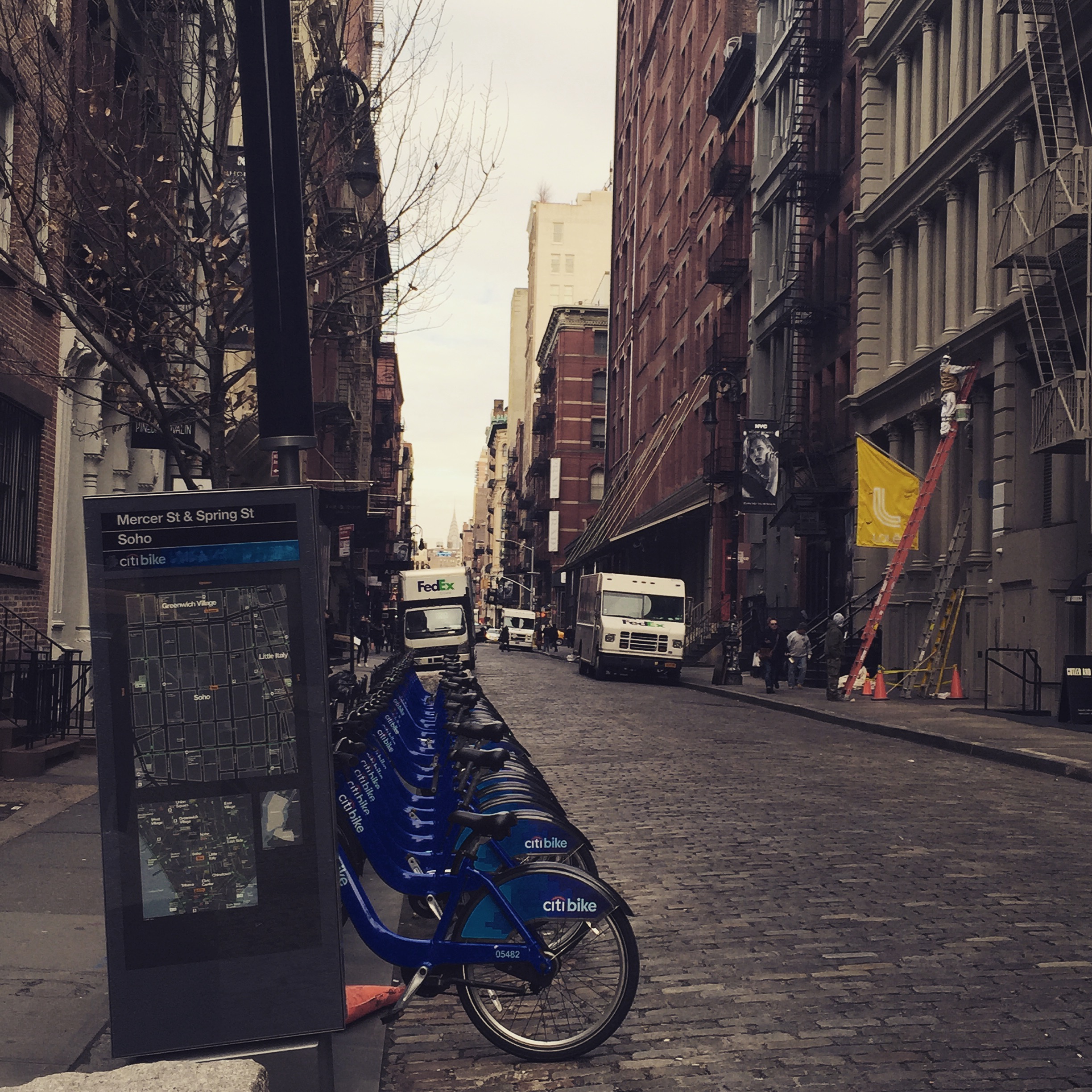
Heading over to Ludlow Street, I could not help but notice the new developments being built in the neighborhood. Although still primarily low-rise tenement buildings, new high-rise condos with all the amenities you could find in a similar building in Soho or Nolita (for, at least for now, at a lower price point) are beginning to spring up. The Blue Condominium was the first – and to many, it failed to fit into its environment (being much larger than surrounding buildings and extremely blue) – and many more are now in various states of construction. The rapid gentrification of the area led the National Trust for Historic Places to put the Lower East Side on their list of America’s Most Endangered Places. While it seems to me that it benefits neither the city nor the neighborhood to leave it full of crumbling tenements, a increased sensitivity in ensuring that the new developments blend in better with their surroundings can only be a good thing. The Hotel on Rivington was built to show off and contrast with its neighbors, while the Blue Moon Hotel, equally new and trendy inside, kept the exterior appearance of the building it renovated, making it almost identical to surrounding buildings.

Lowereastside5

Julian Casablancas sings about the inevitable changes that have been transforming the area in his song, “Ludlow Street.” In a typical Lower East Side scene, heading out in the morning after an evening of drinking too much, he thinks about how the indigenous Lenape tribes were first to be pushed out in 1624. As he sings, “Faces are changing on Ludlow Street/Yuppies invading on Ludlow Street/Nightlife is invading on Ludlow Street/And it’s hard to just move along.”

Soho

soho7
Before Tribeca (TRIangle BElow CAnal), Dumbo (Down Under Manhattan Bridge Overpass), Nolita (North of Little ITAly), or Nomad (North of MADison Square Park), there was SoHo (South of Houston Street). Although London’s Soho isn’t a shortened version of anything (it might be based on a hunting cry but has been a place name there since the early 1600’s so no one really knows), Manhattan’s Soho started the trend of cute acronyms for neighborhood names in the city. Today’s dérive (an unplanned walk in an urban environment) takes place in this cool downtown neighborhood.

Although today we know it as a beautiful area full of artists’ lofts and galleries, and as an upscale shopping destination, Soho in lower Manhattan has an interesting history. Originally a community for freed slaves of the Dutch East India Company in the 1600’s, this was the first settlement for people of color in the city. Surrounded by swampland and a canal, the area was not widely settled until the canal was filled in and became Canal Street. Becoming an industrial center in the mid-1800’s, most of the neighborhood’s characteristic cast iron buildings (the actual name of the historic district is Soho-Cast Iron) were created between 1840 and 1800. Originally used as a building material because cast iron was cheaper than stone or brick (but could be painted to resemble stone), cast iron was also easily molded and allowed for elaborate decoration around the large windows, themselves possible because of the strength of cast iron. With industry moving out of the area, the neighborhood fell into decline, until the 1960’s when artists looking for large spaces with plenty of natural light began to move in. Although originally the artists’ lofts were not zoned for residential living, eventually the city recognized the change that had occurred, and since the 1980’s, the neighborhood has become one of the city’s wealthiest.

Roughly bounded by (naturally) Houston Street to the north, Canal Street to the south, Crosby Street to the east, and Sixth Avenue to the west, I began this dérive on Houston and Crosby, walking south and turning west on Prince Street. Although Soho is surrounded by Greenwich Village, Little Italy, and Tribeca on various sides, and shares certain similarities with each, it also has its own distinctive feel. The neighborhood is full of architecturally significant buildings, many quite unique. The Little Singer Building (named because a few years after it was built in 1903, the Singer Company also built what was for a few years the tallest building in the world – and which was destroyed in 1967 before it could be landmarked), for instance, is now a combination of office spaces and artists’ lofts. It is covered in elaborate wrought iron decoration, terra cotta panels, and cast iron ornamentation. At Prince and Greene, one entire side of a building is painted in a trompe l’oeil façade of a cast iron building.

Prince and Spring Streets, particularly the areas near Broadway, are full of upscale shopping experiences. Dominique Ansel Bakery, famous for being the home of the cronut, is on Spring between Sullivan and Thompson. People line up between 7AM and 8AM every day to get the limited supply of cronuts (2 per person, only one type made per month), but don’t neglect the bakery later in the day – they make delicious treats in addition to the elusive cronuts!

While on Spring Street, glancing south when crossing Thompson Street reveals a beautiful view of One World Trade. Continuing east on Spring, I appreciated crossing the charming cobblestoned streets. Although all of SoHo would have been originally cobblestoned, only those streets still paved with Belgian blocks when the area was landmarked (a few of the north-south streets such as Mercer, Crosby, and Wooster Streets) remain as such. Seeing a row of Citibikes ready for rental, I imagine that cobblestoned streets and bicycling might not be the best pairing.

Soho becomes less hectic as you get away from Houston. Heading south on Mercer Street, It’s hard to imagine that plans to build two large elevated highways linking the Manhattan and Williamsburg Bridges with the Holland Tunnel were narrowly averted in the 1960’s. Fortunately, the value of this lovely area and its concentration of ornate cast iron buildings was recognized in time to preserve Soho for us to enjoy now and for future generations.

Soho3

Soho6

Soho5

Soho4

Soho2

Soho1

Long Island City

LIC 1 rotated

UPDATED JANUARY 2019 – With the announcement that Amazon is moving to LIC, everything I said a few years ago about the true bargains being in the past are even more true. However, this neighborhood is going nowhere but up . . .

Do you look back now and wish you had bought into Williamsburg or Dumbo 10 or 15 years ago? (I know I do.) Today’s dérive (an unplanned walk in an urban environment) takes place in a neighborhood that you may be feeling that way about in the very near future – and in fact, many of the true bargains are already in the past – Long Island City, Queens. One subway stop from 59th and Lexington (on the N and Q lines) and from Grand Central (on the 7 train), or from 53rd and Lexington (on the E train), this neighborhood is much more convenient to midtown Manhattan than most areas in Manhattan itself, has a thriving arts scene, and a park on the East River with magnificent views of the Manhattan skyline.

LIC 8 rotated

Long Island City (LIC) was its own actual city until joining greater New York in 1898. The area was originally the home to numerous factories and bakeries, but now many of these spaces have been or are in the process of being transformed. The Silvercup Bakery site was converted in 1983 to Silvercup Studios, the largest TV and film production studio in the Northeast United States. “Sex and the City” shot there, and current shows shot at Silvercup include “Elementary” and “Girls.” The sign is visible from many areas in LIC and from the 7, N and Q trains as you head toward Queensboro Plaza. The iconic Pepsi-Cola sign, visible from most riverfront areas of Midtown East in Manhattan, sits in front of the former Pepsi factory, now being converted to residential condos.

LIC 6 rotated

In my walk around Long Island City, I was drawn as usual to the waterfront – in this case, a beautiful sprawling park along the East River. Hunter’s Point South Park (a city park) and Gantry Plaza State Park meander for about a mile along the shores of the East River. The views of Midtown Manhattan from here are extraordinary.

LIC 7 rotated

The rapidly changing nature of this neighborhood has its pluses and minuses, as is typical when an area is redeveloped. The building covered in graffiti from multiple artists, 5 Pointz, was painted over despite protests and has now been demolished as the site is being replaced by a residential condo development. On the other hand, since the contemporary art museum PS1 (named after the school building it took over) merged with MoMA in 2000, the museum attracts approximately 150,000 visitors a year to LIC.

The first open house I ever worked in real estate was for a friend and colleague who sold a townhouse in Long Island City for a record price, but one that was still a fraction of what one would pay in Manhattan, or Brooklyn. Queens has come a long way since Claude in Hair (the tribal rock musical on Broadway) claimed to be from Manchester, England, to disguise his shame at hailing from Flushing. Long Island City is already transforming, and while it is still possible to find relative bargains here, a beautiful landmarked townhome or a new development condo with a city view won’t be even relative bargains soon. I was recently asked at a party for advice on investing in a new area (not an uncommon topic of conversation once someone learns you are in real estate) and I recommended Long Island City. The largest producer of fortune cookies in the United States (4 million per day!) is in LIC, but if you decide to make a purchase in the area now, you might be able to create your own luck.

Morningside Heights

Morningside 1

Bounded by Manhattan Valley to the south, Harlem to the north, Morningside Park to the east, and Riverside Park and the Hudson River to the West, Morningside Heights is an area with a long history (an important Revolutionary War battle was fought here) and many illustrious former residents (F. Scott Fitzgerald, George Gershwin, Cecil B. deMille, Fiona Apple, Thurgood Marshall, and Barack Obama among them). Recently I have heard of a trend to call the area “SoHa” or “south of Harlem” – but other than the names of a few places in the neighborhood, have not actually heard anyone use this term! Recently I took a winter stroll through the area to get a feel for what Morningside Heights has to offer.

To begin my dérive (an unplanned walk in an urban environment), I walked along Central Park West until I hit 110th Street, and turned west. Dominating the horizon almost immediately is the fourth largest Christian church in the world, the Episcopal Cathedral of St. John the Divine. Also known as “St. John the Unfinished,” it was designed in 1888 and begun in 1892, but was interrupted by two world wars and is still being fully completed. The Cathedral takes up a huge swath of land on Amsterdam Avenue between 110th and 113th Streets. A pleasant mix of secular and religious, the interior features sculptures of figures representing great thinkers of different centuries: representing the 17th, 18th and 19th centuries are William Shakespeare, George Washington, and Abraham Lincoln. In 2001 the 20th century representatives were completed with a group of four: Martin Luther King, Albert Einstein, Susan B. Anthony, and Mohandas Gandhi. A center for the arts, Philippe Petit (the French high-wire walker who was the subject of Man on Wire) is the Artist in Residence.

When I stopped by on this dérive in late December of 2014, one of the largest pieces of sculpture ever exhibited in the US, Phoenix (by Chinese artist Xu Bing) dominated the nave, two enormous birds suspended in air, looking at the Rose Window. The Cathedral’s Halloween celebration is a “don’t miss” (unless you fail to get your tickets early enough and are shut out) – a screening of an old silent horror movie accompanied by live organ music, followed by the Procession of the Ghouls, a parade of costumed performers and enormous spooky puppets. There are so many reasons to visit the Cathedral – the Feast of St. Francis procession that could include animals as diverse as a kangaroo, a camel, or a yak; the wild and wonderful Winter Solstice celebration – that living in proximity to it would be sufficient to make someone want to be a resident of this neighborhood, in my opinion.

However, walking west from the Cathedral along 113th Street, the quiet nature of these side streets provides yet another reason to live here. Although Broadway is bustling with places to eat and shop, the side streets are largely residential. Continuing west, I ran into Riverside Park, gorgeous year-round. Walking north, I treasured the magnificent buildings along Riverside Drive that face the Hudson River and the park, and their wonderful old-world elegance.

Turning to walk east along 116th Street, I appreciated the banners representing Barnard College – Transforming women and the world for 125 years. One thing people don’t generally think of when they think of New York City is that in fact it is a “college town.” There are over 600,000 students enrolled in the city’s 120 colleges and universities – more than any other city in the United States (yes, more than Boston!). Continuing up 116th Street to Broadway, I entered the campus of NYC’s own member of the Ivy League, Columbia University. It is the fifth oldest institute of higher learning in the US, and one of only nine “Colonial Colleges” founded before the American Revolution. Originally named King’s College and located at Trinity Church in lower Manhattan, it moved (under its post-Revolution name, Columbia College) to midtown for about 50 years in the 1800’s and then to its current spot (as Columbia University) in Morningside Heights in 1896. Although the campus was designed along Beaux-Arts principles, neo-classical styles abound, including its grand library, named one of the most beautiful in the United States.

Columbia’s presence remains a stabilizing force in Morningside Heights, but doesn’t dominate the neighborhood. Residential prices in the area are more reasonable than the Upper West Side, but with abundant public transportation it’s still an easy trip into midtown or downtown. Where else can you confirm who is buried in Grant’s Tomb (Riverside at W. 122nd) or search for peacocks wandering in a garden behind a grand unfinished cathedral? Morningside Heights is a wonderful destination, whether you are an occasional visitor or decide to become a resident.

Dumbo

blogDumbo1

If you have ever been to Paris, you will know the experience of feeling that every street frames a picture-perfect view. It’s not difficult to take a good photograph in Paris – the city displays itself in such a way that every shot turns out to be achingly gorgeous. I love New York City, and particularly enjoy walking around the city in an unplanned way (a dérive), and wonderful photo opportunities are easy to come by (particularly in Central Park, in my opinion). It wasn’t until a recent walk around Dumbo in Brooklyn, however, that I had the same experience I had in Paris – an area so photogenic that it was hard to put my camera (phone) down.

An acronym for Down Under the Manhattan Bridge Overpass, the neighborhood is a relatively small swath of real estate largely between the Brooklyn and Manhattan Bridges along the East River waterfront, and also continuing a bit east from the Manhattan Bridge. Originally a manufacturing area called Fulton Landing after the ferry stop that was the only way to get there from Manhattan until the building of the Brooklyn Bridge in 1883, by the 1970’s industry had largely moved out and the area had its new (endearingly silly) name. In the constant cycle of reinvention that exists in New York City, the area is now a hub for the arts, and for the tech industry – holding 500 tech businesses within a ten block radius. In 2007, the New York City Landmarks Commission made Dumbo a historic district, and since then the value of residential real estate in the area has soared.

To get to the area from Manhattan, there is still ferry service, but it is also easily accessible via subway. I took the 4 subway down the east side and transferred at the spectacular new Fulton station to the A train. One stop toward Brooklyn and I emerged ready to experience a walk around Dumbo. It is helpful to remember that the ground slopes down toward the river in this neighborhood, and with the Brooklyn Bridge on one side and the Manhattan Bridge on the other, it would be difficult to lose your sense of direction here.

Heading down Washington Street, I was quickly struck by the charming nature of this area. The streets are largely cobblestoned as in Tribeca, the repurposed industrial buildings (now residential) are warm rather than imposing, the ground level shops are interesting rather being cookie-cutter national chains, and the geometric shapes formed by the angles of the bridges to either side frame every view perfectly.

I am always drawn to waterfront if it is nearby, so I continued to slope down toward the East River. To my surprise, there were small rocky/sandy sections along the river that looked more like a beach than a riverbank! Of course, the views of the bridges to each side here were even more spectacular. Jutting out into the water toward the Brooklyn Bridge, I saw the famous Jane’s Carousel, built in 1922 and helpfully covered so that it can operate year round (tickets are only $2). Looking back toward Dumbo, I could see the ongoing construction that is continuing to transform the waterfront. St. Ann’s Warehouse is converting an old tobacco warehouse to house its theater offerings (“Where theater meets rock and roll” – well, you had me at “theater” but I like where this catchphrase is going!). Because the shell of the building is landmarked, they will build an entirely modern facility like a nesting doll within the shell but not touching the walls of it.

blogDumbo2

Walking along Water Street, one block away from the waterfront, I enjoyed looking at some of the colorful graffiti along some of the buildings under construction, but did wonder how much longer any of that will be around this rapidly transforming area. Passing Jacques Torres’ famous chocolate shop, I decided not to go in – this time. Continuing past the Galapagos Art Space while looping back to Washington Street and preparing to walk back to Manhattan along the pedestrian path on the Brooklyn Bridge (highly recommended; see my photo tour of the experience here), I realized how many experiences were left for me to experience when I come back – pizza at Grimaldi’s, a ride on Jane’s Carousel, decadent hot chocolate at Jacques Torres – and decided that my next trip to Dumbo will be sooner rather than later.

There are no real estate bargains to be had in Dumbo these days, but if you have the money and the desire to live in a beautiful center for the arts that happens to be tucked away from the bustle of the city – but with killer views of it – in my opinion, it is well worth the cost.

Beekman Place

Beekman4 rotated

Walking through midtown along First Avenue is a stereotypically hectic New York City experience, with multiple lanes of busy traffic, shops, and restaurants creating a noisy and bustling ambiance. Walk just a few steps east of First on 51st Street, however, and it is as if the city has magically melted away. Welcome to Beekman Place, a quiet residential oasis just blocks from the heart of Midtown Manhattan.

Beekman Place itself is only two blocks long, from 49th to 51st Streets, running just a short block east of First Avenue. However, apartments in the streets immediately surrounding Beekman Place are often said to be in the eponymous neighborhood (itself a sub-division of the Turtle Bay area). Perched high above the east river, able to survey the FDR Drive but feeling removed from it, there are views of the iconic Pepsi Cola sign to the east, the Ed Koch Queensborough bridge to the north, and the United Nations to the south.

The area received its name due to the Beekman family mansion built there in 1760. During the Revolutionary War, the British headquartered in the mansion for a time. Nathan Hale (“I only regret that I have but one life to give for my country”) was tried as a spy in the mansion’s greenhouse, and was hanged in the orchard surrounding the home. Later, George Washington was a frequent visitor to Beekman mansion while president. The mansion was eventually torn down in 1874 after being abandoned in the 1850’s during a cholera epidemic. Eventually the area became a slum, only to have its fortunes turn with the building of One Beekman Place in 1929. The area became virtually a synonym for a certain type of privilege (Hubbell Gardiner in “The Way We Were” had grown up on Beekman – enough said), home to Rockefellers and foreign royalty.

Taking a dérive (an unplanned walk in an urban environment) in the area after previewing an apartment for sale for a customer, I found the area to be far from stuffy – charming and livable. East 51st Street ends in a steep series of steps that lead to Peter Detmold Park. The dog run here is relatively famous among pet owners in the city, being very large and beautiful. A non profit group, PDP-ARF (Peter Detmold Park – Animals Run Free) maintains the dog run, and it is a center for neighborhood events. The Beekman neighborhood association was going to hold a caroling party on the December afternoon that I was there, an almost small-town touch to this quiet gem.

Looking up from the park toward the back of the homes on the south side of Beekman Place, I realized what spectacular views over the East River those apartments have – many with private terraces. Walking back up from the park and taking the very short stroll along the fronts of those homes on Beekman Place, the feeling is similar to the Gramercy area, but with virtually no traffic. There is only one way to drive in (E. 50th) and two ways to drive out (E. 49th and 51st), but no reason to do so unless you live there. Walking back toward First Avenue on E. 49th, I found myself on another of New York City’s quirky one-block streets, Mitchell Place.

Walking away from Beekman Place, within just a few blocks I was in the heart of midtown, passing the Waldorf Astoria. I loved the contrast of this quiet sleepy yet residential area with the bustle of midtown so near.  Prices in this neighborhood, while not low budget, are still less than similar apartments on Park or Fifth, in part because it is so far to the  east of the 4-5-6 subway line. Elegant yet livable; remote yet close to the heart of the city; supremely pet friendly – Beekman Place won me over.

Central Park in Autumn

CP - city and trees

It’s no secret to anyone who has read my blog posts that I adore Central Park. New York City’s jewel, it occupies a surprisingly large rectangle in the center of Manhattan. Its geometric edges belie the diverse topography within the park itself – pick a different entrance and a different segment of the park each time you enter and you might think you were in an entirely new place. Not only does the park change within its sections, it changes dramatically with each season, and depending on the weather, even within each season. For this dérive (an unplanned walk within an urban environment), I entered the park at its southwest corner on a cool late-Autumn day.

This corner of Central Park is surrounded by the hectic confusion of Columbus Circle, with the budding skyscrapers of Billionaire’s Row along the south end, and Time Warner Center and 15 Central Park South along the west. Walking into the park here (once you have passed the horde of bicycle rental peddlers) is an immediate escape from the traffic and crowds. It takes longer for the trees to change to their autumn colors in the city compared to areas right outside – or even those farther south – because of the “heat island” effect of all the concrete. Once the trees in Central Park begin to turn, however, they really show off. The experience was walking through the park this time of the year is uniquely engaging. The crunching of leaves beneath your feet is an auditory reminder of the season (as long as you take off your ear buds).  The burst of yellow, orange, and red leaves in the foreground is a visual treat, highlighted by the stately apartment buildings in the background.

Wandering through the lower end of the park, I heard the Central Park Carousel before I saw it. There has been a carousel in this spot in the park since 1871, this fourth one having been there since 1951. It was built in 1908, and lived in Coney Island before being moved to Central Park. It has 57 hand-carved horses and two chariots. The Carousel is open every day of the year, weather permitting. The Carousel has to be ridden to be experienced – like the rest of New York City, it is fast!

Just east of the Carousel is the Central Park Dairy, a fanciful building that looks like it was taken from a fairy tale, once a source of fresh milk for city kids. Now it’s one of five information centers and gift shops in the park. Just past the Dairy, still heading east, is one of my favorite statues in the park – Balto the husky. Balto led a pack of sled dogs to carry diphtheria medication 1000 miles between Nome and Anchorage when a serious epidemic broke out among children in Alaska. The heroic dogs became famous, and this statue was installed only 10 months after the event. Appropriately, the patina on this inviting bronze statue is worn from legions of children sitting on his back.

Continuing east but curving a bit south again, I was once again charmed by the sound of a park icon before seeing it – the Delacorte Clock near the Central Park Zoo. Given to the Park by George Delacorte (who also donated the Alice in Wonderland statue and the incomparable Delacorte Theater, home of Shakespeare in the Park) in 1965, this clock with a moveable animal sculpture carousel can be experienced every day on the hour and half hour from 8 AM to 6 PM. It plays nursery tunes most of the year, while a penguin, hippo, elephant, kangaroo, bear, and goat dance around with musical instruments and two monkeys strike the bell. During the end of the year, the music switches over to holiday tunes.

In my opinion, a person could spend several lifetimes in New York City, and never grow tired of Central Park. Always changing, it provides a way to stay in touch with our animal nature while surrounded by the buildings and endless activities that humans have created – allowing those of us who live in New York City to be stimulated or calmed, depending on what we need at any particular moment.

Gramercy Park

Gramercy Park 3

Most neighborhoods in New York City have a story to tell – generally, it is a cyclical one, perhaps from farmland to residential, to tenements, and back to gentrification. There are however a few areas of New York City that have remained remarkably stable. One of these is the Gramercy Park neighborhood, which was created to be a fashionable residential location and has remained fashionable to the present. The neighborhood is roughly between Third and Park Avenue South, and between 18th and 22nd Streets. The Historic District encompasses some of this area, and nowadays the greater area might be considered to go all the way from 23rd to 14th Street, still between Third Avenue and Park Avenue South.

My favorite way to experience a neighborhood is to walk through it without a pre-planned route (a dérive). Emerging from the subway on Park Avenue South and 23rd Street, I immediately noticed that there are generally low lying buildings here. The Manhattan schist, or bedrock, is deeper in this part of the island, so generally there is nothing over 20 stories in height. Venturing farther from the subway stop, the quiet nature of this neighborhood becomes clear. Originally the area was swampy, but in 1831 the land was bought, and a plan for the area designed by, Samuel Ruggles. The most significant part of his plan included a private park, like the private garden squares popular then, and still found today, in London.

As you walk toward Gramercy Park, the tall and heavy fences with locked gates cannot be ignored. Gramercy Park is the only private park in Manhattan. It lies between 20th and 21st Streets (Gramercy Park South and North), and midblock streets called Gramercy Park East and West. As Lexington Avenue heads south, it hits a dead end at the park, and reemerges on its south side as Irving Place. Only the residents of the buildings facing the park have keyed access to the park and the value of an apartment that includes the right to a key is significantly increased compared to one close by but without access. Keys can be also checked out by members of the Player’s Club, and guests of the Gramercy Hotel can be escorted to the park by a hotel employee and let in, then picked up when they are ready to leave. The keys to these locks cannot be copied, the locks are changed every year, and hefty lost key fees insure that the park remains private. The keys are even individually numbered and coded.

The statue in the middle of the park is of Edwin Booth as Hamlet, one of the best Shakespearean actors of the 19th century (namesake of the Booth theatre – and brother to John Wilkes Booth, assassin of President Lincoln). He lived at 16 Gramercy South and eventually gave the building for the formation of the Player’s Club. Every Christmas eve the park is opened to the public for caroling, so if you’re dying to be inside those locked gates, this is your one opportunity (or, you could buy a place with a key).

Walking around the perimeter of the park (outside the gates, of course!) the Gramercy Park Hotel, built in 1925, dominates the northern edge, while the western edge features a line of immaculate townhouses. E.B. White’s Stuart Little takes place on Gramercy Park, presumably in one of these homes. Most of New York City has some kind of interesting history waiting to be uncovered, but Gramercy Park seems to have more than most neighborhoods; for instance, Thomas Alva Edison and John Steinbeck once lived on the park. Nearby, Teddy Roosevelt’s birthplace on E 20th Street is a National Historic Site.

While the idea of a gated private park in New York City does seem to go against our democratic ideals, it has certainly preserved the value of the residences facing Gramercy Park and stabilized the neighborhood. Of course, Central Park is open to all, and proximity to it can also significantly increase a home’s value. Gramercy is a quiet, pleasant neighborhood – on the cusp between midtown and downtown, but with some of the understated characteristics of streets in Carnegie Hill uptown.

Murray Hill

Murray Hill Empire

Have you ever watched an old movie or television program and heard someone’s phone number expressed as “Murray Hill” followed by five numbers (for instance, the Ricardos in I Love Lucy were at MH5-9975)? That telephone exchange once covered all of the east side of Manhattan, with an East 37th Street building serving as the hub. The Murray Hill neighborhood itself covers roughly the area between E. 34th and E. 40th Streets, between Madison and Third Avenues. After showing a customer a potential home recently, I took an unplanned walk (a dérive) to experience what it would be like to live or work in Murray Hill.

However, my first questions were: who was Murray and was there truly a hill (because I was unable to detect a significant one while walking the area)? In fact, Robert Murray was a Quaker, an Irish immigrant around the time of the American Revolution who became a successful shipping merchant and built a house on what would now be Park Avenue and 36th Street. The area would have been the limits of uptown Manhattan at that point, with farmland continuing north. At that point there was a hill (since leveled) and a reservoir existed where Bryant Park and the New York Public Library now sit. For a time in the 19th Century, Murray Hill was the destination for many of the industrial age’s titans to build their mansions and townhouses, before the birth of Millionaire’s Row further uptown on Fifth Avenue with views of the newly created Central Park.

MurrayHillChrysler

Starting on Park Avenue and 40th Street, magnificent Grand Central Station looms just a few blocks north, the Chrysler Building emerging behind it and to the side – looking like a cross between a skyscraper and an Art Deco fairytale castle. One of the things I appreciated immediately was that the many shorter buildings in the area create multiple opportunities for iconic views of the Chrysler Building to the north and east, and the Empire State Building to the south and west. The high rise buildings, like the one I was showing to a customer, often have several apartments with perfectly framed views of these buildings. In fact, these views are made more spectacular by close proximity. Wandering the streets in no particular order, the sudden unexpected views of these iconic skyscrapers was a real delight.

MurrayHilltownhouses

While the avenues in this neighborhood are bustling and full of restaurants, bars, and shops, the streets tend to be surprisingly quiet. Many of the street blocks contain rows of townhouses or mid-rise buildings, with the high rise buildings tending to be on the Avenues. Eventually I came across the Morgan Library and Museum on Madison at 36th Street. I happened upon it from the side, on 36th Street, and first noticed the sculpted lionesses guarding this side entrance. I was not surprised to discover later that they were by the same artist who created the better-known lions at the front of the New York Public Library a few blocks away. The magnificent main building was created to house the manuscript collection of Pierpont Morgan, a prominent financier in the beginning of the 20th century. His son later gave his father’s collection and the building for the creation of the Morgan Library and Museum. Although best known for its illuminated manuscripts and sketches, it also houses original handwritten musical scores and lyrics, from Mozart to Bob Dylan (his first draft of “Blowin’ in the wind,” written on a scrap of paper).

Heading out of the neighborhood into Kips Bay to the east, I realized that the proximity to the Queens Midtown Tunnel could make this a very convenient neighborhood for those who regularly head to Long Island. With Grand Central Terminal only a few blocks away, it is also well situated for people who use Metro North to go to upstate or to Connecticut. Murray Hill struck me as an interesting midtown neighborhood, with options for high rise living with killer skyscraper views as well as peaceful townhouse living with a view of leafy trees.

Manhattan Valley

455 CPW

Recently I was looking for a townhouse for a customer, and came across one on Manhattan Avenue and 105th Street. While I suppose I would have thought of this address as being either “Upper-Upper West Side” or “Lower Morningside Heights” before spending some time there, I have since learned that the area bounded by 110th Street and 96th Street to the north and south, and Central Park West and Broadway to the east and west is actually called Manhattan Valley. This part of town was known as the Bloomindale District in the past, for a Bloomingdale Street previously in the area (long since gone). There is a natural valley here, caused by what was once the path of a small stream leading from the Harlem Meer to the Hudson River. Between the price for the townhouse I was viewing in the area, and the price of a 2 bedroom co-op recently listed by a colleague on West 100th just off Central Park West, I quickly realized that this area, while very close to the Upper West Side in both location and atmosphere, offers opportunities for excellent value in real estate.

As I have written before, I find that the best way to get the feeling of what it would be like to live in an area is to take a dérive (an unplanned walk in an urban setting). For this one, I started at Broadway and 96th Street. 96th Street, like 86th on the east side, is a busy major two-way thoroughfare, often packed with cars on their way to the Henry Hudson and on to the George Washington Bridge. I walked east to Columbus, and headed north. The Columbus Square mega-residential development between Columbus and Amsterdam and between 97th and 100th Streets, has brought in a series of high-end shopping destinations along this stretch of Columbus. In addition to the Whole Foods, Sephora, Petco, and Starbucks already there, Crumbs cupcakes will be reopening here within a month.

Turning east on 100th, I walked to the beginning of Manhattan Avenue. The topography of the island of Manhattan is not a perfect rectangle, although we have imposed a grid of streets on most of it. This disparity occasionally leads to extra streets in some areas, and Manhattan Avenue appears between Central Park West and Columbus beginning at W. 100th Street, and continuing well into Harlem. The super block developments created by Park West Village and the Frederick Douglass Houses prevent cars from using this area as a way to cut crosstown, making it noticeably quiet. The blocks between 104th and 106th are simply gorgeous rows of townhouses, reminding me strongly of the beautiful peaceful townhouse blocks near Prospect Park in Brooklyn.

Turning east again on 106th, I walked to Central Park West, appreciating the view of 455 Central Park West. Formerly the New York Cancer Hospital, this property has quite an interesting history. This was the first cancer treatment facility in the country, created with money raised by John Jacob Astor and others after former president Ulysses S. Grant discovered he had throat cancer. They built a beautiful chateau, which looked more like a museum of art than a hospital (the rounded towers were created as a state-of-the-art medical feature to prevent germs building up in sharp corners), and it continued on this site until the mid-20th Century. The developers of this property restored the chateau into condominium apartments, and added a modern tower behind it with unimpeded Central Park views. Walking north on Central Park West to 110th, and turning west, I was now on Cathedral Parkway and had to finish this derive with a nod to our spectacular Cathedral of St. John the Divine, which I will discuss in more depth in a future derive in Morningside Heights.

I loved spending time in this neighborhood. For someone looking for a home with the feel of the Upper West Side or near New York’s jewel, Central Park, this area offers significant value.