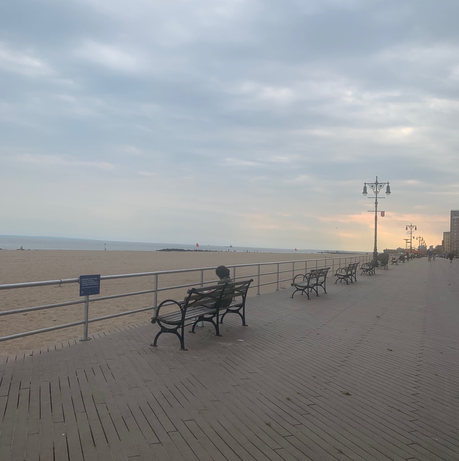
It’s been a hot summer in New York City, and many escape to the Jersey Shore or the Hamptons (or Martha’s Vineyard, Cape Cod, or Bar Harbor, for that matter) to find some cooling ocean breezes. However, we are fortunate that in NYC we have several beaches we can get to fairly easily via public transportation. I have previously blogged about taking the ferry to Rockaway Beach in Queens, and taking the subway to Coney Island. Recently though, I enjoyed a walk through three different beaches in Brooklyn, starting with Manhattan Beach, continuing to Brighton Beach, and then finishing up on Coney Island. Consider this a bit of a summer photo essay, and a reminder that there are always things to do in New York City.
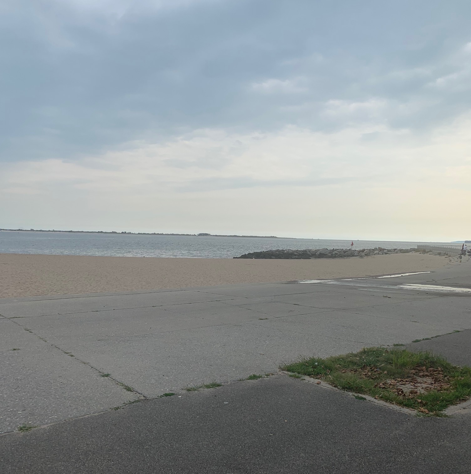
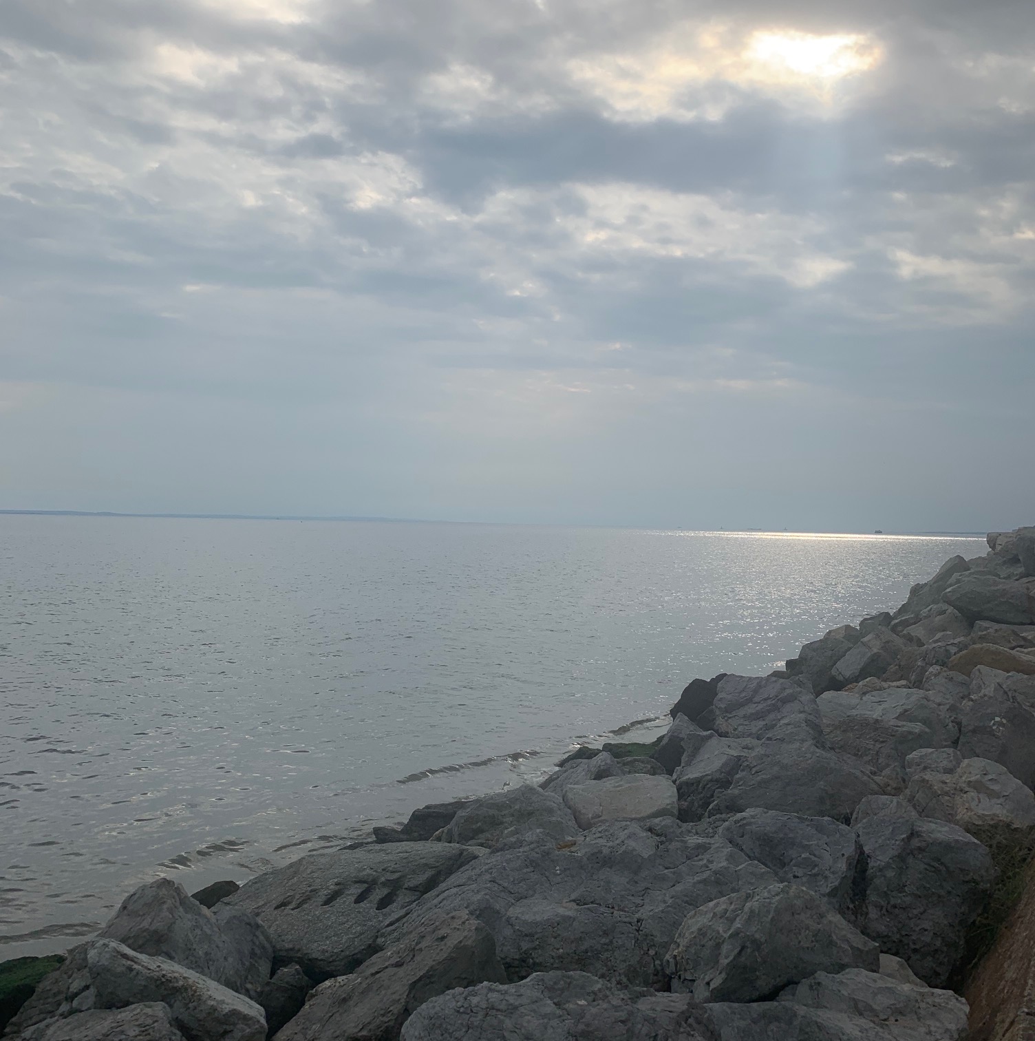
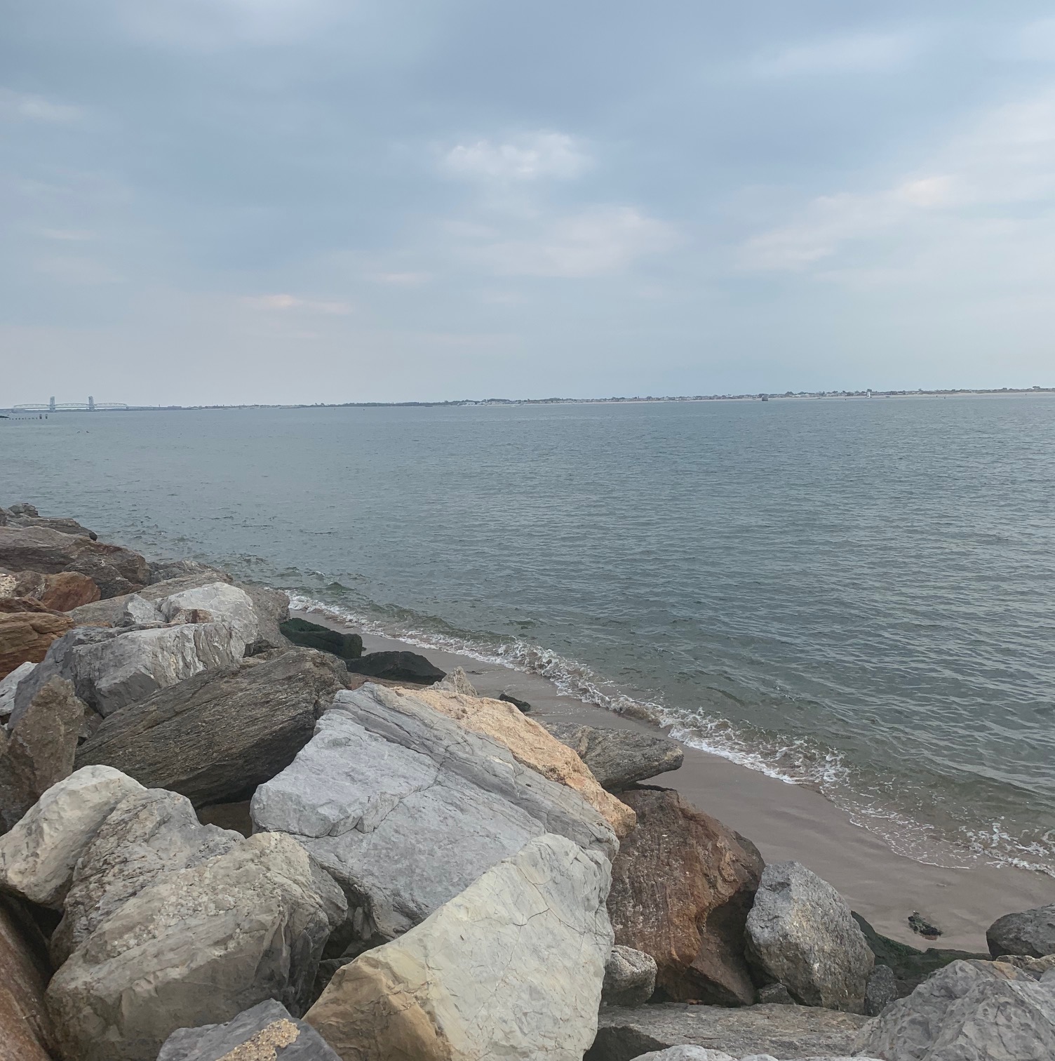
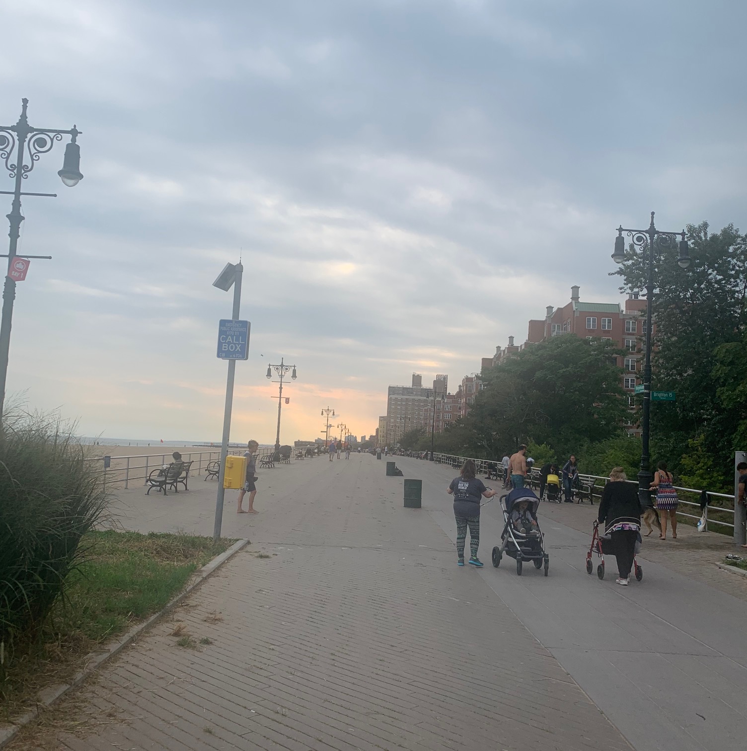
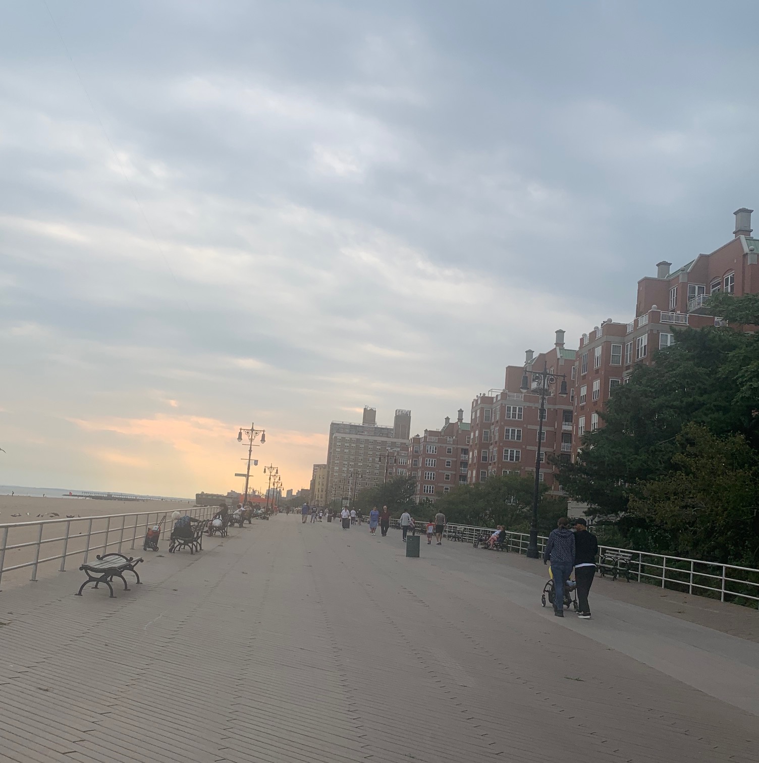
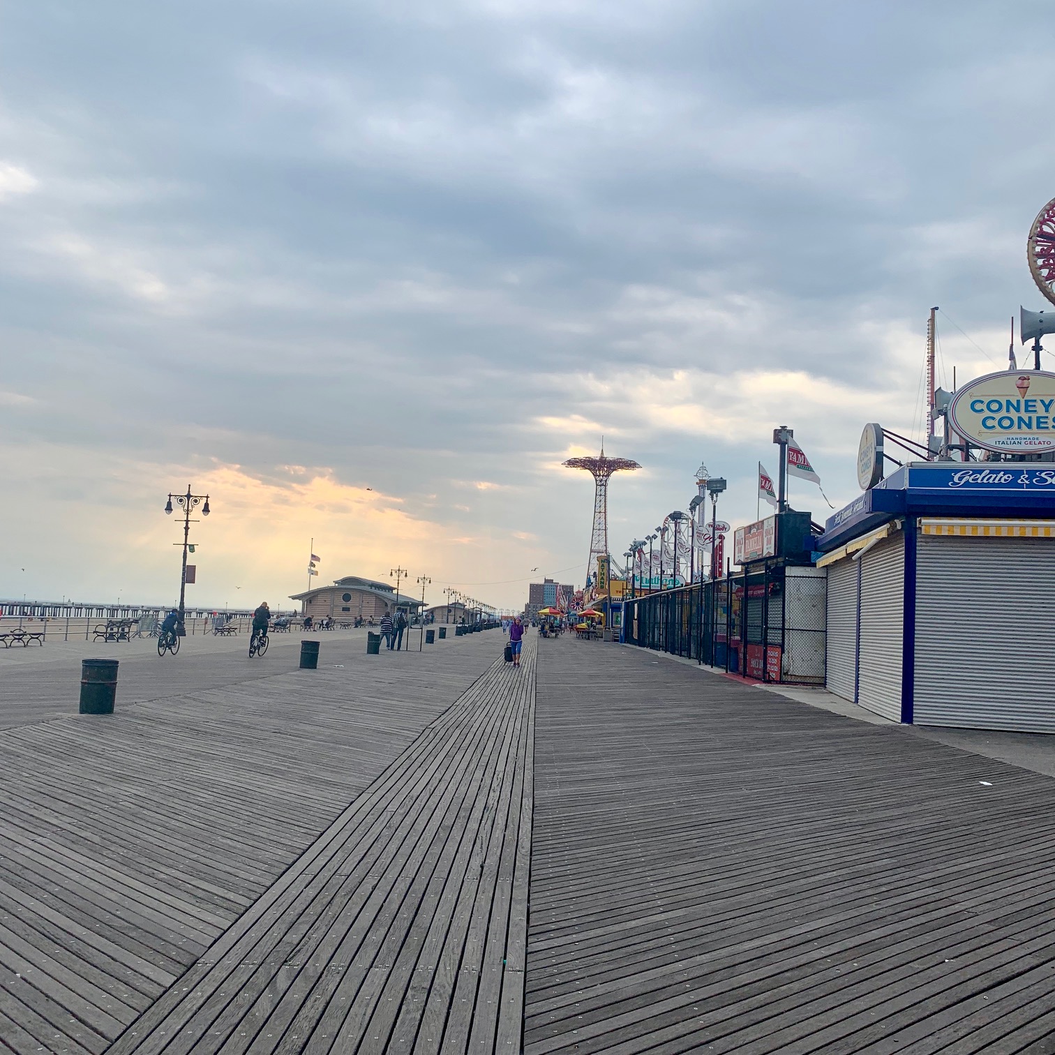
To get to Manhattan Beach, you can take the Q to the Brighton Beach stop, and then either take the B1 or B49 bus toward Sheepshead Bay, or walk about 20 minutes or so. Manhattan Beach looks across Jamaica Bay right at Rockaway Beach. Walk with the water to your left and you will be walking back toward Brighton Beach. You will get a boardwalk beginning in Brighton Beach, which then eventually joins the Coney Island boardwalk.
There are multiple public transportation options at Stillwell Avenue for getting back. If you don’t stop, the entire walk from Manhattan Beach to Coney Island Beach is about an hour. There are plenty of reasons to stop though – not only to enjoy the ocean but to have a bite to eat, or sit and people watch. I went late on a weekday when it had been threatening rain off and on, and the walk was quiet, but on a sunny summer day be prepared for it to be crowded. Hey, if you can spend the month of August somewhere cooler looking at some other beach, enjoy! But if you can’t, don’t forget all the beaches that are easy to get to within the city.
The Hudson River Greenway along the Hudson River on Manhattan’s West Side is accessible for walking and biking from Battery Park all the way north to Inwood Hill Park at the top of the island. It keeps being expanded and is a destination for residents and visitors alike with recent additions like Little Island Park, Pier 26, and Pier 57. On the other hand, while the riverfront area along the East River has some lovely patches (like the John Finlay Walk next to Carl Schurz Park in Yorkville), there are also stretches where there is no waterfront access. There is a new plan to connect all of the East River waterfront, similarly to that seen on the Hudson River, and a new section of this was recently opened, beginning at East 54th Street and continuing up to connect an existing path at East 61st Street.
Entering the new stretch at East 54th Street, the views are instantly gorgeous. You can see south along the East River, as well as east to Long Island City.
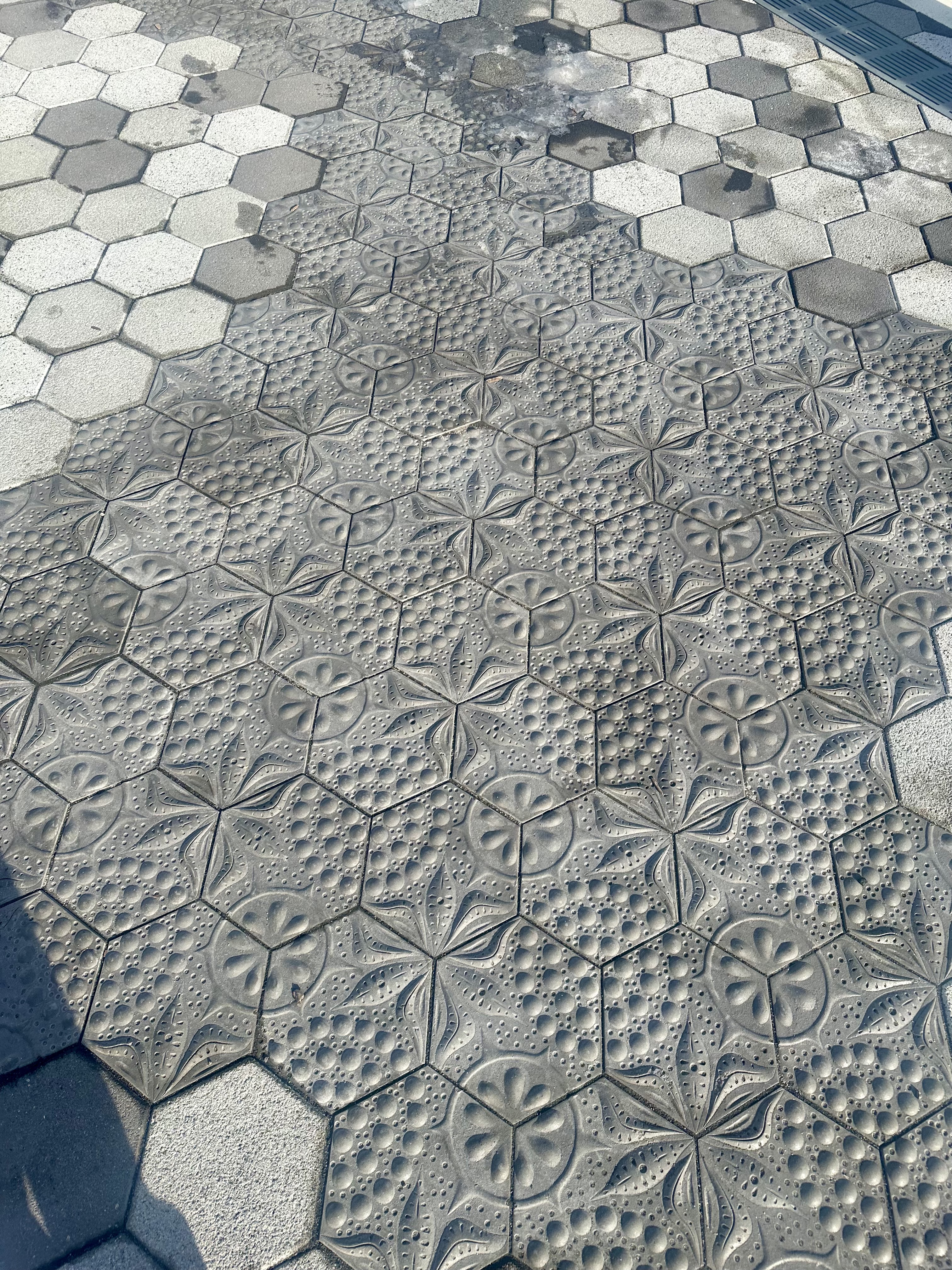
The tiling on the walkway is inspired by diatoms, single-celled microscopic algae. They are the base of the food chain in the river, and convert sunlight into energy. There can be hundreds or even thousands of diatoms in one spoonful of East River water. For more details about the use of these diatom-patterned pavers, check out the description from the artist who was involved, Stacy Levy.
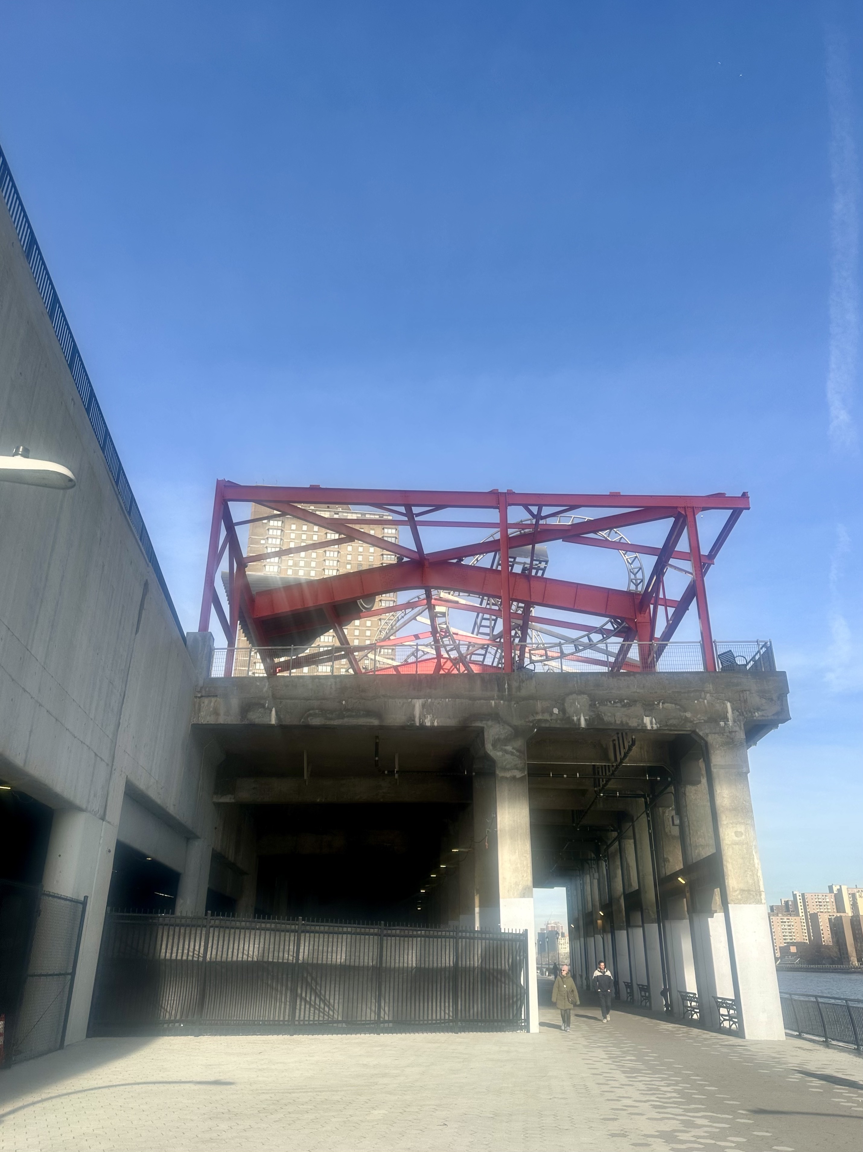
As you start to connect to Andrew Haswell Green Park at East 61st, you can’t help but notice the thing that looks like an abandoned steel roller coaster track. In fact, it is an artwork by artist Alice Aycock, called The Roundabout. A little more about that as we exit the new walkway next to it!
You get some thrilling views of the Ed Koch/Queensboro/59th Street Bridge, especially as you walk under it.
If you choose to exit at East 61st rather than continuing north to the existing Andrew Haswell Green park, you get an up close look at Roundabout. It covers the roof of a defunct Department of Sanitation Building, and was inspired by the weightlessness of Fred Astaire’s dancing! You can read more about this artwork here.
The eventual goal of the East River Waterfront project is to have a continuous loop around all of Manhattan next to the waterfront. It will likely help the livability (and hence the value) of the far east side of midtown Manhattan to have a waterfront park, and one that connects all waterfront areas in Manhattan will be even more appreciated. I look forward to seeing the East River waterway in Manhattan continue to develop and enrich the experience of New Yorkers and visitors to the city alike.
I love walking, and especially walking in New York City, and have written about it often (see old posts here, here, here, and here – among many), and have even compared walking in NYC to walking in London and Paris (see it here) and described walking in the ultimate car city, Los Angeles (see it here). Soon I will be going on a very long walk – I plan to hike Mount Kilimanjaro in Tanzania with a family member (and will be writing about the preparation for that as well as – hopefully – an account of the trip afterwards). (POSTSCRIPT: read about the Kili Climb here, about preparation for it here, and the safari afterward here.) As part of my training as I headed into the final weeks before leaving, I recently did something I have wanted to do for a while – I walked the entire length of Broadway from Battery Park to the tip of Inwood, about 13 miles, with my fully loaded daypack for Kili (including 4 liters of water), wearing my hiking boots, etc. Here’s what my day was like!
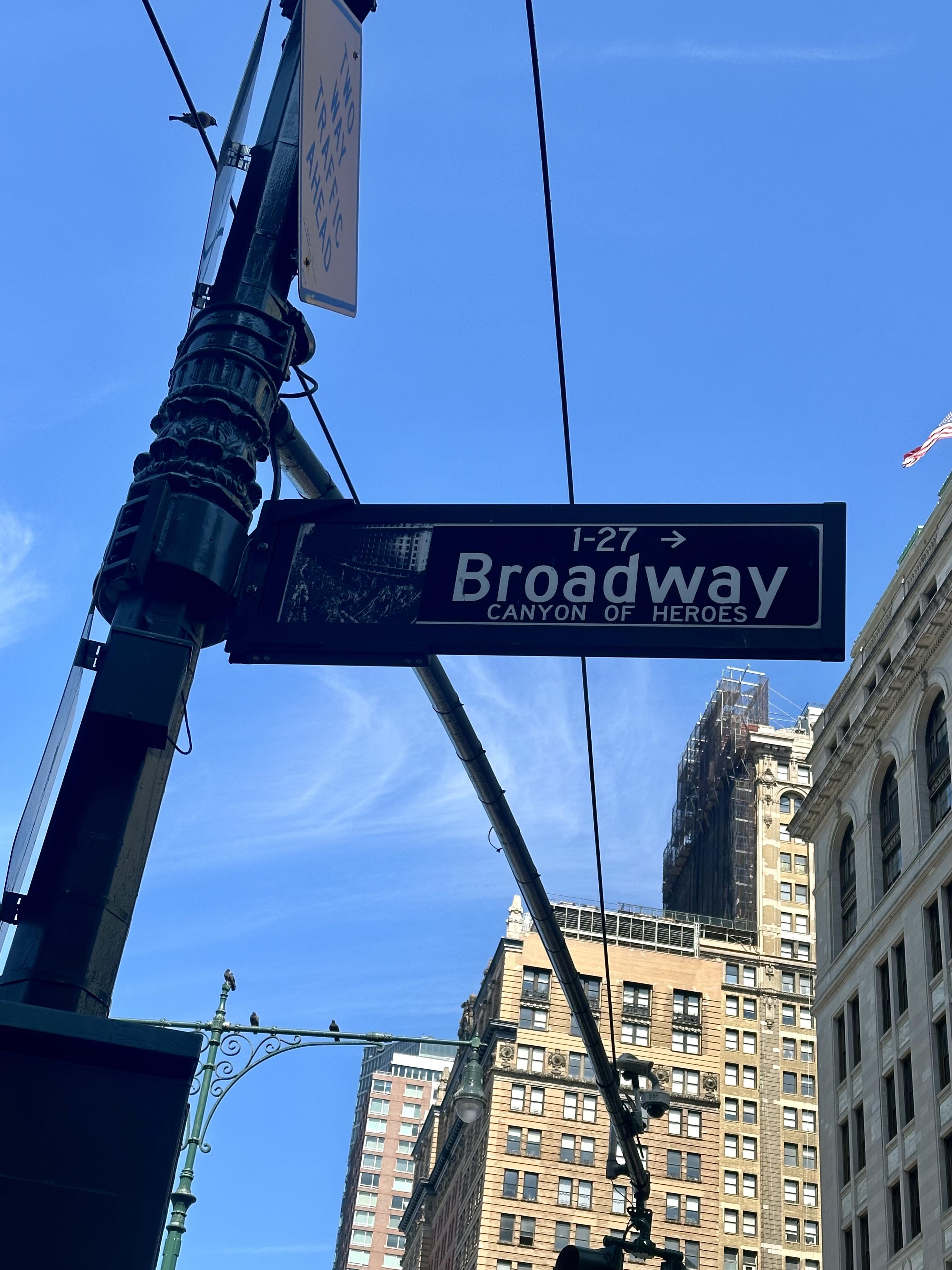
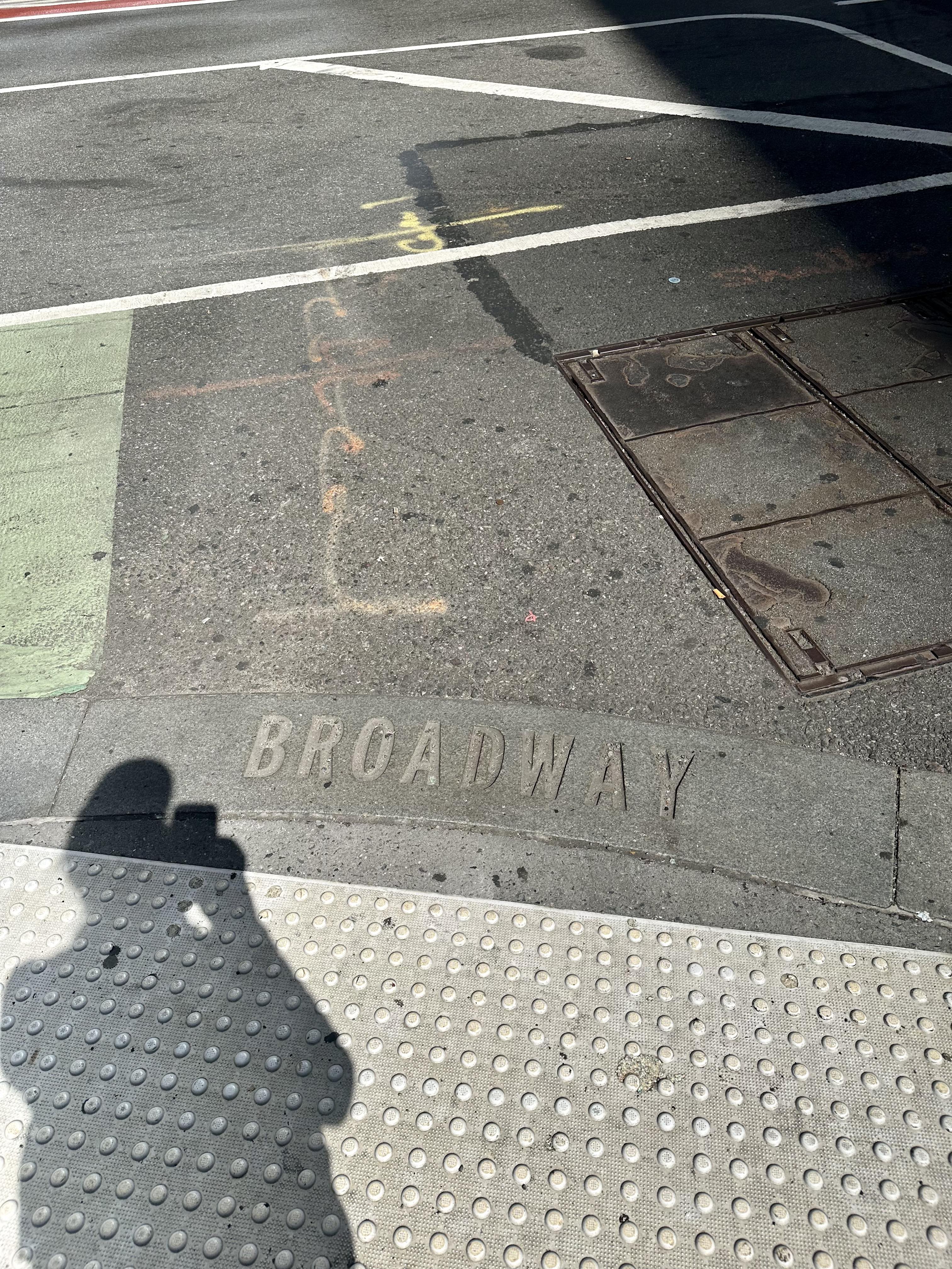
Broadway is the only avenue in Manhattan that runs its entire length (and in fact, continues north for two miles into The Bronx and then runs for 18 miles through Westchester County, through the towns of Yonkers, Hastings-On-Hudson, Dobbs Ferry, Irvington, and Tarrytown). It is also a street that does not follow the grid in Manhattan above 14th Street. Much of it follows the Weckquaesgeek trail, a major thoroughfare long before Europeans arrived. It was then widened by the Dutch, and named the “High Way.” When the British took over it was renamed Broadway because of its unusual width. In the 18th Century, Broadway ended just north of Wall Street, and the section below that was Great George Street, but since 1899 Broadway has begun just north of Battery Park, so that is where I began my walk, on a Saturday in late July that was finally not too hot or humid to contemplate such a long walk.
I took the subway to South Ferry (I had thought about biking down but decided not to test my endurance too much!), and began my walk at One Broadway, just north of the Museum of the American Indian. Before too long I encountered the famous Wall Street bull at Broadway’s intersection with Wall and watched people line up to take photos.
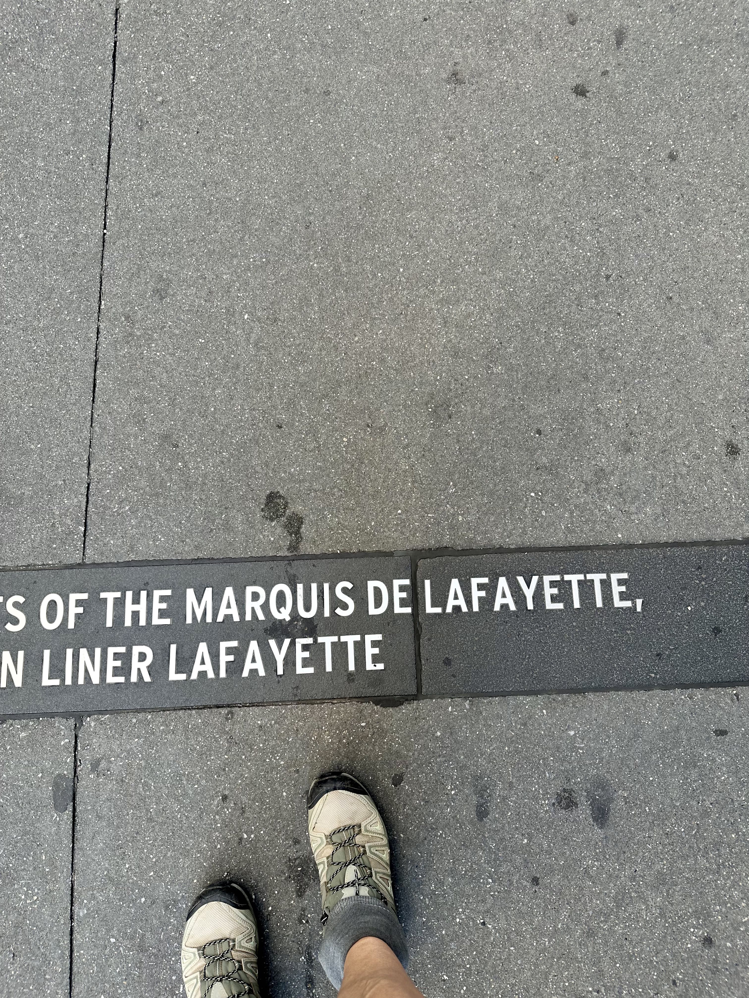
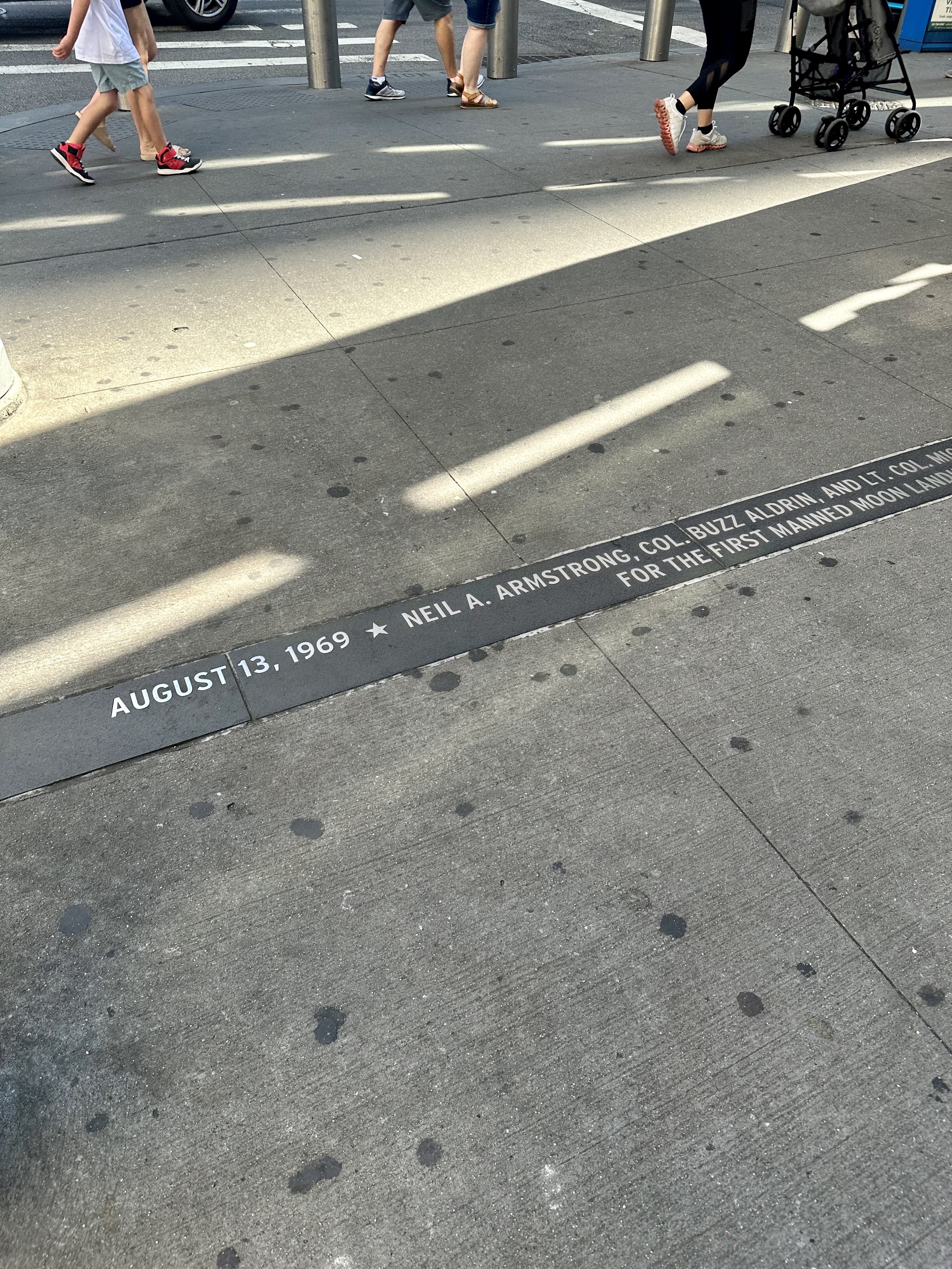
Not too far north from there I began reading the markers for the Canyon of Heroes. This is the section of Broadway where ticker tape (from when the financial district had tons of ticker tape paper as a side effect of doing business) parades have celebrated heads of state, winning local sports teams, and special occasions like the end of World War II or the return of Americans who first walked on the moon. It is fun to read these although you will only read those on one side of Broadway if you are trying to make good time. I stayed on the east side of the street for much of the day to take advantage of shade. I also started from the southern end of Broadway and walked north, rather than starting from the north and walking south (I found out later there is a “Broad City” challenge that starts at the northern tip of Manhattan because it was done in an episode of the show). If you do start from the south, you can read the Canyon of Heroes markers more clearly because they aren’t upside-down, and the sun will be more behind you near the middle of the day rather than in your eyes. On the other hand, as I will describe later, the Inwood section of the hike is much more hilly so you might want to get that over with earlier in the day.
Still in the Canyon of Heroes, be sure to appreciate Trinity Church to your left. Trinity’s first church in Manhattan was built in 1698 and was destroyed in the Great Fire of 1776. There was a second building on Wall Street until Trinity Church as we see it now was built in 1846. It was the tallest building in the United States until 1869, and the tallest in NYC until 1890.
Continuing north, if you look to your left, you can catch a glimpse of the Oculus, first on its own and a block later, with One World Trade rising behind it. (I have written before about the Oculus and about One World Trade.) They aren’t actually on Broadway, but St. Paul’s Chapel, which somehow survived 9/11 and was used as a staging area for helping rescue and recovery workers after 9/11, is on Broadway at Fulton. After George Washington was sworn in as President, he went to St. Paul’s for services and the pew he sat on has a plaque noting this.
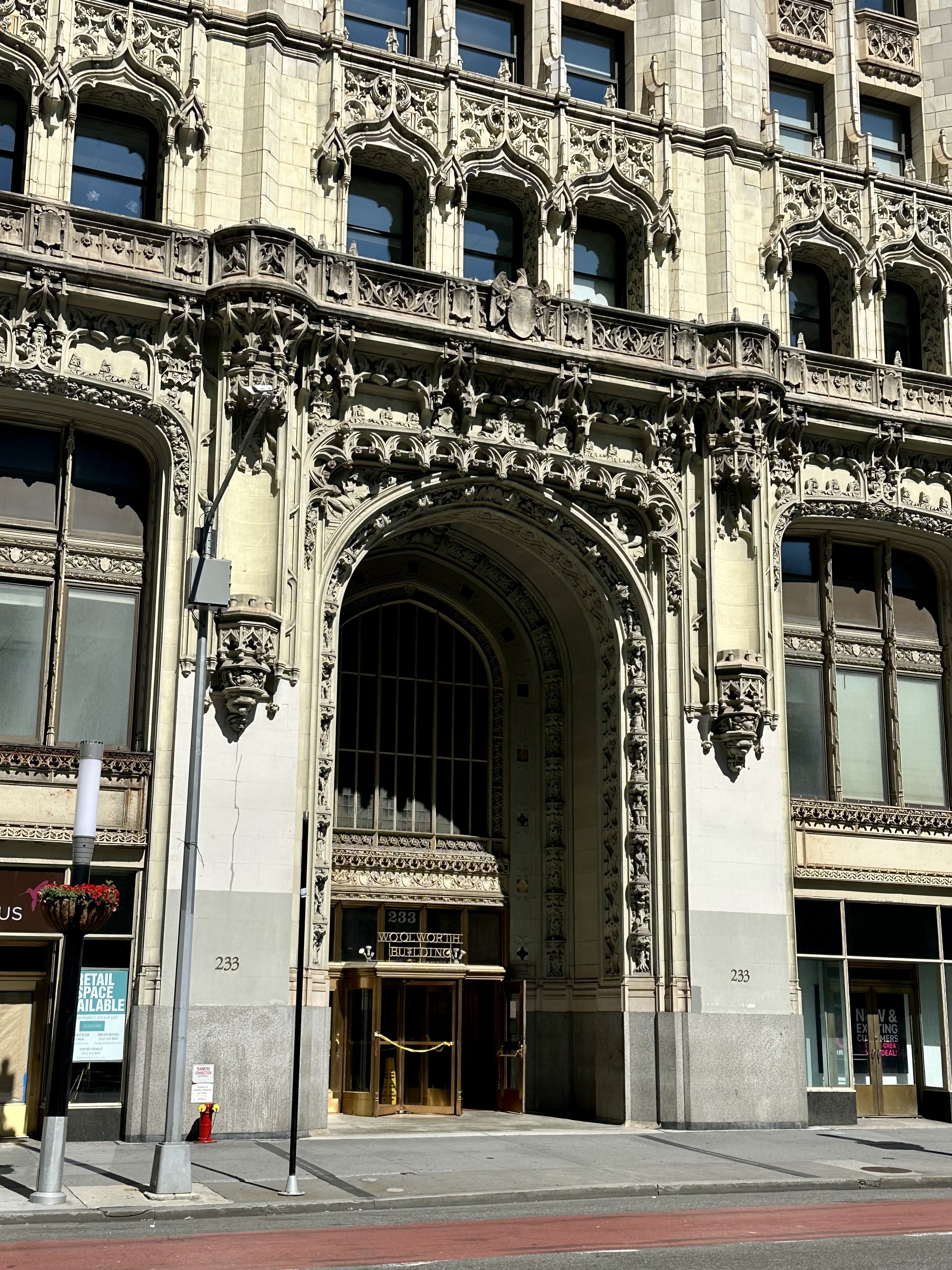
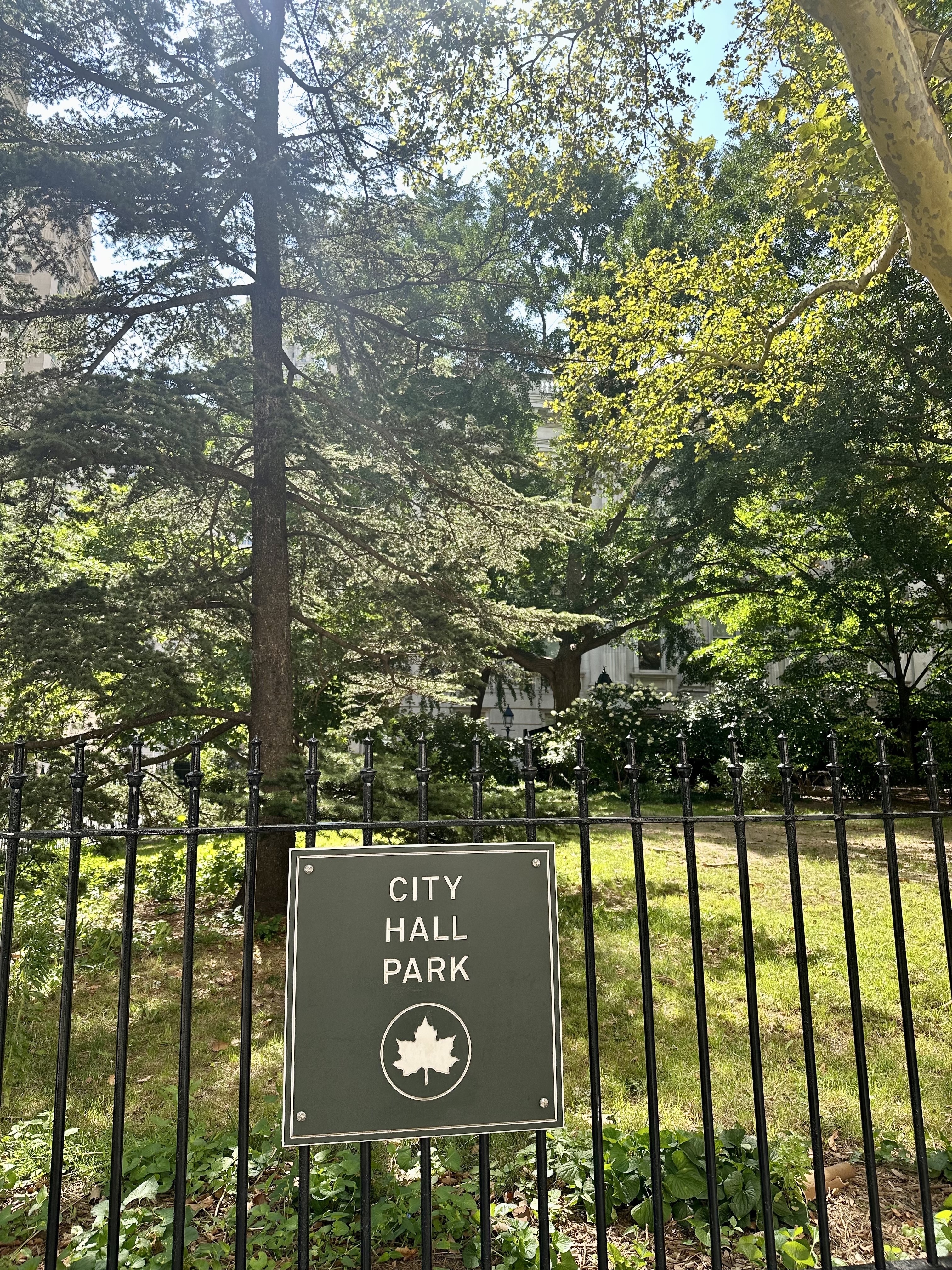
Continuing north, I passed the Woolworth Building, which was the tallest building in the world from 1913 to 1930, with a height of 792 feet. Perhaps more impressively, over 100 years after it was built, it is still one of the 100 tallest buildings in the United States. It has been converted to residential condos, and the penthouse – which is pretty spectacular, to say the least – recently sold for only $30M (down from over $100M when first listed!) in “white box” state, ready for finishing out to the buyer’s taste and use, but is a very unique space. After passing City Hall (which, built in 1812, is the oldest city hall in the US still used for its original governmental functions) and City Hall Park, I couldn’t resist a smile as I passed Zero Bond. This was the location of my work as a background actor for the final season (as it turned out, the final episode) of Succession, and I had scarfed down some craft services for lunch just outside that building standing next to Matthew Macfadyen (“Tom”). You can read more about that experience here.
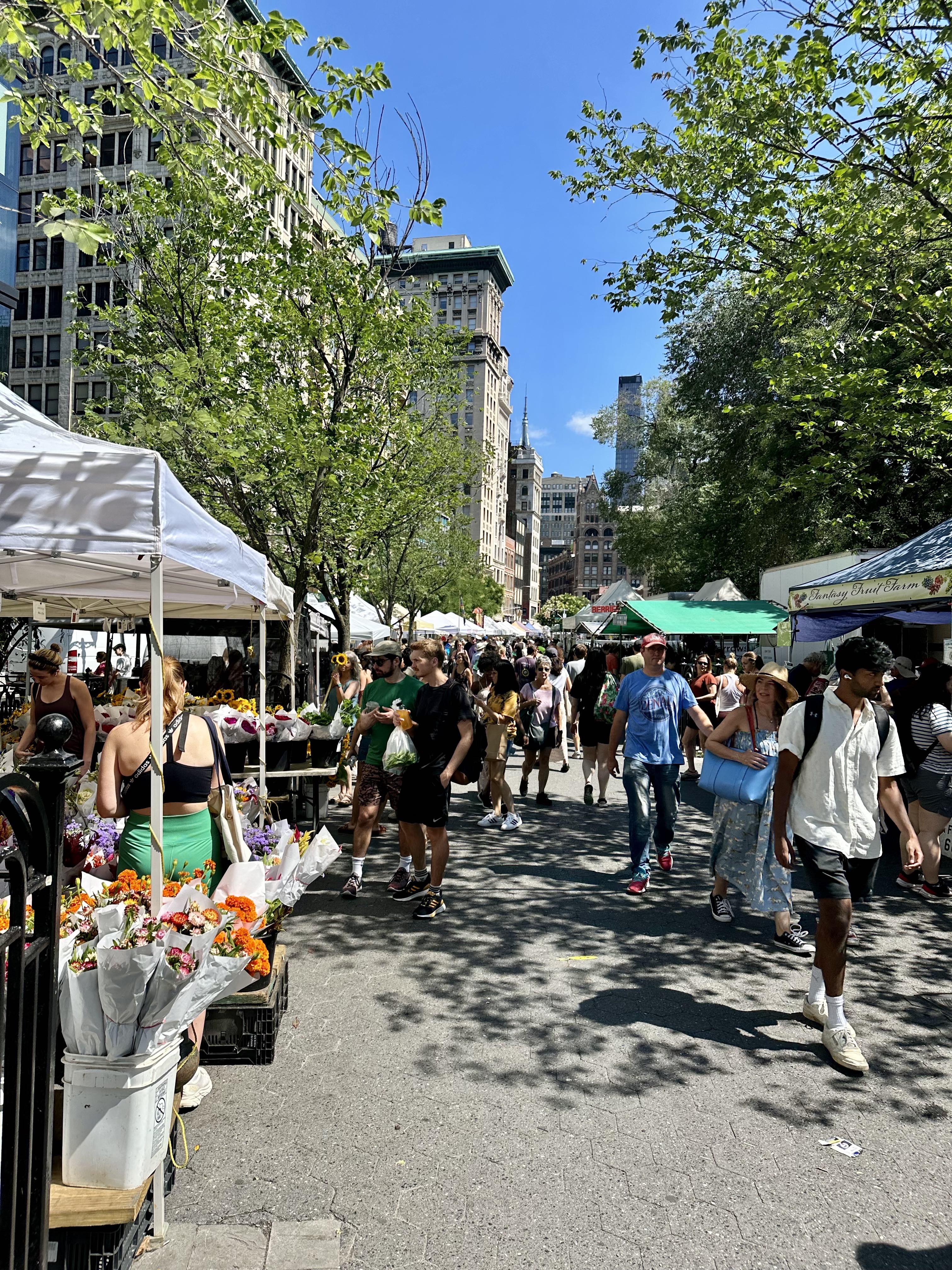
After walking through Greenwich Village, the next big event is Union Square, where Broadway begins to cut across the Manhattan grid, creating interesting little parks or “squares.” I was doing this on a Saturday, so the excellent Green Market was in full swing. I had been hydrating up to this point, but decided to buy some fruit and enjoy it (raspberries and red currants) for my first snack of the day.
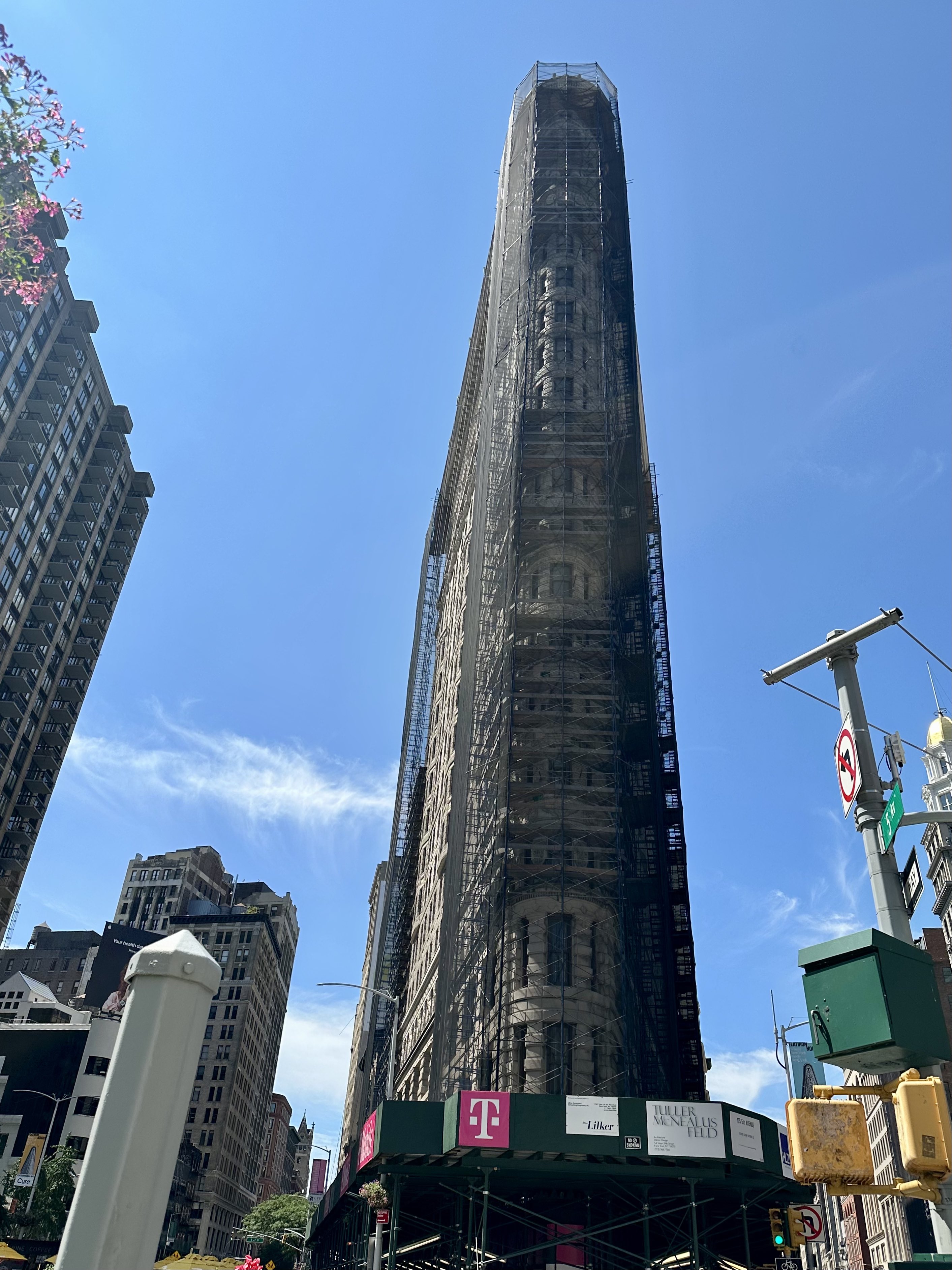
At 23rd Street, Broadway intersects with Fifth Avenue, and you get a great view of the Flatiron Building (unfortunately scaffolded right now for some facade repair). Completed in 1902, at 20 stories it was considered dangerous and a “folly” for the builder. A National Historic Landmark, The Flatiron Building is now universally adored – it was the fourth most loved building in the United States in a survey in 2019 (behind Falling Water, the Empire State Building, and Coit Tower in San Francisco).
Broadway intersects with Seventh Avenue at 34th Street, home of Macy’s flagship store. The real Santa (of course! come on, watch Miracle on 34th Street) hangs out in Santaland every holiday season, and the Thanksgiving Day Parade ends in front of the store. This building was completed in 1902 and is a National Historic Landmark.
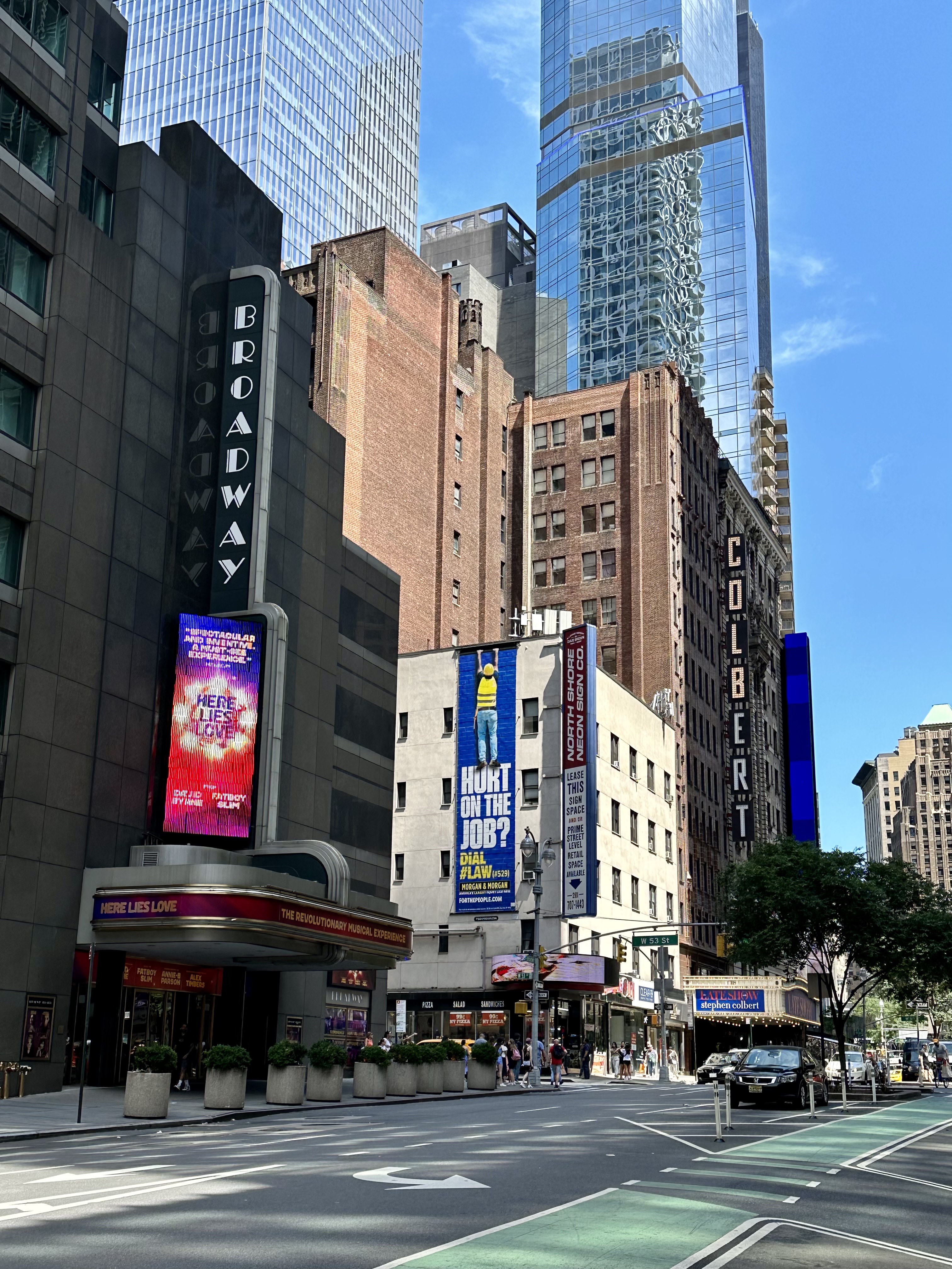
When Broadway crosses 42nd Street, you are at the “Crossroads of the World,” Times Square. Full of screens, neon, costumed performers, street theatre, hordes of confused tourists, and surrounded by Broadway theaters, Times Square is a lot, no question. There’s also no place like it. I actually successfully timed my day to avoid the pre-matinee crowds.
Speaking of Broadway theaters, a few blocks north of Times Square you can see the simply named Broadway Theater, currently the home of Here Lies Love, and the Ed Sullivan Theater, currently home to the Colbert Show. Did you know that most Broadway theaters are not actually on Broadway? There are 41 Broadway theaters (theaters with 500 or more seats, generally between 41st and 54th Streets, with the exception of the Vivian Beaumont a bit north in Lincoln Center at W 65th) but only the Broadway, Winter Garden, and Palace (currently undergoing a multi-year renovation) have addresses on Broadway itself.
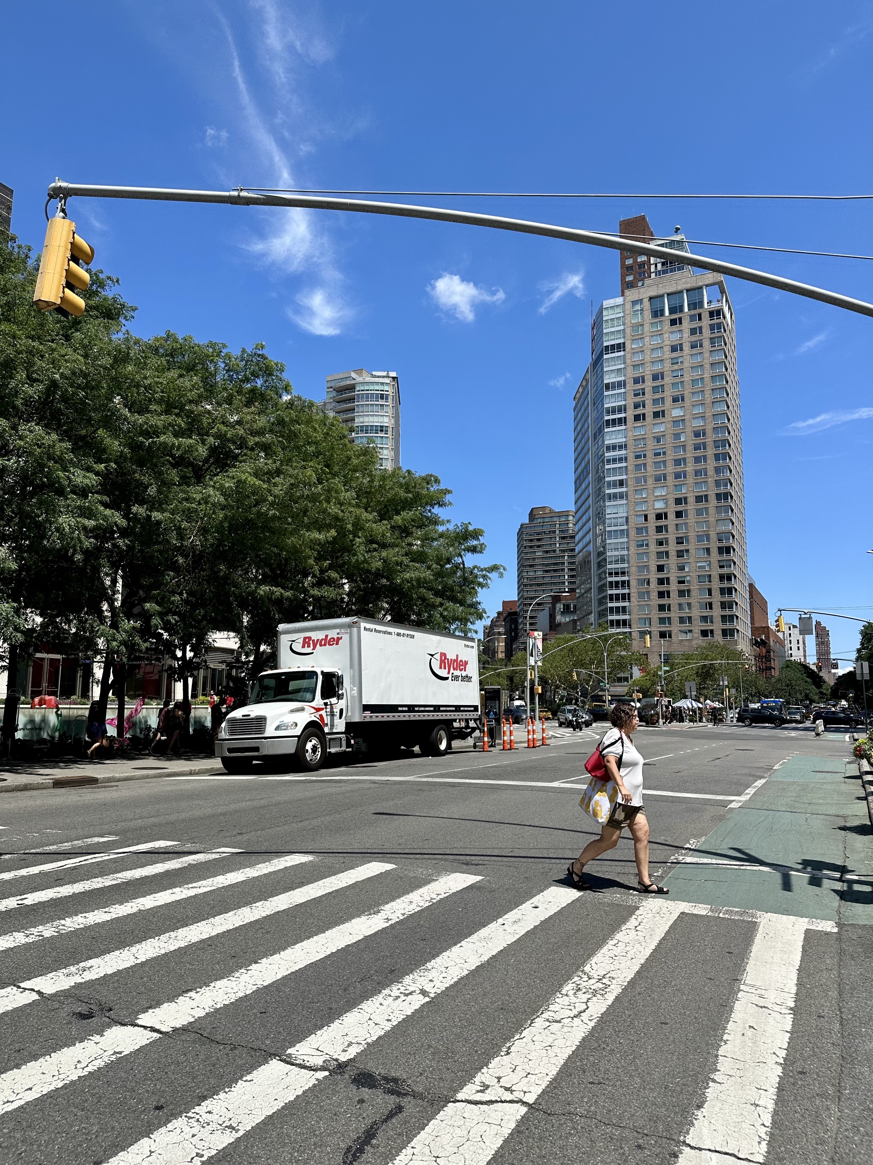
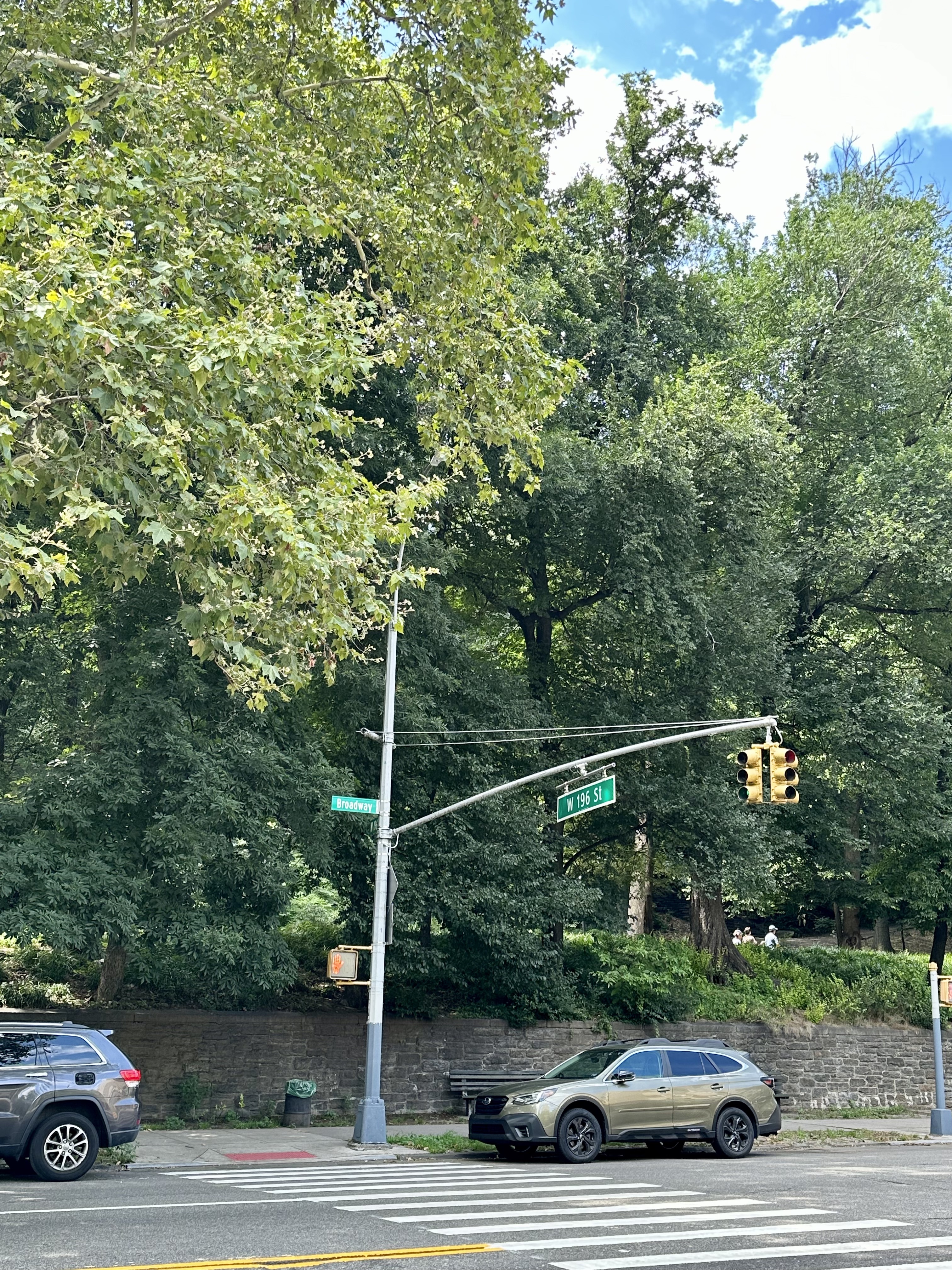
When Broadway crosses Eighth at 59th Street, you are at Columbus Circle, looking to your right at the Southwest corner of Central Park. Broadway will continue to move west on the diagonal, intersecting W 66 (at Lincoln Center), and heading through the relative quiet and residential nature of the Upper West Side.
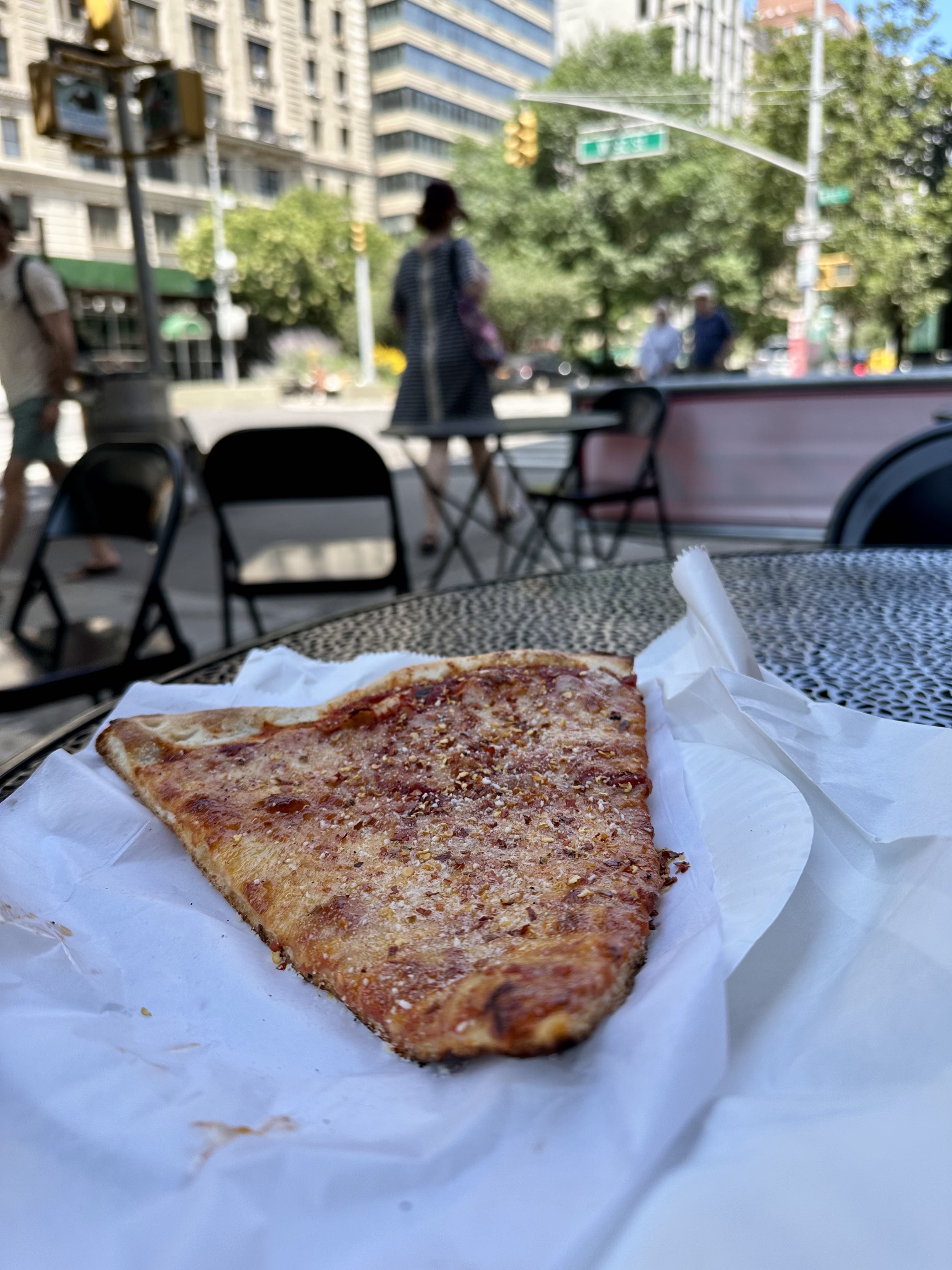
At some point in the W 90s, I stopped in at a random pizza place for a classic NY slice. Around this point I was beginning to tire a bit, but the pizza helped. Later on I stopped at a Mister Softee truck, but as you will see from the rest of this blog post, as I became more tired I took fewer photos.
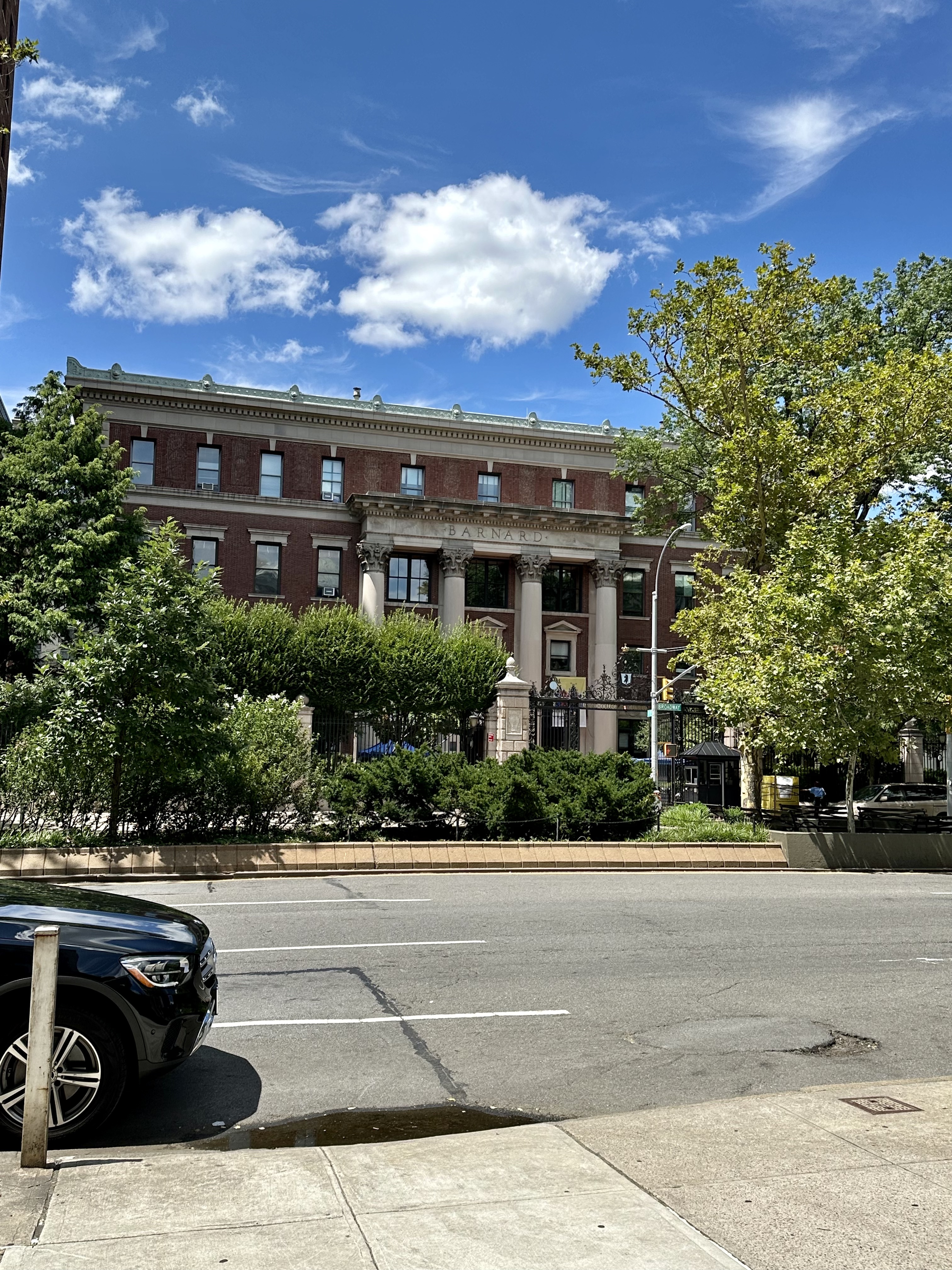
Continuing north along Broadway into Morningside Heights, I passed Columbia University on my right and Barnard College on my left. Columbia was established as King’s College in 1754 on the grounds of Trinity Church in lower Manhattan, and moved to the current campus in 1896. Columbia is the 5th oldest institution of higher learning in the United States (after Harvard, William & Mary, Yale, and Princeton).
After Morningside Heights, Broadway seemed to get very hilly, and although there are plenty of lovely things to see – Inwood Park deserves its own blog post – I began to get more interested in finishing the trip than in taking pictures.
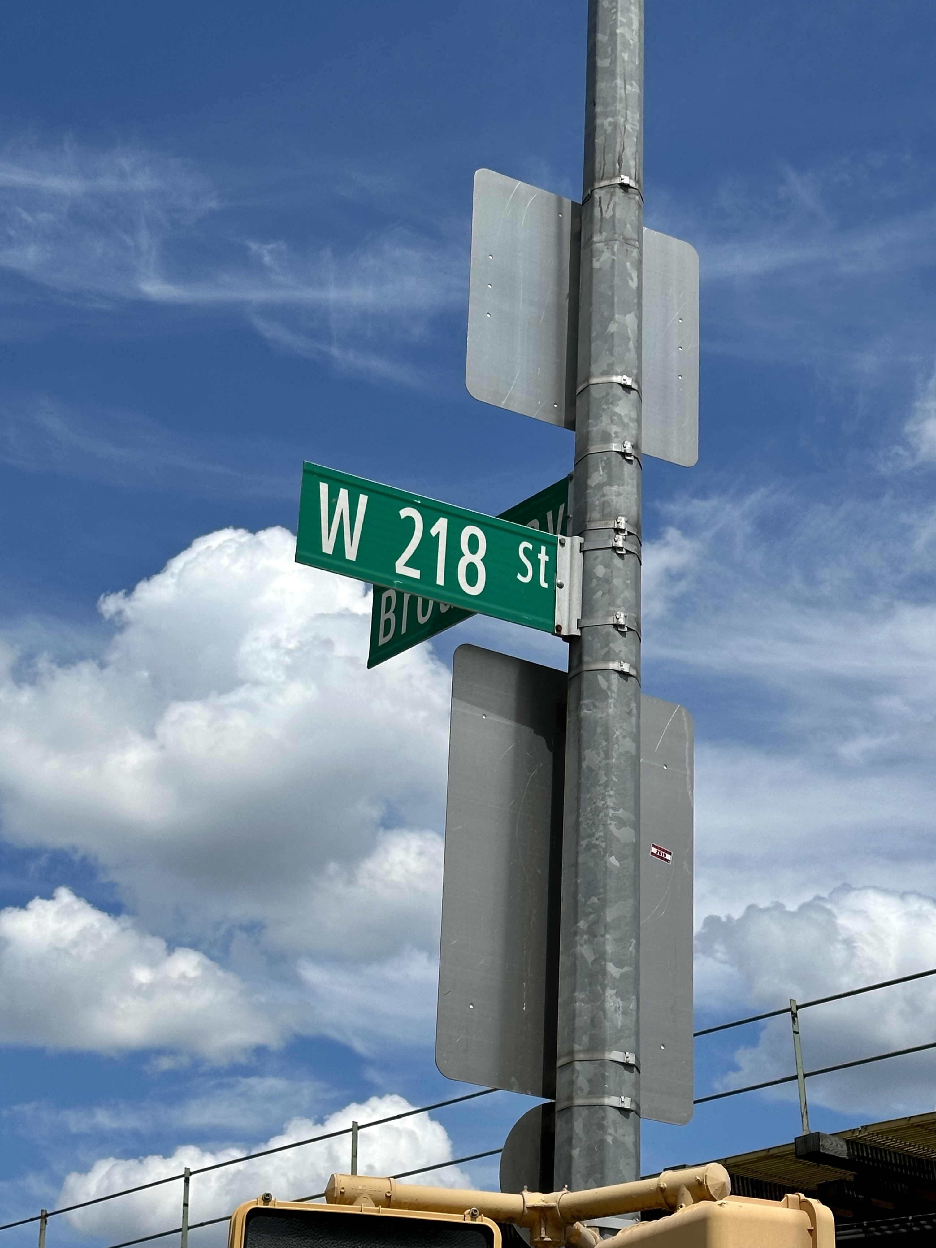
At the very tip of Manhattan Broadway swung east again, preparing to continue into The Bronx after a bridge over the Harlem River. After trudging to 218th Street, not wanting to go across the bridge, I considered myself to have done the walk, and backtracked to the 215th Street MTA station to catch the 1 train. I felt strong the next day, with no sore muscles, so felt good about the trek in terms of trying out my Kili gear on a long hike. The entire trip, including stops here and there for food, or bathroom breaks, took just under 6 hours. I feel the day would be more fun if you did it with someone over the course of an entire day, took more breaks, didn’t mind veering off Broadway now and then, and considered stopping at 125th Street (or starting there if you want to do the trip heading south instead of north). The most interesting thing to me was how different Broadway is in all its varying incarnations and neighborhoods. Walking it was like a microcosm of Manhattan itself; constantly different, never boring, not a city but more like a series of cities. The length and many-sidedness of Broadway illustrates the thing I love most about New York City – its constant variety and reinvention. Samuel Johnson once famously remarked that if you are bored with London you are bored with life – and to me that is true (I would say, even more true!) of my beloved New York City.
People who don’t live in New York City might wonder how – or even if – NYC children trick or treat. They definitely do; many larger buildings keep a list of people willing to accept trick or treaters, and residents of the building can pick up a list on October 31 so that they and their children don’t knock on the doors of too many empty apartments. In my experience, you can end up with a prodigious amount of candy (and the occasional healthy treat) in a large apartment building – even better if you pair with another family in another building and maximize possibilities in both places. (Insider tip: take the elevator to the top floor and use the stairs to walk down, if you are able – the elevators become very busy on Halloween night.) However, there are places in the city where you can trick or treat in a very traditional, door-to-door manner – primarily the townhouse blocks on the Upper East and Upper West Sides of Manhattan, or Brooklyn Heights and Park Slope, Astoria in Queens, etc. In addition, some of these houses go so all-out on decorating that they make the few weeks leading up to Halloween a “treat” to walk past. This October I made a point of stopping to take photos of houses I happened to pass while walking around the Upper East Side. I will start with a few sedately decorated examples, and progress to the truly terrifying. Perhaps one aspect of the legendary toughness of a native New Yorker is having to pass the gauntlet of horror at some of these homes to score a Reese’s Pumpkin!
This building is keeping it classy. A seasonal display of pumpkins brightens the foyer.
Friendly jack-o-lanterns accentuate this private garden.
These two townhouses have picked up the fright factor a bit without going too far – a few fluttering ghosts and a welcoming row of skulls let you know this is probably a good place to trick or treat.
If this one was closer to the door, its scare factor would go up, but as is, it decorates the house nicely without being too terrifying. I like how the ghoul is holding a pumpkin.
This is a selection of decorations that I find to be fairly typical of what you see this time of year, some scary touches and nice additions to any city stroll.
Two views of this townhouse – I love the white pumpkins, ghosts, and seasonal plants leading to a giant inflatable (but not too scary) Pumpkin King.
Even though this is a skeleton, the presence of his skeleton doggies brightens up the scene, in my opinion. I really enjoyed this one.
Similarly, these skeletons have a jaunty, Pirates of the Caribbean vibe . . .
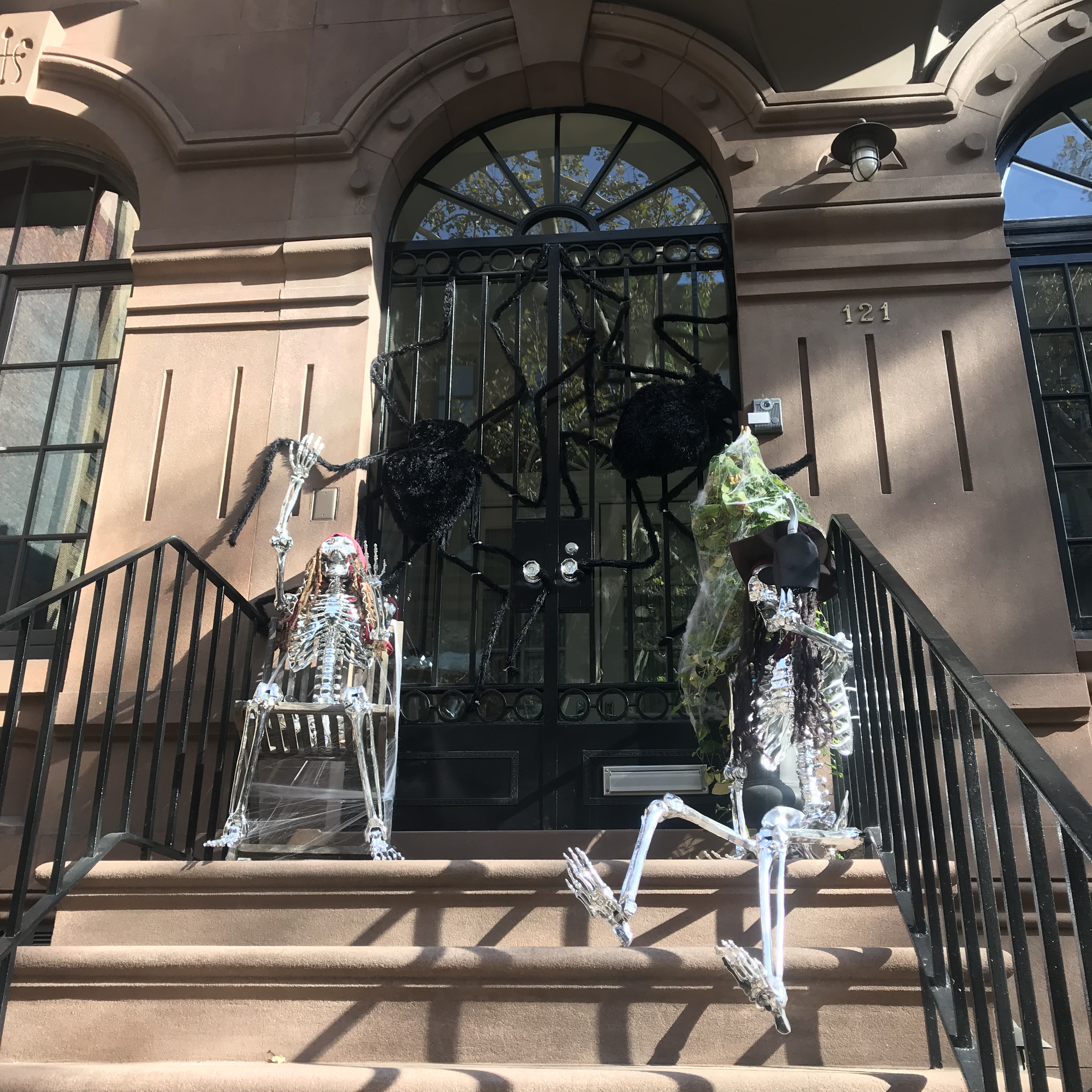
I noticed a theme this year of many townhouses covered with spider webs, often along with the spiders and sometimes also other frightening figures.
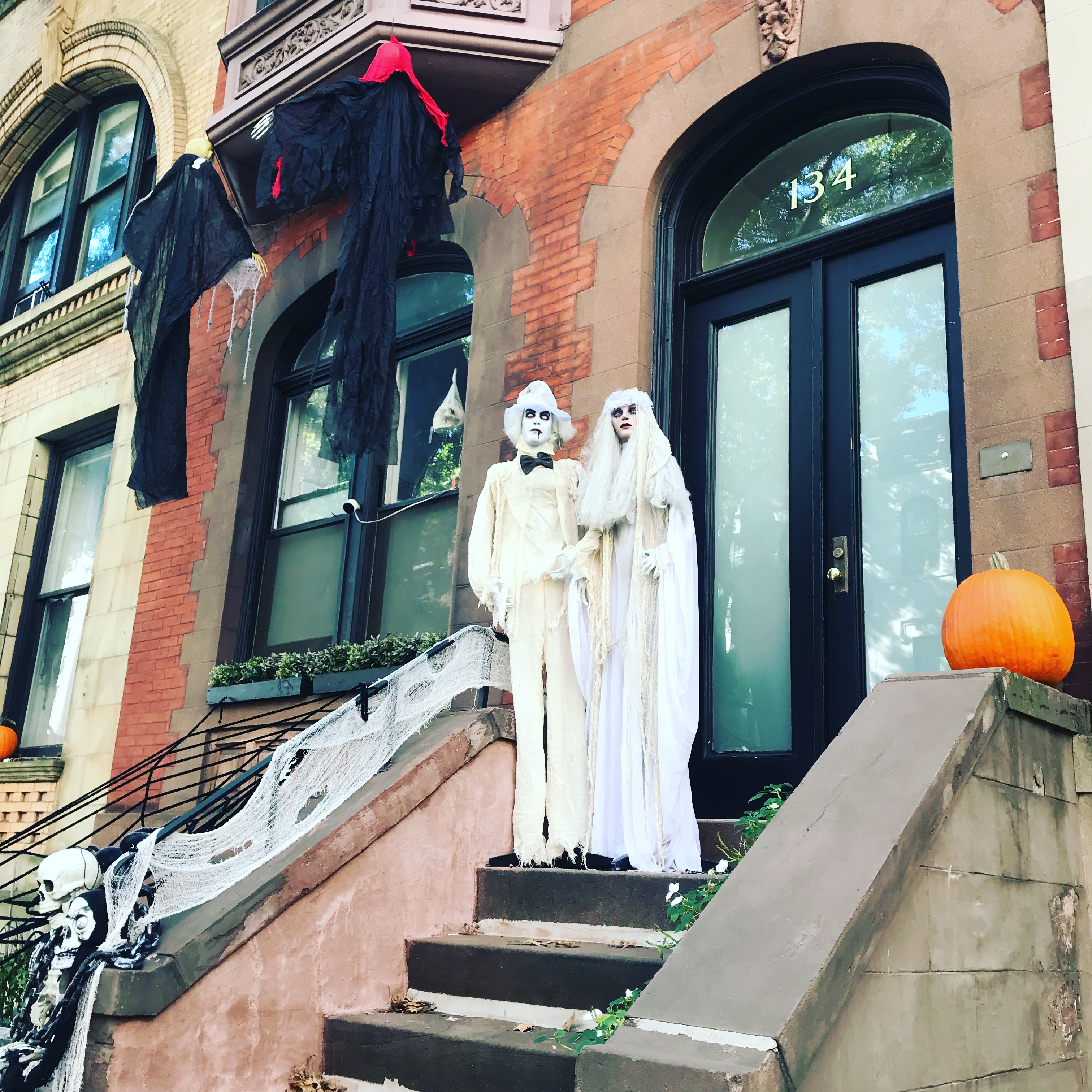
Now we are progressing to a higher scare factor: this Dracula actually emerges and returns to his coffin on regular intervals. Note that trick-or-treaters would need to walk right past this to ring the doorbell!
This townhouse really followed through on its zombie theme.
The suit of armor is a unique touch, and pretty creepy.
Not much to say – these are just disturbing.
This house wins the prize for most terrifying decoration that I happened to pass by this year. I would find it difficult to approach these figures in broad daylight, and can only imagine what it would be like to pass them on Halloween night to ring the doorbell!
On Halloween night, many of these homes will open their doors to reveal mini-haunted houses, and often the residents also dress up. My most vivid Halloween memory as a child is of approaching a house, and being absolutely terrified of the zombie who answered the door. When I ran away rather than take candy, he ran after me offering a bowl of treats – but to my terrified mind, he was simply chasing me! Ah, the joy of being scared, as long as ultimately it is in a safe setting. New York City is such a wonderful place to live, and the dedicated and fortunate owners of these townhouses enrich it with their decorations. There are many advantages to living in a townhouse – outdoor space, not sharing walls or floors/ceilings with neighbors, abundant space – but the ability to express yourself to the community through your decoration is certainly a plus for many.
One of my favorite places to go in London is Borough Market, with so many different foods to explore that I never get tired of returning. New York City has many great markets as well, Chelsea Market and Essex Street Market on the Lower East Side being two I particularly love. A new market recently opened in downtown Brooklyn, and having been there, I highly recommend that anyone check it out.
The DeKalb Market Hall is close to many subway lines (A-C-E at Hoyt, 2-3 at Hoyt, 2-3-4-5 at Nevins, or B-Q-R at DeKalb). I took the Q from the Upper East Side and was there in about 45 minutes. With the Q, you take the outside route over the East River from Manhattan to Brooklyn, with some great views of lower Manhattan and downtown Brooklyn thrown in. The City Point building is just off the Manhattan Bridge (entrance on Flatbush Avenue) and has a Target, Trader Joe’s (that so far does not seem to have the lines of the ones on 14th Street or the Upper West Side), Century 21, Flying Tiger (check this out if you’ve never been to one; you will discover 100 items you didn’t know existed and now must have), and Alamo Drafthouse (an absolutely perfect cinema with waiter service to your chair, including an extensive drink menu). The DeKalb Market Hall is in the basement of the complex.
Once you get to the market, take a walk around once or twice to get your bearings – there are so many choices that it can be a little overwhelming.
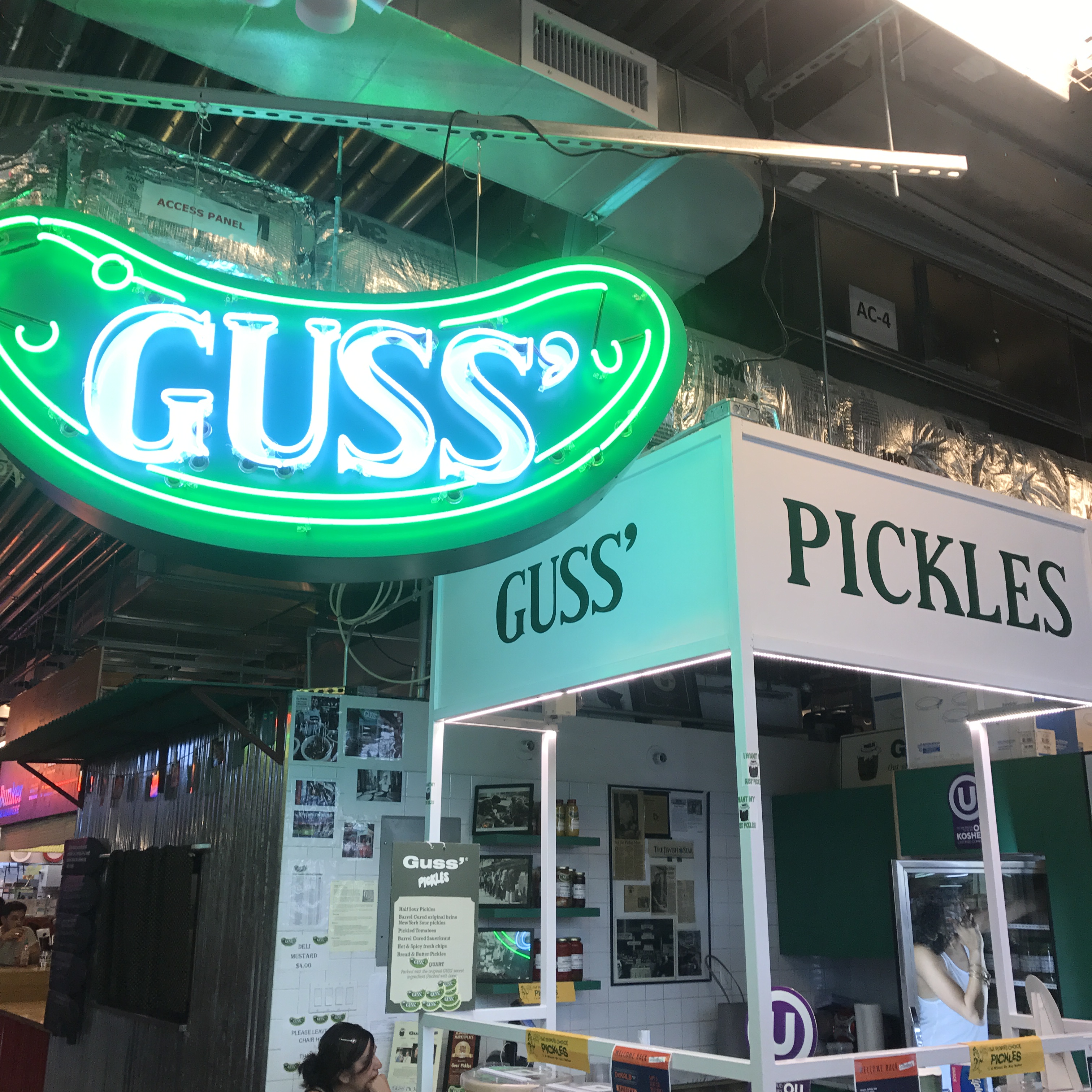
Guss’ Pickles still makes real fermented pickles, in many flavors, the way they did at their original spot on the Lower East Side. You can ask for a sample of anything. If you love pickles (and I definitely do), don’t pass this up.
So many choices – from juice bars, to mini doughnuts, to ice cream, to Katz’s deli, to healthy selections, to classic hamburgers and more.
I highly recommend the burger at Andrew’s Classic Roadside – really delicious and not overpriced.
In addition to all the things to do in the City Point complex, the Market is about a 15 minute stroll to the gorgeous Brooklyn Heights waterfront (see my previous blog about this area here). If you live in the area, the DeKalb Food Market is a great everyday addition to your choices for eating out. If you are a visitor to NYC, check it out and explore the surrounding area as well – you could easily spend a day doing it. And if you are a NYC resident, but not of Brooklyn (like I am), I believe it’s worth the trip. I enjoyed my time at the Market and will return soon.
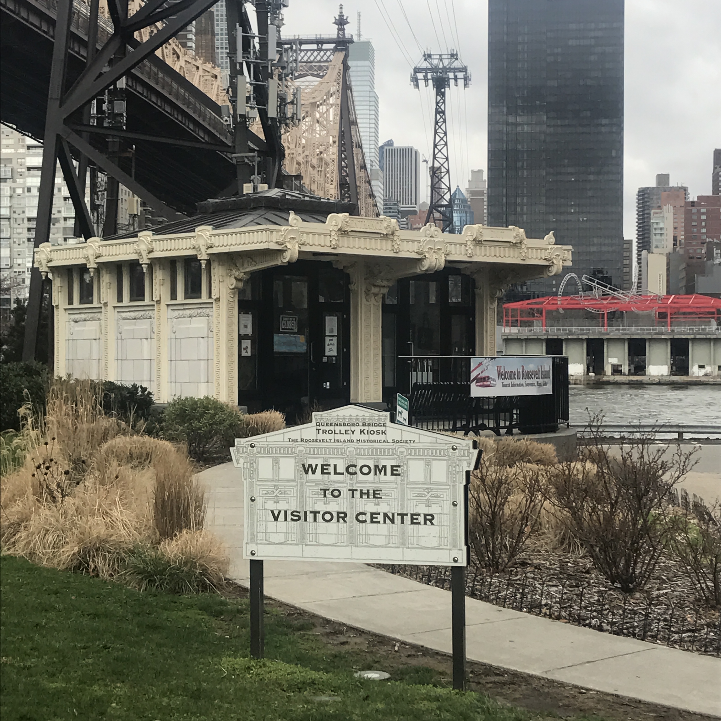
Once home to an insane asylum, prisons, and a smallpox hospital, Roosevelt Island was originally called Hog Island and later Welfare Island before being renamed for President Franklin Delano Roosevelt in 1971 (a decision that certainly helped make it seem a more palatable choice to those considering living there!). Only 2 miles long and 800 feet or less wide, this island, lying between Manhattan’s Midtown and Upper East Side and Queens, is owned by the city of New York but now has numerous rental buildings, one coop, and one condo (all landlease buildings, leasing the space from the city on a 99 year lease negotiated in 1969). Accessible via subway (the F line) but more famously by the Roosevelt Island tram, it is simultaneously very close to Manhattan and also a little isolated and remote. As I enjoy exploring a neighborhood by taking an unplanned walk (a dérive), I headed to Roosevelt Island this spring to see what living here might be like.
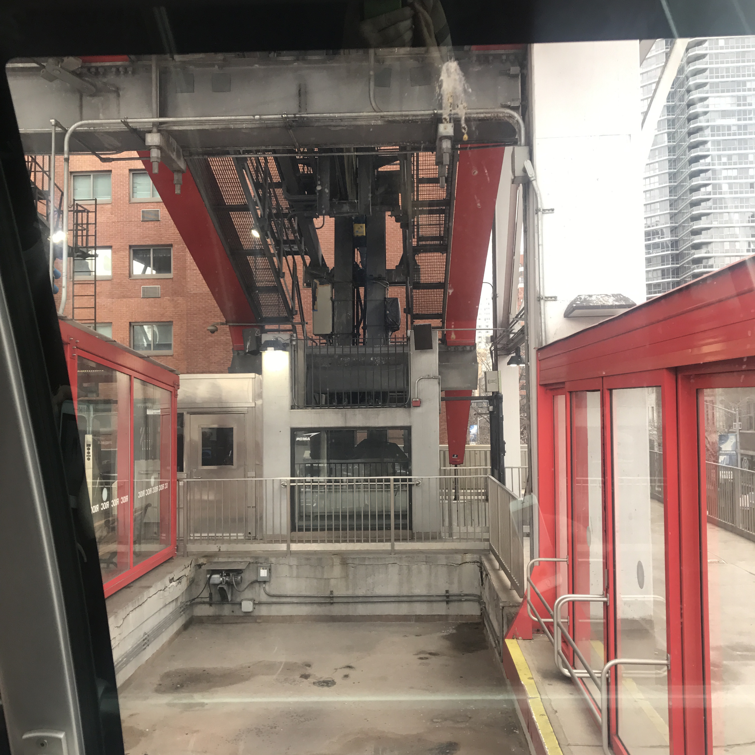
The Roosevelt Island Tramway was intended to be a temporary way to entice residents to the neighborhood during its residential development. Opened in 1976, it makes over 100 trips per day, between the hours of 6 AM and 2 AM (every 15 minutes most of the day, but continuously during rush hours). Although not operated by the MTA, it uses the MetroCard and offers free transfers to the MTA system.
When on the tram, you can’t help to imagine what it would like if the tram were to stop mid-journey (or something worse, thanks to the 2002 Spider Man film!). There has never been a Green Goblin attack, or anything similar, but the tram has been stuck before. The worst instance of this was in 2006 when two trams were stopped midair for seven hours due to an electrical outage. Rescue baskets were sent to the trams, but each could hold only 15 people, so the evacuation of the trams took a very long time. Following an extensive 2010 overhaul, there have been no similar incidents on the trams.
The large (unphotogenic) construction site just south of the tram is the new Cornell University Tech Campus, due to open in 2017.
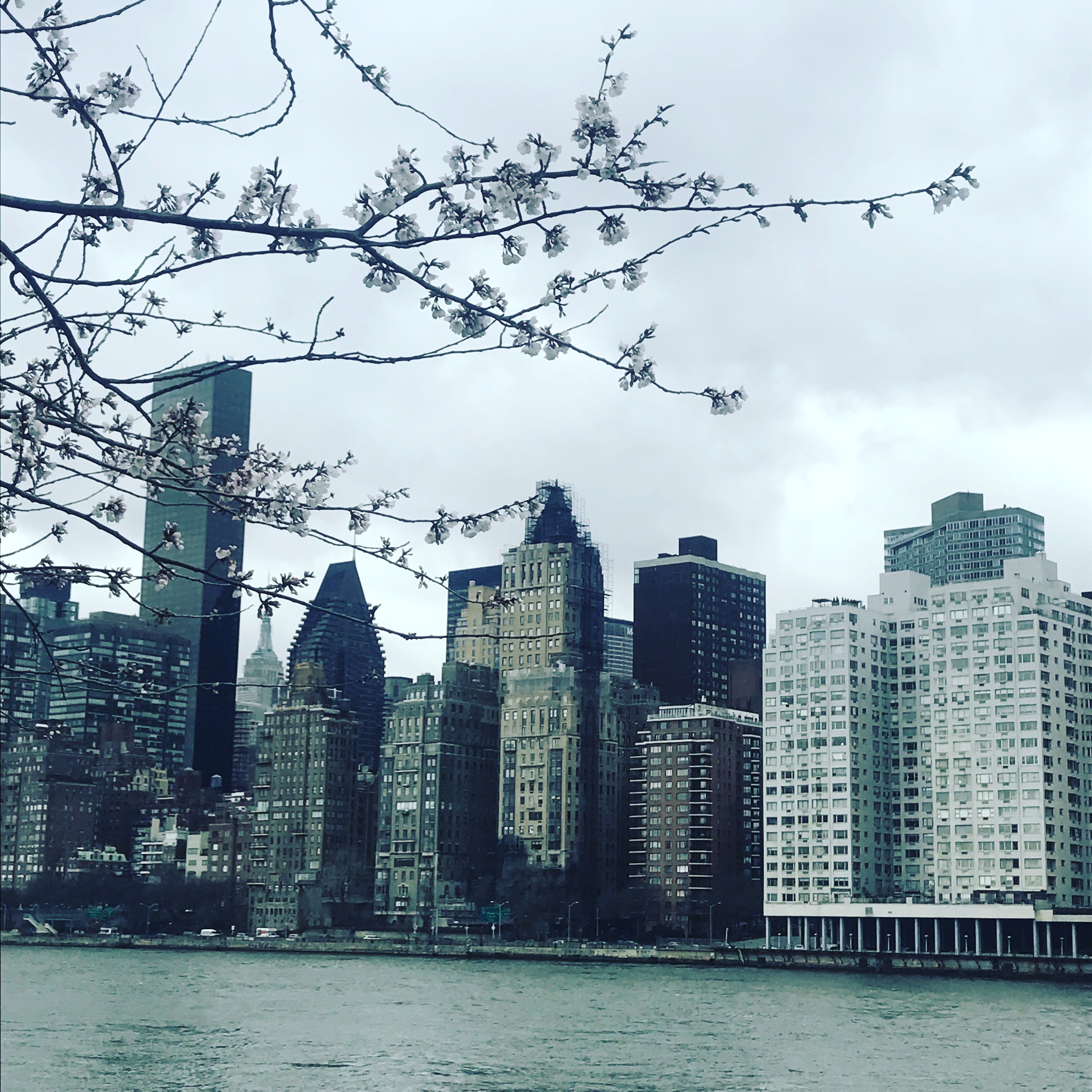
Walking along the river, cherry trees blossom and frame a view west to Sutton Place in midtown Manhattan.
It is impossible to miss the creepy ruins of the old Smallpox Hospital on the way to the Four Freedoms Park on the southern tip of Roosevelt Island. Opened in 1854, and closed a century later, the Gothic Revival building fell into disrepair. Now added to the National Register of Historic Places, a stabilization project is underway and it will one day be open to the public (hopefully only in daylight hours).
Opened in 2012, the Franklin Delano Roosevelt Four Freedoms Park celebrates the former president as well as his famous 1941 speech about freedom of speech, freedom of religion, freedom from want, and freedom from fear. Designed by the renowned architect Louis Kahn, it is a beautiful and spare park with spectacular views of Manhattan, including a direct view of the United Nations.
Heading back north and past the tram station, Roosevelt’s Island Main Street unfolds.
Built in 1798, Blackwell House is the sixth oldest surviving home in New York City.
1888 Chapel of the Good Shepherd, on the National Register of Historic Places.
There is a free red bus around the island, and it was easy to return via the F subway, one stop to Lexington and 63rd.
As of the 2010 U.S. Census, Roosevelt Island had a population of 11,661. Roosevelt Island has relatively affordable rents and prices compared to midtown Manhattan, and the buildings are largely full-service buildings with amenities such as swimming pools and gyms. Many apartments feature the kind of spectacular view of Manhattan found in red-hot Long Island City, Queens. I found the small town atmosphere of Roosevelt Island to be very unique. Along Main Street was everything a person would need – an apartment, groceries, a library, public school, and so on. Just a few hundred feet from midtown Manhattan, it felt like being in a small town anywhere in the United States. Less distant in terms of a commute from central Manhattan than many parts of the five boroughs, it still feels a world away – the skyscrapers of Manhattan a bit like a mirage just across the East River.
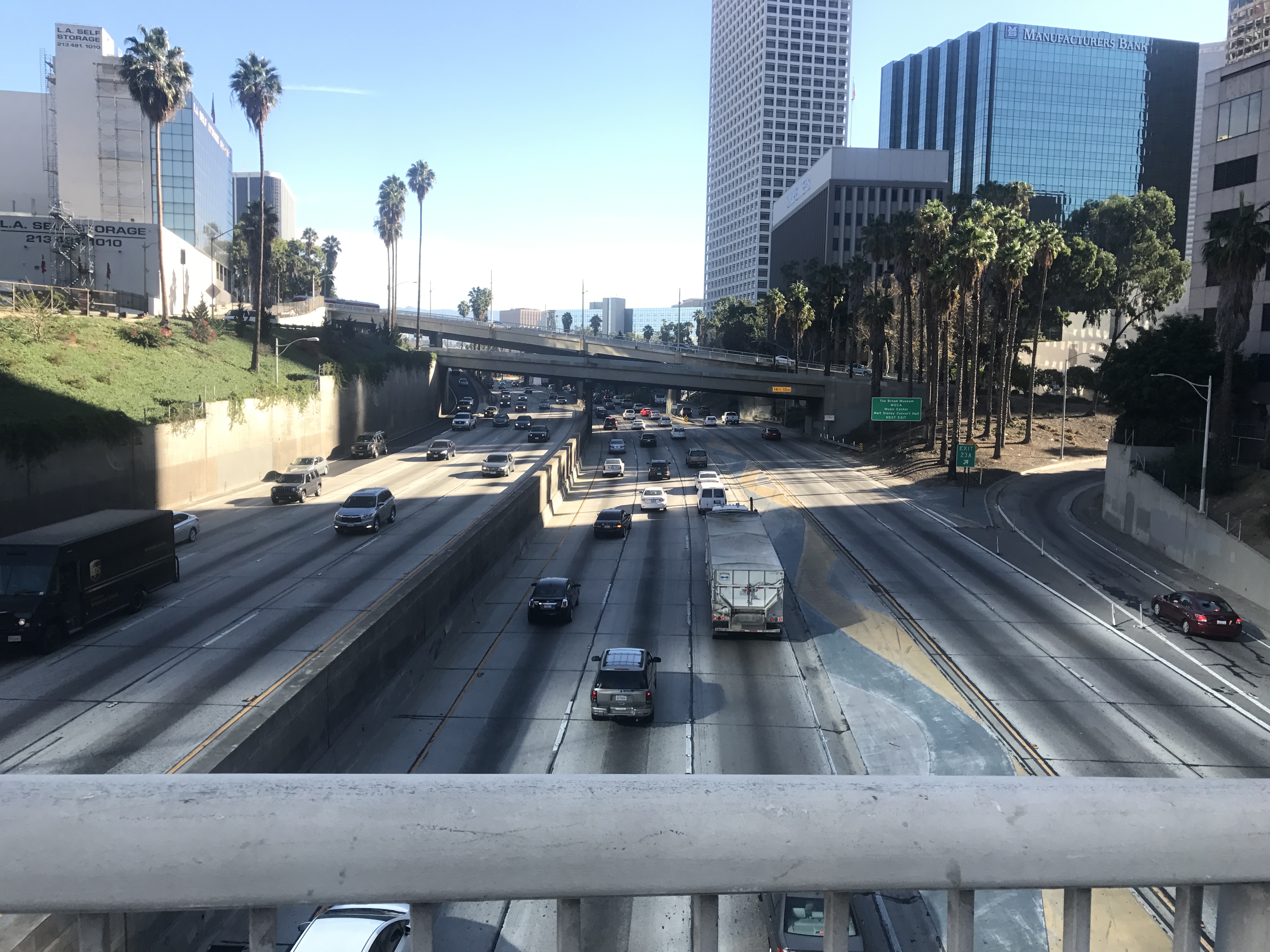
The rivalry between the great US city on the East Coast (New York) and the one on the West Coast (Los Angeles) is, in my opinion, partially true but largely fabricated. You can find great restaurants, nightlife, and art in either. New York has snow; Los Angeles has smog. Los Angeles clearly wins for beaches and weather; New York is the victor in the live theater domain and has Central Park. While in general the cost of renting or purchasing a home in Los Angeles is less than in NYC, there is a variety of housing choices at price ranges from moderate to extravagant in both cities (you will nearly always get more space in Los Angeles, though, since NYC is severely physically restricted in how it can expand, especially Manhattan island). However, there is one giant difference that completely shapes the experience of living or visiting each city: NYC is the quintessential walking city (and the experience of walking in it was my motivation to begin this blog), while LA has the ultimate car culture. On my numerous visits to LA, I have often commented that the one thing that would prevent me from ever living there is that I hate having to drive everywhere. On a recent trip, however, I decided to take a few walks and see if a quality walking experience could be found in the city of angels.
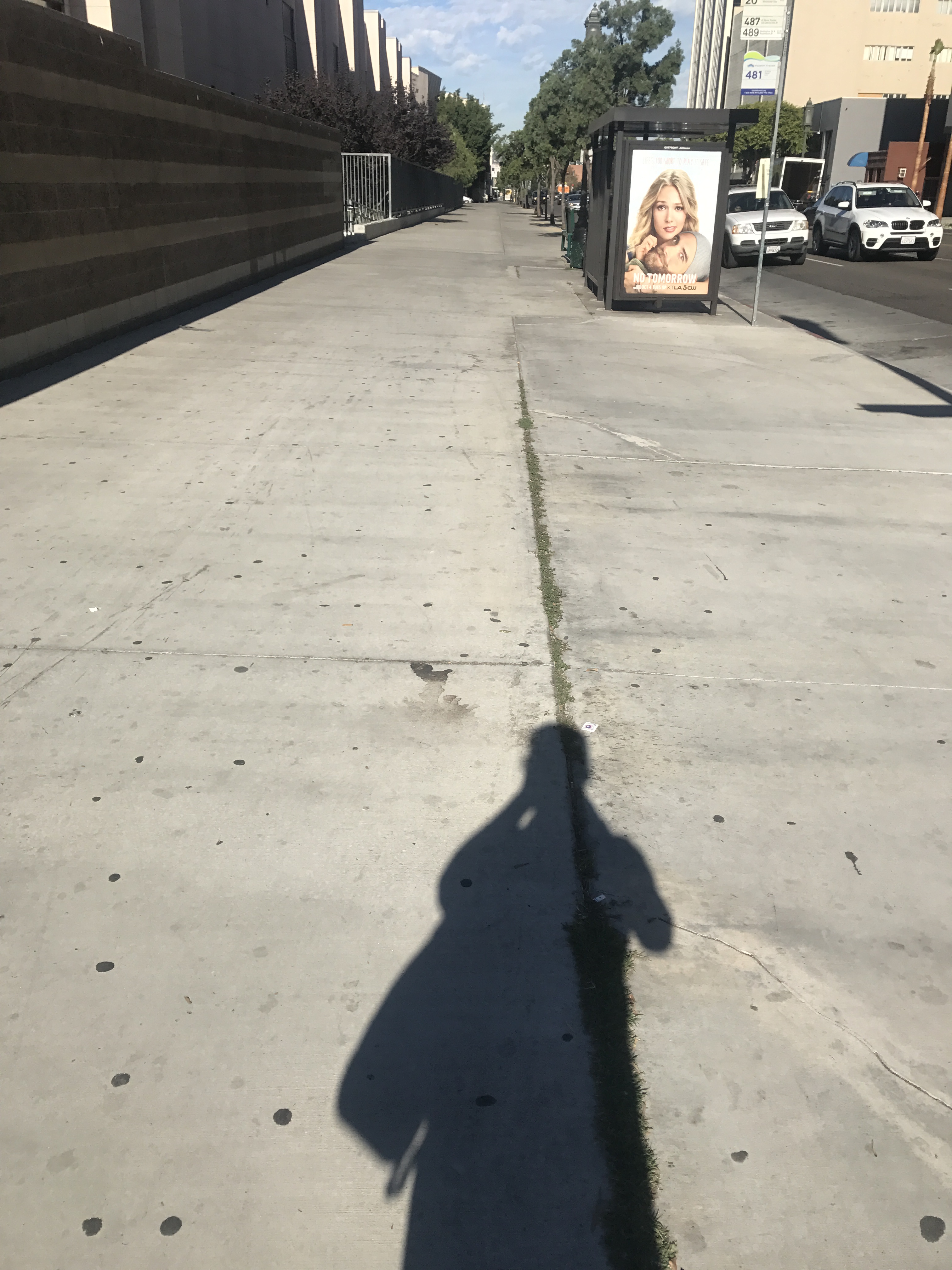
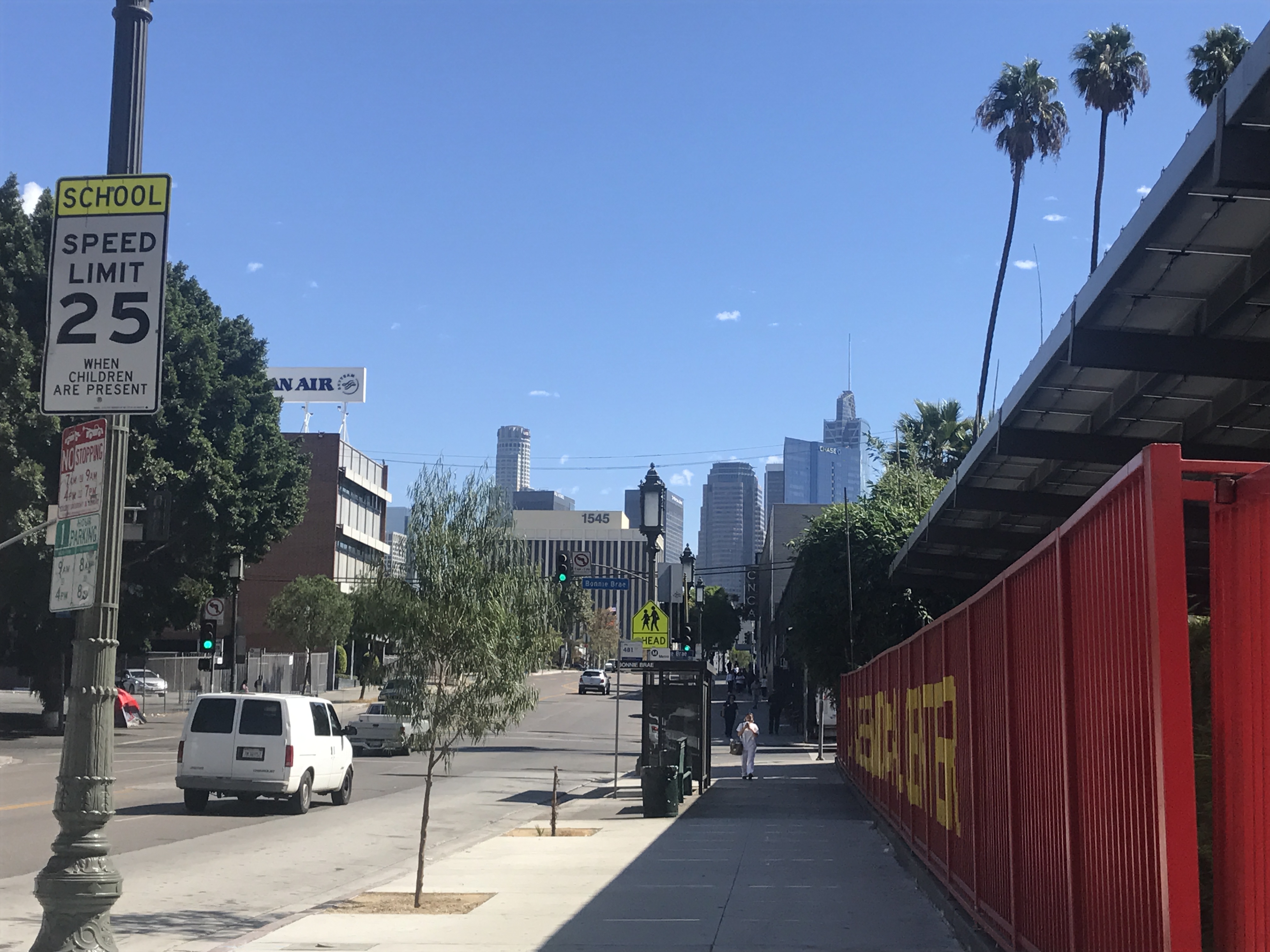
I was staying downtown at 7th and Grand, and decided to walk to Wi Spa, on Wilshire and S. Rampart. According to Google maps, this is a walk of just under 2 miles, and I routinely walk 5 miles or more per day in NYC. This route was a fairly direct one since Wilshire was just a block parallel to 7th, but almost immediately I noticed the difference between walking in NYC vs. LA. This route had me walking next to and in close proximity to heavy traffic most of the time.
In addition, unlike virtually anywhere I walk in NYC, I was alone on the sidewalk for most of the time despite being surrounded by people in cars. I recalled Ray Bradbury’s story, “The Pedestrian,” set in the future where a lone walker in the evening was so unusual that the protagonist of the story ended up being carted off by the police for a psychiatric evaluation. Although born in Illinois, Bradbury was an Angeleno for most of his life, and I wonder if a similar solitary experience walking in the city inspired him to think of this story.
Eventually I went by MacArthur Park (yes, the inspiration for what has been called “the worst song ever written,” although I have a fondness for it since I recall enjoying the number in “Priscilla, Queen of the Desert” on Broadway). Although it had some lovely areas, the only people I saw also enjoying it were living in a sort of tent city there.
Shortly after MacArthur Park, I was at Wi Spa. If you are in Los Angeles and would enjoy an authentic Korean spa experience, this one can’t be beat (I have never been so clean as after a scrub there).
The view of downtown Los Angeles walking back was pleasant, but it did occur to me that just as Los Angeles has widely varied neighborhoods, the experience of walking would also vary from place to place. For my next dérive, I went to Santa Monica. I drove there, but the Metro Expo line can also take you there as of this past spring.
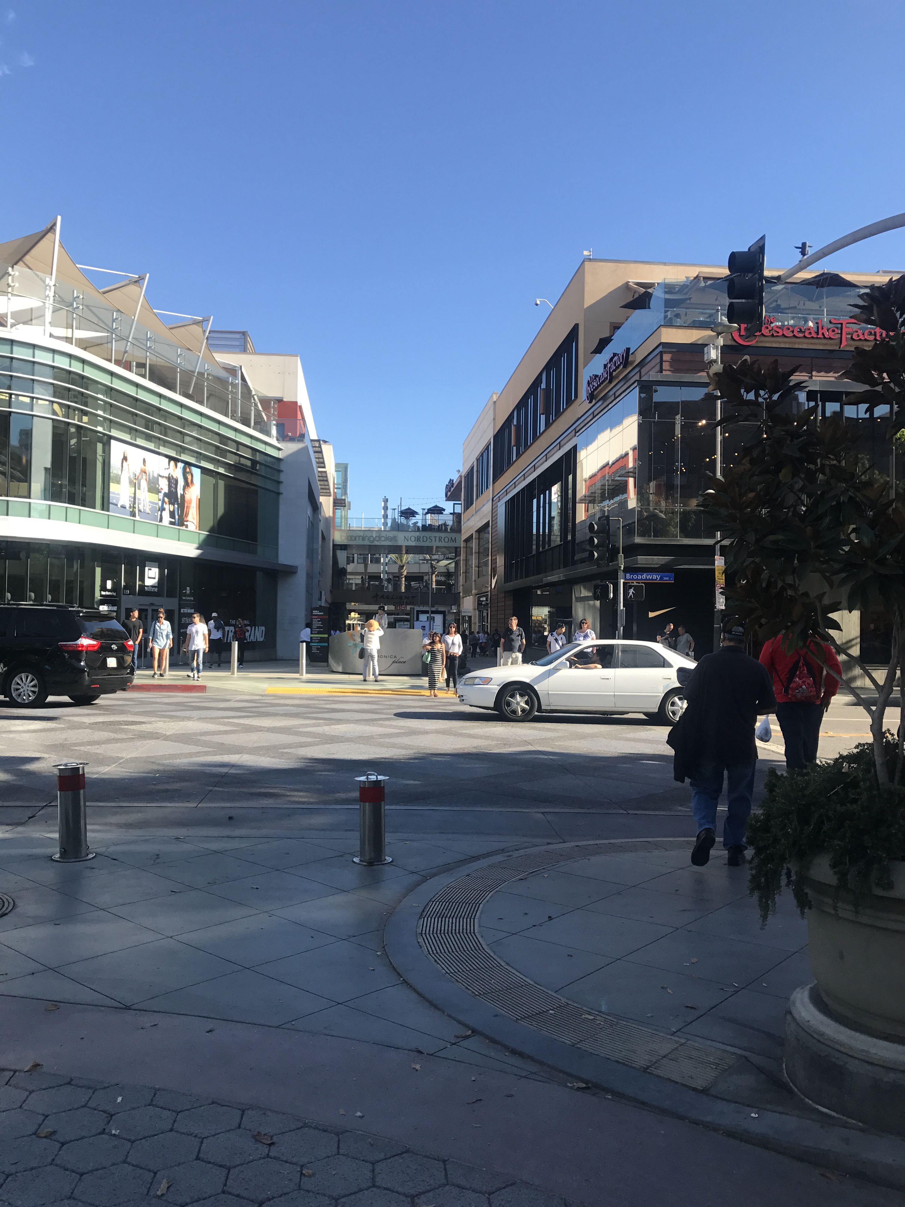
It occurred to me while in Santa Monica that perhaps no one was walking on Wilshire because there wasn’t much to see! There were plenty of people walking in Santa Monica.
The Third Street promenade is just east of the Santa Monica pier, and has shopping, dining, and street entertainers (my favorite to date were the skateboarding bulldogs I stayed to watch one time – very talented).
Walking back from a stroll along the Promenade and back, I turned along Ocean Avenue.
Again, plenty of walkers, plenty of places to eat and shop. The ocean just across the street, and the sun warm. Not bad!
Heading over one block west, I found the Hotel California . . . somehow smaller than I had imagined for a place filled with people who can “check out, but can never leave.”
The ocean front walk, even on a week day, was busy with walkers, bicyclists, and skateboarders.
Walking back, I took the sandy stretch at the edge of the Pacific Ocean, heading back toward the pier. A very different experience than the walks I routinely enjoy in NYC, but there was something magical about the sounds and textures of this walk (I would never dream of talking off my shoes to walk in the city, not even in my beloved Central Park). Los Angeles is vast, and sprawling, so while it is not practical to walk to get from place to place as it can be in New York City, there are wonderful places to walk – you just have to drive to get there.
Most of us lucky enough to live in New York City love the aspects of the city that make it unique – the tall buildings, the pace, the endless array of entertainment. However, we may also seek out a chance of pace every now and then, travelling to the Caribbean, the Berkshires, or the New England coast. What I recently discovered is that it is possible to take a mini-vacation to what seems to be a small New England fishing village – but without leaving the five boroughs. As I remarked in my posts about Coney Island and Governors Island you can feel as though you have left the city for the price of a swipe on your Metrocard – and that is true for a trip to City Island in the Bronx.
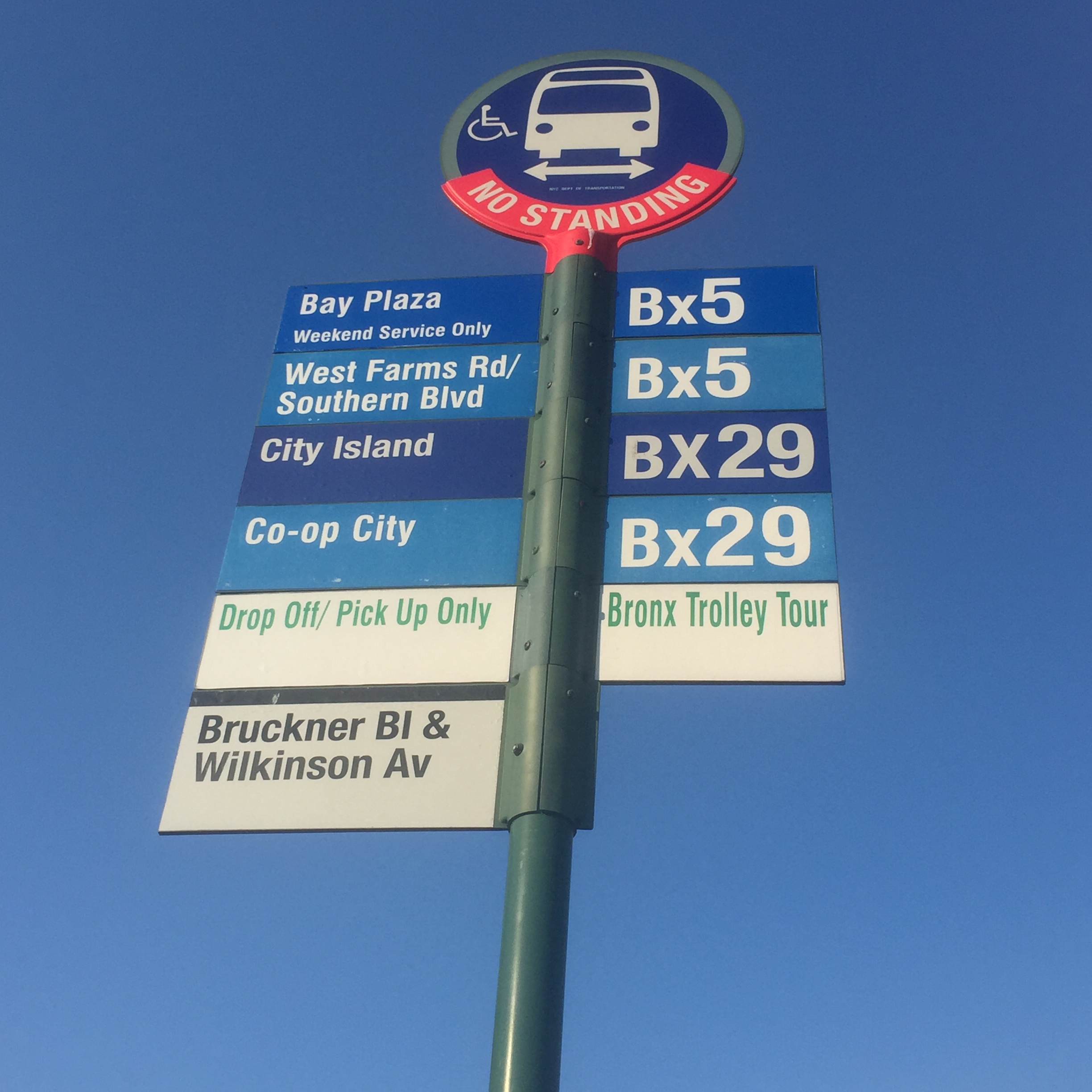
Driving to City Island is easy, but to get there via public transportation (as I did), take the 6 Pelham Bay subway train to the last stop, Pelham Bay Parkway and catch the Bx29 bus for a quick ride to City Island Avenue.
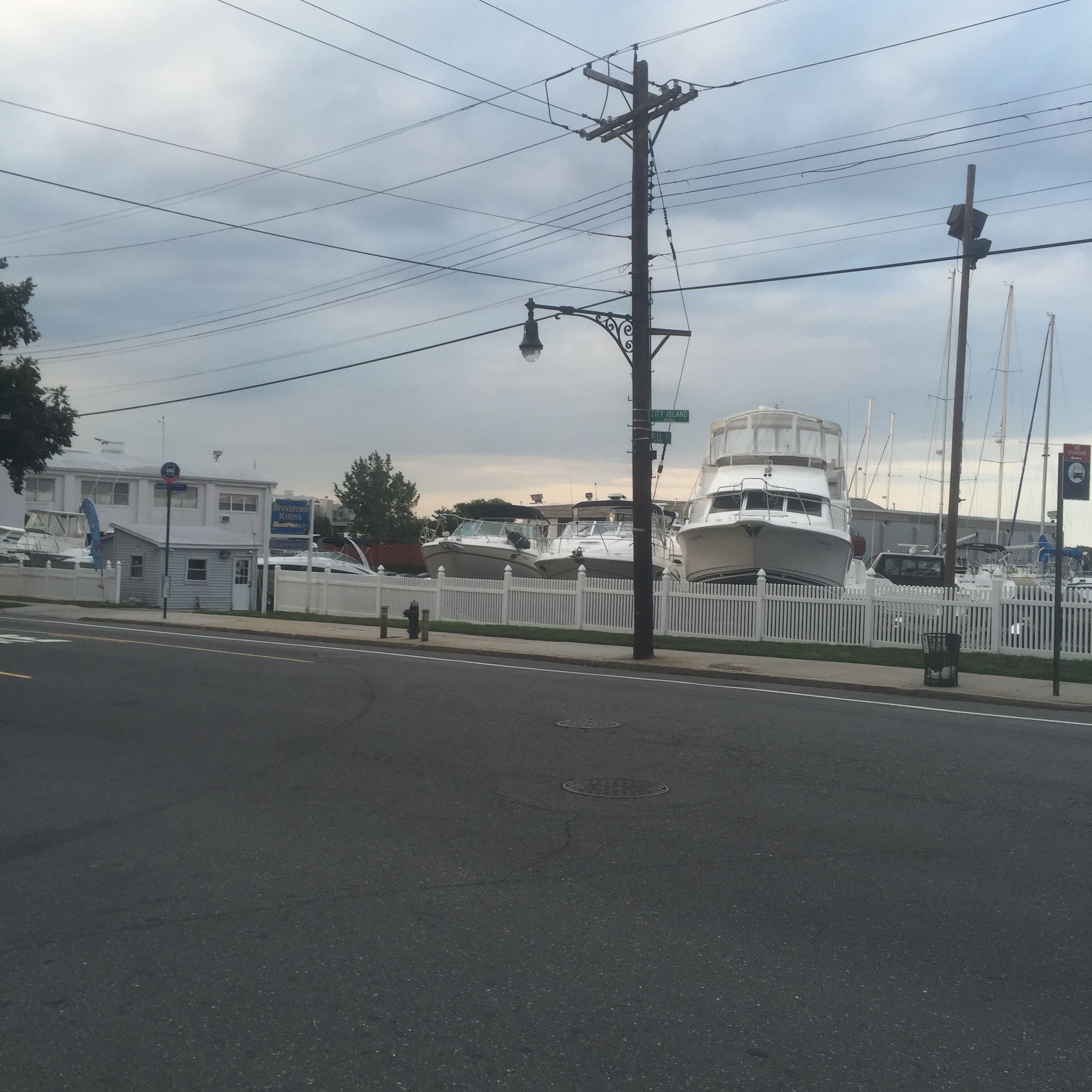
Originally settled by the Lenape and later by Europeans in 1654, it was connected to the mainland by ferry until the building of a bridge in 1873. From about 1860 to 1980, City Island was a center for boat building and yachting, and three yacht clubs remain on the island to this day.
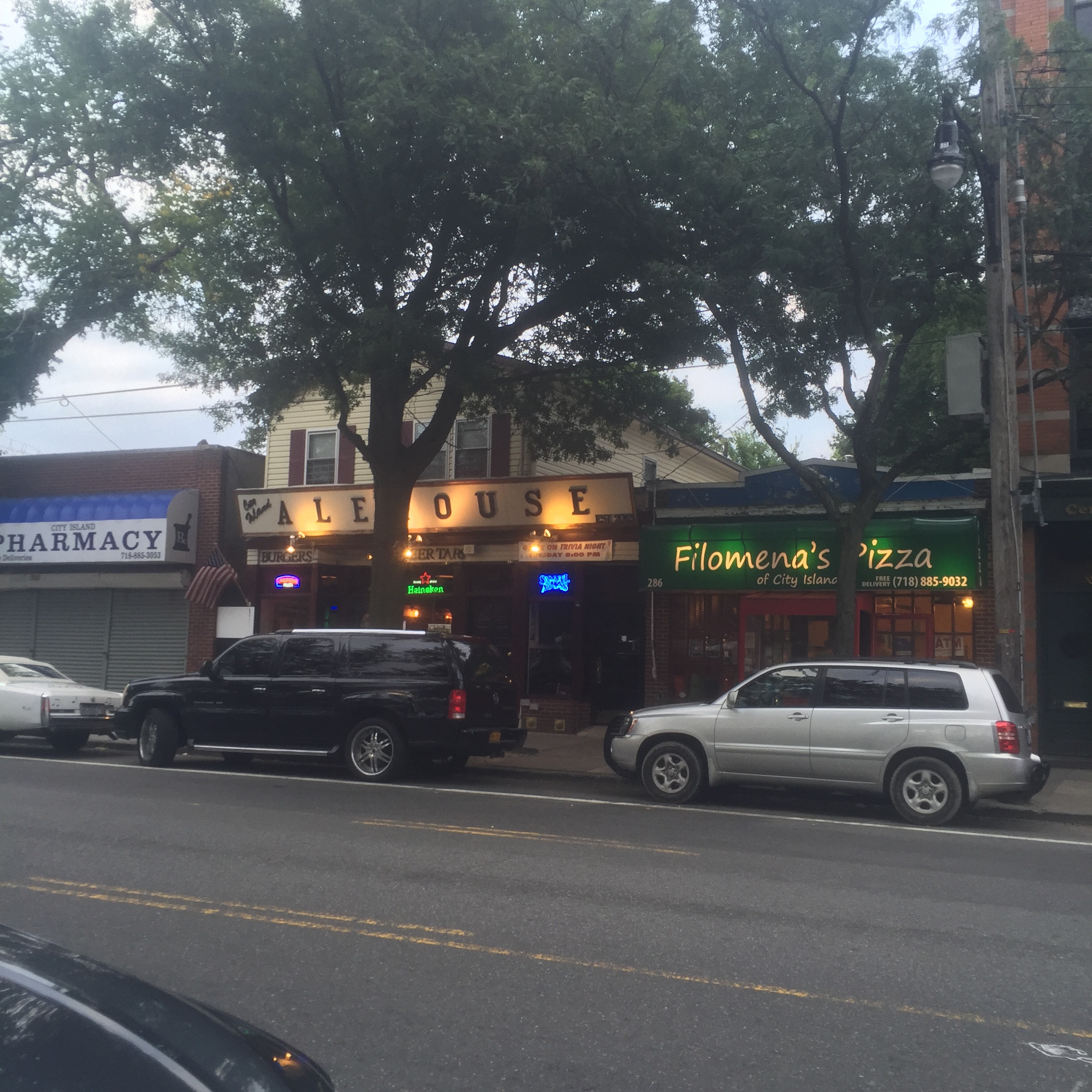
City Island Avenue cuts down the middle of the island, lined with quaint shops, art galleries, and restaurants. At every cross street, you can look in either direction and generally see a block of houses or low-rise apartments leading to the water.
On the first Friday of every month, there is a free trolley to pick up visitors from the subway stop and take them to City Island Avenue. They give out a discount card valid for that evening, and often shops and galleries will have free treats to hand out along the avenue.
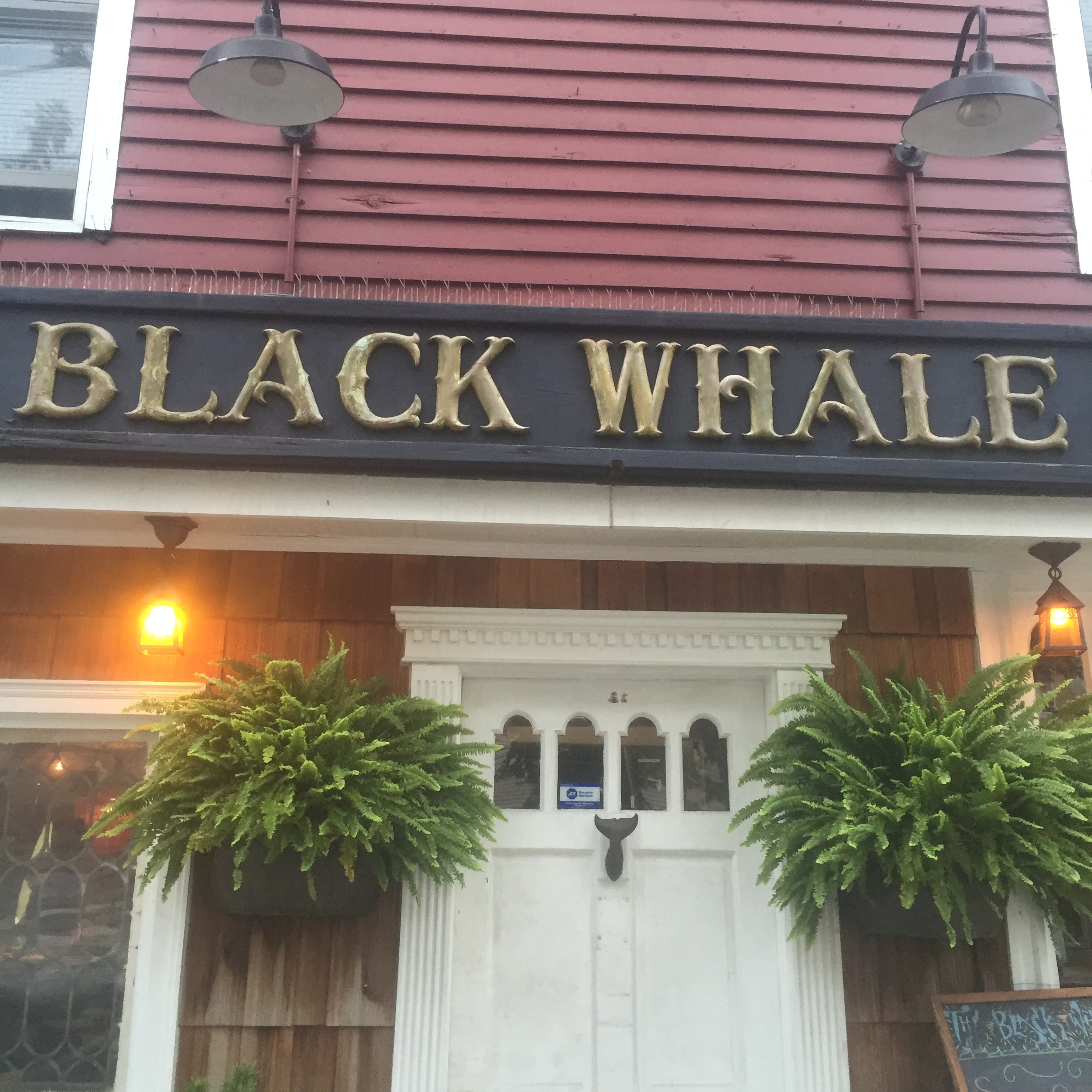
City Island Avenue is just over a mile long, so an easy and pleasant walk. At the very end, when it dead ends at the water, there are two competing seafood restaurants with ocean views.
City Island has a resident population of just over 4000 people, many associated with nearby Albert Einstein College of Medicine. The brilliant neurologist and author Oliver Sacks lived on City Island until his recent death, and some of the film based on his book Awakenings was shot on the island. City Island is a real estate bargain (due in no small part to its remoteness) – houses selling for under $300/sq ft, on average, and a three bedroom house can be rented for about $3000/month.
Alice Payne wrote about the history of City Island in her book Tales of the Clamdiggers. Clamdiggers are people born on City Island (Musselsuckers are those living on the island born elsewhere!). The rest of us are, I suppose, simply visitors, ready to take a break from the everyday and experience one of the most unique corners of the great city of New York.
I wrote recently about Coney Island, and how easy it is to feel you are taking a mini-break from New York City without leaving the city itself. I recently spent a day on Governors Island, in some ways more disorienting (in a good way!) since you are simultaneously surrounded by nature and yet experiencing spectacular views of lower Manhattan, the Brooklyn Bridge, and the Statue of Liberty.
Governors Island sits a mere 800 yards away from Manhattan and is even closer to Brooklyn (400 yards). Originally reserved for the Governors of the New York Colony during British rule, the American Continental Army used it to their advantage and fired on the British from the island during the Revolutionary War. After American Independence, forts were built on the island for coastal protection, and Castle Williams (which is still standing) was later used to hold Confederate prisoners of war during the Civil War. When material dug out from Manhattan to create the first subway line was used to enlarge Governors Island, it became first an Army base and later one for the Coast Guard. By 1996, however, the Coast Guard had ceased to use the island, and it began to be redeveloped as a public park. Fort Jay and Castle Williams, as well as 22 acres of the island, have been declared a National Monument – the remaining 100 acres belong to the city and are in the middle of a ten year plan to revitalize Governors Island for use by the residents of New York.
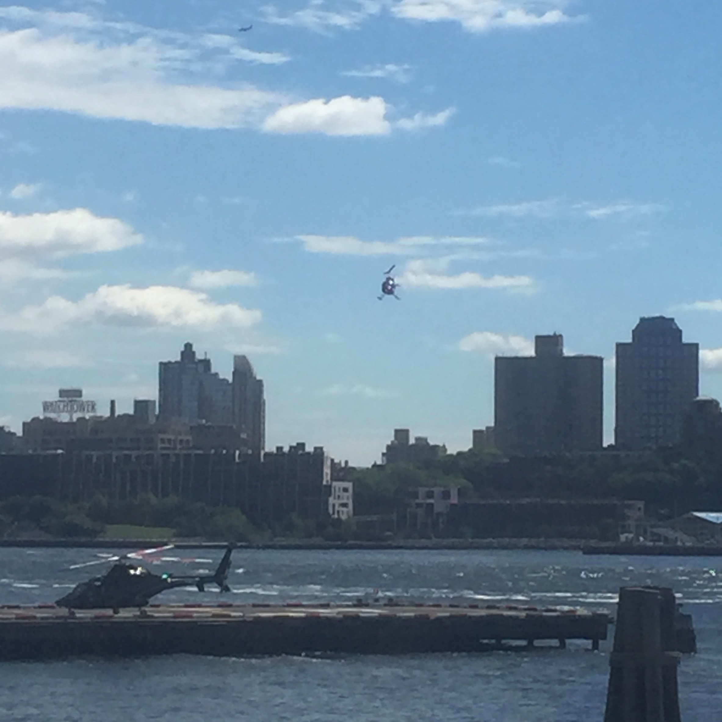
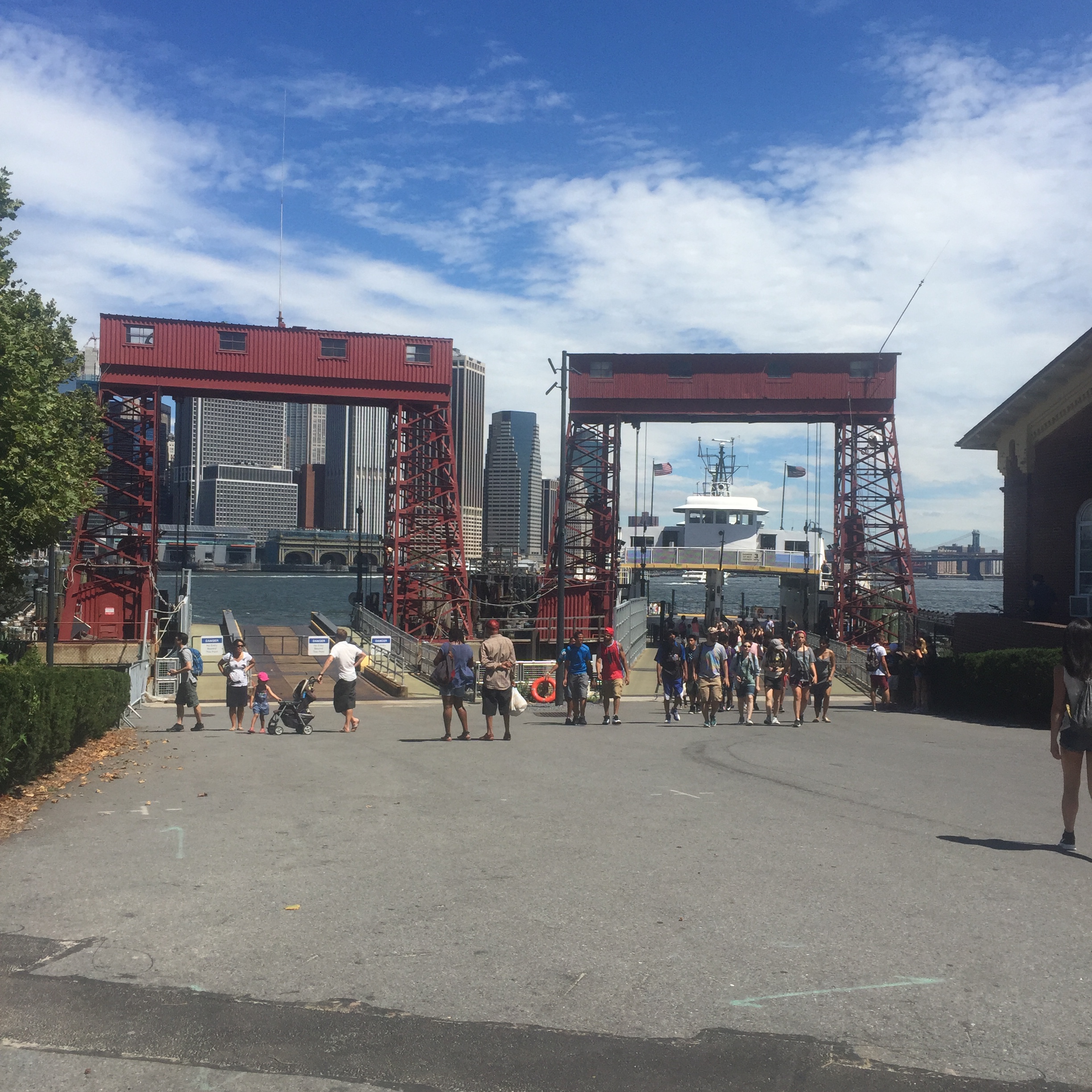
Getting to Governors Island is somehow both easy and difficult. The ferry leaves from lower Manhattan (just north of the Staten Island Ferry terminal) on the hour starting at 10 AM, and leaves the island to return to Manhattan on the half hour. The cost is $2 roundtrip, but is free if you are a resident and have an idNYC card (if you are a resident and don’t have one, what are you waiting for? there are so many great discounts and benefits, check out the card here). The actual ferry ride is only seven minutes long, but if you miss one (as I did, slower than expected subway traffic on the 4 getting me there just a few minutes after the 10 AM ferry left) it’s a long wait.
One entertaining thing to do in the area if you miss a ferry is to watch helicopters take off and land just north of the Battery Maritime Building.
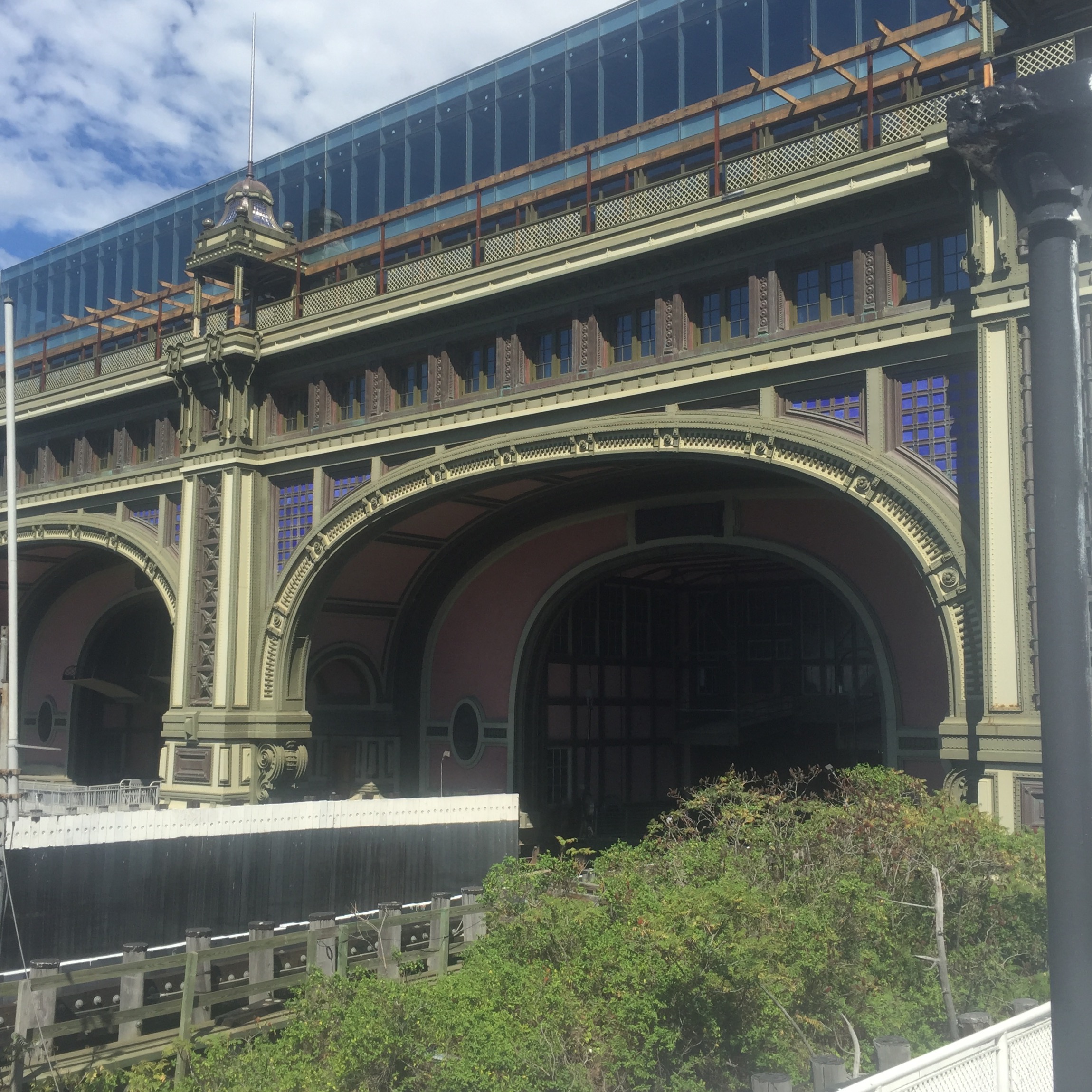
Once the ferry is ready to load, it only takes a few minutes before you are looking back at the Battery Maritime building as the ferry leaves lower Manhattan.
Within a few minutes you arrive on Governors Island at Soissons Landing.
The constant odd juxtaposition of quaint old buildings, green lawn, and spectacular views of the skyscrapers of lower Manhattan is disorienting, but in an exciting way.
One view of Castle Williams.
If you pass the old historic buildings and follow the signs for the newest part of Governors Island Park, The Hills, you can find the longest slide in NYC, three stories tall and 57 feet long. My advice on a sunny day is to be sure you are wearing long pants – that metal slide gets HOT!
The Hills was constructed using so much landfill it would require 1806 subway cars to transport it. Much of it came from the demolition of some buildings and parking lots elsewhere on Governors Island. Some of the actual hills were created using pumice, because any heavier material would push the existing landfill into the harbor.
A plaque marking the National Park Service site, Castle Williams, with fantastic views of lower Manhattan, which is just a few hundred yards away.
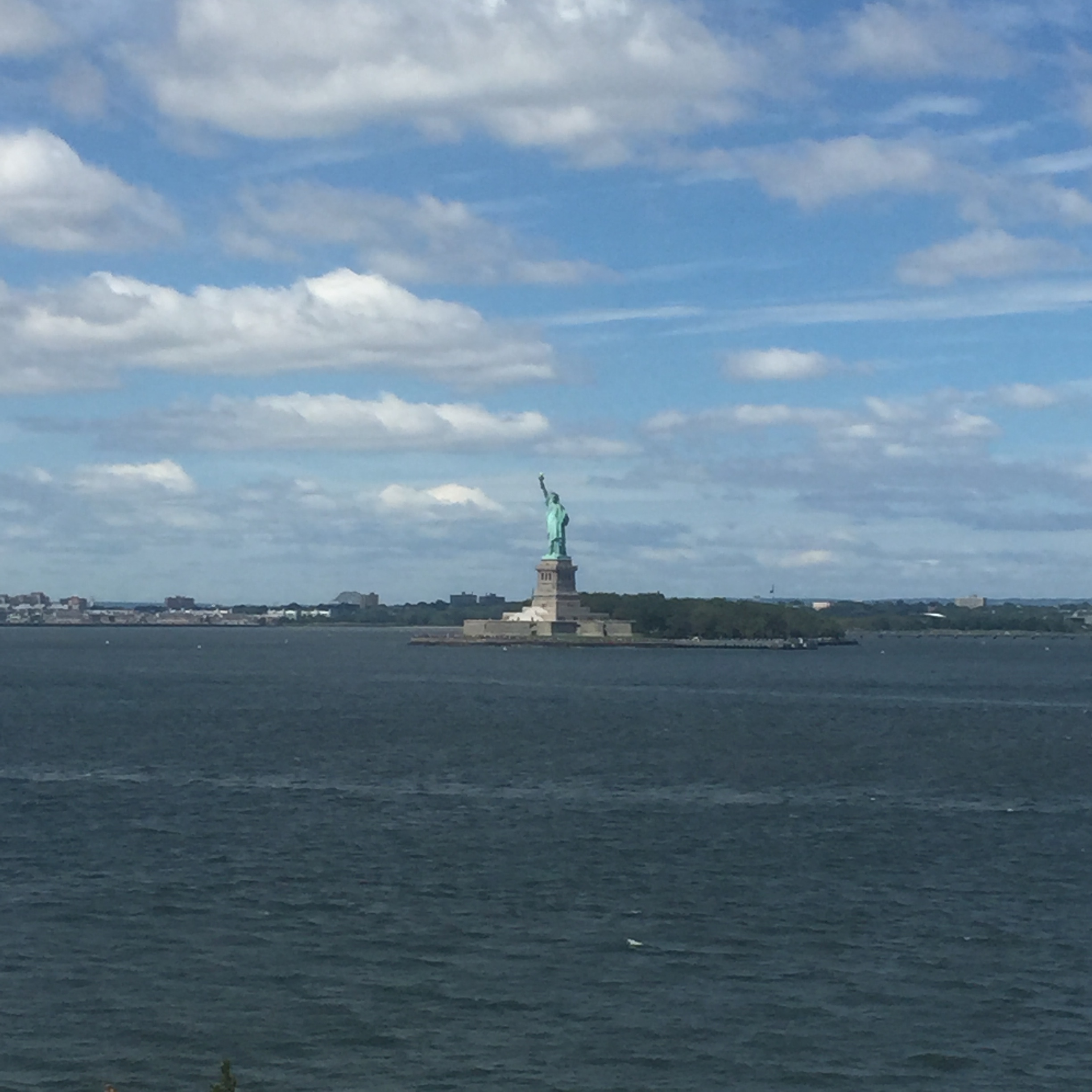
Wonderful views of the Statue of Liberty can also be seen from the western edge of Governors Island.
Ferries return on the half hour, with the last ferry back at 6 during the week and 7 on the weekend.
Returning back to Manhattan, you can feel as though you have taken a trip to another country, one where you gazed at the city as though it was a movie backdrop or a mirage. I highly recommend taking the journey. I found I appreciate the city so much more when I have seen it through a different angle – even one that technically lies within the city limits. Governors Island is open daily during the summer season, which lasts roughly the end of May through the end of September. For more information check out their website here.
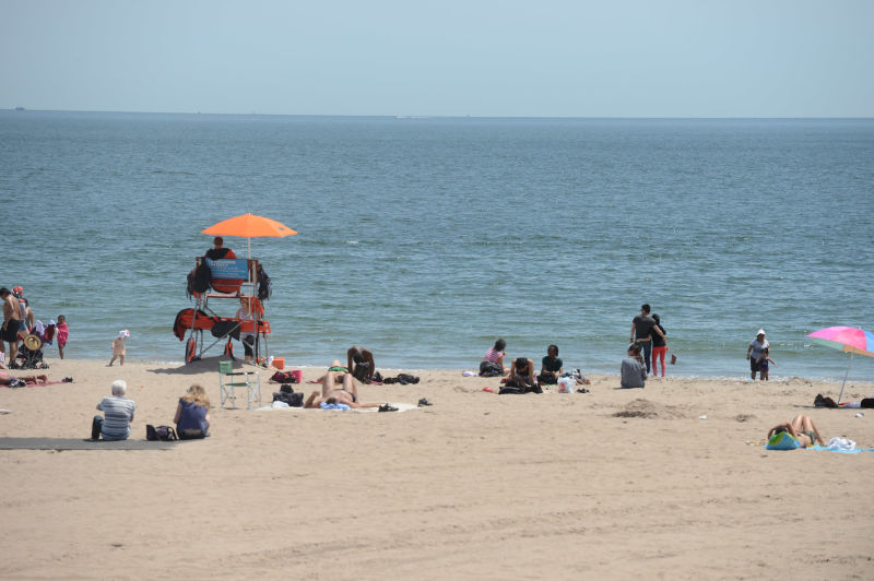
It’s summertime, and the livin’ in New York City is . . . hot and muggy. If you can’t make it out of town for a visit to the Hamptons, or the Caribbean, or the south of France, at least for the cost of one swipe of a MetroCard each way you can still get to a beach and not even leave the five boroughs. I think calling Coney Island “the playground of the world” (as the sign near the Wonder Wheel proclaims) is an over-statement, but it can be a fun day trip. I will note that the sea breeze is a real thing on these sticky August days, refreshing you even if all you do is walk along the water as the waves lap your ankles.
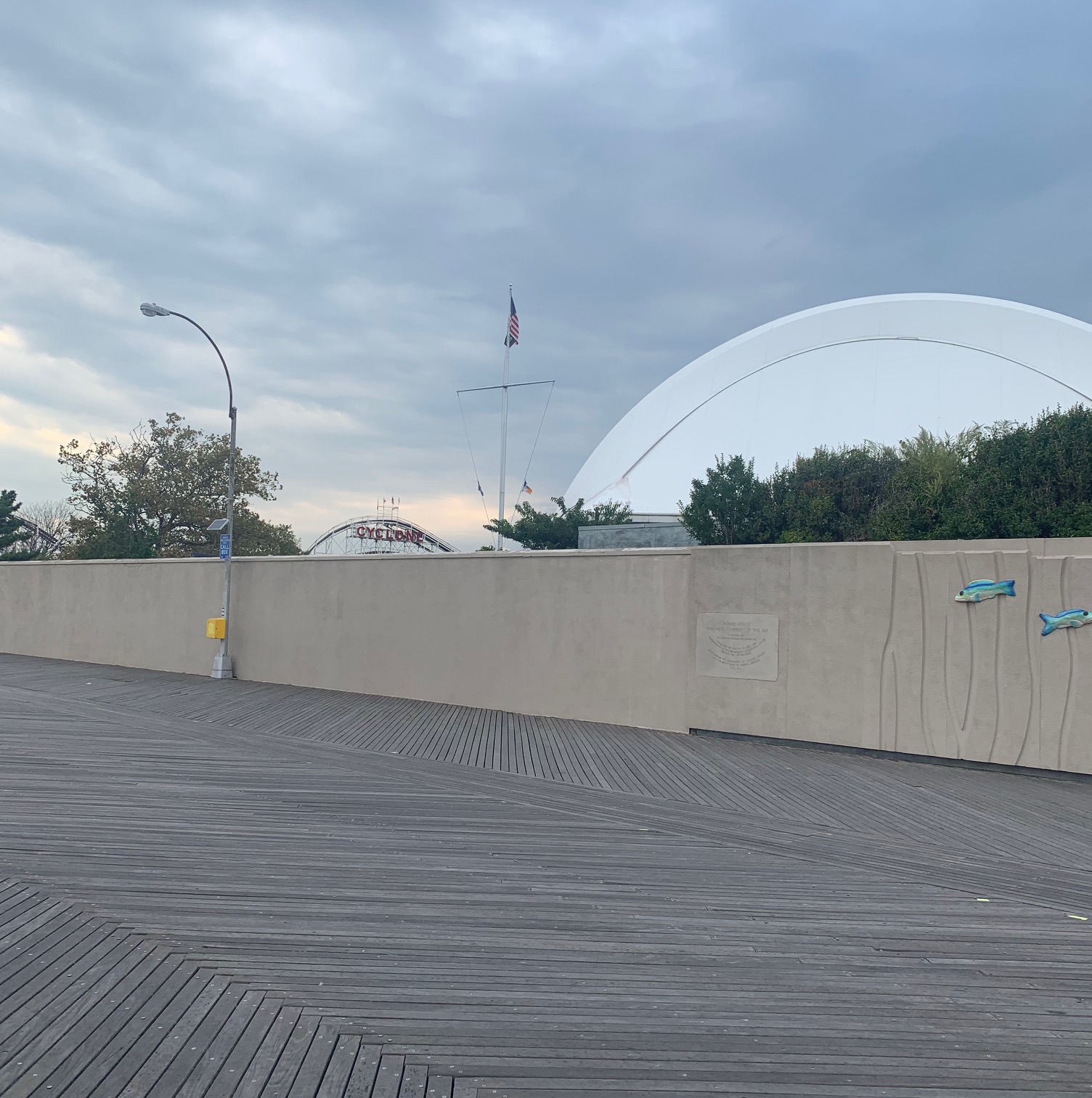
Coney Island was in fact once a barrier island, but became attached to the Brooklyn mainland via landfill. The source of the name “Coney” is uncertain – it could be due to a large number of wild rabbits, or coneys, but also could derive from someone’s name. Native Americans called it Narrioch, meaning “always in light” because of the abundant sunshine on the beach. After the Civil War, it became a popular seaside destination, and large piers were built. However, it was with the addition of rides that Coney Island began to take on the familiar persona of an amusement park at the beach. The United States’ first roller coaster, Switchback Gravity Railway (apparently they had yet to figure out how to create memorable names), opened in 1884. While the early 20th Century led to Coney Island’s heyday with the creation of Steeplechase Park, Luna Park, and Dreamland, it also began to develop a reputation as a somewhat seedier place as well – “Sodom by the Sea.” This didn’t keep it from becoming the #1 tourist attraction in the country (in fact, it could have helped), with 100,000 visitors a day, on average (to compare, Disney World’s Magic Kingdom averages about 56,000 a day, the most of any current theme park). Following World War II and some demolition (unsurprisingly, sponsored by Robert Moses) Coney Island began a steady decline that reached a nadir in the 1970s and ’80s. A steady revitalization began in the early years of the 21st Century, and despite serious damage from Hurricane Sandy in 2012, Coney Island is looking better these days than it has in a long time.
Recently I spent a day at Coney Island, taking the 4 subway from the Upper East Side and transferring to the N at Union Square. It was a solid 90 minute journey, so bring a good book – or a good companion – if you plan to make the trek. Getting out of the Stillwell Avenue subway station, you can’t miss Nathan’s, the home of the famous (or nauseatingly infamous) hot dog eating contests every July 4th. My personal preference is for pizza (you can’t go wrong with either Grimaldi or Totonno) but my friends and family who like hot dogs love Nathan’s (just please don’t try to eat 70 of them in 10 minutes).
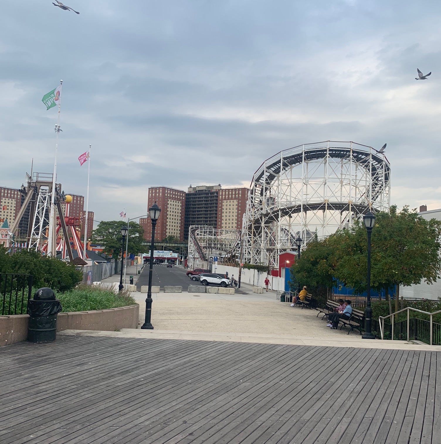
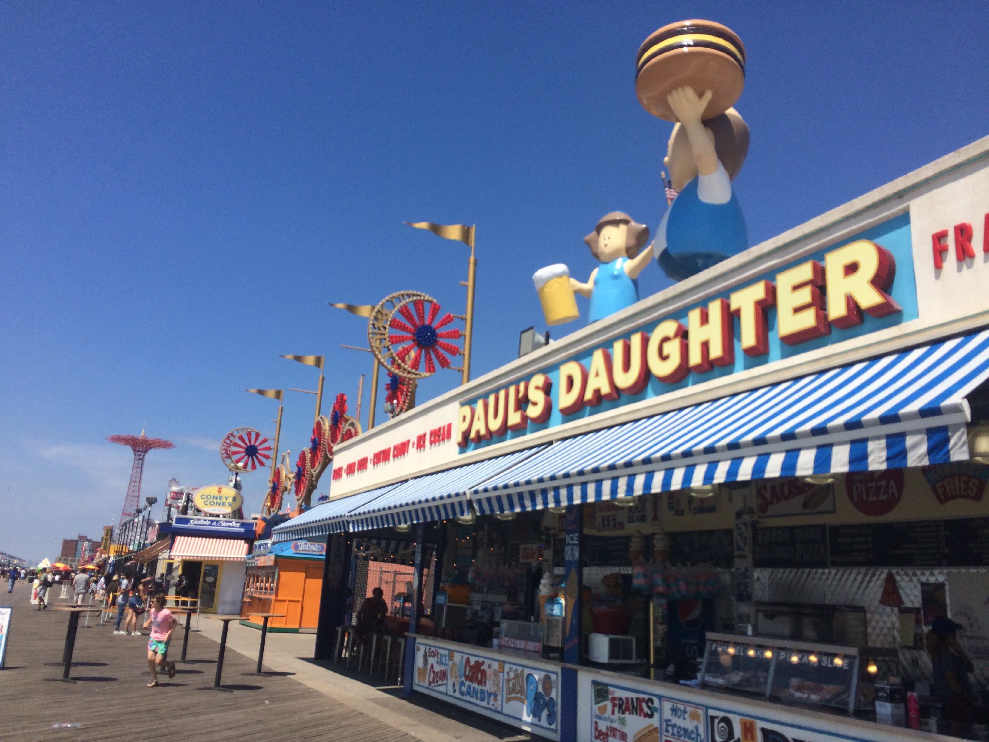
Once you get to the boardwalk, there are many competing places to eat, but I’m personally more interested in the rides on one side of the boardwalk and the Atlantic ocean on the other.
The Wonder Wheel is my favorite ride, built in 1920. It’s 120 feet tall and many of the cars are not fixed to the rim but swing back and forth as the wheel goes around -it’s thrilling.
From the top of the Wonder Wheel, I noticed lower Manhattan shimmering off in the distance like a mirage.
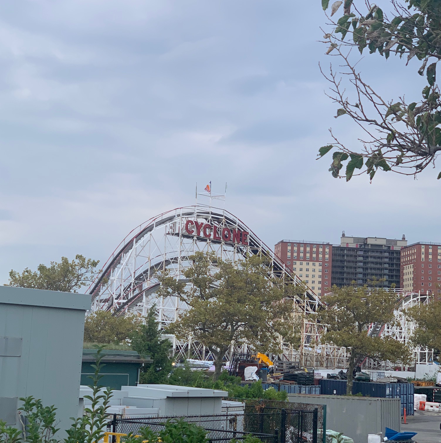
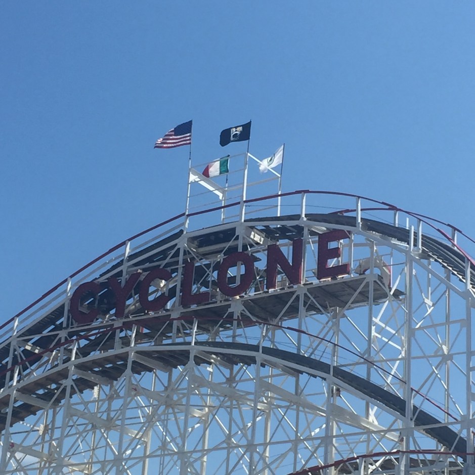
Of course the most famous ride in Coney Island is the Cyclone, a wooden coaster built in 1927 that is both a New York City landmark and on the national Register for Historic Places. I’ve ridden it a few times, and it still delivers plenty of excitement and the very real possibility of whiplash.
Walking back along the beach rather than the boardwalk, it is fun to walk along the ocean’s edge and feel the cool breeze. The beach can be packed, particularly on summer weekends, but it is kept clean and the sand raked, and there are lifeguards. On the day I was there, lifeguards were keeping people out of the water because both sharks and sting rays had been sighted!
If the idea of a seaside apartment to live in or use over weekends appeals, real estate values are beginning to improve in Coney Island – but still there are many apartments readily available to buy, averaging about $417/sq ft. Neighboring Brighton Beach has been rapidly increasing in value, with apartments there now at $665/sq ft, on average, and it is possible that Coney Island will follow this trend as more money is poured into its revitalization.
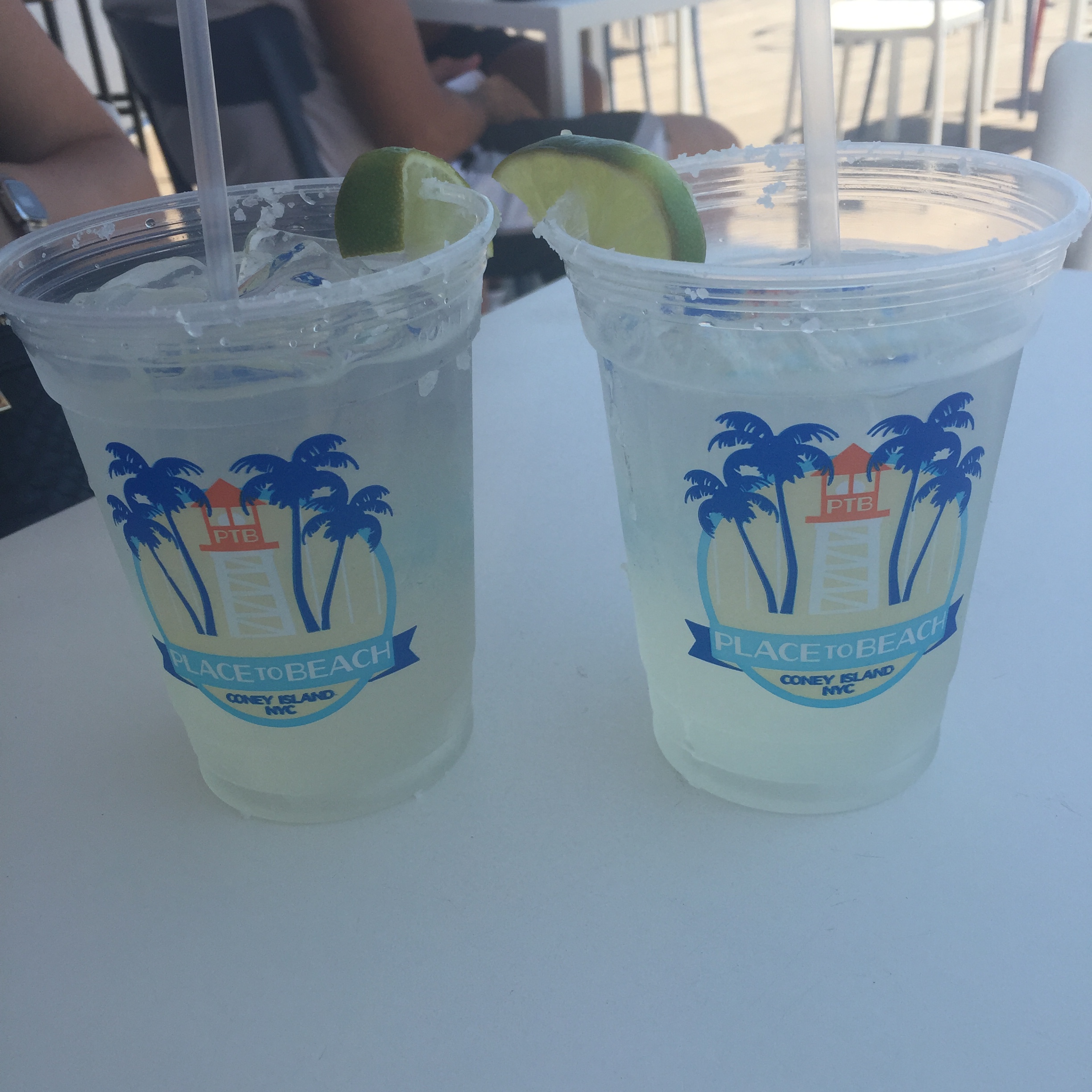
There is much more to do on Coney Island (the NY Aquarium and the minor league baseball team the Brooklyn Cyclones, to name only two), but one of my favorite ways to end a day there is with a drink on the boardwalk. It’s hard to know which is more fun: people-watching on the boardwalk, or gazing past them to watch the ocean as the sun begins to set. A day at the beach combined with a day at the amusement park – and all without leaving New York City.