The Hudson River Greenway along the Hudson River on Manhattan’s West Side is accessible for walking and biking from Battery Park all the way north to Inwood Hill Park at the top of the island. It keeps being expanded and is a destination for residents and visitors alike with recent additions like Little Island Park, Pier 26, and Pier 57. On the other hand, while the riverfront area along the East River has some lovely patches (like the John Finlay Walk next to Carl Schurz Park in Yorkville), there are also stretches where there is no waterfront access. There is a new plan to connect all of the East River waterfront, similarly to that seen on the Hudson River, and a new section of this was recently opened, beginning at East 54th Street and continuing up to connect an existing path at East 61st Street.
Entering the new stretch at East 54th Street, the views are instantly gorgeous. You can see south along the East River, as well as east to Long Island City.
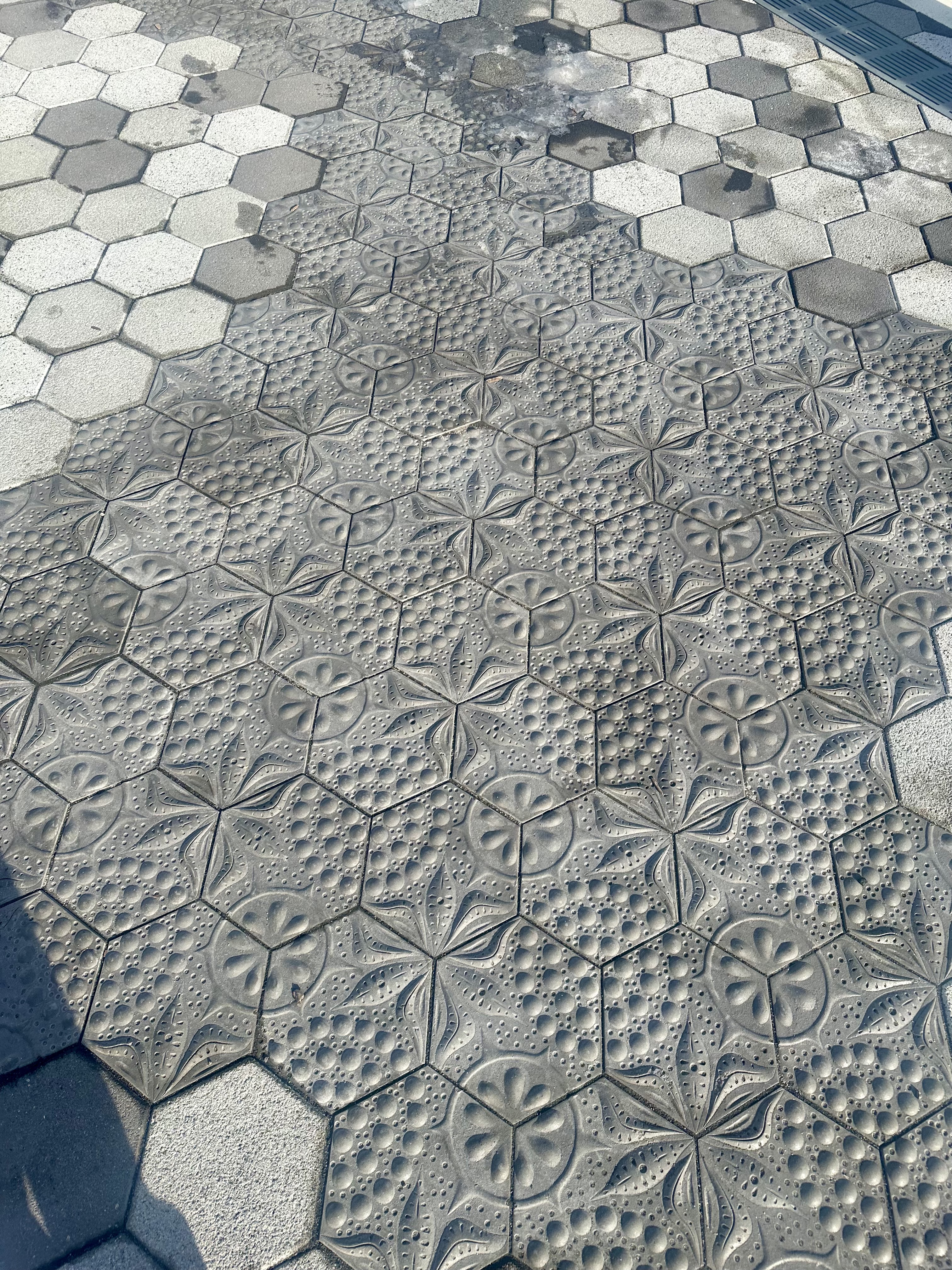
The tiling on the walkway is inspired by diatoms, single-celled microscopic algae. They are the base of the food chain in the river, and convert sunlight into energy. There can be hundreds or even thousands of diatoms in one spoonful of East River water. For more details about the use of these diatom-patterned pavers, check out the description from the artist who was involved, Stacy Levy.
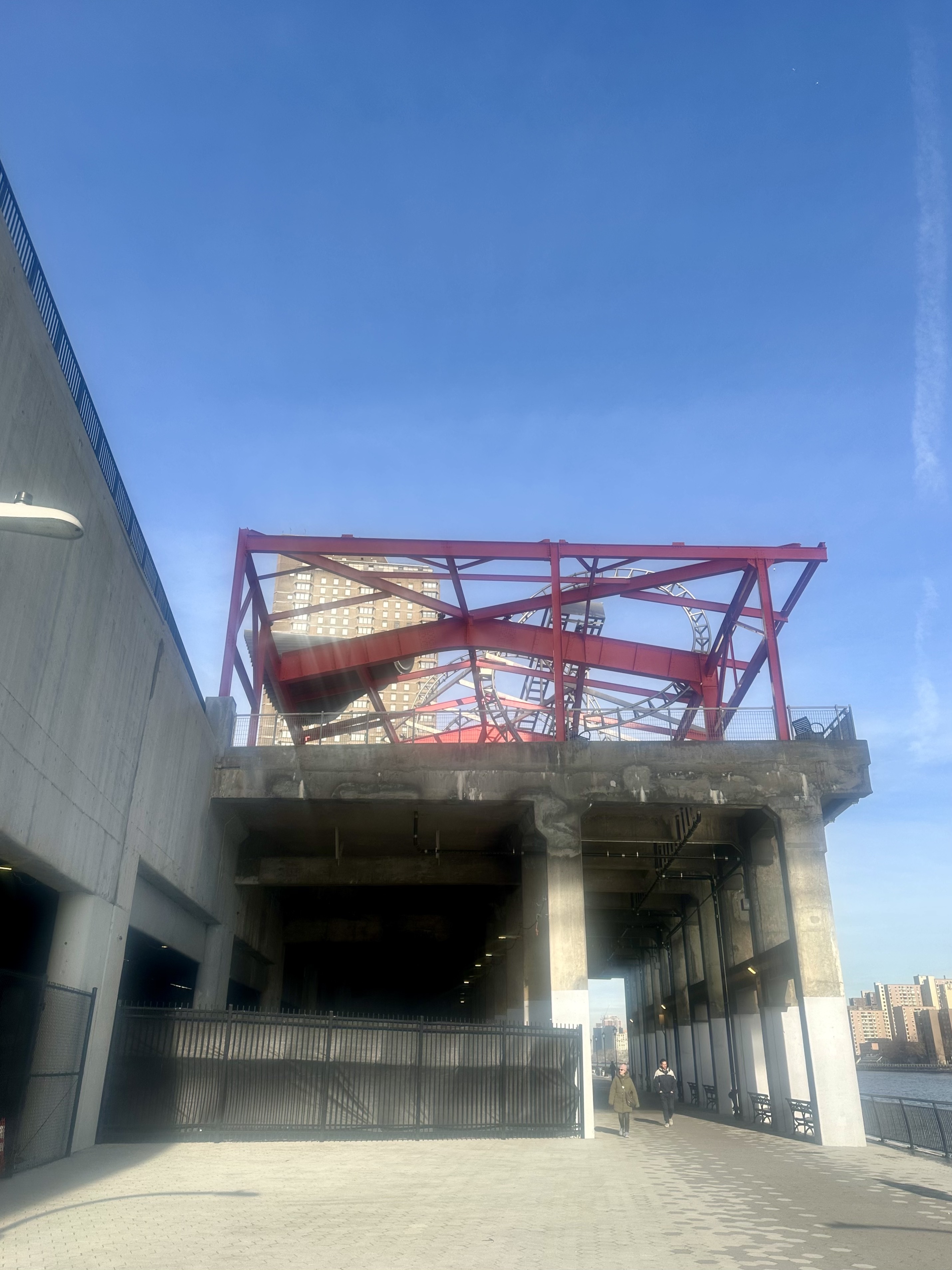
As you start to connect to Andrew Haswell Green Park at East 61st, you can’t help but notice the thing that looks like an abandoned steel roller coaster track. In fact, it is an artwork by artist Alice Aycock, called The Roundabout. A little more about that as we exit the new walkway next to it!
You get some thrilling views of the Ed Koch/Queensboro/59th Street Bridge, especially as you walk under it.
If you choose to exit at East 61st rather than continuing north to the existing Andrew Haswell Green park, you get an up close look at Roundabout. It covers the roof of a defunct Department of Sanitation Building, and was inspired by the weightlessness of Fred Astaire’s dancing! You can read more about this artwork here.
The eventual goal of the East River Waterfront project is to have a continuous loop around all of Manhattan next to the waterfront. It will likely help the livability (and hence the value) of the far east side of midtown Manhattan to have a waterfront park, and one that connects all waterfront areas in Manhattan will be even more appreciated. I look forward to seeing the East River waterway in Manhattan continue to develop and enrich the experience of New Yorkers and visitors to the city alike.
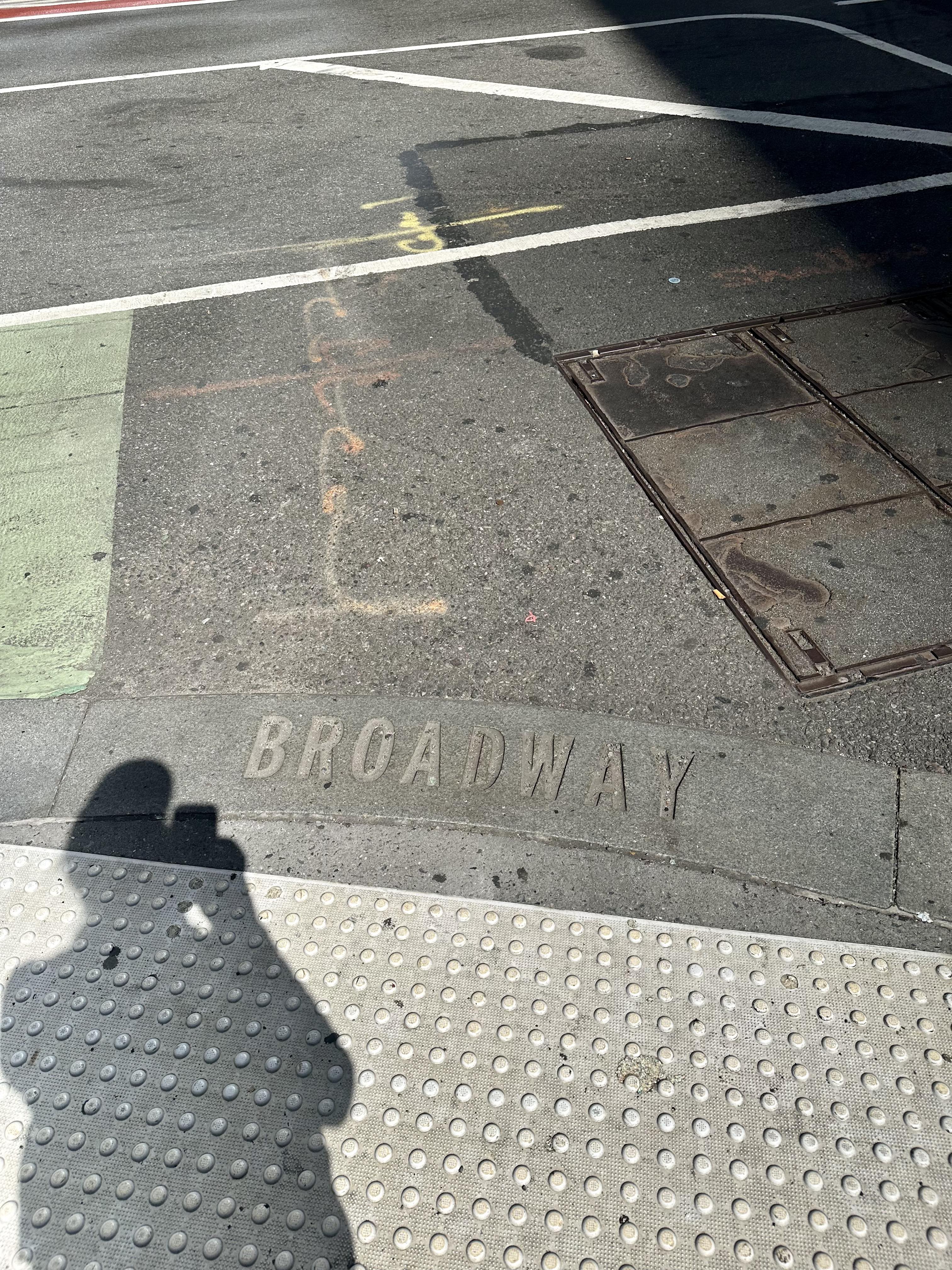
I love walking, and especially walking in New York City, and have written about it often (see old posts here, here, here, and here – among many), and have even compared walking in NYC to walking in London and Paris (see it here) and described walking in the ultimate car city, Los Angeles (see it here). Soon I will be going on a very long walk – I plan to hike Mount Kilimanjaro in Tanzania with a family member (and will be writing about the preparation for that as well as – hopefully – an account of the trip afterwards). (POSTSCRIPT: read about the Kili Climb here, about preparation for it here, and the safari afterward here.) As part of my training as I headed into the final weeks before leaving, I recently did something I have wanted to do for a while – I walked the entire length of Broadway from Battery Park to the tip of Inwood, about 13 miles, with my fully loaded daypack for Kili (including 4 liters of water), wearing my hiking boots, etc. Here’s what my day was like!
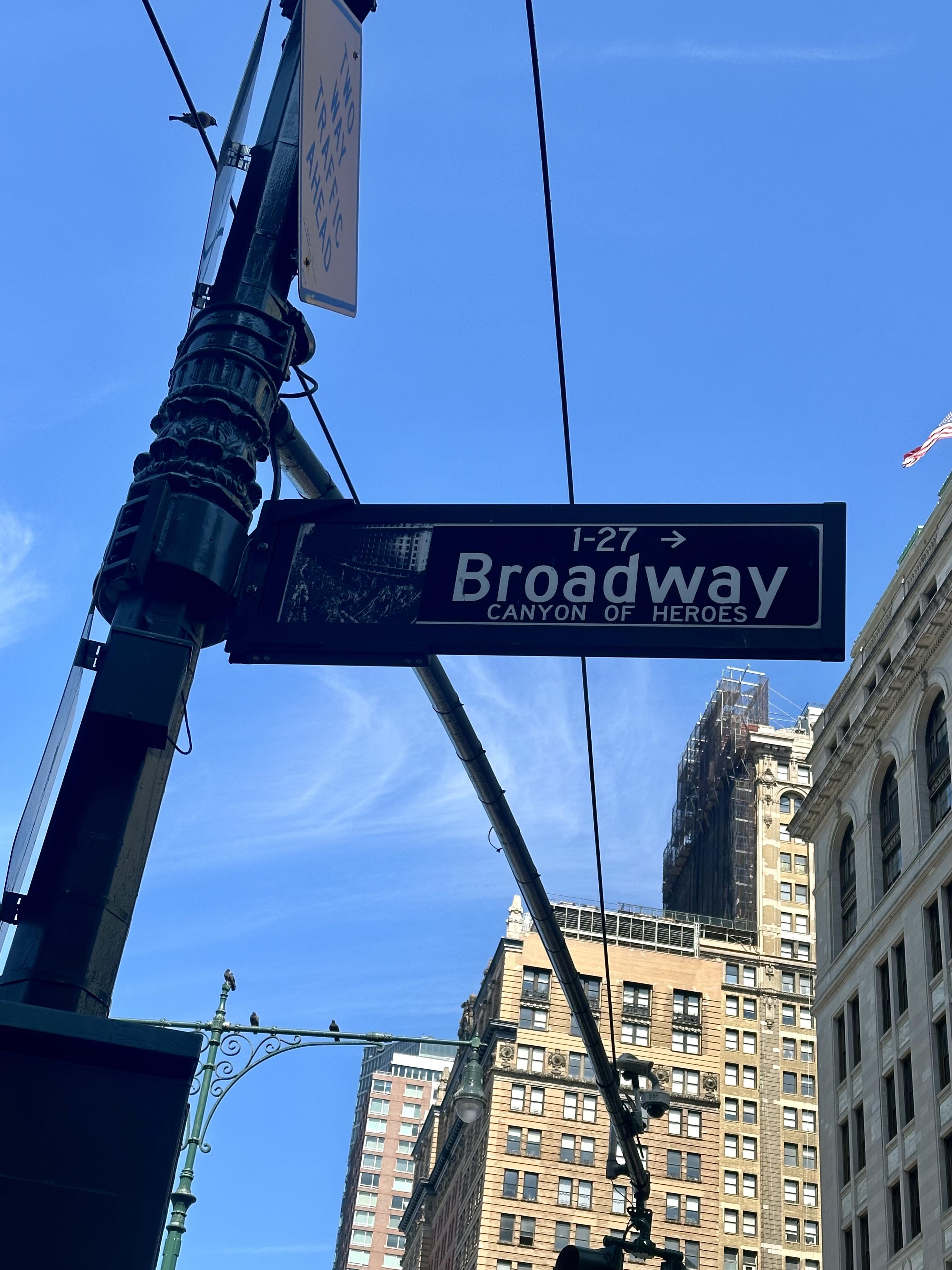
Broadway is the only avenue in Manhattan that runs its entire length (and in fact, continues north for two miles into The Bronx and then runs for 18 miles through Westchester County, through the towns of Yonkers, Hastings-On-Hudson, Dobbs Ferry, Irvington, and Tarrytown). It is also a street that does not follow the grid in Manhattan above 14th Street. Much of it follows the Weckquaesgeek trail, a major thoroughfare long before Europeans arrived. It was then widened by the Dutch, and named the “High Way.” When the British took over it was renamed Broadway because of its unusual width. In the 18th Century, Broadway ended just north of Wall Street, and the section below that was Great George Street, but since 1899 Broadway has begun just north of Battery Park, so that is where I began my walk, on a Saturday in late July that was finally not too hot or humid to contemplate such a long walk.
I took the subway to South Ferry (I had thought about biking down but decided not to test my endurance too much!), and began my walk at One Broadway, just north of the Museum of the American Indian. Before too long I encountered the famous Wall Street bull at Broadway’s intersection with Wall and watched people line up to take photos.
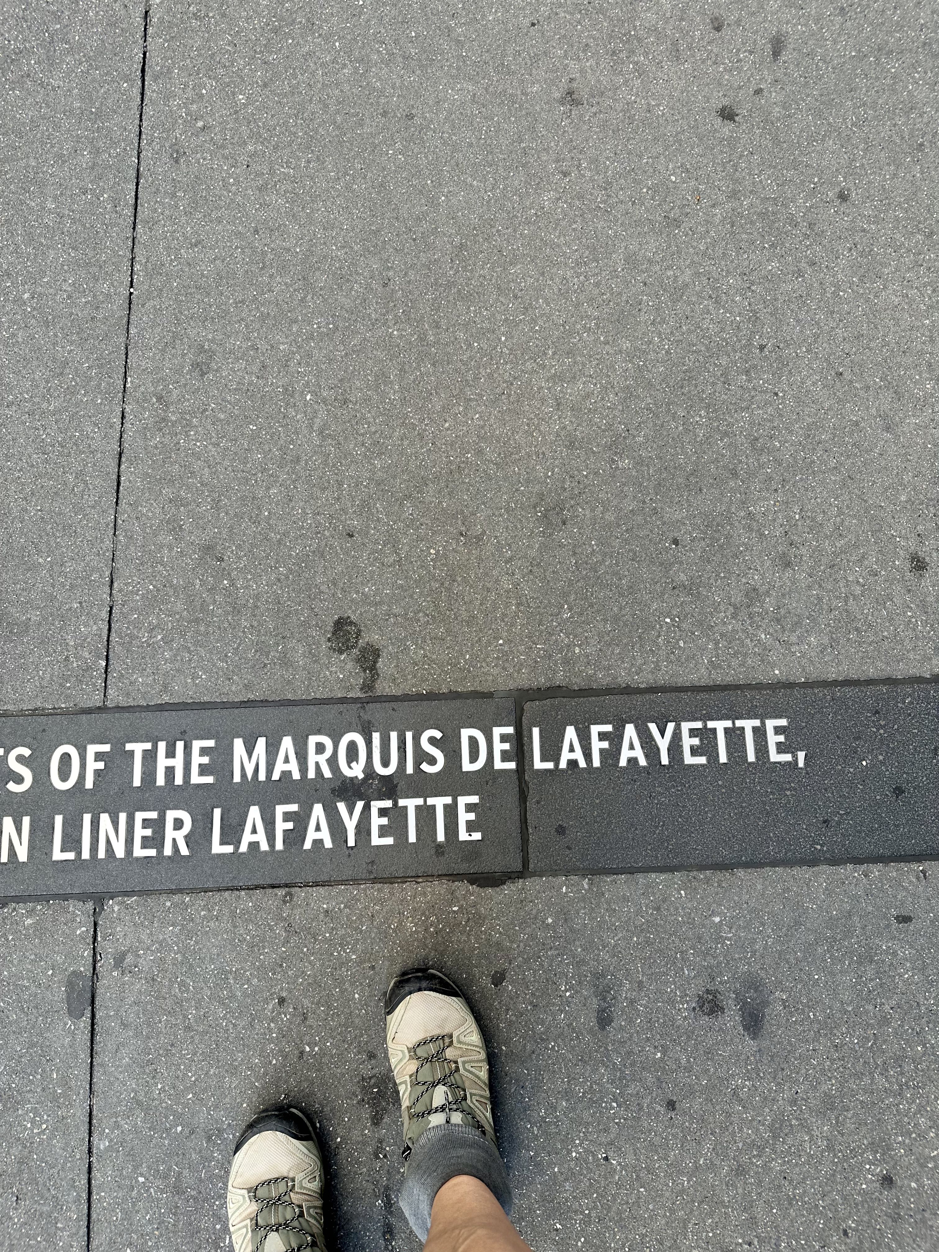
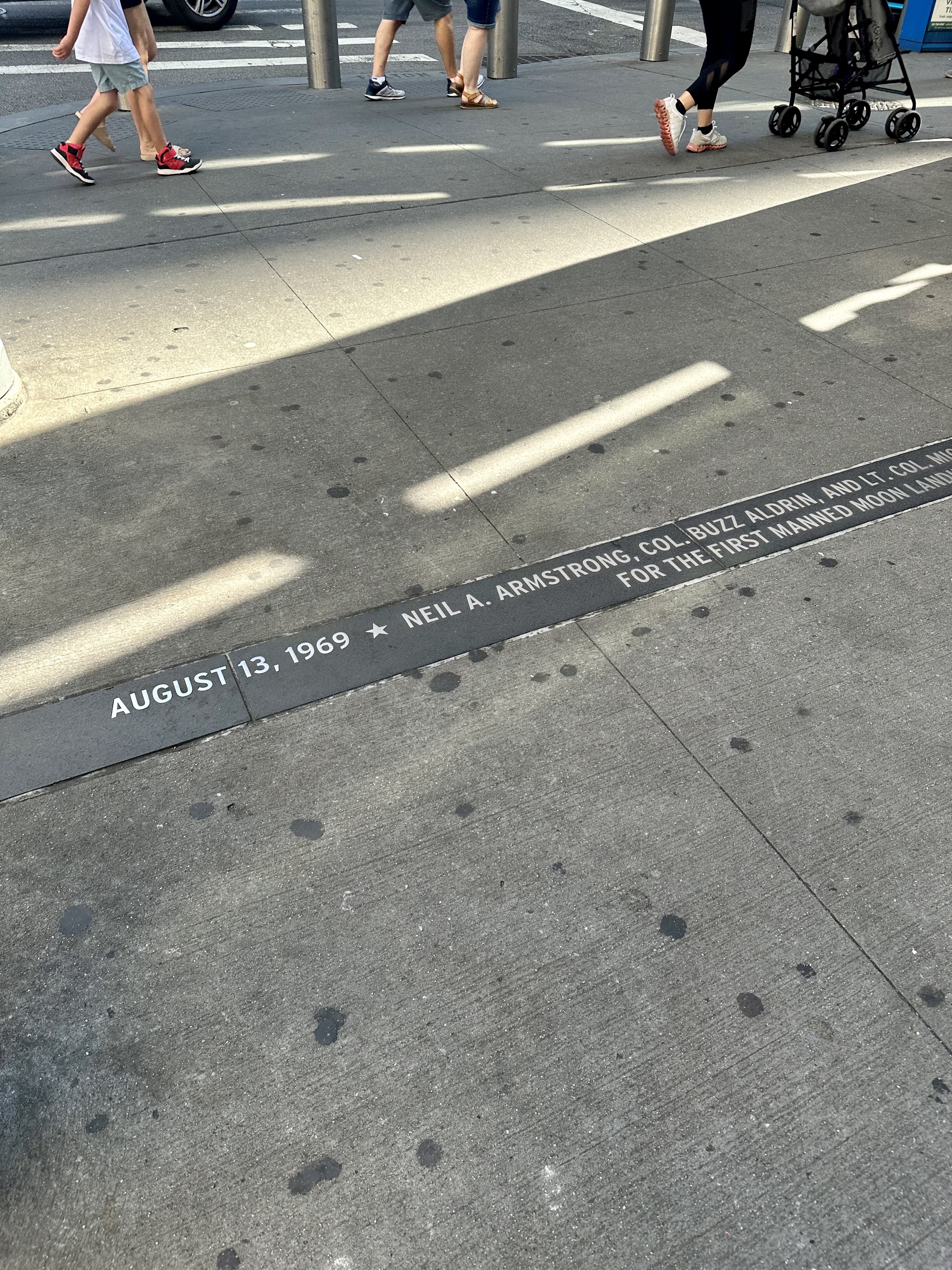
Not too far north from there I began reading the markers for the Canyon of Heroes. This is the section of Broadway where ticker tape (from when the financial district had tons of ticker tape paper as a side effect of doing business) parades have celebrated heads of state, winning local sports teams, and special occasions like the end of World War II or the return of Americans who first walked on the moon. It is fun to read these although you will only read those on one side of Broadway if you are trying to make good time. I stayed on the east side of the street for much of the day to take advantage of shade. I also started from the southern end of Broadway and walked north, rather than starting from the north and walking south (I found out later there is a “Broad City” challenge that starts at the northern tip of Manhattan because it was done in an episode of the show). If you do start from the south, you can read the Canyon of Heroes markers more clearly because they aren’t upside-down, and the sun will be more behind you near the middle of the day rather than in your eyes. On the other hand, as I will describe later, the Inwood section of the hike is much more hilly so you might want to get that over with earlier in the day.
Still in the Canyon of Heroes, be sure to appreciate Trinity Church to your left. Trinity’s first church in Manhattan was built in 1698 and was destroyed in the Great Fire of 1776. There was a second building on Wall Street until Trinity Church as we see it now was built in 1846. It was the tallest building in the United States until 1869, and the tallest in NYC until 1890.
Continuing north, if you look to your left, you can catch a glimpse of the Oculus, first on its own and a block later, with One World Trade rising behind it. (I have written before about the Oculus and about One World Trade.) They aren’t actually on Broadway, but St. Paul’s Chapel, which somehow survived 9/11 and was used as a staging area for helping rescue and recovery workers after 9/11, is on Broadway at Fulton. After George Washington was sworn in as President, he went to St. Paul’s for services and the pew he sat on has a plaque noting this.
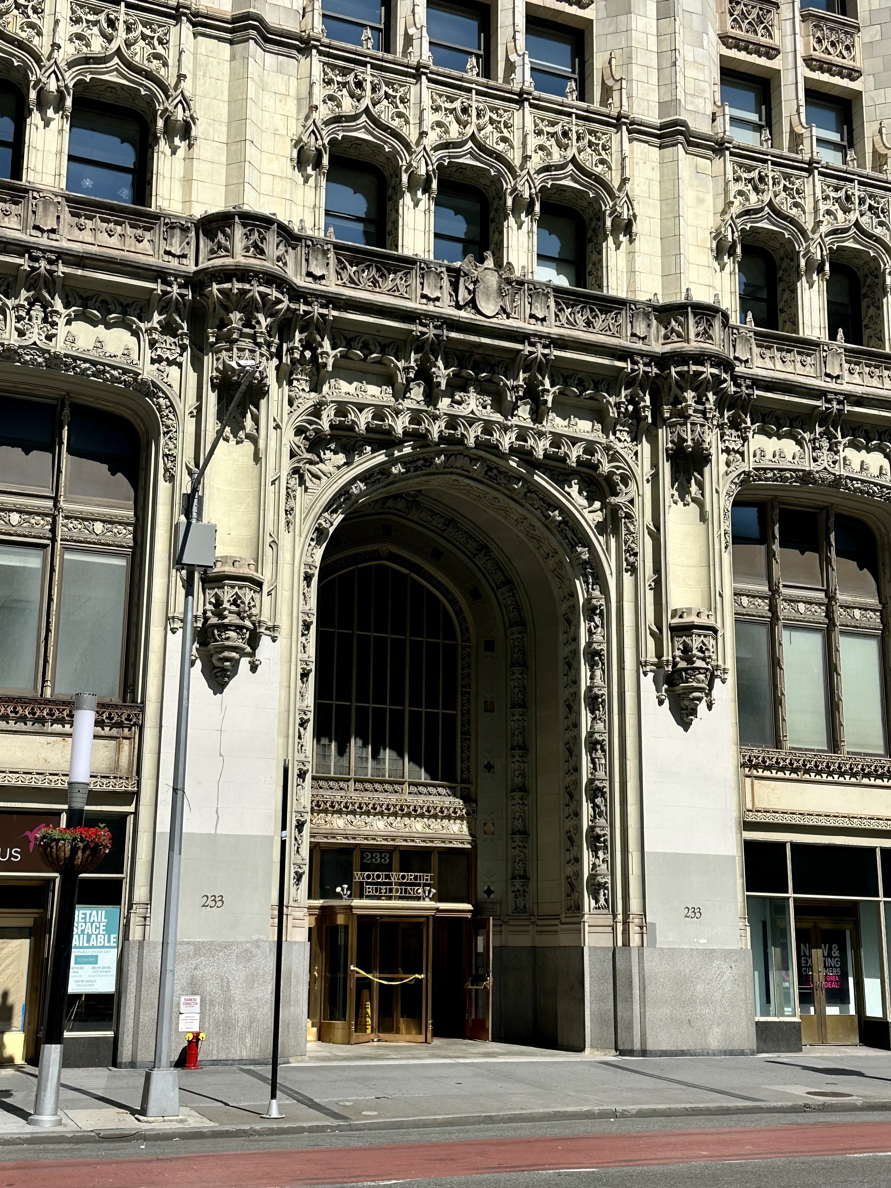
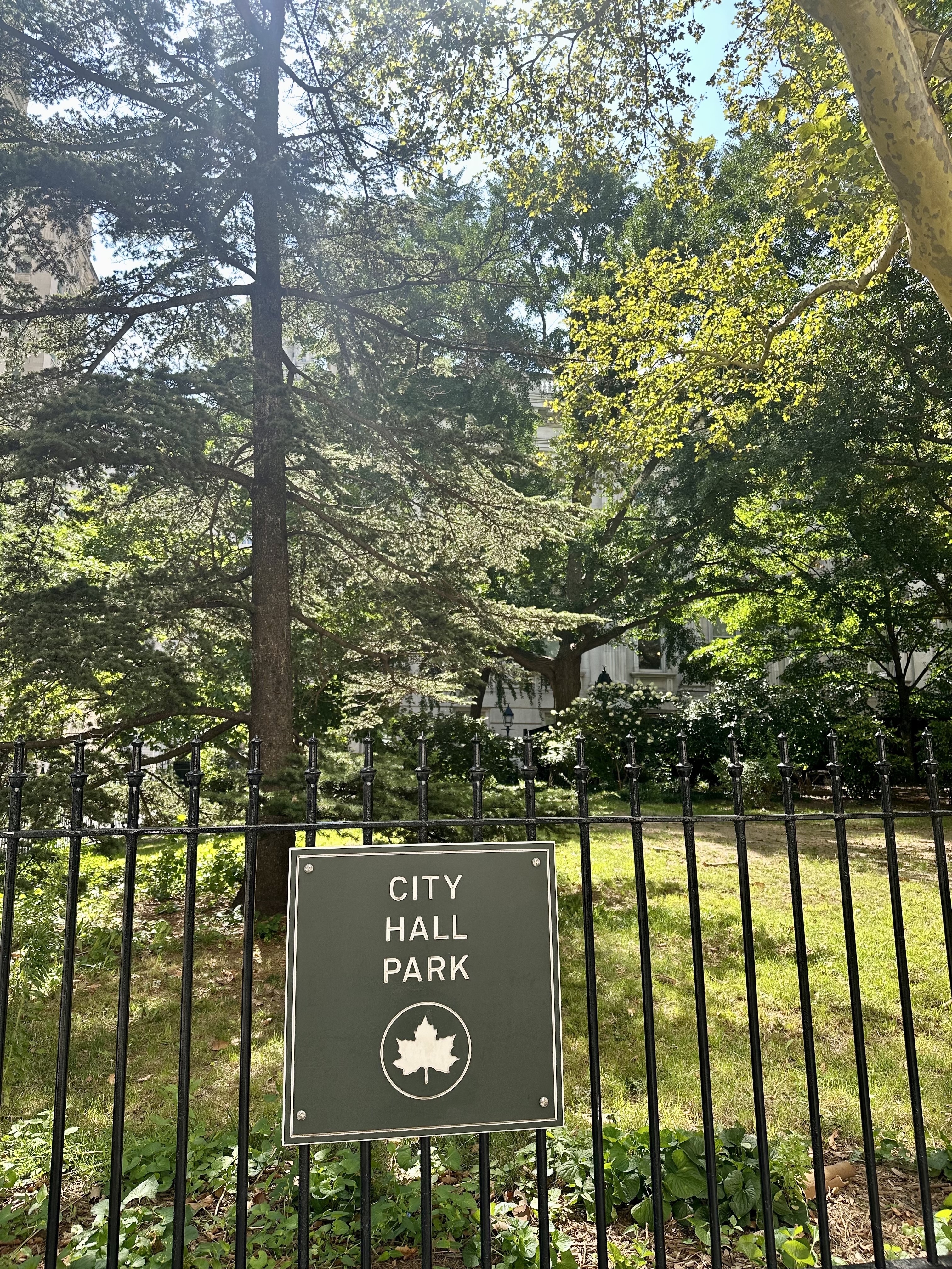
Continuing north, I passed the Woolworth Building, which was the tallest building in the world from 1913 to 1930, with a height of 792 feet. Perhaps more impressively, over 100 years after it was built, it is still one of the 100 tallest buildings in the United States. It has been converted to residential condos, and the penthouse – which is pretty spectacular, to say the least – recently sold for only $30M (down from over $100M when first listed!) in “white box” state, ready for finishing out to the buyer’s taste and use, but is a very unique space. After passing City Hall (which, built in 1812, is the oldest city hall in the US still used for its original governmental functions) and City Hall Park, I couldn’t resist a smile as I passed Zero Bond. This was the location of my work as a background actor for the final season (as it turned out, the final episode) of Succession, and I had scarfed down some craft services for lunch just outside that building standing next to Matthew Macfadyen (“Tom”). You can read more about that experience here.
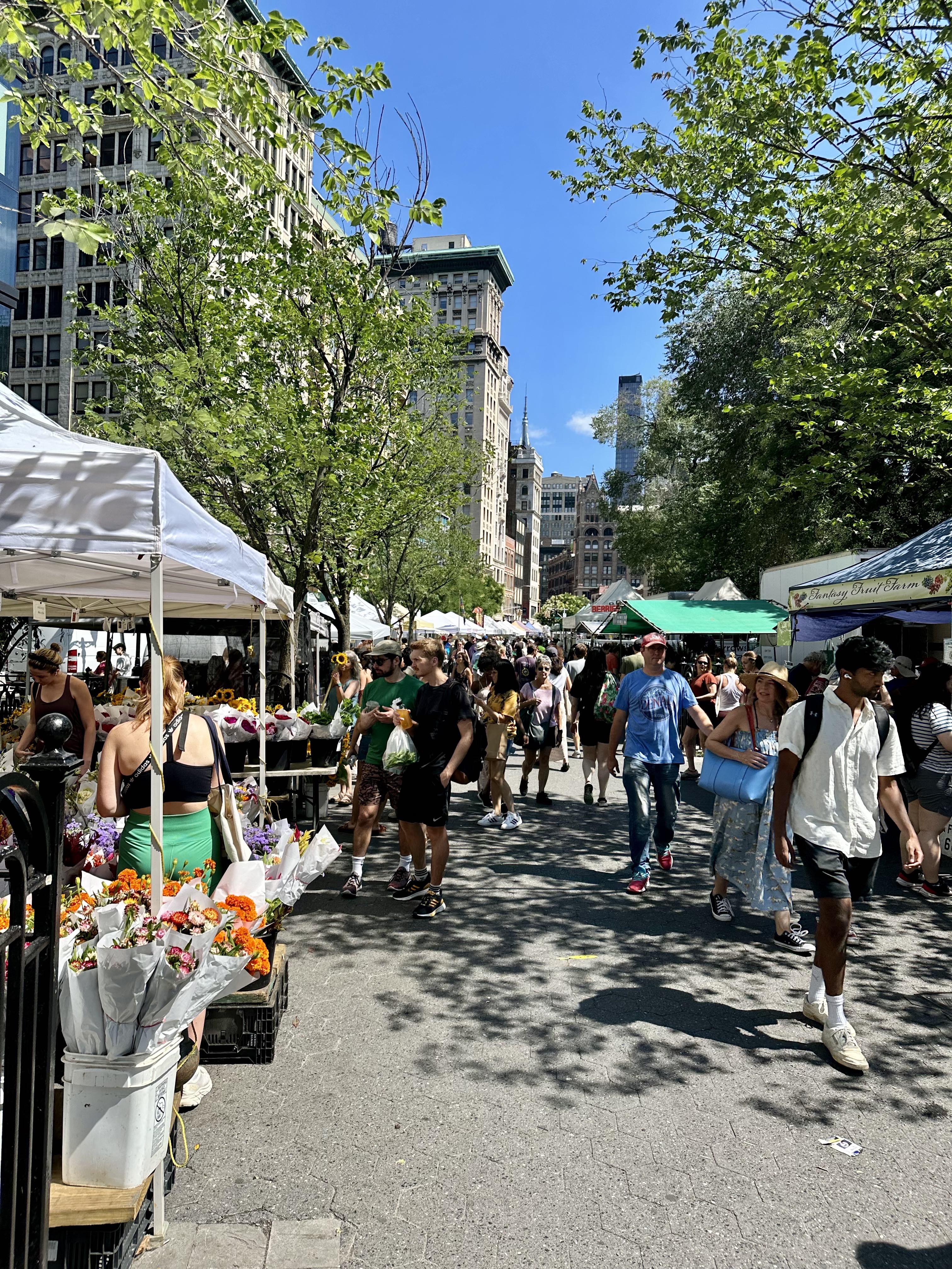
After walking through Greenwich Village, the next big event is Union Square, where Broadway begins to cut across the Manhattan grid, creating interesting little parks or “squares.” I was doing this on a Saturday, so the excellent Green Market was in full swing. I had been hydrating up to this point, but decided to buy some fruit and enjoy it (raspberries and red currants) for my first snack of the day.
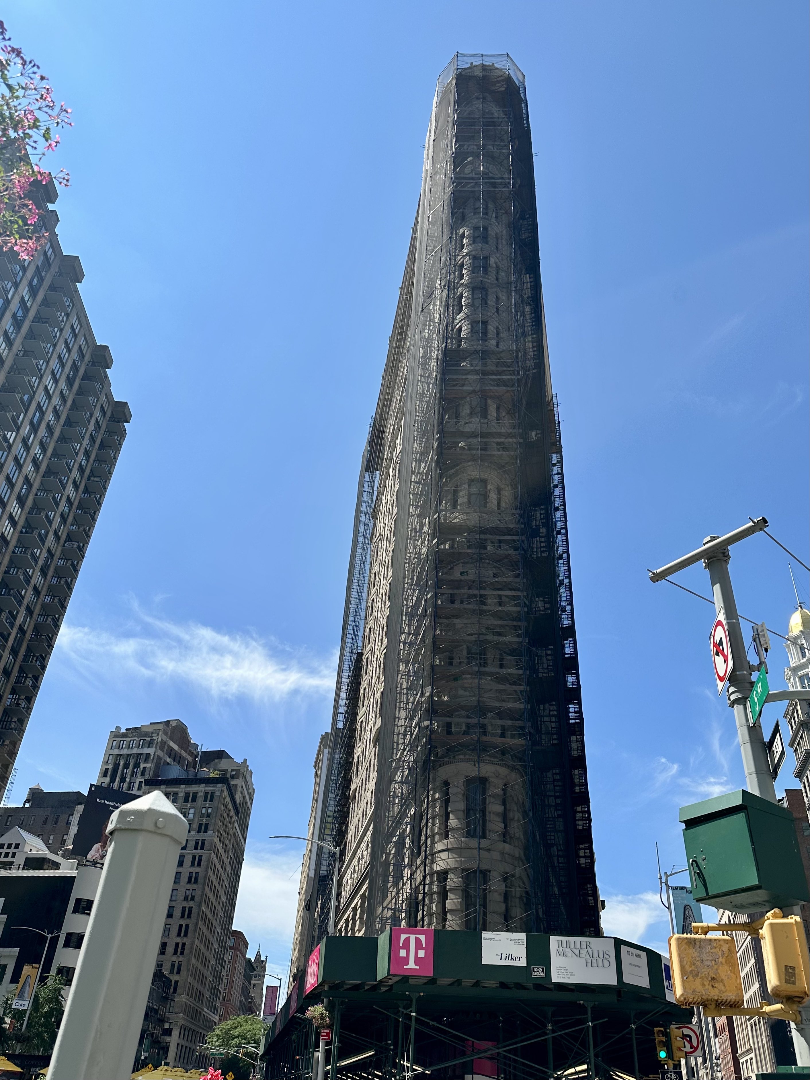
At 23rd Street, Broadway intersects with Fifth Avenue, and you get a great view of the Flatiron Building (unfortunately scaffolded right now for some facade repair). Completed in 1902, at 20 stories it was considered dangerous and a “folly” for the builder. A National Historic Landmark, The Flatiron Building is now universally adored – it was the fourth most loved building in the United States in a survey in 2019 (behind Falling Water, the Empire State Building, and Coit Tower in San Francisco).
Broadway intersects with Seventh Avenue at 34th Street, home of Macy’s flagship store. The real Santa (of course! come on, watch Miracle on 34th Street) hangs out in Santaland every holiday season, and the Thanksgiving Day Parade ends in front of the store. This building was completed in 1902 and is a National Historic Landmark.
When Broadway crosses 42nd Street, you are at the “Crossroads of the World,” Times Square. Full of screens, neon, costumed performers, street theatre, hordes of confused tourists, and surrounded by Broadway theaters, Times Square is a lot, no question. There’s also no place like it. I actually successfully timed my day to avoid the pre-matinee crowds.
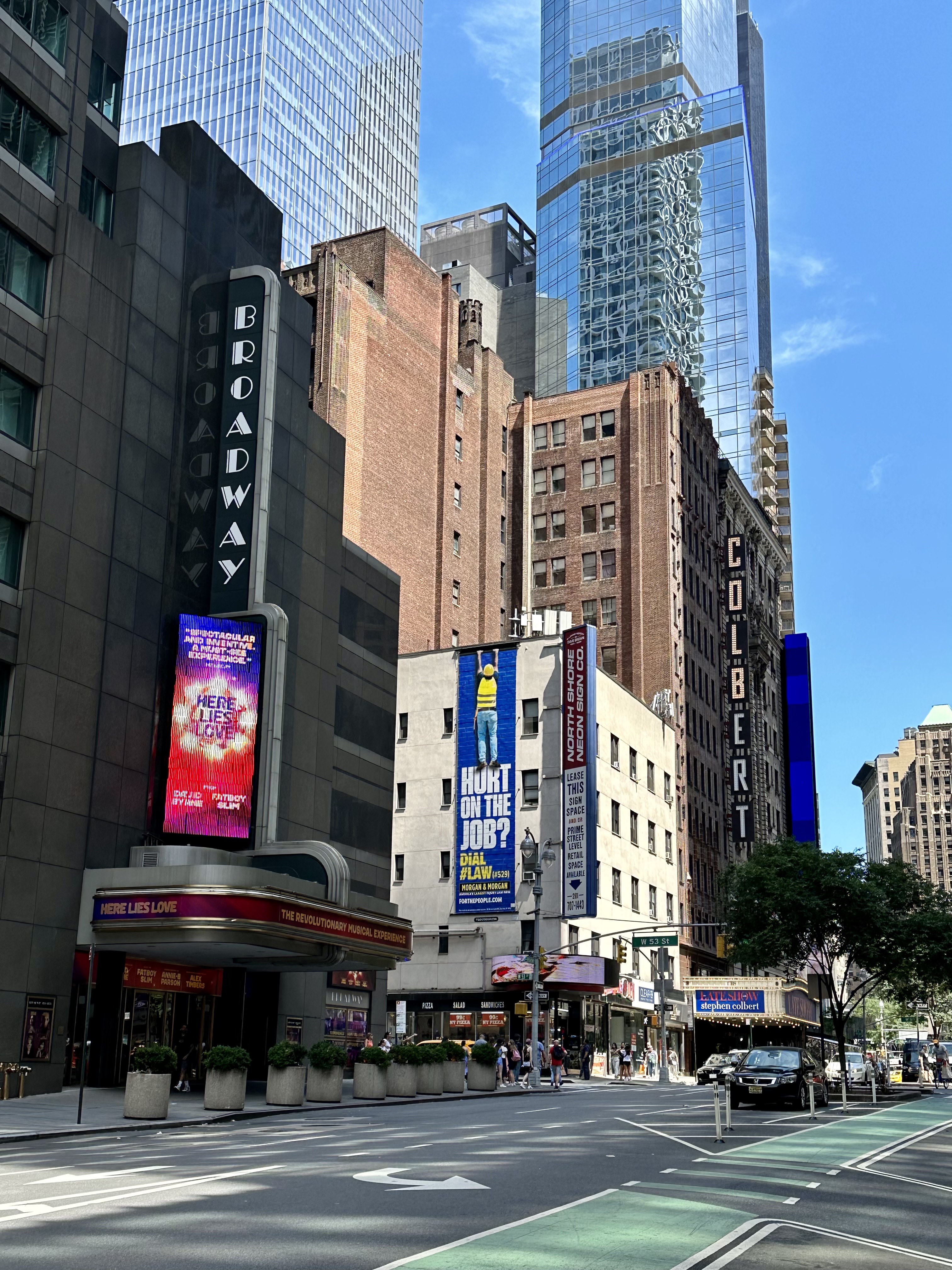
Speaking of Broadway theaters, a few blocks north of Times Square you can see the simply named Broadway Theater, currently the home of Here Lies Love, and the Ed Sullivan Theater, currently home to the Colbert Show. Did you know that most Broadway theaters are not actually on Broadway? There are 41 Broadway theaters (theaters with 500 or more seats, generally between 41st and 54th Streets, with the exception of the Vivian Beaumont a bit north in Lincoln Center at W 65th) but only the Broadway, Winter Garden, and Palace (currently undergoing a multi-year renovation) have addresses on Broadway itself.
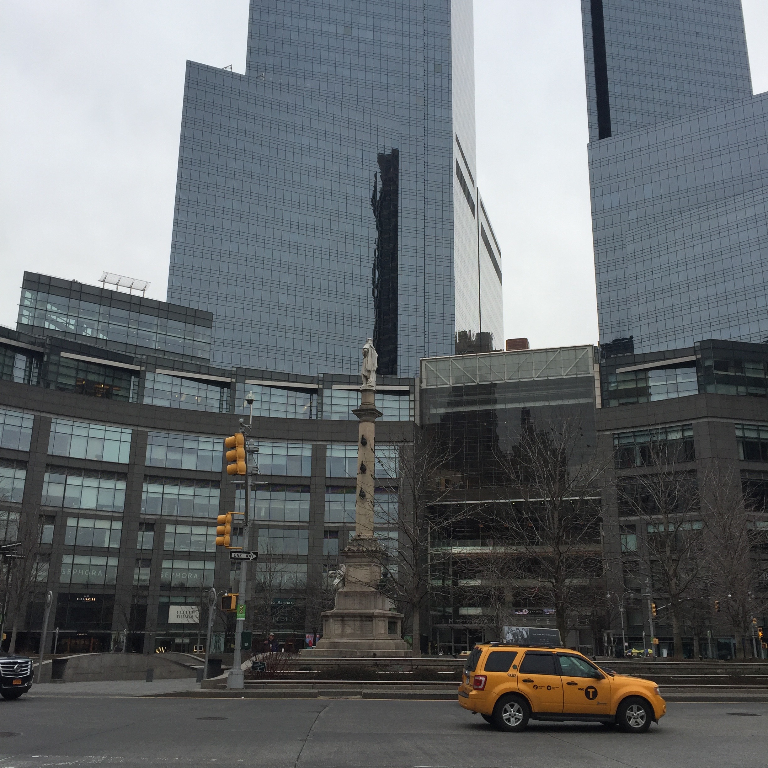
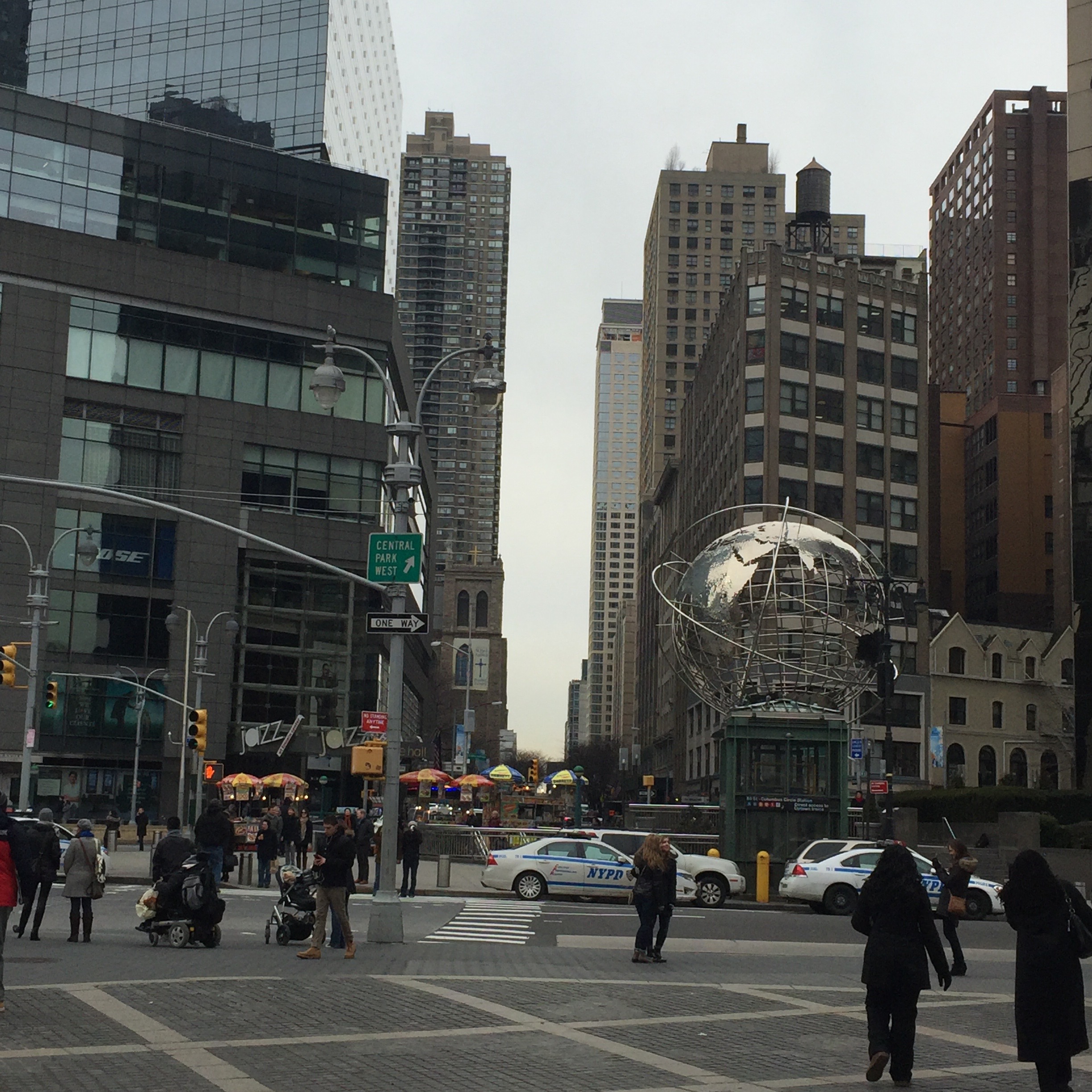
When Broadway crosses Eighth at 59th Street, you are at Columbus Circle, looking to your right at the Southwest corner of Central Park. Broadway will continue to move west on the diagonal, intersecting W 66 (at Lincoln Center), and heading through the relative quiet and residential nature of the Upper West Side.
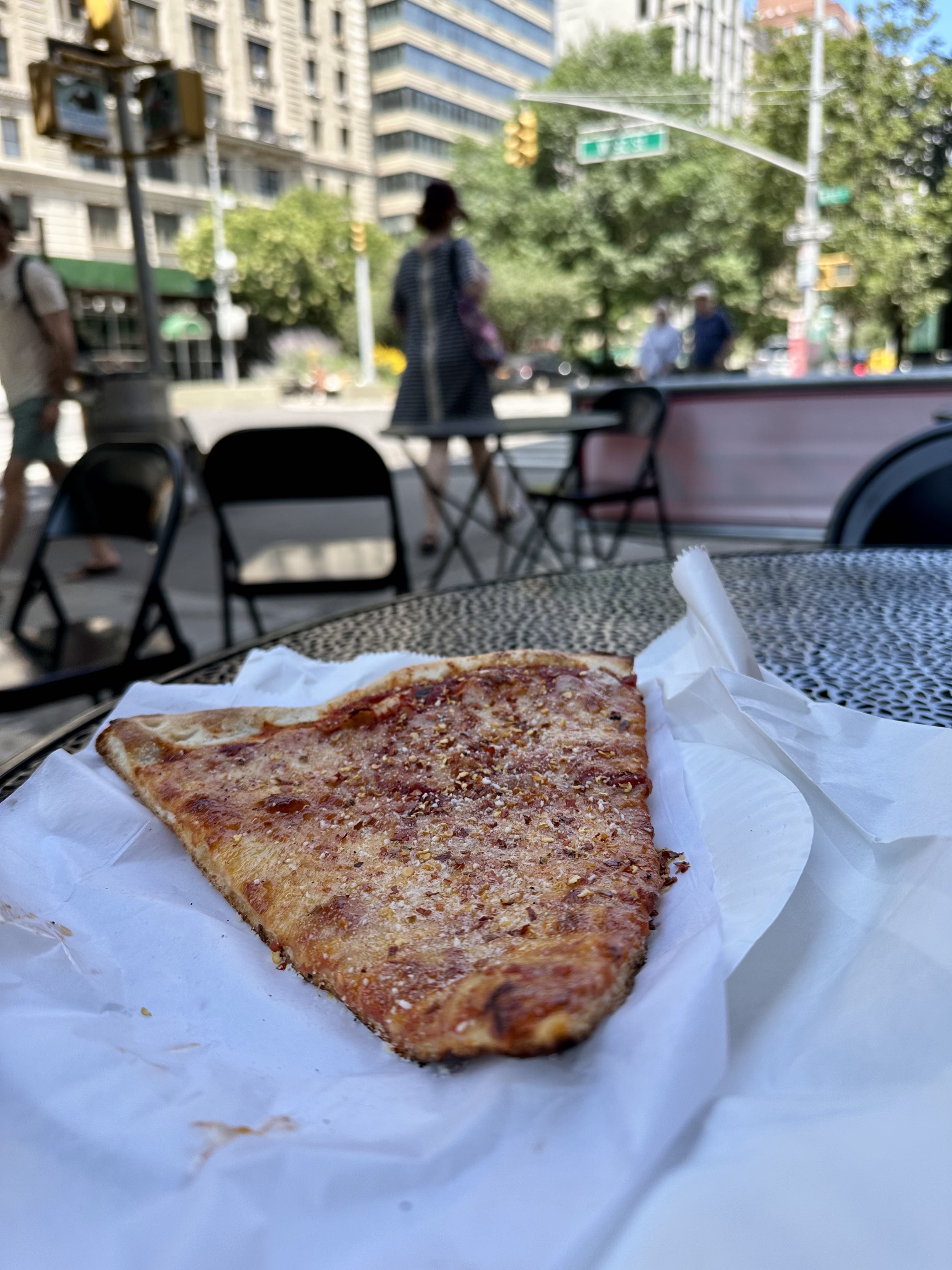
At some point in the W 90s, I stopped in at a random pizza place for a classic NY slice. Around this point I was beginning to tire a bit, but the pizza helped. Later on I stopped at a Mister Softee truck, but as you will see from the rest of this blog post, as I became more tired I took fewer photos.
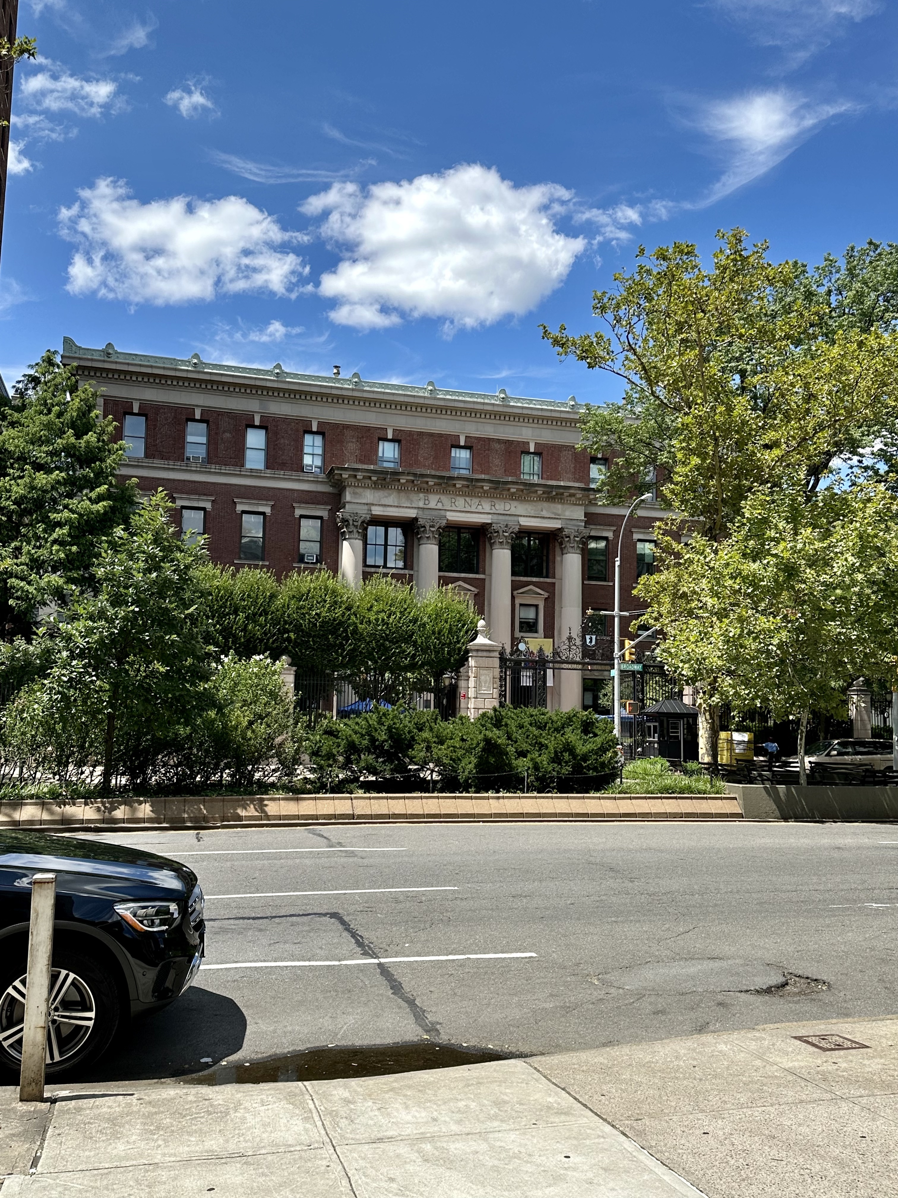
Continuing north along Broadway into Morningside Heights, I passed Columbia University on my right and Barnard College on my left. Columbia was established as King’s College in 1754 on the grounds of Trinity Church in lower Manhattan, and moved to the current campus in 1896. Columbia is the 5th oldest institution of higher learning in the United States (after Harvard, William & Mary, Yale, and Princeton).
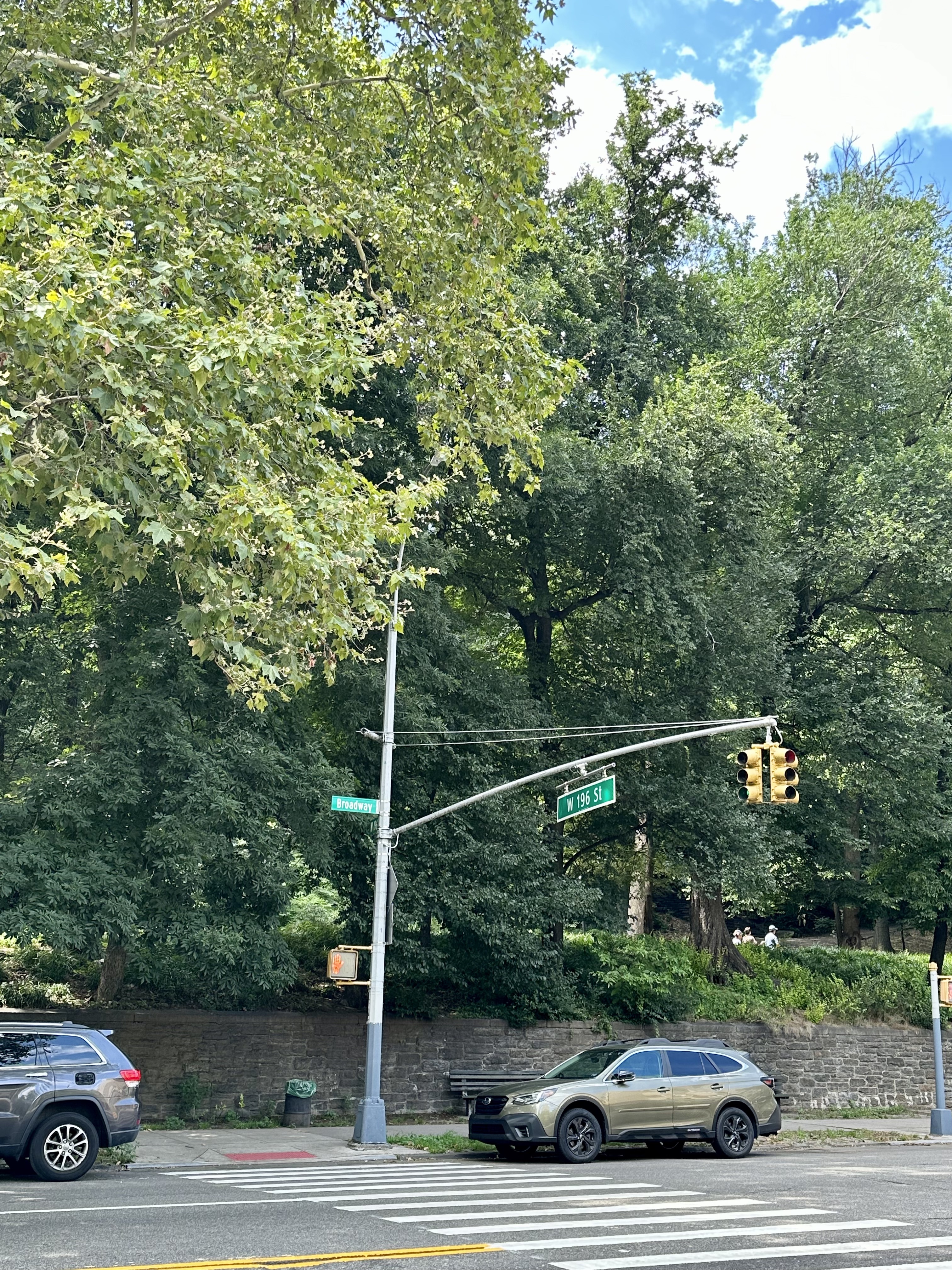
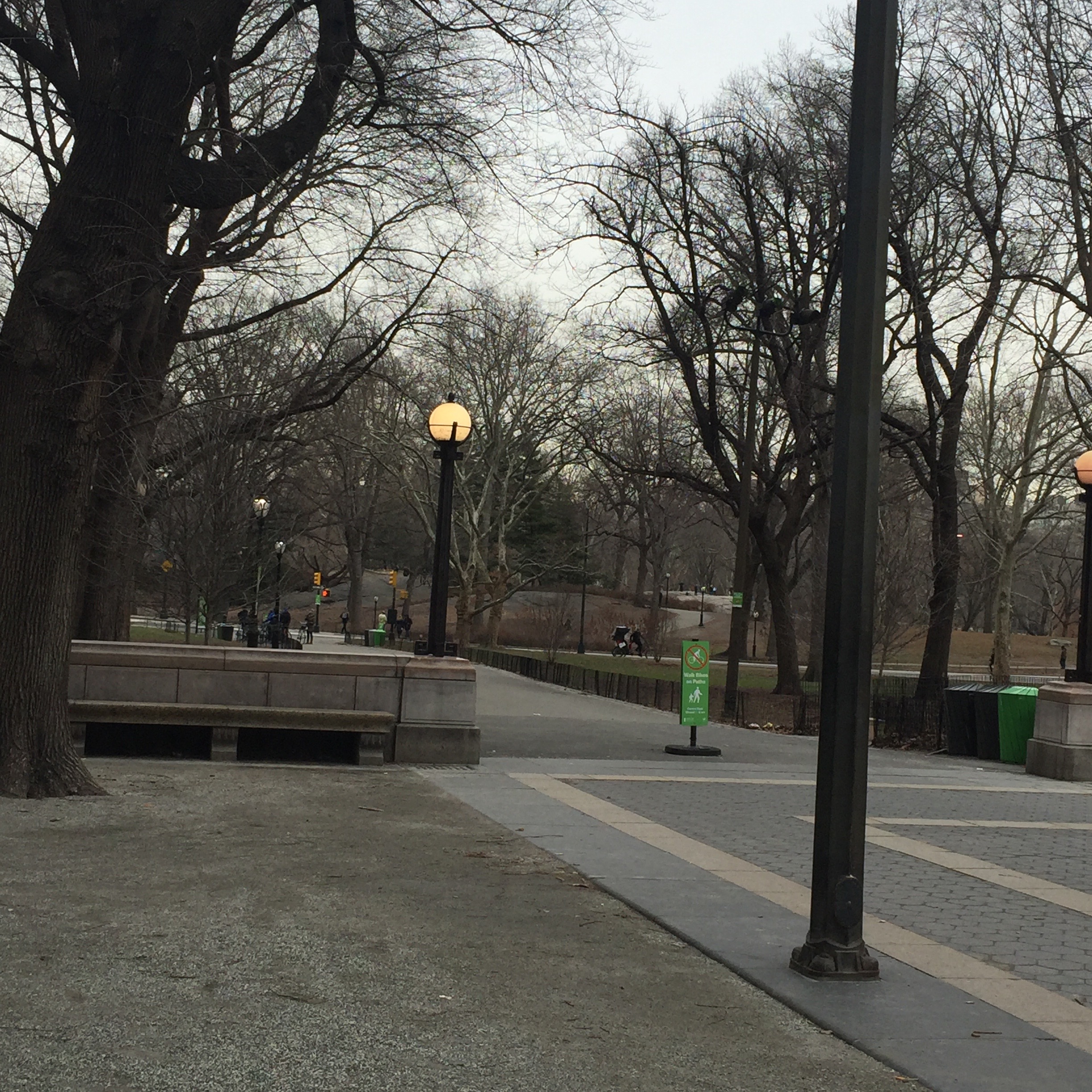
After Morningside Heights, Broadway seemed to get very hilly, and although there are plenty of lovely things to see – Inwood Park deserves its own blog post – I began to get more interested in finishing the trip than in taking pictures.
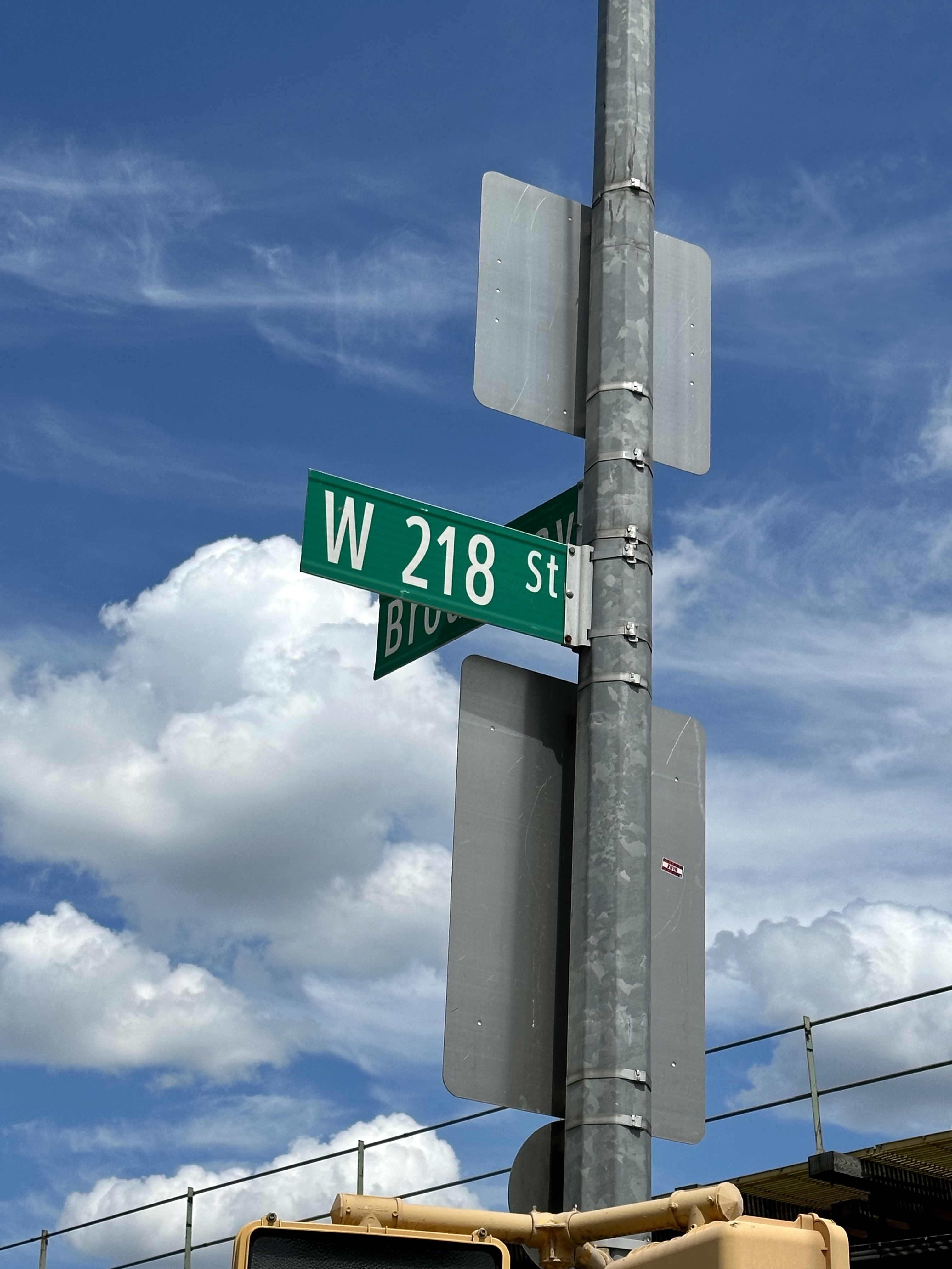
At the very tip of Manhattan Broadway swung east again, preparing to continue into The Bronx after a bridge over the Harlem River. After trudging to 218th Street, not wanting to go across the bridge, I considered myself to have done the walk, and backtracked to the 215th Street MTA station to catch the 1 train. I felt strong the next day, with no sore muscles, so felt good about the trek in terms of trying out my Kili gear on a long hike. The entire trip, including stops here and there for food, or bathroom breaks, took just under 6 hours. I feel the day would be more fun if you did it with someone over the course of an entire day, took more breaks, didn’t mind veering off Broadway now and then, and considered stopping at 125th Street (or starting there if you want to do the trip heading south instead of north). The most interesting thing to me was how different Broadway is in all its varying incarnations and neighborhoods. Walking it was like a microcosm of Manhattan itself; constantly different, never boring, not a city but more like a series of cities. The length and many-sidedness of Broadway illustrates the thing I love most about New York City – its constant variety and reinvention. Samuel Johnson once famously remarked that if you are bored with London you are bored with life – and to me that is true (I would say, even more true!) of my beloved New York City.
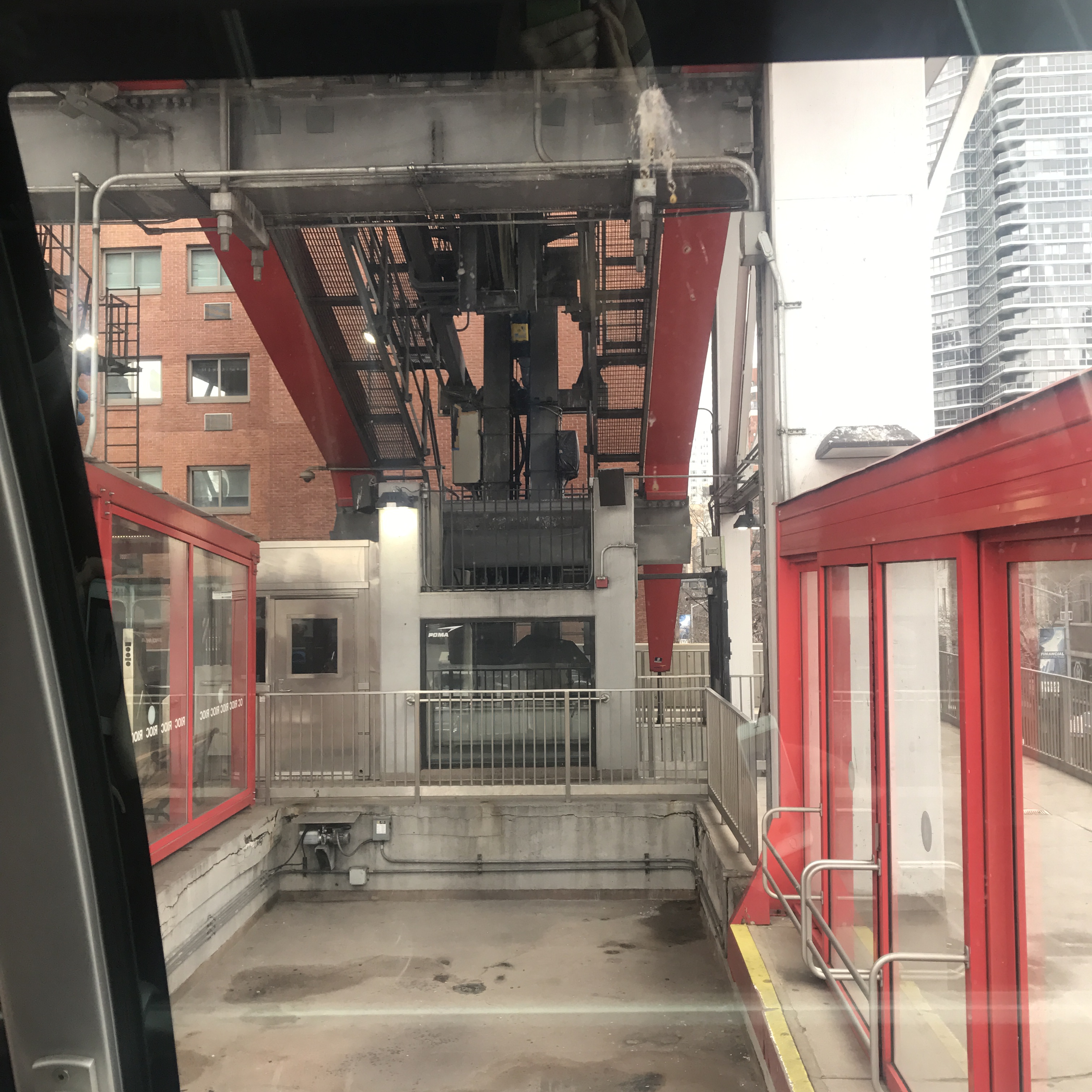
Once home to an insane asylum, prisons, and a smallpox hospital, Roosevelt Island was originally called Hog Island and later Welfare Island before being renamed for President Franklin Delano Roosevelt in 1971 (a decision that certainly helped make it seem a more palatable choice to those considering living there!). Only 2 miles long and 800 feet or less wide, this island, lying between Manhattan’s Midtown and Upper East Side and Queens, is owned by the city of New York but now has numerous rental buildings, one coop, and one condo (all landlease buildings, leasing the space from the city on a 99 year lease negotiated in 1969). Accessible via subway (the F line) but more famously by the Roosevelt Island tram, it is simultaneously very close to Manhattan and also a little isolated and remote. As I enjoy exploring a neighborhood by taking an unplanned walk (a dérive), I headed to Roosevelt Island this spring to see what living here might be like.
The Roosevelt Island Tramway was intended to be a temporary way to entice residents to the neighborhood during its residential development. Opened in 1976, it makes over 100 trips per day, between the hours of 6 AM and 2 AM (every 15 minutes most of the day, but continuously during rush hours). Although not operated by the MTA, it uses the MetroCard and offers free transfers to the MTA system.
When on the tram, you can’t help to imagine what it would like if the tram were to stop mid-journey (or something worse, thanks to the 2002 Spider Man film!). There has never been a Green Goblin attack, or anything similar, but the tram has been stuck before. The worst instance of this was in 2006 when two trams were stopped midair for seven hours due to an electrical outage. Rescue baskets were sent to the trams, but each could hold only 15 people, so the evacuation of the trams took a very long time. Following an extensive 2010 overhaul, there have been no similar incidents on the trams.
The large (unphotogenic) construction site just south of the tram is the new Cornell University Tech Campus, due to open in 2017.
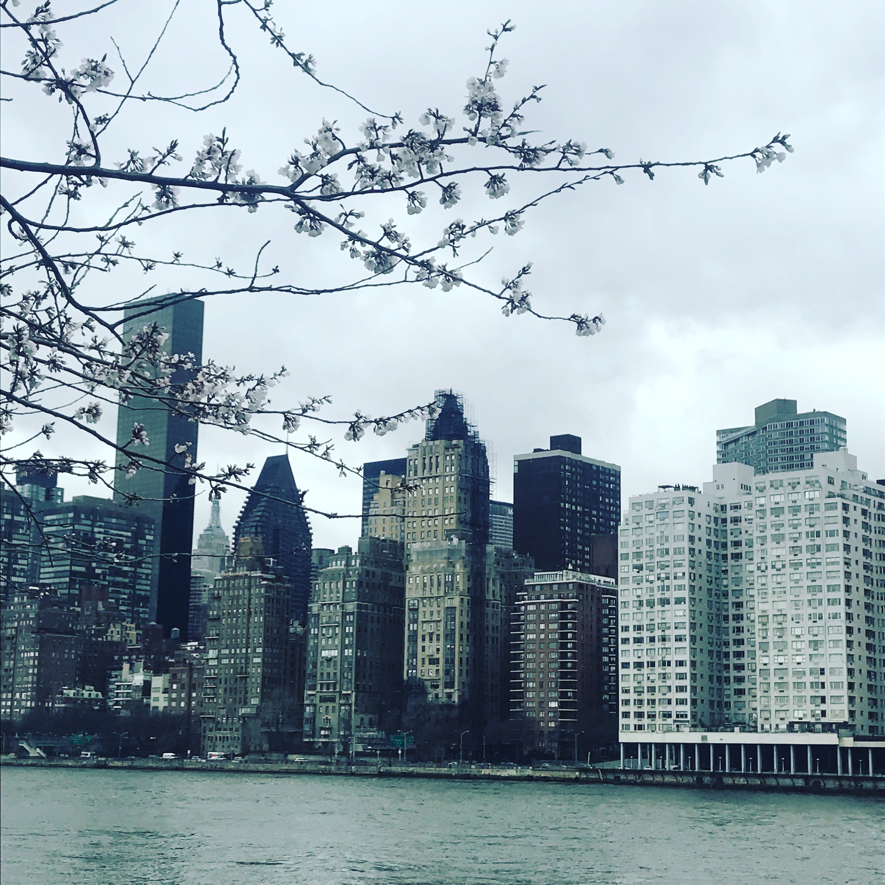
Walking along the river, cherry trees blossom and frame a view west to Sutton Place in midtown Manhattan.
It is impossible to miss the creepy ruins of the old Smallpox Hospital on the way to the Four Freedoms Park on the southern tip of Roosevelt Island. Opened in 1854, and closed a century later, the Gothic Revival building fell into disrepair. Now added to the National Register of Historic Places, a stabilization project is underway and it will one day be open to the public (hopefully only in daylight hours).
Opened in 2012, the Franklin Delano Roosevelt Four Freedoms Park celebrates the former president as well as his famous 1941 speech about freedom of speech, freedom of religion, freedom from want, and freedom from fear. Designed by the renowned architect Louis Kahn, it is a beautiful and spare park with spectacular views of Manhattan, including a direct view of the United Nations.
Heading back north and past the tram station, Roosevelt’s Island Main Street unfolds.
Built in 1798, Blackwell House is the sixth oldest surviving home in New York City.
1888 Chapel of the Good Shepherd, on the National Register of Historic Places.
There is a free red bus around the island, and it was easy to return via the F subway, one stop to Lexington and 63rd.
As of the 2010 U.S. Census, Roosevelt Island had a population of 11,661. Roosevelt Island has relatively affordable rents and prices compared to midtown Manhattan, and the buildings are largely full-service buildings with amenities such as swimming pools and gyms. Many apartments feature the kind of spectacular view of Manhattan found in red-hot Long Island City, Queens. I found the small town atmosphere of Roosevelt Island to be very unique. Along Main Street was everything a person would need – an apartment, groceries, a library, public school, and so on. Just a few hundred feet from midtown Manhattan, it felt like being in a small town anywhere in the United States. Less distant in terms of a commute from central Manhattan than many parts of the five boroughs, it still feels a world away – the skyscrapers of Manhattan a bit like a mirage just across the East River.
Most of us lucky enough to live in New York City love the aspects of the city that make it unique – the tall buildings, the pace, the endless array of entertainment. However, we may also seek out a chance of pace every now and then, travelling to the Caribbean, the Berkshires, or the New England coast. What I recently discovered is that it is possible to take a mini-vacation to what seems to be a small New England fishing village – but without leaving the five boroughs. As I remarked in my posts about Coney Island and Governors Island you can feel as though you have left the city for the price of a swipe on your Metrocard – and that is true for a trip to City Island in the Bronx.
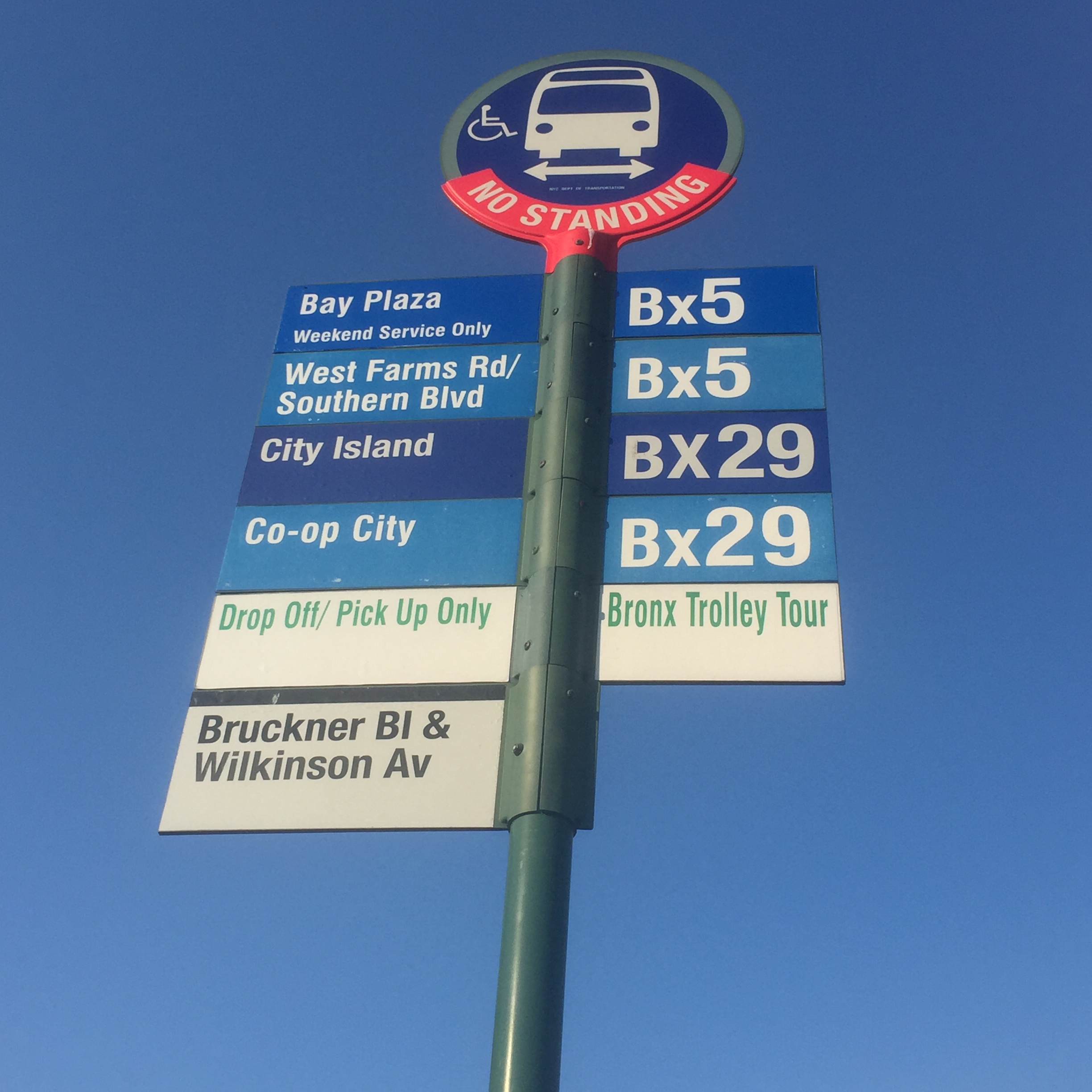
Driving to City Island is easy, but to get there via public transportation (as I did), take the 6 Pelham Bay subway train to the last stop, Pelham Bay Parkway and catch the Bx29 bus for a quick ride to City Island Avenue.
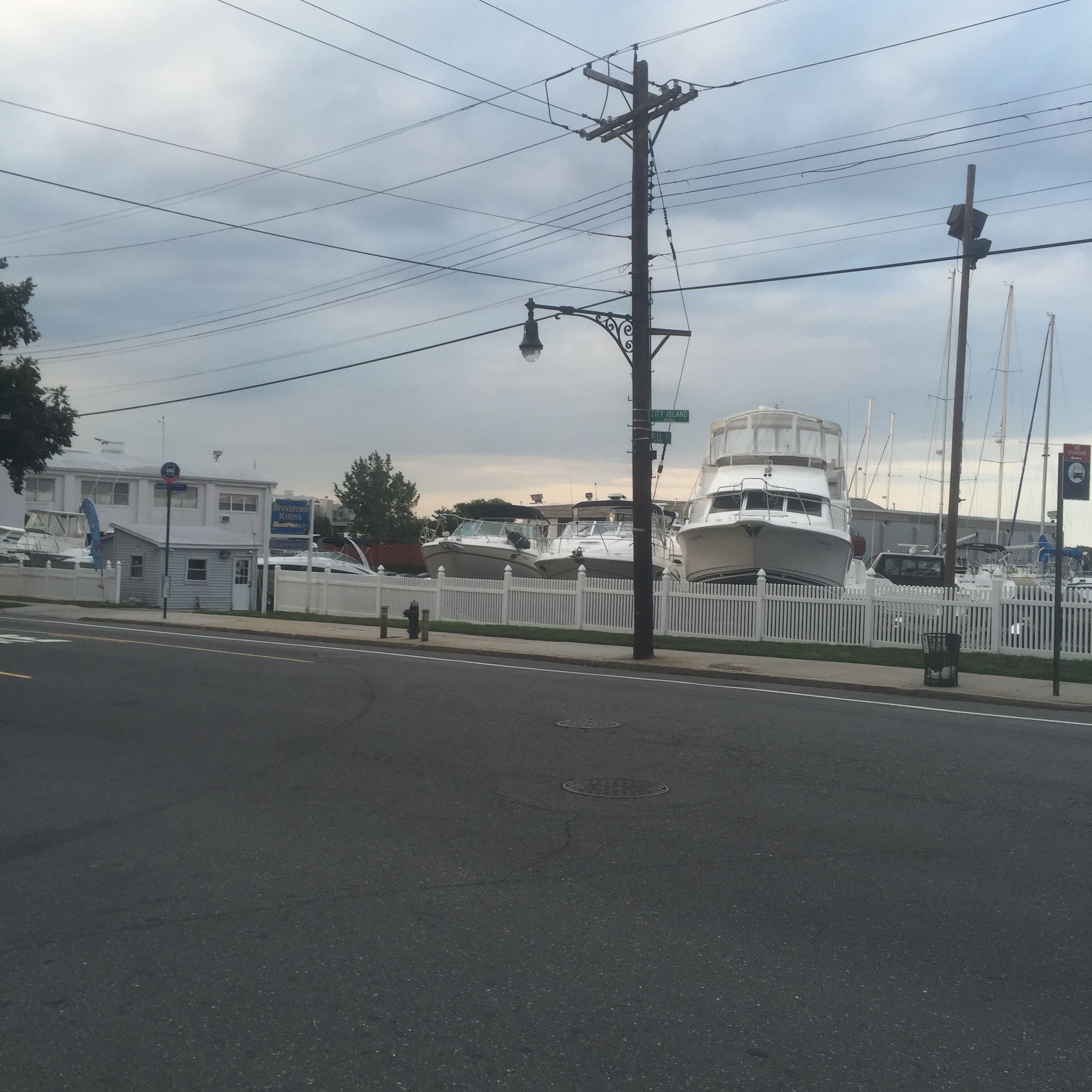
Originally settled by the Lenape and later by Europeans in 1654, it was connected to the mainland by ferry until the building of a bridge in 1873. From about 1860 to 1980, City Island was a center for boat building and yachting, and three yacht clubs remain on the island to this day.
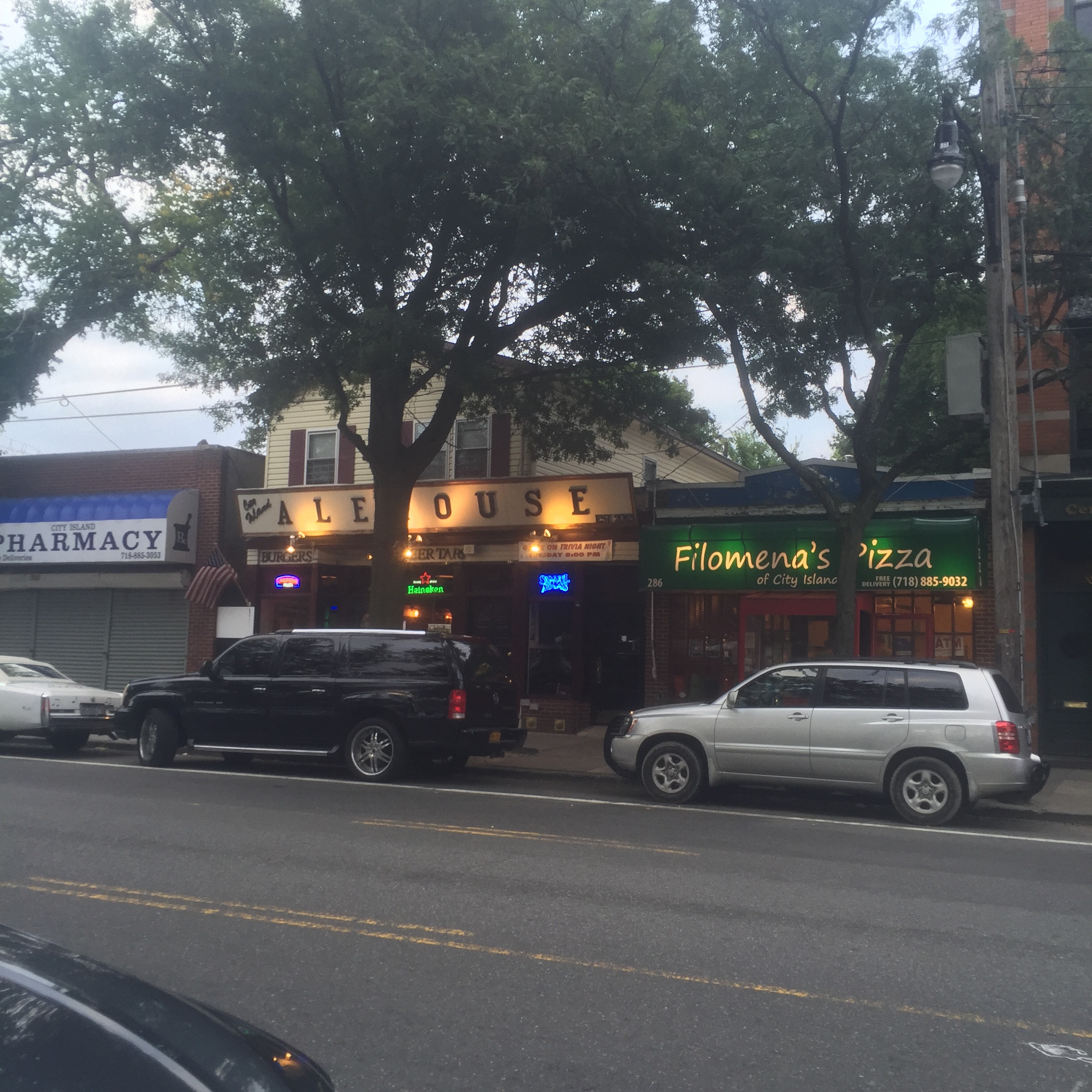
City Island Avenue cuts down the middle of the island, lined with quaint shops, art galleries, and restaurants. At every cross street, you can look in either direction and generally see a block of houses or low-rise apartments leading to the water.
On the first Friday of every month, there is a free trolley to pick up visitors from the subway stop and take them to City Island Avenue. They give out a discount card valid for that evening, and often shops and galleries will have free treats to hand out along the avenue.
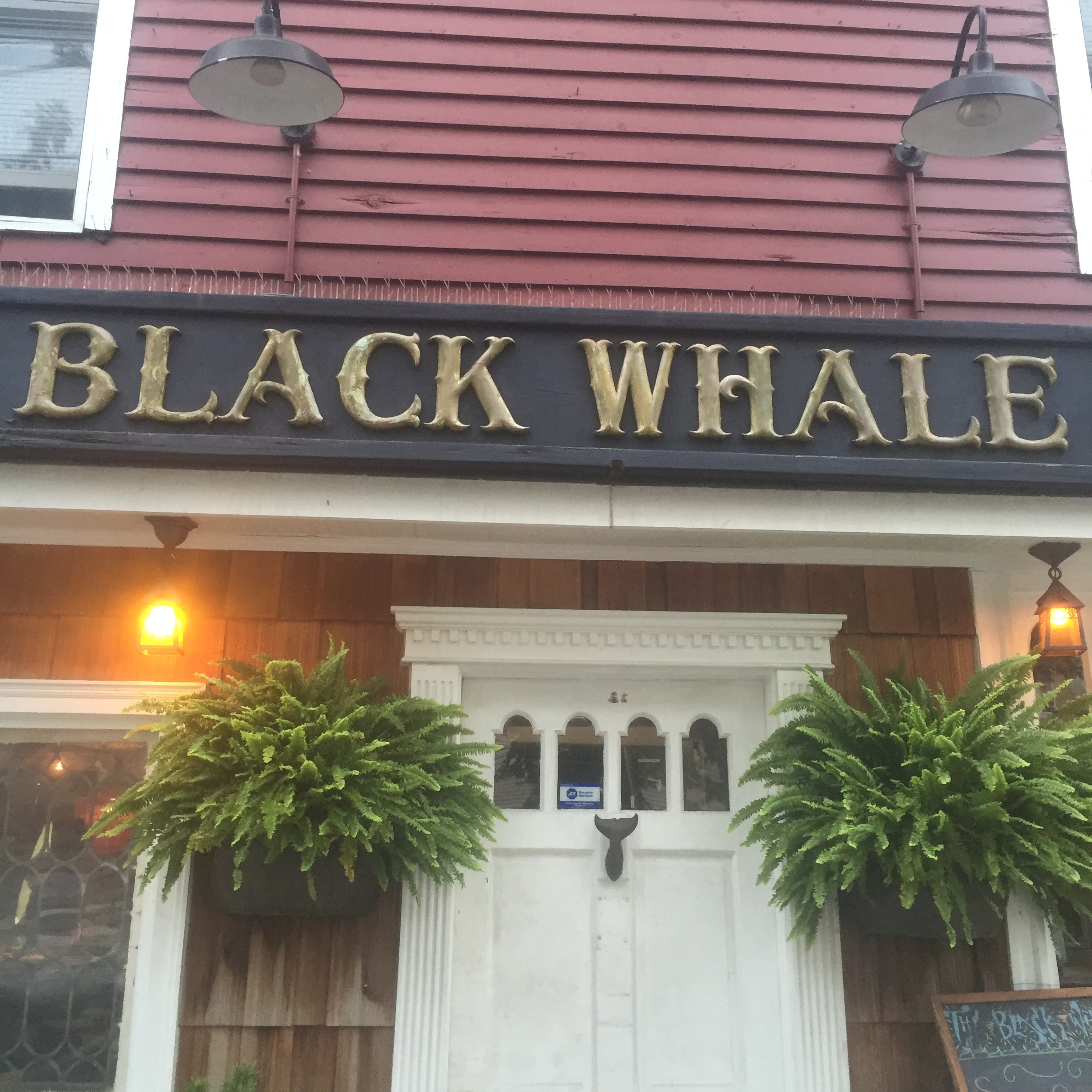
City Island Avenue is just over a mile long, so an easy and pleasant walk. At the very end, when it dead ends at the water, there are two competing seafood restaurants with ocean views.
City Island has a resident population of just over 4000 people, many associated with nearby Albert Einstein College of Medicine. The brilliant neurologist and author Oliver Sacks lived on City Island until his recent death, and some of the film based on his book Awakenings was shot on the island. City Island is a real estate bargain (due in no small part to its remoteness) – houses selling for under $300/sq ft, on average, and a three bedroom house can be rented for about $3000/month.
Alice Payne wrote about the history of City Island in her book Tales of the Clamdiggers. Clamdiggers are people born on City Island (Musselsuckers are those living on the island born elsewhere!). The rest of us are, I suppose, simply visitors, ready to take a break from the everyday and experience one of the most unique corners of the great city of New York.
I wrote recently about Coney Island, and how easy it is to feel you are taking a mini-break from New York City without leaving the city itself. I recently spent a day on Governors Island, in some ways more disorienting (in a good way!) since you are simultaneously surrounded by nature and yet experiencing spectacular views of lower Manhattan, the Brooklyn Bridge, and the Statue of Liberty.
Governors Island sits a mere 800 yards away from Manhattan and is even closer to Brooklyn (400 yards). Originally reserved for the Governors of the New York Colony during British rule, the American Continental Army used it to their advantage and fired on the British from the island during the Revolutionary War. After American Independence, forts were built on the island for coastal protection, and Castle Williams (which is still standing) was later used to hold Confederate prisoners of war during the Civil War. When material dug out from Manhattan to create the first subway line was used to enlarge Governors Island, it became first an Army base and later one for the Coast Guard. By 1996, however, the Coast Guard had ceased to use the island, and it began to be redeveloped as a public park. Fort Jay and Castle Williams, as well as 22 acres of the island, have been declared a National Monument – the remaining 100 acres belong to the city and are in the middle of a ten year plan to revitalize Governors Island for use by the residents of New York.
Getting to Governors Island is somehow both easy and difficult. The ferry leaves from lower Manhattan (just north of the Staten Island Ferry terminal) on the hour starting at 10 AM, and leaves the island to return to Manhattan on the half hour. The cost is $2 roundtrip, but is free if you are a resident and have an idNYC card (if you are a resident and don’t have one, what are you waiting for? there are so many great discounts and benefits, check out the card here). The actual ferry ride is only seven minutes long, but if you miss one (as I did, slower than expected subway traffic on the 4 getting me there just a few minutes after the 10 AM ferry left) it’s a long wait.
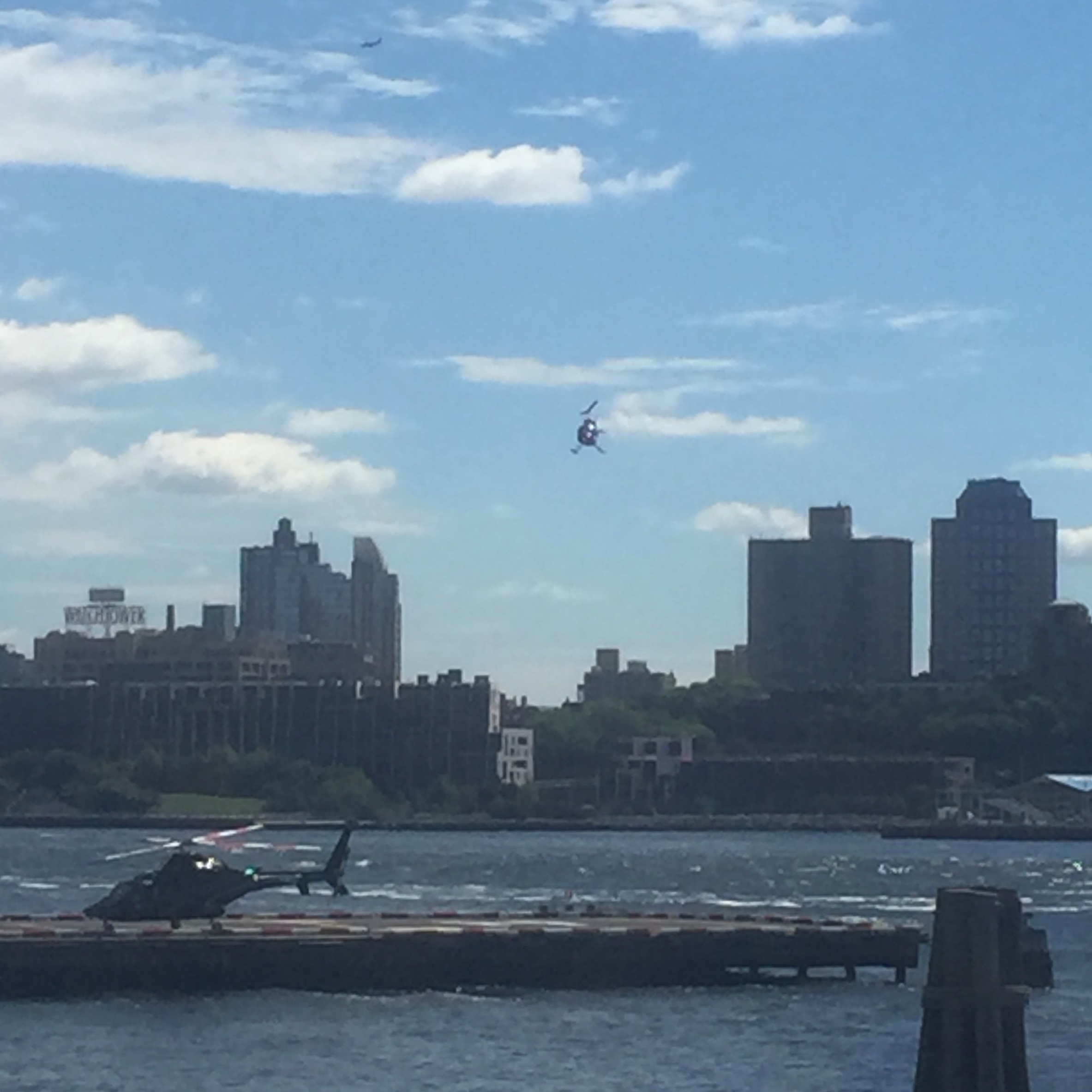
One entertaining thing to do in the area if you miss a ferry is to watch helicopters take off and land just north of the Battery Maritime Building.
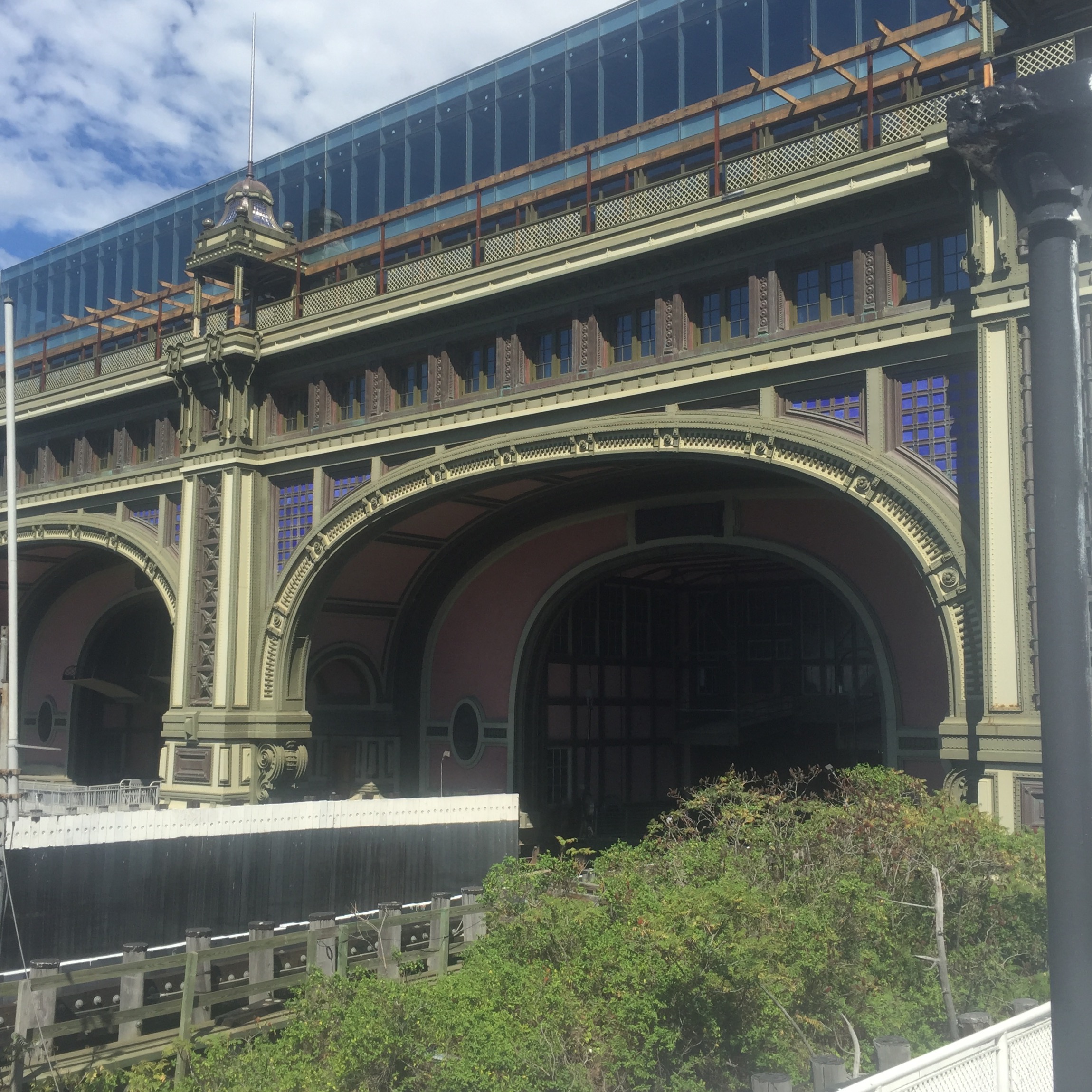
Once the ferry is ready to load, it only takes a few minutes before you are looking back at the Battery Maritime building as the ferry leaves lower Manhattan.
Within a few minutes you arrive on Governors Island at Soissons Landing.
The constant odd juxtaposition of quaint old buildings, green lawn, and spectacular views of the skyscrapers of lower Manhattan is disorienting, but in an exciting way.
One view of Castle Williams.
If you pass the old historic buildings and follow the signs for the newest part of Governors Island Park, The Hills, you can find the longest slide in NYC, three stories tall and 57 feet long. My advice on a sunny day is to be sure you are wearing long pants – that metal slide gets HOT!
The Hills was constructed using so much landfill it would require 1806 subway cars to transport it. Much of it came from the demolition of some buildings and parking lots elsewhere on Governors Island. Some of the actual hills were created using pumice, because any heavier material would push the existing landfill into the harbor.
A plaque marking the National Park Service site, Castle Williams, with fantastic views of lower Manhattan, which is just a few hundred yards away.
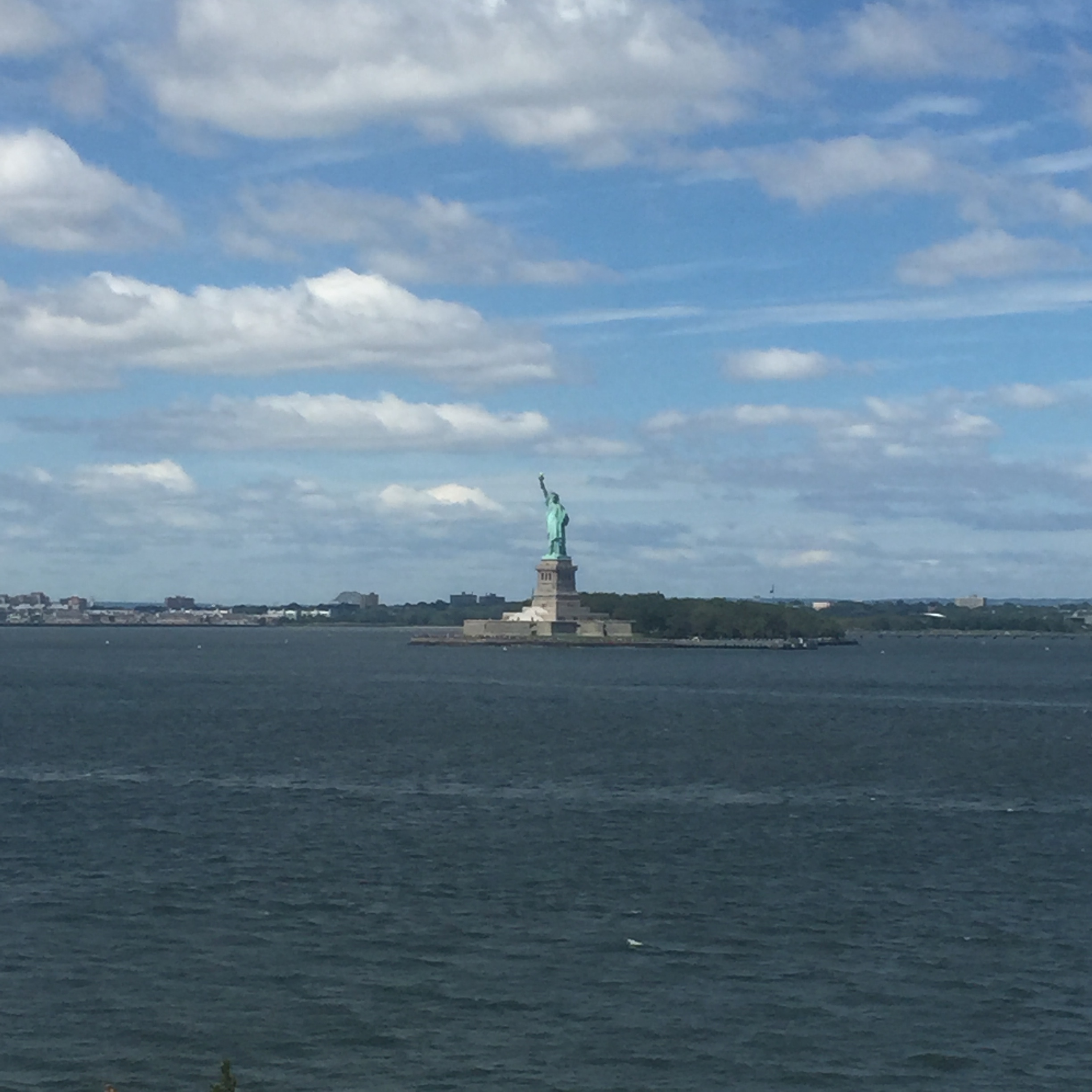
Wonderful views of the Statue of Liberty can also be seen from the western edge of Governors Island.
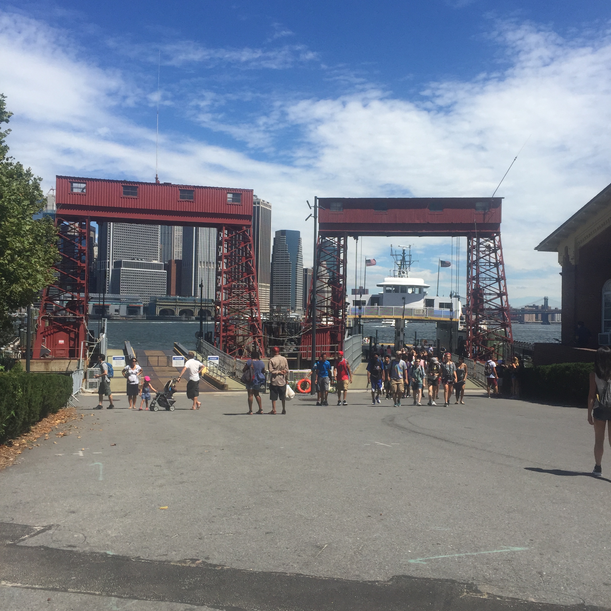
Ferries return on the half hour, with the last ferry back at 6 during the week and 7 on the weekend.
Returning back to Manhattan, you can feel as though you have taken a trip to another country, one where you gazed at the city as though it was a movie backdrop or a mirage. I highly recommend taking the journey. I found I appreciate the city so much more when I have seen it through a different angle – even one that technically lies within the city limits. Governors Island is open daily during the summer season, which lasts roughly the end of May through the end of September. For more information check out their website here.
Recently I was fortunate enough to spend a few days each in Paris and London before returning to my beloved New York City (see above, the magnificent Manhattan grid, personified here on majestic Park Avenue). I was able to take several dérives (unplanned walks in an urban environment) as well as talk with New Yorkers currently living in each city. This experience led me to think about the similarities and differences of each of these great cities, and how living in each is unique. In addition, because I am a real estate agent in New York City, I will share what I learned from meeting with colleagues in the other two cities and compare all three markets.
My first stop was Paris. It’s hard to find someone not charmed by this extremely elegant city. Oscar Wilde once quipped, “When good Americans die, they go to Paris.” Thomas Jefferson, after his years as Ambassador to France, noted that “a walk about Paris will provide lessons in history, beauty, and the point of Life.” I don’t know if I would agree to that extent (perhaps I missed my lesson on the point of life?) but I do agree with the filmmaker Wes Anderson, who said “Paris is a place where, for me, just walking down a street that I’ve never been down before is like going to a movie or something. Just wandering the city is entertainment.” I noted in a previous blog post about Dumbo in Brooklyn that I felt you couldn’t take a bad photo in Paris (and felt the same about Dumbo), because every new vista seemed to provide a perfectly framed gorgeous scene.
Central Paris looks the way it does mainly due to the vast restructuring under the time of President Louis-Napoléon Bonaparte, the nephew of the more famous Napoléon, and the urban planner Georges Eugène Haussmann. Medieval Paris through the nineteenth century was filthy and unsanitary, with reeking sewers (Victor Hugo described it well in Les Misérables) and gorgeous buildings like the Louvre hidden behind crumbling tenements. Haussmann appropriated land and destroyed what he needed to in order to create a gigantic cross through the heart of the city made up from east to west along the Rue de Rivoli and Rue Saint-Antoine, and north-south along two new Boulevards, Strasbourg and Sébastopol. In later renovations, more boulevards were created, generally on the diagonal rather than a grid.
The unusual aspect of all of this is that so much work was done within a relatively short period of time in the mid-nineteenth century. This is the more significant factor to the consistency of the look of Paris compared to most other cities.
I asked a native New Yorker who now lives in Paris about how the layout of the two cities affects living there. She pointed out that, with most of Manhattan a grid, people refer to an address as an intersection of an Avenue and a Street. For example, if you were meeting someone at Carl Schurz Park in Yorkville you might agree to meet on the corner of East End Avenue and 84th Street. In Paris, a meeting place is more likely to be described as what arrondissement it is in, what metro stop it is near, and then the actual address.
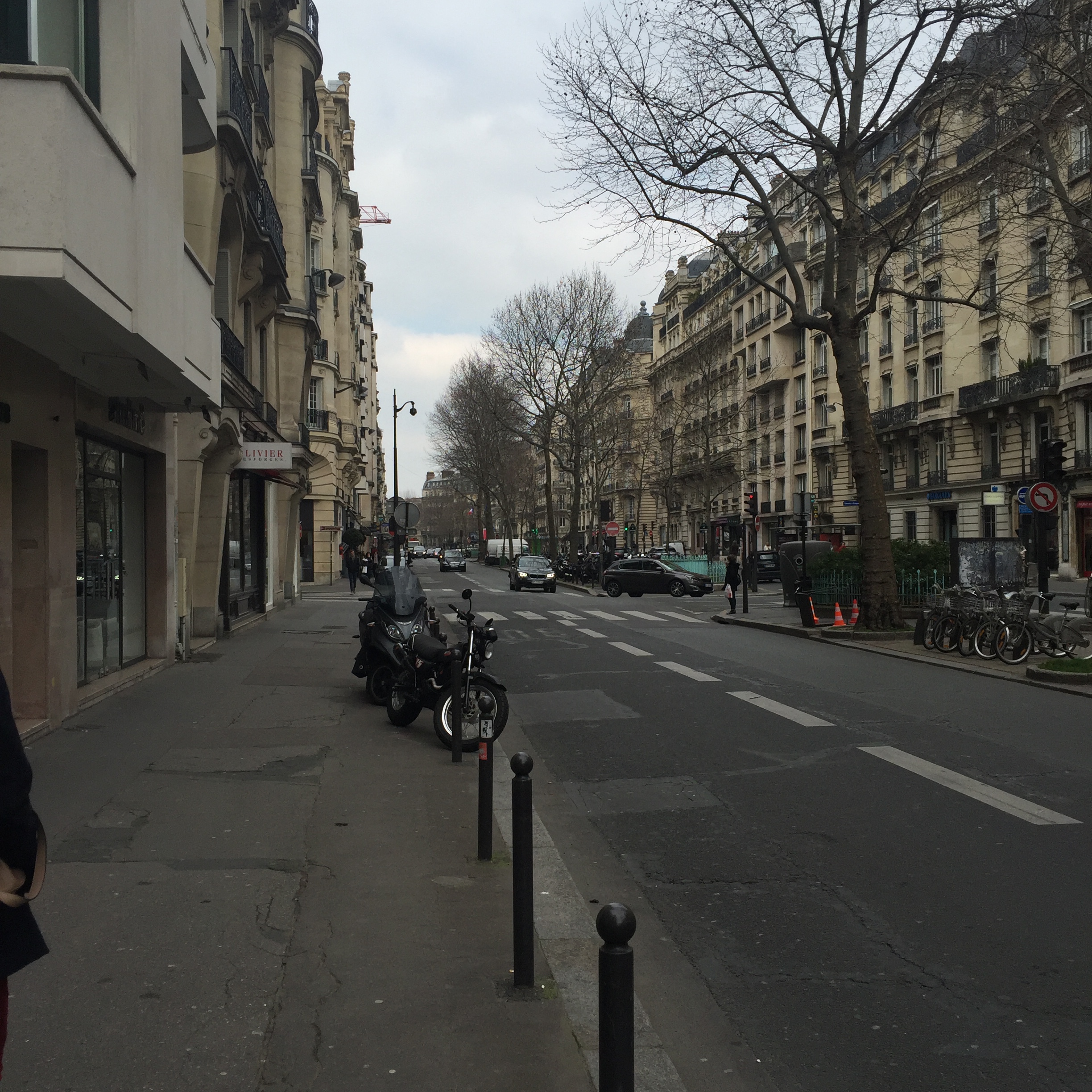
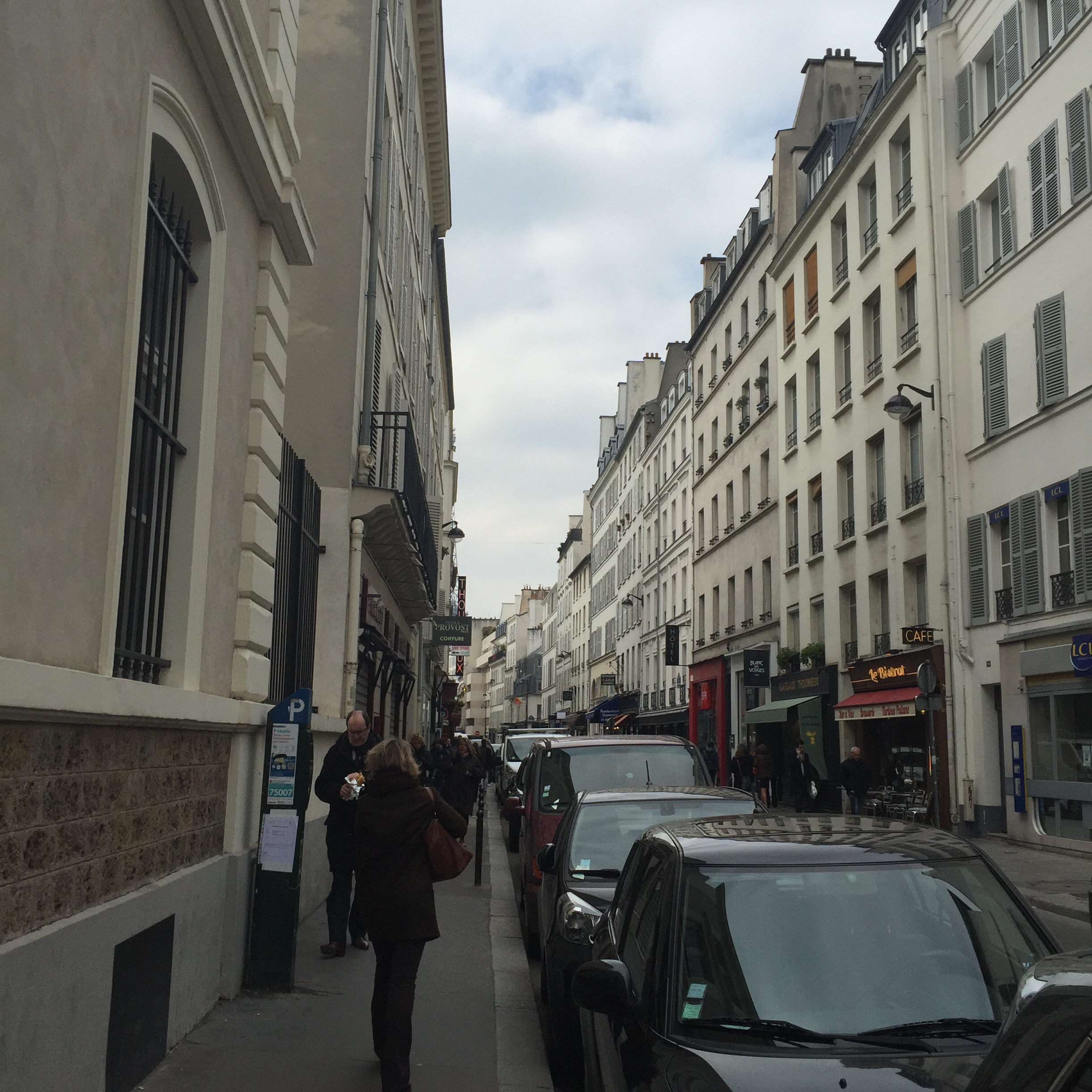
The experience of walking in Paris is very different on the wide boulevards versus the much narrower streets. In addition, the boulevards keep cutting through on the diagonal, creating triangles. New York City has Broadway running on a huge diagonal along the entire length of Manhattan from northwest to southeast, creating such iconic “squares” as Times Square and Herald Square. However, most of Manhattan above 14th Street unfolds as a predictable series of streets intersecting at right angles with avenues.
After a very enjoyable and easy trip on the Eurostar train, my next stop was London.
When looking up quotes to enliven this blog post, I was surprised to find so few really positive quotes about London compared to Paris. For instance, William Butler Yeats commented, “This melancholy London – I sometimes imagine that the souls of the lost are compelled to walk through its streets perpetually. One feels them passing like a whiff of air.” Hmmm. Worse, from G.K. Chesterton: “London is a riddle. Paris is an explanation.” And confusingly, from author Peter Shaffer: “If London is a watercolor, New York is an oil painting.” While I enjoy Paris and of course find it to be beautiful, I love London – second in my heart only to New York City. If only I could write a pithy quotable quote to express this feeling!
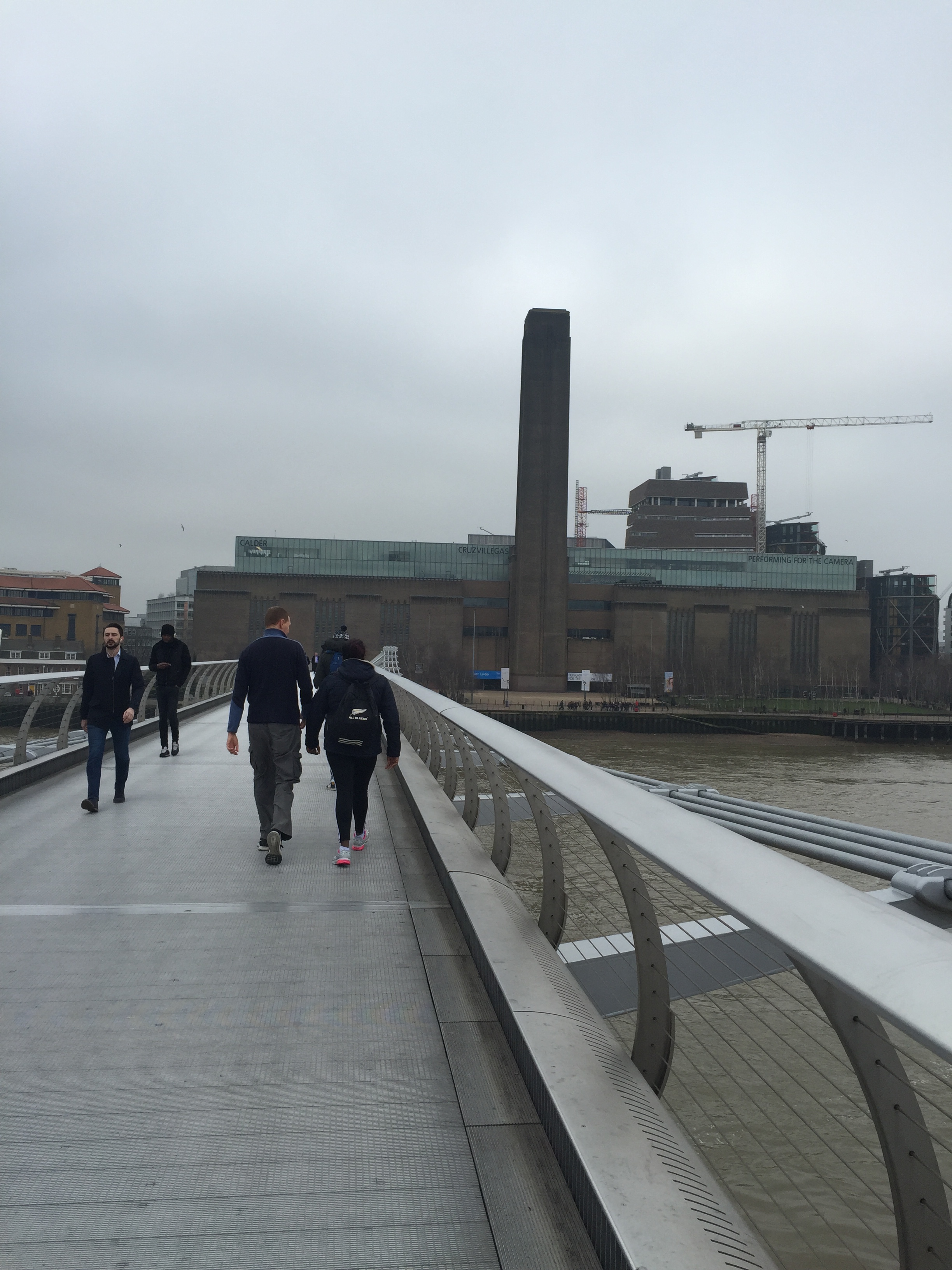
Walking across the Millennium Bridge, itself completed and opened in June 2000, you get part of why I love London – the juxtaposition of new and old, with St. Paul’s (completed in 1711) framed by this very modern structure.
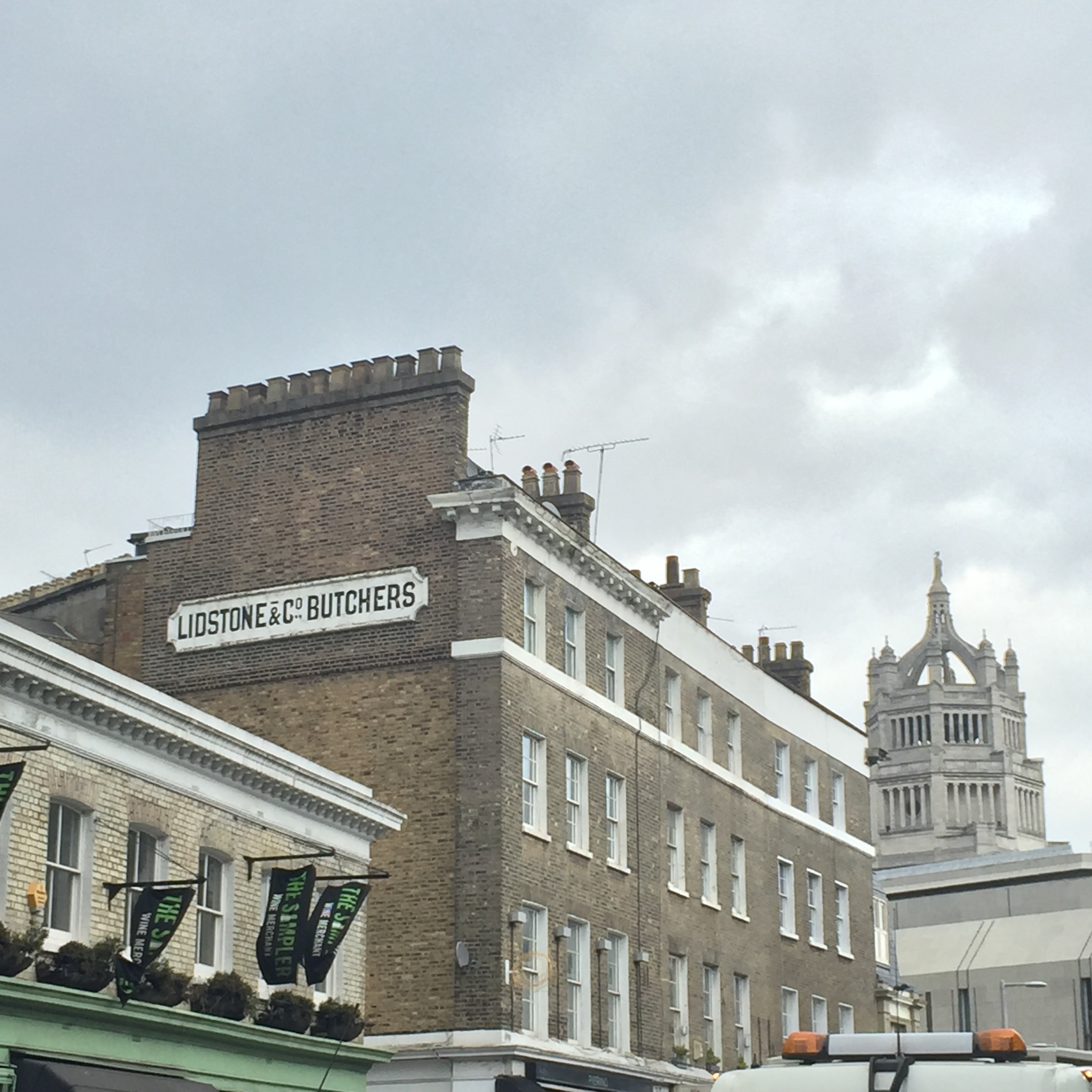
Another example of this is seen here, near Borough Market, with the hyper-modern Shard building visible above these tiny quaint buildings.
And speaking of Borough Market, it’s one of my favorite places in London. The Southwark neighborhood surrounding it is a delightful jumble of streets.
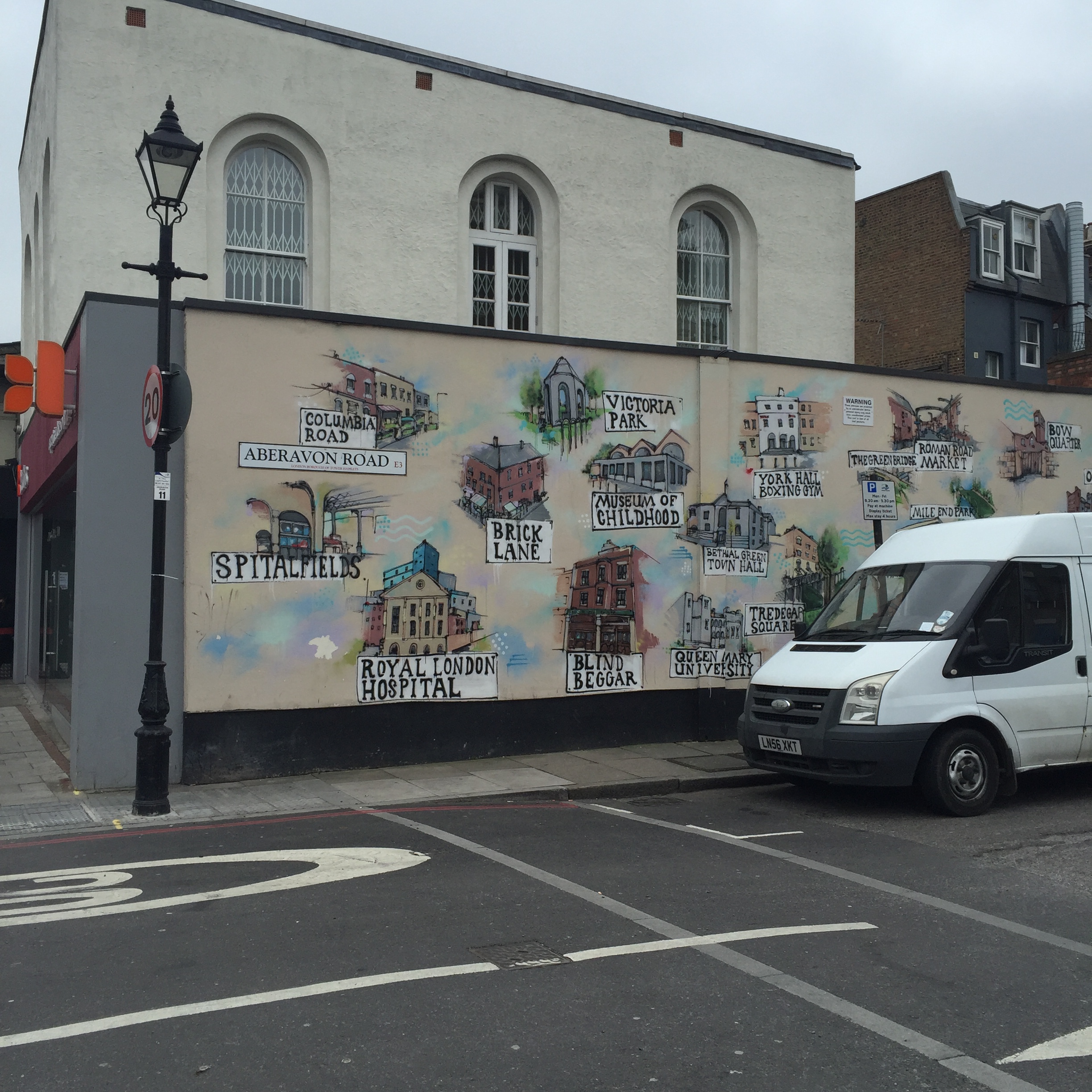
London is not consistent in architectural style as Paris is – not only are neighborhoods (like the newly fashionable East End, depicted in a mural above) different, even within a neighborhood you can find a variety of styles and eras represented. This is in part due to the Great Fire of 1666, meaning that very little of medieval London still exists (the Tower being a notable exception), and in part due to the bombings during World War II and the rebuilding since then.
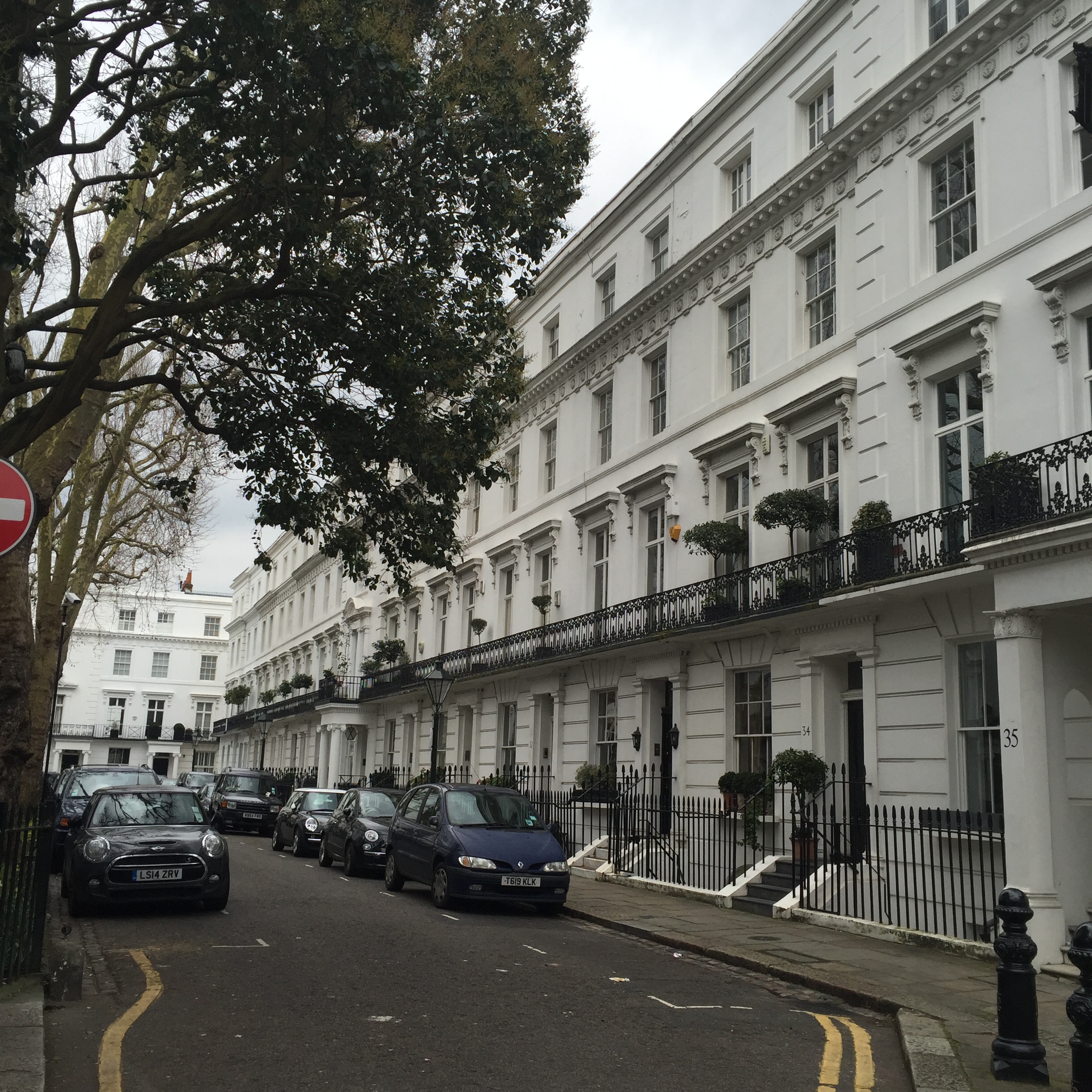
Some neighborhoods, like Chelsea (above) and Mayfair (below) do keep more of a consistent architectural style, however.
Walking in London can be confusing, since it is even less of a grid than Paris and certainly much less so than Manhattan above 14th Street. However, this labyrinth of twisting streets and sudden alleyways is what makes taking an unplanned walk (with few time constraints) so rewarding. James Geary, the American journalist, remarked, “London always reminds me of a brain. It is similarly convoluted and circuitous. A lot of cities, especially American ones like New York and Chicago, are laid out in straight lines. Like the circuits on computer chips, there are a lot of right angles in cities like this. But London is a glorious mess. It evolved from a score or so of distinct villages, that merged and meshed as their boundaries enlarged. As a result, London is a labyrinth, full of turnings and twistings just like a brain.” I don’t know that the brain analogy would have ever come to me (and I have a degree in neuroscience!) but I would agree that the twistings and turnings do make it a “glorious mess.” A native New Yorker now living in London pointed out how much larger in area central London is compared to Manhattan, while central Paris is much more compact. Of course the population of London was 8.539 million in 2014, while New York City (all five boroughs) was an equivalent 8.406 million at roughly the same time (Manhattan only 1.626 million, however). Paris, on the other hand, has a population of 2.244 million, a significantly smaller number.
One last comparison between New York City and London. One of my favorite quotes about NYC is from O. Henry, who said (quite a long time ago, I will add), “It’ll be a great place if they ever finish it.” The constant construction and cranes seen in London (above) remind me very much of New York. I love how NYC is constantly changing, and while obviously historic preservation is important, the tearing down and building up of our city is part of what gives it the feeling of always being new, in the process of reinventing itself.
A significant similarity between Paris and London is that they each have rivers running through the heart of the city, with part of the joy of walking there involving crossing bridges to get from one side to the other. In Manhattan, you are surrounded by water, and there are enjoyable strolls both on the East River and the Hudson. You can also walk over the Brooklyn Bridge (see my photo tour of doing that here), highly recommended. However, I would say that the most similar feeling to crossing a bridge in Paris or London is to cross Central Park, not as long as a river but as significant for the large section of Manhattan it divides. The difference in feeling (and strong loyalty it inspires) among east siders and west siders is similar to the change between the north and south bank areas of the Thames, or Rive Gauche versus Rive Droit.
As far as real estate values in these three cities, despite all the recent concern over whether London’s housing prices could continue their meteoric rise despite new concerns over a possible Brexit and the additional tax on luxury properties, London housing prices increased 13.5% in the past year, compared to New York City’s 12% (still a large increase!). There is some indication, however, that the foreign investor is starting to see London as a less advantageous place to buy, since prime real estate in London at the highest price points declined 0.8% in the first three months of 2016. Meanwhile, in Paris, even before the November 2015 terrorist attacks, home values were down 2.8% and projected to fall another 3% in 2015. At this point in 2016, homes in Paris are down 9% from values in 2011.
Most people, of course, live in a particular city because their work brings them there, they have family there, or some other practical reason. Those who can afford to own places in more than one city may choose to do so in part for financial reasons, but often also because the city is an appealing place to visit. New York, London, and Paris all offer so much and uniquely so – although I would argue that they are equally suited for an individual like myself who loves to walk.
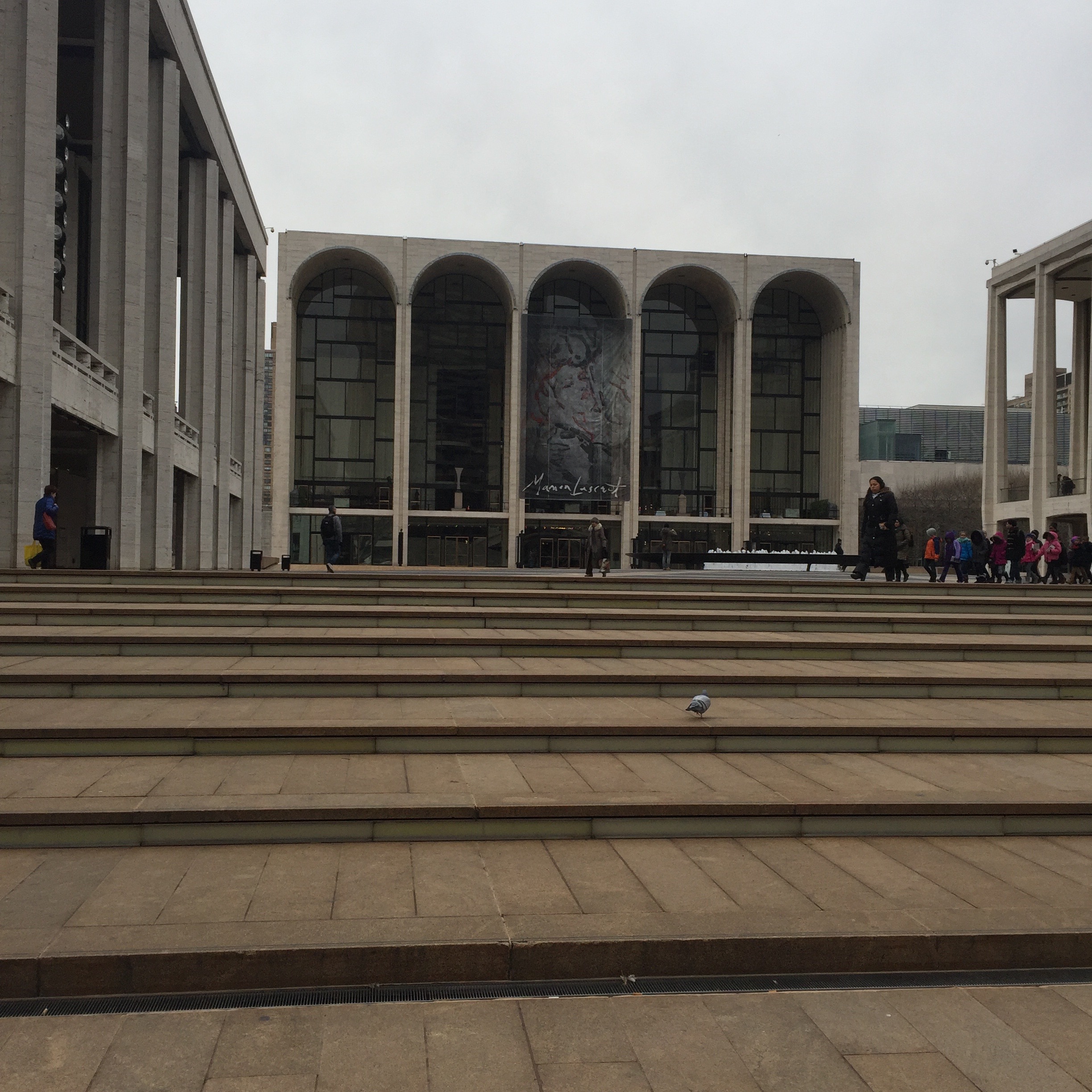
Just as the larger neighborhood known as the Upper East Side has many smaller neighborhoods within it, such as Yorkville, Carnegie Hill,Lenox Hill (yes, lots of hills on the UES!), the Upper West Side – on the opposite side of Central Park – also has subdivisions. Recently I have had two customers interested in looking for homes in the area of the UWS known as Lincoln Square, the southeast corner of the neighborhood – roughly bounded by Central Park West and Amsterdam Avenue to the east and west, and 59th to 66th Streets to the south and north. Interestingly enough, the area was characterized in 1940 as the “worst slum in New York City” by the New York Housing Authority, and the urban renewal efforts in the 1950’s and 1960’s led to the development of the Lincoln Center for the Performing Arts. This anchored the residential redevelopment of the area into the vibrant neighborhood it is now.
As I have written before, my favorite way to experience a neighborhood is by taking an unplanned walk within the area (a dérive), so on an overcast but not terribly cold February day, I started at Columbus Circle and began my stroll.
At Columbus Circle, you stand at the intersection of the Upper West Side, Central Park, and Midtown West. The shops at Columbus Circle house a Whole Foods as well as specialty stores and Jazz at Lincoln Center.
Turning around to look at Central Park for a moment . . .
Just north of the statue of Columbus, a subway hub that can get you quickly to virtually any location in the city.
Walking north a few block on Central Park West, I can’t resist stopping to admire 15 Central Park West, a phenomenally successful building on so many different levels – a classic limestone two-towered building that looks as though it could have always been there, but simultaneously a new development from 2007 with prices per square foot averaging well over $5000 per square foot. I greatly enjoyed reading Michael Gross’s recent book about the development of the site, House of Outrageous Fortune.
Walking west on W. 61st Street, you can see a side entrance to 15 CPW. On the W. 62nd Street side, there is a lovely garden.
This part of the Upper West Side can be a little confusing, in that Broadway is the next Avenue you come to after Central Park West, while for much of the neighborhood the park block is between CPW and Columbus. Broadway, transecting the length of Manhattan on a diagonal, disrupts the orderly grid of most of Manhattan above 14th Street, creating “squares” – really triangles – as it cuts across the orderly boulevards. Union Square, Madison Square Park, Herald Square, and Times Square are all the result of Broadway’s slow progress from west to east as it heads south in Manhattan, and Lincoln Square is yet another. Walking up Broadway to W. 63rd, I headed west again to see Lincoln Square itself, namesake for this neighborhood.
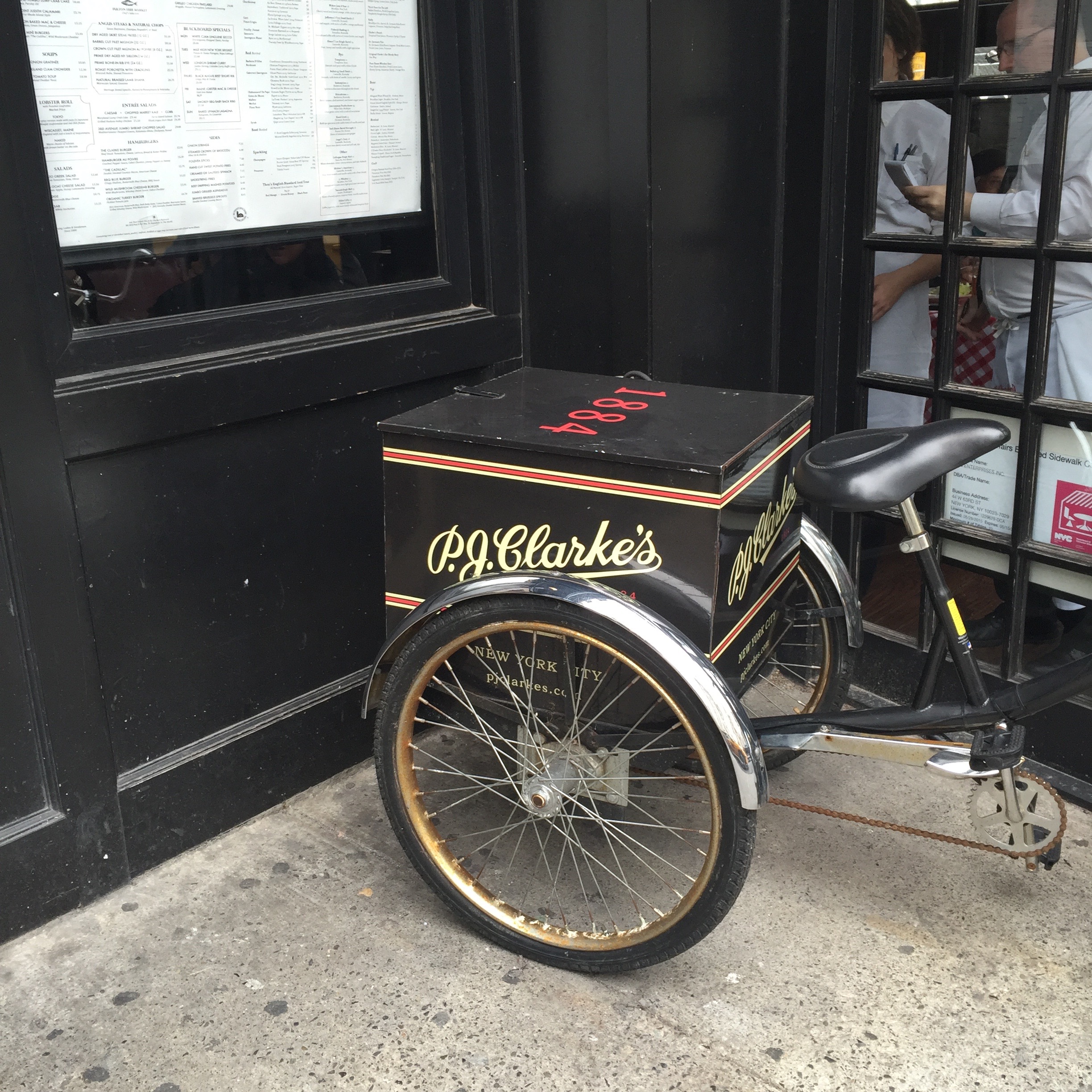
Just south of Lincoln Square is the Empire Hotel, whose sign is a local landmark, and P.J. Clarke’s, a cozy yet upscale place to sit and have a nice meal.
Obviously a strong selling point for the neighborhood is the proximity to Lincoln Center, and the ease of attending performances of opera, music, ballet, theatre, and even the Big Apple Circus in the fall of each year.
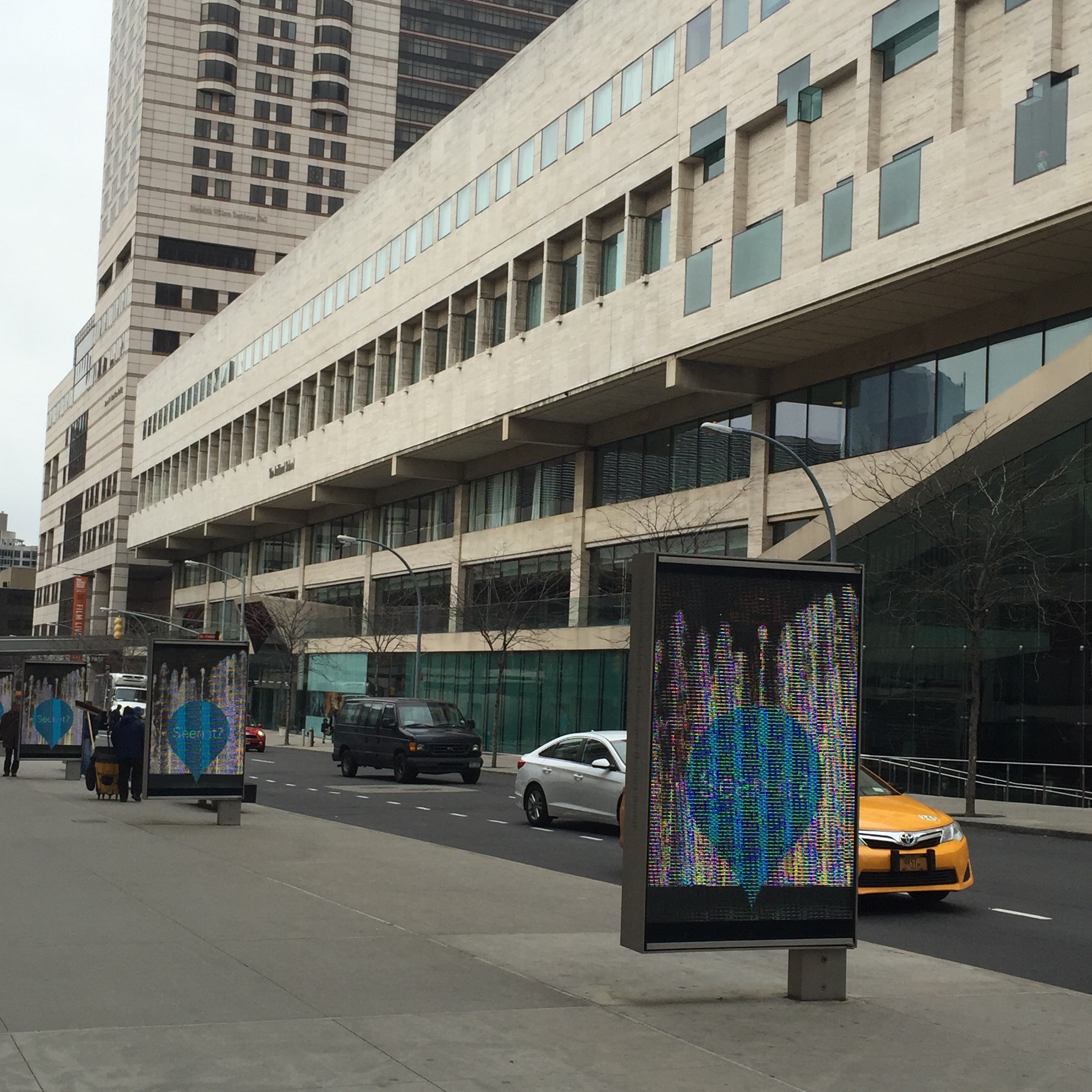
The Julliard School, just north of Lincoln Center, also offers high quality student performances.
Looking east while standing in front of Julliard, I noticed the Mormon Visitor Center, best known to me as the place where Hannah and Harper volunteer in Tony Kushner’s epic play, “Angels in America.”
Just north of Julliard is Alice Tully Hall, home to more intimate concerts than those in much larger Avery Fisher Hall (newly renamed David Geffen Hall).
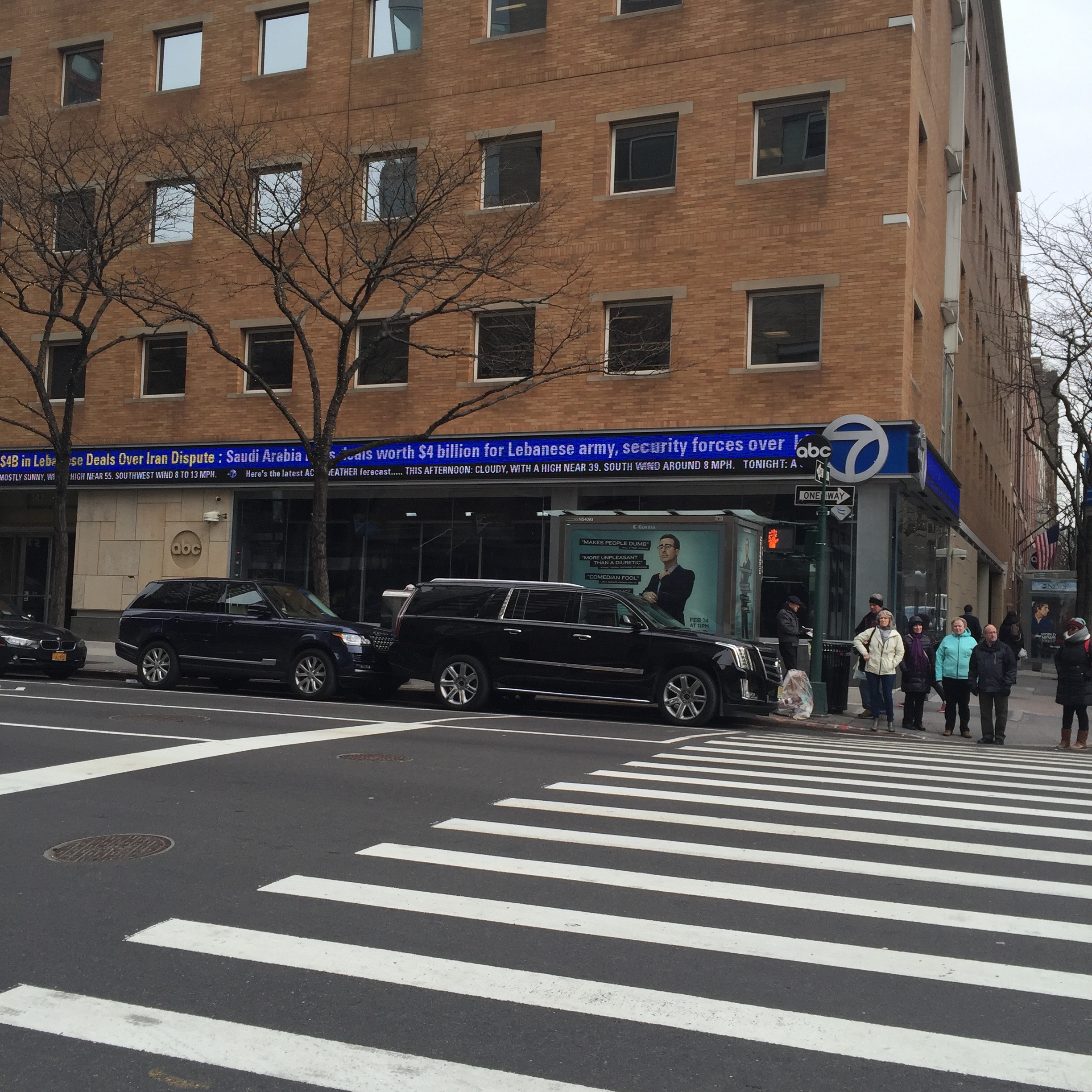
Turning east again on West 66th St., I walked past ABC studios on the way back to Central Park. Just a few blocks north of this intersection is the Loews Lincoln Square Cineplex. I really love this as an option for seeing popular movies, as each individual theatre has the name and style of an old-time movie palace, making the experience there have a little more personality than many multiplexes.
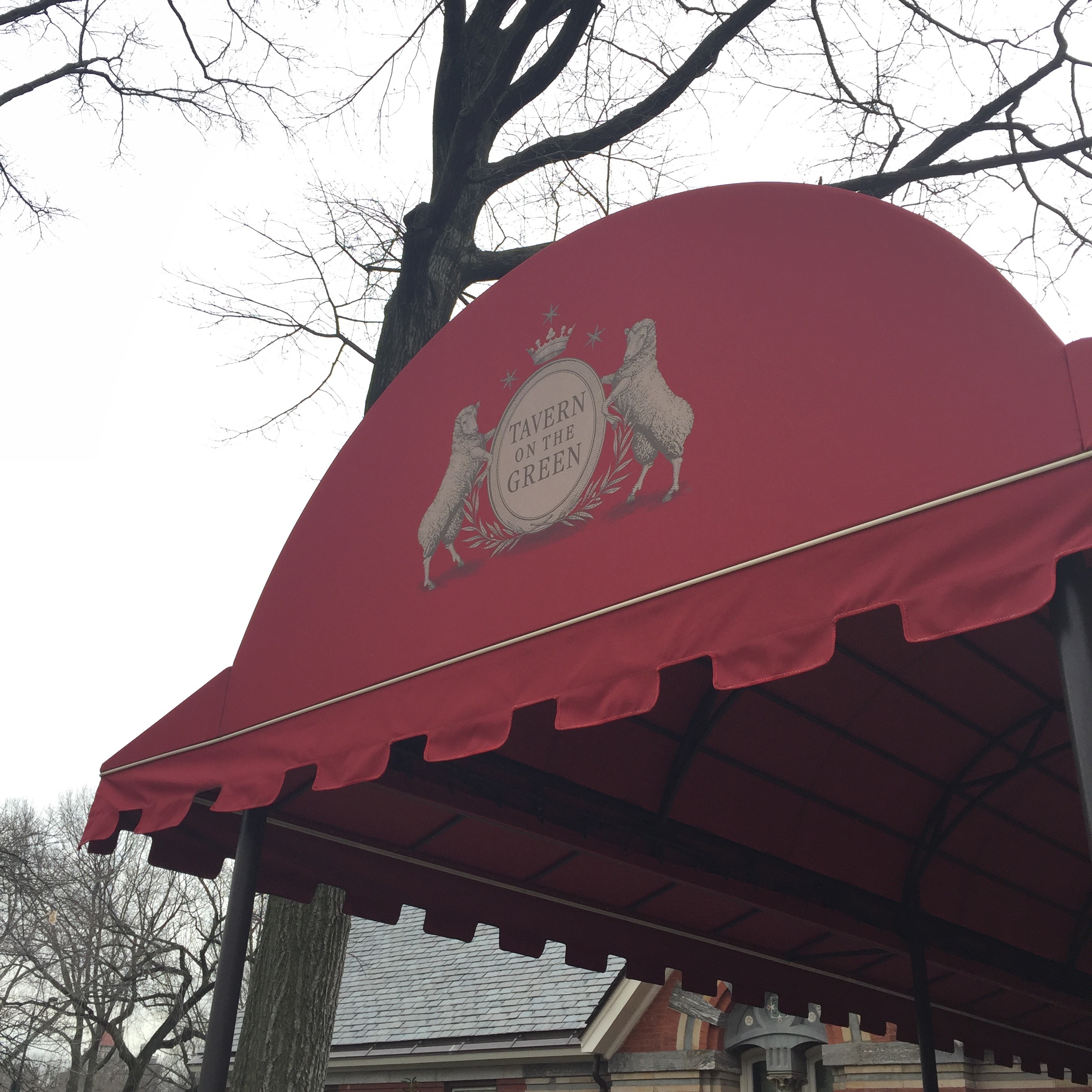
Ending up in Central Park at 66th, yet another advantage to this neighborhood is its proximity to Tavern on the Green, renovated a few years ago but with the twinkling outside fairy lights remaining.
So what does it cost to live in Lincoln Square? As with any neighborhood, it varies greatly depending on the building, but average prices are just under $3000/square foot, compared to just over $2000/square foot for all of the Upper West Side (averaging prices of the far northern sections of the UWS with those to the south, of course). Central Park South, just to the south and east of Lincoln Square averages $5000/square foot, in part because of the premium associated with apartments with views of the park. Lincoln Square tends to be newer buildings, mostly condos, compared to the largely prewar coop inventory of most of the UWS.
In my opinion, the location of Lincoln Square is unparalleled – at the intersection of the Upper West Side, Midtown West, and with Central Park as a virtual front yard.
Walking to show two apartments in the 400 block of East 52nd (not in the actual building Greta Garbo lived in for decades, but the same block), I was struck by the nomenclature “Turtle Bay” for the area (roughly from 42nd Street to 53rd Street, from Lexington Avenue to the East River) and vowed to find out whether there had in fact been turtles in a bay here a long time ago. What I discovered was one of those funny mistranslations that sometimes occurs: the Dutch called this area “Deutal” (Knife) Bay after a sharp turn in the East River (the reason why York Avenue/Sutton Place disappears at 54th Street) but the English-speaking later settlers misheard it as “Turtle.” My interest piqued, I decided to take my next dérive (an unplanned walk in an urban environment) in this area.
Initially farmland (including that of the Beekman family, who gave their name to Beekman Place), Turtle Bay evolved into an industrial neighborhood, noted particularly for its slaughterhouses. In the early 20th Century, Charlotte Hunnewell Sorchan bought and renovated a series of houses in the area, and sold to friends, including Maria Bowen Chapin, who founded the Chapin School. This began the evolution of Turtle Bay into a residential neighborhood, which was cemented when the last of the slaughterhouses was torn down to make way for the United Nations building.
I began my dérive at my favorite skyscraper in New York City, the Chrysler Building. Finished in 1930, it was the world’s tallest skyscraper for 11 months before being ousted by the Empire State Building, and is still the world’s tallest brick building (although it does have a steel skeleton). An Art Deco masterpiece, to me it has an airy fairy-castle quality that contrasts markedly with the more aggressive forms of most NYC skyscrapers.
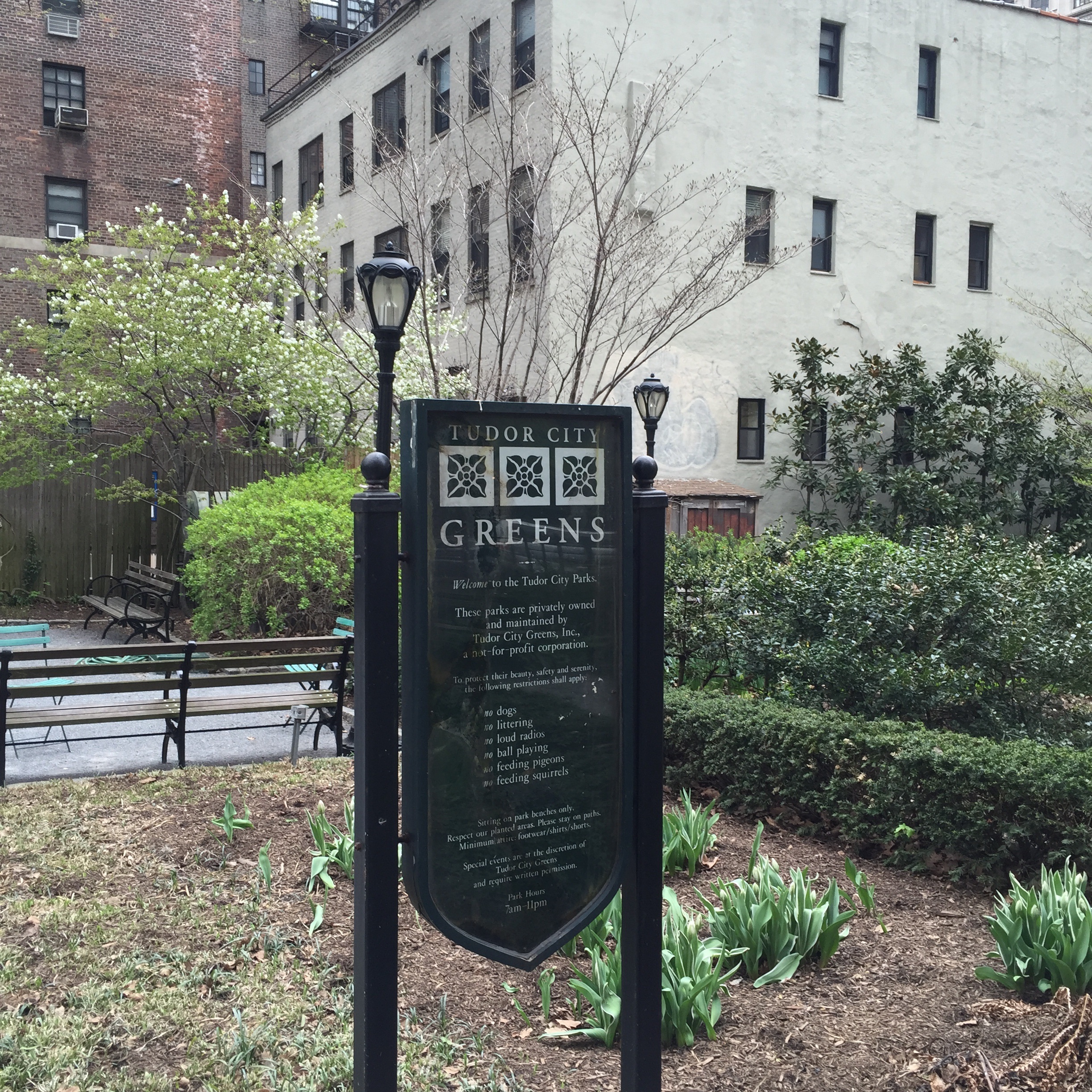
Walking east on 42nd Street, the distinctive Tudor City sign dominates the eastern view. The first residential skyscraper complex in the world, it was built in the 1920’s by a real estate developer with dreams of keeping middle-class people in the city rather than taking flight to the suburbs. Despite the name “Tudor,” the architecture is neo-Gothic in style. Most of the apartments face away from the East River, since when they were built the slaughterhouses, and their accompanying smell, still operated along the river. Many Tudor City apartments have wonderful views of the Chrysler and Empire State Buildings, but few face the United Nations for this reason.
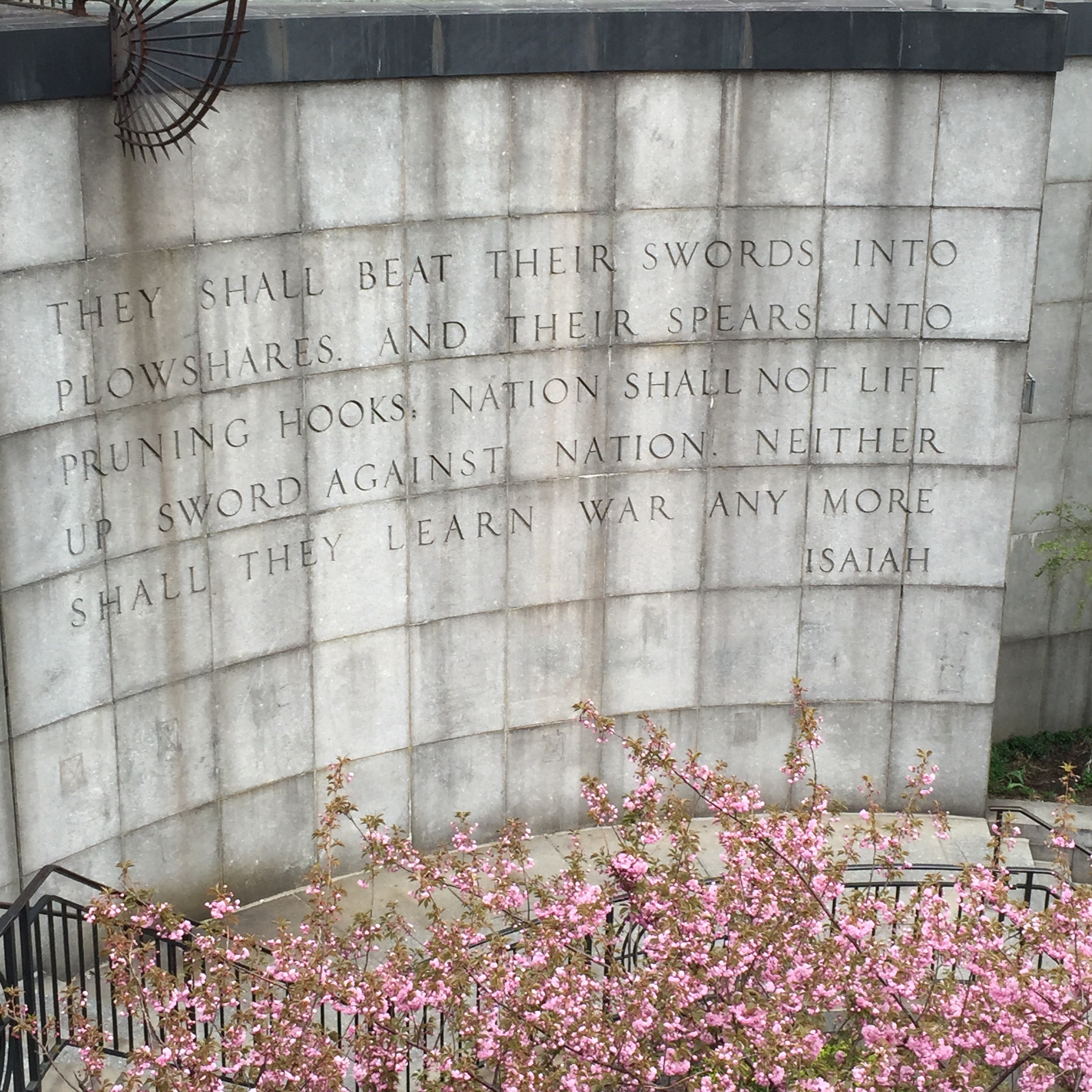
Taking a set of steps down from Tudor City to First Avenue, the United Nations (as well as multiple diplomatic missions) now dominates the area of Turtle Bay between First Avenue and the East River. Established after World War II to promote cooperation between the nations of the world and winner of the Nobel Peace Prize in 2001, the organization is imperfect but the quote across the street from the UN from Isaiah (“ . . . neither shall they learn war any more”) reveals the hope behind creating such an assembly. On a lighter note, I remember my young daughters once asking where aliens would land on earth if they were to try to reach the “leader” and I said it would have to be Manhattan because of the UN. Whether this was good news or bad news to them, I will have to ask and find out.
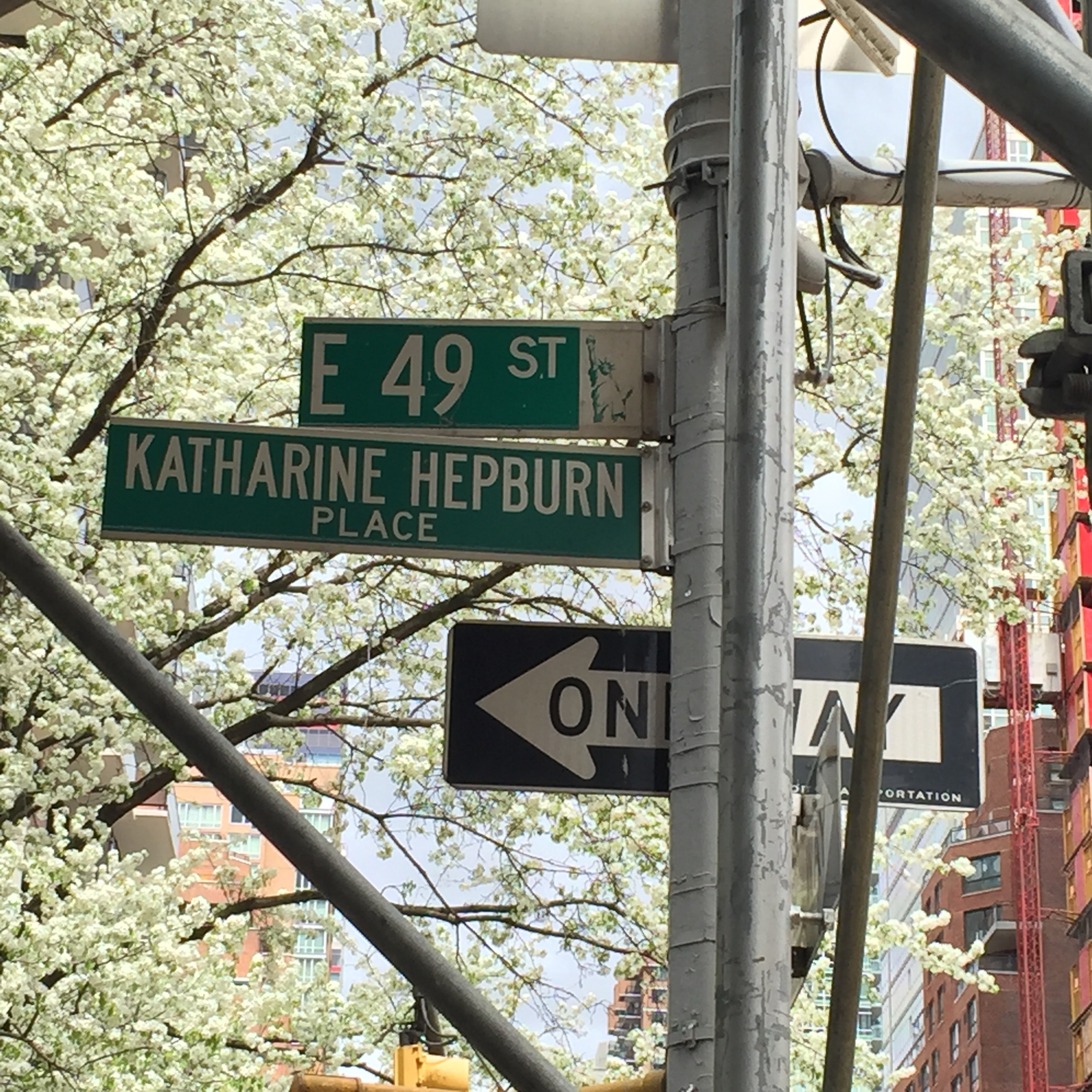
Continuing north on First from the UN, I passed Mitchell Place, one of New York’s micro-streets (comprising just one block between First and Beekman Place, next to E. 49th Street). Turning west on 49th Street, I thought of E.B. White writing Charlotte’s Web in this neighborhood (he was living on E. 48th at the time) and stopped to admire the signage for “Katharine Hepburn Place” on the corner of Second and 49th). She lived in a beautiful townhouse between Third and Second on 49th Street for most of her adult life, and that block is a gracious quiet row of townhouses.
Turtle Bay, unlike some more cohesive neighborhoods in NYC, has a wide variety of experiences represented: from the bustle of the shops and restaurants along the Avenues, to the quiet of Beekman Place, or from the gardens of Tudor City surrounded by neo-Gothic residences, to the international nexus of the United Nations. It is, however, a place where it is possible to find an apartment on a dead-end block with little to no traffic noise, but only a few blocks from everything midtown Manhattan has to offer.
Recently I was fortunate enough to see the new musical “Hamilton” at the Public Theater (arriving on Broadway this summer), leading me to my last blog post – a walk through Hamilton Heights, the neighborhood in upper Manhattan where Alexander Hamilton had farmland and lived in his final two years. However, much of Alexander Hamilton’s time in the city was spent in the area now known as the Financial District. Roughly occupying the same space as the original settlement of New Amsterdam, it lies at the very southernmost point of Manhattan, below City Hall Park, excluding the areas of Battery Park and Battery Park City. This neighborhood is a unique mixture of very old (the colonial remnants of New Amsterdam) and very new (it’s only recently become a popular choice as a residential neighborhood and new development buildings abound). With these thoughts in mind, I decided to take my next unplanned walk in an urban environment (a dérive) in the Financial District.
I emerged from the subway at Bowling Green, the traditional starting point of ticket tape parades up Broadway. This tradition with a spontaneous parade associated with the dedication of the Statue of Liberty in 1886, and since has continued with celebrants as diverse as Theodore Roosevelt (upon his return from safari in Africa in 1910), Albert Einstein in the 1920’s, Charles Lindbergh as well as Amelia Earhart following their successful solo trans-Atlantic flights, Jesse Owens after winning four Olympic gold medals in 1936, the pianist Van Cliburn in 1958, the Apollo 11 astronauts, and the New York Yankees (nine times).
Wandering from Battery Park to State Street and on to Pearl Street, I came across what is possibly Manhattan’s oldest building (from 1719), Fraunces Tavern. This building is now a museum and restaurant as well as a National Historic Landmark. Once the meeting place of the secret society the Sons of Liberty, it became the headquarters for General George Washington at one point during the Revolution, and is where he gave his famous farewell address to his officers.
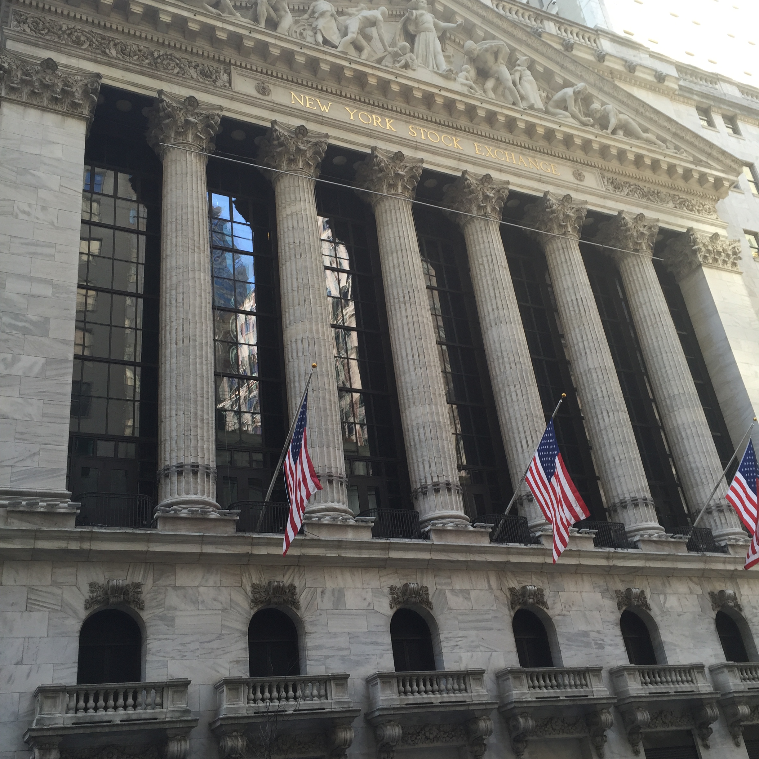
Continuing north on Broad Street, as I approached the intersection with Wall Street it was impossible to miss the imposing façade of the New York Stock Exchange. The roots of this center of American finance go back as far as the years immediately following the Revolution, and the earliest securities traded were War Bonds and stock from the First Bank of the United States (established by the first Secretary of the Treasury, Alexander Hamilton).
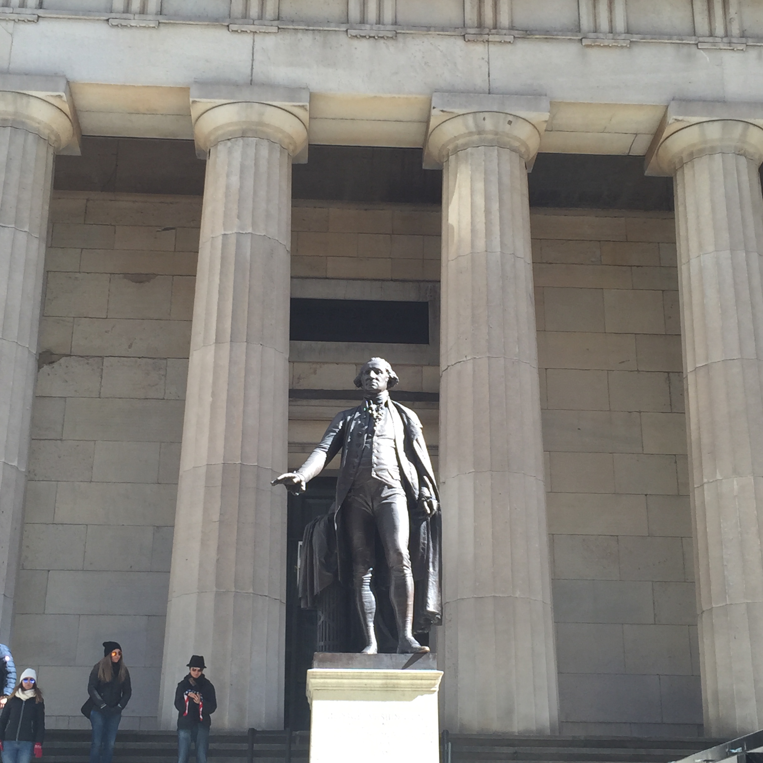
Nearby, on the corner of Wall Street and Nassau Street, is Federal Hall, the site of the first United States Capitol Building and the location of George Washington’s inaugural. A statue of the first President stands imposingly in front, gesturing as if to say “hold your applause.”
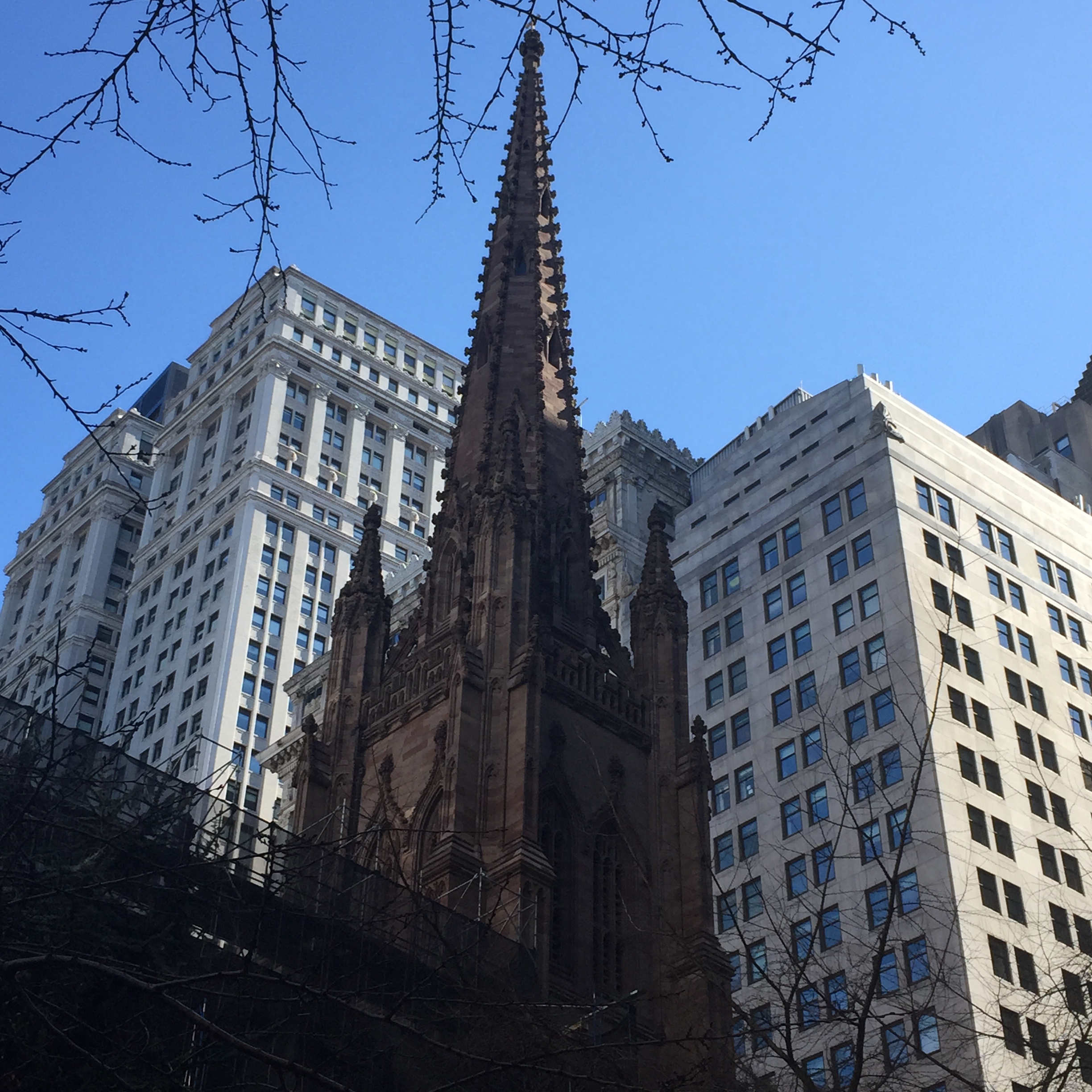
Nearby at Broadway and Wall Street is Trinity Wall Street Episcopal Church, first charted during colonial days (1696) by King William III. The current building on the site dates from 1846, but the cemetery attached to it is much older, and one of the few in Manhattan. It holds several luminaries, including Robert Fulton (inventor of the steamboat) as well as Alexander Hamilton and his wife Eliza Schuyler Hamilton.
Walking behind the cemetery along Church Street, it is impossible to miss One World Trade. Adjacent to the original footprints of the World Trade Center (now reflecting pools) and the site of the 9-11 Museum, it dominates the skyline in the area, and is now open for business. The influx of workers to One World Trade is bringing new shops and restaurants to the area. The new World Trade Center transportation hub is due to open at the intersections of Vesey, West Broadway, and Greenwich Streets at the end of 2015. Designed by famed Spanish architect Santiago Calatrava, it has been the source of controversy over its cost and overruns. However, seeing it soar in such an emotionally impactful area (Calatrava has said it is supposed to look like a bird being released from a child’s hand) was very pleasing to me.
Prior to 2001 and the 9-11 attacks, about 15-20,000 residents lived in the Financial District. Nothing could be more revealing of the strong and resilient nature of New Yorkers (and also of the success of some incentives and tax breaks created by the city to spur growth) than the fact that now there are over 60,000 residents of the neighborhood. In 2014, the average price per square foot in the Financial District was higher than the average in Manhattan for the first time, comparable to that of the Upper West Side and Greenwich Village. Simultaneously historic and fresh, this neighborhood is the closest thing New York City has to the center of Rome, where new buildings are interspersed with views of the Forum or Coliseum.
The hottest ticket in New York City this year is Lin-Manuel Miranda’s new musical, “Hamilton,” currently at the Public Theater on Lafayette Street but moving to Broadway this summer. Coincidentally the day after I was fortunate enough to see it, while searching for a new apartment for a couple, I found a possibility for them in Hamilton Heights. Of course I had heard of the neighborhood in upper Manhattan and had been there before, but the connection to Alexander Hamilton didn’t fully register until that moment. I decided that my next dérive (an unplanned walk in an urban environment) would take place in Hamilton Heights, while the soundtrack to “Hamilton” was still freshly ringing in my head.
Hamilton Heights lies between 135th and 155th Streets to the south and north, and between Edgecombe Road and the Hudson River to the east and west. This puts it just south of Washington Heights (location of Miranda’s “In the Heights”) and just north of Manhattanville and Morningside Heights. Why all the “heights” in upper Manhattan? Take a walk in any of these neighborhoods, and you will see – the elevation in this part of the island is considerable, and some streets are quite steep, particularly rising from the Hudson. Alexander Hamilton’s farmland in the last two years of his life before the infamous duel with Aaron Burr was roughly in the part of the neighborhood between 140th and 146th Streets.
Public transportation options are good in Hamilton Heights. The 1, A, B, C, and D trains all make stops here, and it is possible to get from 155th Street to Times Square in about 15 minutes. For my dérive, I took the C and emerged at St. Nicholas Avenue and 135th Street. St. Nicholas Park rises steeply to the west of St. Nicholas Avenue here, and the majestic neo-Gothic tower of Shepard Hall of the City College of New York can be seen rising from the ice-age Manhattan schist that was used to construct the iconic campus buildings. CCNY was the first public institution of higher learning in the United States, and the beauty of its campus holds up to the private colleges and universities that predated it. Ten Nobel Prize winners have graduated from CCNY, the most recent alum winning for Medicine in 2014.
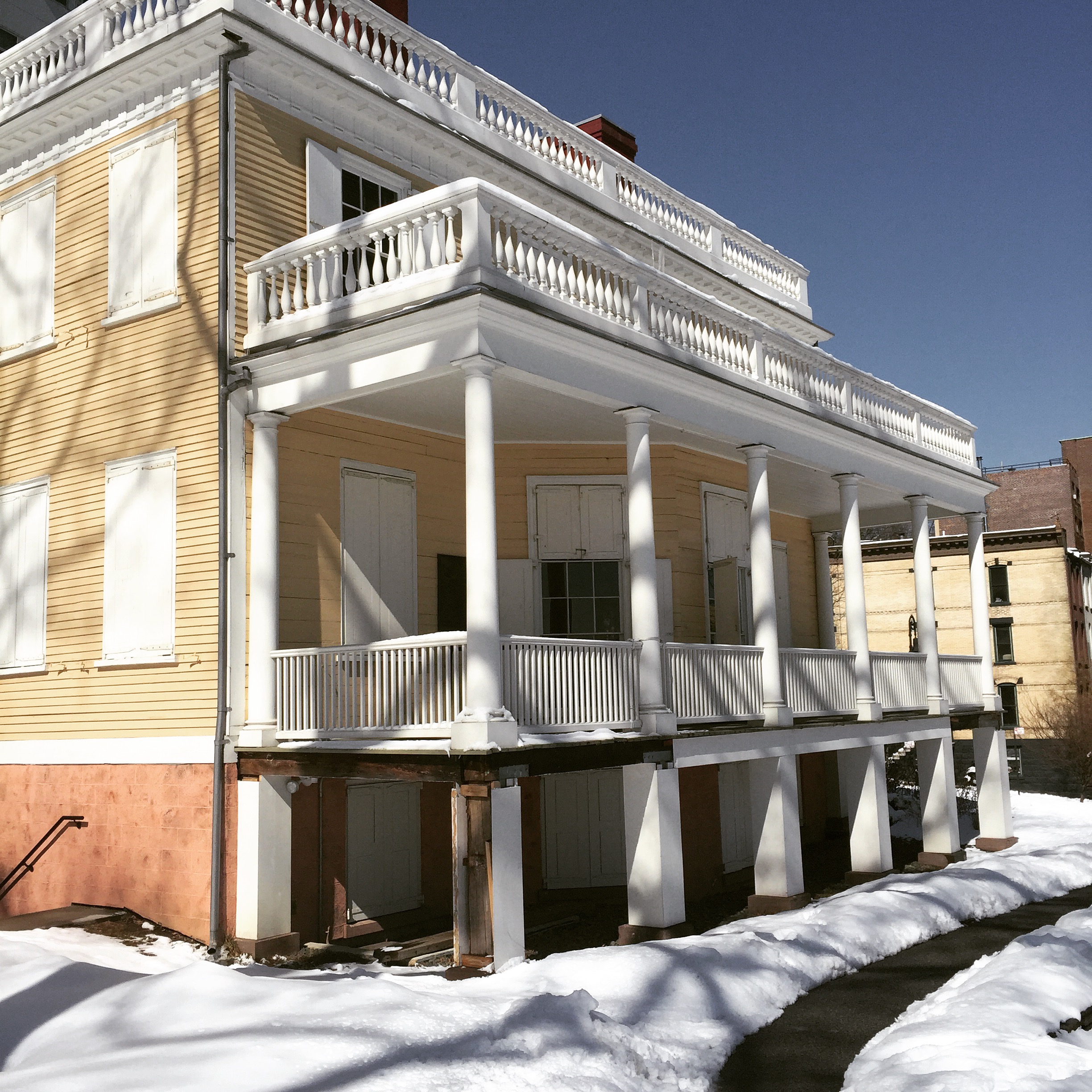
Just to the north of the main quad of CCNY sits Alexander Hamilton’s home for the final two years of his life, named Hamilton Grange after his ancestral home in Scotland. This location in St. Nicholas Park is not where he lived, however – the house itself has been moved three times, but has settled in this location, not too far from its original spot. The Grange is a National Park Service site, and has been restored to reflect its appearance during 1802-1804 when Hamilton lived in it.
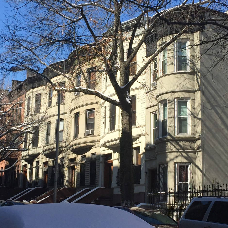
Walking north on Hamilton Terrace from St. Nicholas Park, it is easy to forget that you are in Manhattan. This is a very quiet, residential neighborhood with rows of townhouses or brownstones on tree-lined streets. Hamilton Terrace goes on for blocks without any intersections, and most of the townhouses here date from the 1890’s. Hamilton Terrace runs into Convent Avenue, and continuing north, the sub-neighborhood of Sugar Hill reveals stately rowhouses that once were the residences of famous New Yorkers such as Cab Calloway, W.E.B DuBois, Duke Ellington, and Babe Ruth (when he was an infant). Nicknamed Sugar Hill because it was where wealthy residents of Harlem moved in the 1920’s to enjoy the “sweet life,” the area holds large pre-war apartments that are still affordable, by current New York City standards.
The Billy Strayhorn standard, “Take the A Train,” most familiar as an instrumental version performed by the Duke Ellington orchestra, does have lyrics, and they give you clear directions about how to get to this charming affordable neighborhood in upper Manhattan:
You must take the A Train
To go to Sugar Hill way up in Harlem
If you miss the A Train
You’ll find you’ve missed the quickest way to Harlem
Hurry, get on, now, it’s coming
Listen to those rails a-thrumming (All Aboard!)
Get on the A Train
Soon you will be on Sugar Hill in Harlem